Trailheads in the West
Trailheads and public land access points across the West, each compiled from its own sources: the road in, parking, fees, and season.
Point at a dot to see the place.Tap a dot to see the place.
Arizona
- Burro Creek Recreation Site TrailheadA BLM campground on U.S. 93 between Wikieup and Wickenburg, Arizona, where Burro Creek's deep pools lie below saguaro-studded canyon walls.
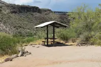
- Pine Creek Trailhead (Tonto Natural Bridge)Pine · Hiking trailTonto Natural Bridge State Park is located in central Arizona near Payson. It is believed to be the largest natural travertine bridge in the world. There are four hiking trails, a picnic area, and a group use area. The park provides habitat for animals, insects, and birds as well as Interpretive exhibits including artifacts on the history of Tonto Natural Bridge, plus information about travertine, prehistoric inhabitants, and the historic Goodfellow Lodge.
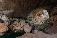
- Red Mountain TrailheadFlagstaff · TrailVolcanic cinder cone that rises 1,000 feet above the surrounding landscape, in the shape of a 'U' with a large natural amphitheater cutting into the cone's northeast flank.
California
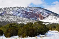
- Ancient Bristlecone Pine Forest (Schulman Grove Discovery Trail)Big Pine · Day use onlyThe Schulman Grove of the Ancient Bristlecone Pine Forest, in the White Mountains above Big Pine, California, where Edmund Schulman cored the first trees known to exceed 4,000 years.
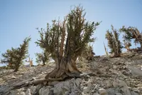
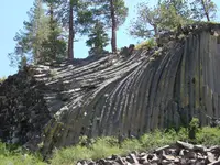
- Devils Postpile National Monument (Devils Postpile Trailhead)Mammoth Lakes · National monumentA 798-acre national monument in the Reds Meadow Valley near Mammoth Lakes, California, protecting a cliff of glacier-polished basalt columns up to 60 feet tall.
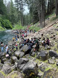
- McArthur-Burney Falls Memorial State ParkBurney · Premier waterfallThe park's centerpiece is the thundering 129-foot white-water falls on Burney Creek, complemented by the voluminous springs emanating from the basalt cliff face.
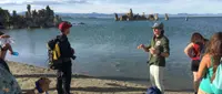
- Mono Lake South Tufa TrailheadLee Vining · State natural reserveAncient lake in the eastern Sierra Nevada, with spectacular views of the tufa towers formed over many years when the calcium-bearing freshwater springs and carbonate-rich lake water combined and precicipitated out as limestone.
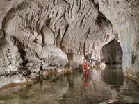
- Natural Bridges Day Use Area TrailheadVallecito · Day use onlyModerate 0.7-mile trail leads to a unique series of limestone caves with Coyote Creek running through them, an outstanding but sensitive geologic resource at New Melones Lake; pets not permitted on the trail; vault toilets at the parking area, no drinking water.
Colorado
- Fish Creek Falls TrailheadSteamboat Springs · Trailhead and picnic siteA Forest Service trailhead and picnic site four miles up Fish Creek Falls Road from Steamboat Springs, Colorado, where snowmelt drops 283 feet above a footbridge on the canyon floor.
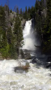
- Rifle Falls State Park TrailheadRifle · State parkRifle Falls State Park's lush vegetation and waterfalls have attracted photographers and movie crews from around the country to capture the area's unique scenery. Mysterious limestone caves beneath the falls entice spelunkers and other curious visitors to explore.
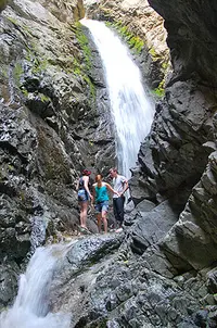
- Zapata Falls TrailheadAlamosa · SrmaA short but adventurous hike over slippery rocks leads to a magnificent 25-foot waterfall at Zapata Falls Recreation Area.
Idaho
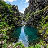
- Box Canyon Springs TrailheadHagerman · Nature preserveA spring-fed basalt canyon off West Point Road near Wendell, Idaho, where about 180,000 gallons a minute pour from a headwall that a megaflood cut some 45,000 years ago.
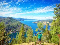
- Mineral Ridge TrailheadCoeur d'Alene · National recreation trailThe 3.3-mile trail was the first BLM recreation site developed in Idaho in 1963. In 1982, the trail was designed as a National Recreation Trail and offers an invigorating hike and stunning views of Lake Coeur d'Alene. An interpretive trail guide describes the plants, animals and interrelationships of the forest at 22 marked stations along the trail.
Montana
- Holland Falls TrailheadSeeley Lake · TrailheadHolland Falls Trailhead, at the end of Forest Road #44 near Condon, Montana, starts a 1.6-mile lakeshore climb to a 40-foot waterfall named for the valley's first homesteader.
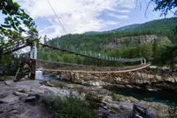
- Kootenai Falls TrailheadTroy · Landmark, watchable wildlifeBuilt by the Forest Service to access forest fires across the Kootenai River, this foot bridge was destroyed by a major flood in 1948. The bridge was rebuilt on concrete piers and is now protected from flooding by Libby Dam. Used for administrative purposes, it also offers a breathtaking view of the Kootenai River gorge directly below Kootenai Falls. It is at an elevation of 2,100 feet.
- Natural Bridge Falls TrailheadBig Timber · Picnic areaA day-use picnic area and paved trail on Montana's Boulder River south of Big Timber, where the river leaps a limestone falls at runoff and runs underground the rest of the year.
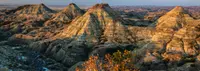
- Natural Bridges TrailheadTerry · Hiking trail and trailheadThe Terry Badlands WSA is located in Prairie County, 3 miles northwest of Terry, MT; colorful banded cliffs that overlook rolling prairie; geologic features include sandstone bridges, spires, table tops, and buttes divided by many deep gullies.
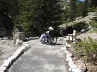
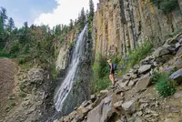
- Palisade Falls TrailheadBozeman · TrailheadPopular 1/2 mile nature trail, fully accessible and paved, providing views to Palisade Falls.
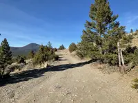
- Ringing Rocks TrailheadPipestone · Geologic areaUnique geological formation. Part of the edge of the Boulder Batholith, and found in a large jumbled pile of boulders, the rocks in this unique geologic formation near Butte, Montana, chime melodically when tapped lightly with a crescent wrench or mallet.
- Woodbine Falls TrailheadNye area · TrailheadUSFS trailhead at Woodbine Campground for the 0.8-mile Woodbine Falls Trail in the Beartooth foothills.
Nevada
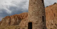
- Cathedral Gorge State ParkPanaca · State parkA Nevada state park two miles northwest of Panaca, where slot canyons run through the clay of an old lakebed and a CCC water tower of the 1930s still stands.
- Grimes Point Archaeological AreaFallon · Archaeological siteA field of petroglyph boulders beside U.S. 50 east of Fallon, Nevada, on the old shore of Lake Lahontan, with a sealed storage cave reached only by guided tour.
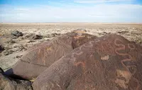
- Hickison Petroglyph Recreation AreaAustin · Historic & cultural siteA free BLM campground and petroglyph trail in the piñons off U.S. 50 east of Austin, Nevada, where horseshoe-shaped carvings have been read as hoofprints, hunting omens, and puberty marks.
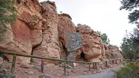
- Red Rock Canyon NCA (Lost Creek Trailhead)Las Vegas · Self-guided interpretive trailSelf-guided interpretive trail in the Mojave Desert at Red Rock Canyon, introducing visitors of all ages to pictographs, lessons of desert life, towering views, and a hidden seasonal waterfall that flows December through April.
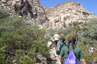
- Valley of Fire State Park (Mouse's Tank Trailhead)Overton · State parkWorld-renowned for its 40,000 acres of bright red Aztec sandstone outcrops nestled in gray and tan limestone, Valley of Fire State Park contains ancient, petrified trees and petroglyphs dating back more than 2,000 years.
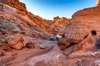
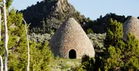
- Ward Charcoal Ovens State Historic ParkEly · State historic parkPerched in the Egan Mountain Range in eastern Nevada, a scenic, forested retreat featuring six beehive shaped charcoal ovens that were used from 1876 through 1879 to help process rich silver ore.
New Mexico
- Dripping Springs TrailheadLas Cruces · Natural areaA Bureau of Land Management natural area on the west face of the Organ Mountains east of Las Cruces, where a short trail climbs to the ruins of a mountain hotel and a health resort.
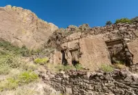
- Malpais Nature Trailhead (Valley of Fires)Carrizozo · BLM recreation area and nature trailheadA BLM recreation area immediately adjacent to the Carrizozo Malpais lava flow, four miles west of Carrizozo, NM, on US Highway 380, with paved accessible nature trails through the lava surface, RV and tent camping, showers, an accessible Visitor Center, a Junior Ranger program, and a new Kipuka Trail.
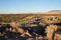
- Spence Hot Spring TrailheadJemez Springs · TrailheadSpence Hot Spring is reached from a short hike from the parking area, located five (5) miles north of Jemez Ranger District Office. The popular Spence Hot Spring includes a small pool that accommodates a relatively low number of people.
Oregon
- Captain Cook TrailheadYachats, OR · TrailheadA short Forest Service path south of Yachats, Oregon, that runs from the Cape Perpetua Visitor Center past a 1933 CCC camp and Alsea shell middens to the tidepools at Cook's Chasm.
- Crack-in-the-Ground TrailheadChristmas Valley, Oregon · Volcanic fissureA volcanic fissure two miles long and up to seventy feet deep north of Christmas Valley, Oregon, where homesteaders once made ice cream with ice from its caves.
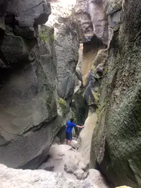
- Fort Rock State Natural Area Trailheadnear Bend, Oregon · State natural areaFort Rock State Natural Area, Lake County, Oregon: a ring of tuff cliffs on the high-desert floor, its walls cut into benches by the waves of a vanished lake.
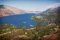
- Rowena Crest TrailheadHood River, Oregon · Scenic viewpoint on historic columbia river highway state trailRowena Crest is a stunning viewpoint and trailhead along the Historic Columbia River Highway that looks down on Mayer State Park and the Columbia River Gorge. The view includes the iconic Rowena Loops — the horseshoe curves that wind up to the viewpoint, a true engineering marvel.
- Terwilliger Hot Springs TrailheadBlue River · Hot springsEnjoy the 1/4 mile hike along the Rider Creek Trail (#3319) to the clothing optional hot springs. There are four soaking pools spaced apart by rock walls laid out in steps down a ravine. Temperatures range from 85 degrees Fahrenheit in the lower pool to 112 degrees Fahrenheit in the upper pool.
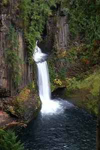
- Toketee Falls TrailheadIdleyld Park, Southern Oregon · TrailheadThis trailhead leads to the majestic Toketee Falls on the 0.4-mile Toketee Falls Trail #1495.
Utah
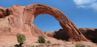
- Corona Arch TrailheadMoab · Out-and-back hikeA three-mile round-trip hike off Utah 279 near Moab, by cables and a ladder over slickrock, to a 140-foot Navajo Sandstone span once famed for a rope swing.
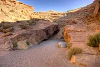
- Little Wild Horse TrailheadTrailheadLittle Wild Horse and Bell Canyons, one of the most popular slot canyons in Utah, within the Muddy Creek Wilderness.
Washington
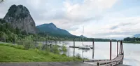
- Beacon Rock TrailheadSkamania · Hiking trailhead in a year-round washington state parkA trail of switchbacks, bridges, and railing built onto the side of an 848-foot basalt plug above the Columbia near Skamania, Washington, completed by Henry J. Biddle in 1918.
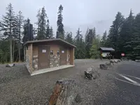
- Big Four Ice Caves TrailheadGranite Falls · TrailheadA Forest Service picnic ground and trail on Washington's Mountain Loop Highway, where a burned 1921 resort's lobby fireplace faces the avalanche ice at Big Four Mountain's base.
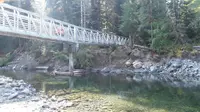
- Franklin Falls TrailheadSnoqualmie Pass · TrailheadA trailhead off I-90 Exit 47 near Snoqualmie Pass, where a one-mile path reaches a 70-foot falls and a loop follows the last mile of the 1860s wagon road.
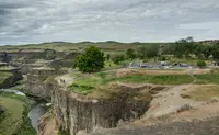
- Palouse Falls TrailheadLaCrosse, WA · State park heritage siteThe Palouse River runs through a narrow cataract and drops 200 feet at Palouse Falls into a churning bowl, then moves swiftly through a winding gorge of columnar basalt carved more than 13,000 years ago.
Wyoming
- Porcupine Falls TrailheadLovell, WY · TrailheadPorcupine Falls Trailhead provides access to a beautiful waterfall and mountain scenery. There are hitching rails at this trailhead but no other facilities and parking is limited.
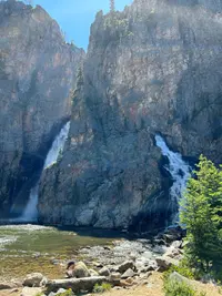
- Sinks to Rise TrailheadLander · TrailThe Sinks To Rise Trail is an ADA accessible, paved Braille Trail that offers a guide rope and accessible interpretive graphics for the visually impaired.
- Swift Creek-Periodic Spring TrailheadAfton · TrailheadPeriodic Spring is the largest intermittent non-geothermal spring in the world; the spring turns off and on every 15 minutes in the late summer and fall.
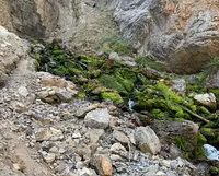
- Turtle Rock TrailheadLaramie · TrailheadA very popular trail within the Vedauwoo Day Use Area. The easy trail winds around Turtle Rock, an icon Sherman Granite outcropping. Hikers will enjoy a 2.8 mile loop winding around the boulders, slabs and cliffs of the Vedauwoo rock formation, as well as beaver ponds.
More under Out of Doors: Hot Springs, Swimming Holes, Rockhounding, and Spring Water.