.jpg)
.jpg)
.jpg)
.jpg)
Corona Arch Trailhead
Moab, Grand County, Utah. Out-and-back hike, road and slickrock terrain, hikers only; Year-round. Summers are hot.
Details

- Where
- Moab, Grand County, UT. No street address stated. Directions
- Getting there
- Trailhead: 10 miles west of the Utah 279/U.S. 191 junction near Arches National Park, on Utah Scenic Byway 279.
- Fees
- None.
- Access
- Other trail users: None; Canine compatibility: Dogs allowed.
- Phone
- (435) 259-2100
- Managed by
- Moab Field Office.
- Established
- 2018.
- Coordinates
- 38.574296, -109.632611.
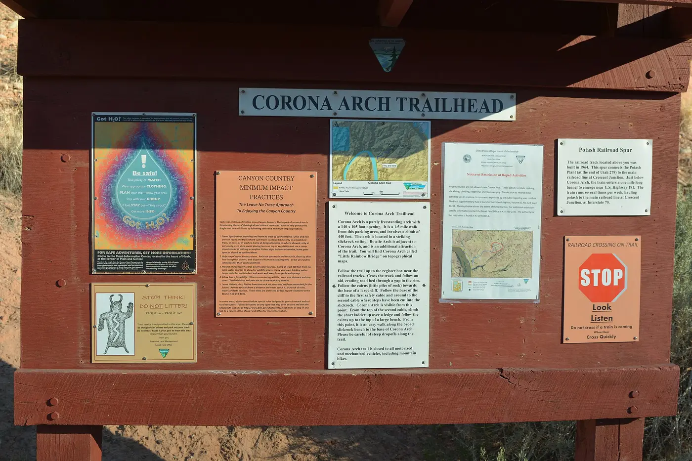
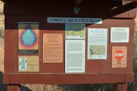
A BLM register box stands a tenth of a mile up the Corona Arch Trail, just short of a set of railroad tracks. Hikers sign in, step across the rails, and follow an old roadbed up through a gap in the rim. The trailhead is on the right-hand side of Utah 279, the Potash Road, ten miles south of its junction with US 191 and opposite the Gold Bar Campground. Moab is about 14 driving miles away. The Bureau of Land Management’s Moab Field Office manages the trail. It charges no fee and asks walkers to pick up any litter they find and to stay precisely on the route.
Cables, a ladder, and a twisted juniper
The BLM, Visit Utah, and Discover Moab all give the hike as 3 miles round trip. Geologist Allyson Mathis, measuring with a handheld GPS, logged 1.3 miles one way. Elevation gain is 440 feet by Discover Moab’s count, about 400 by Mathis’s, and 250 by Visit Utah’s. Most accounts allow about two hours.
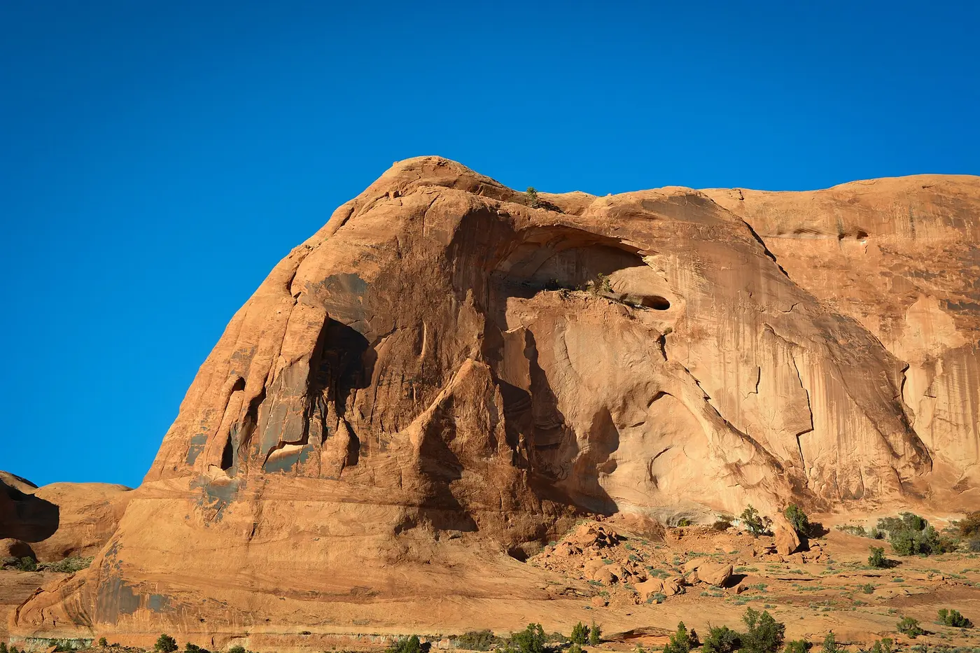
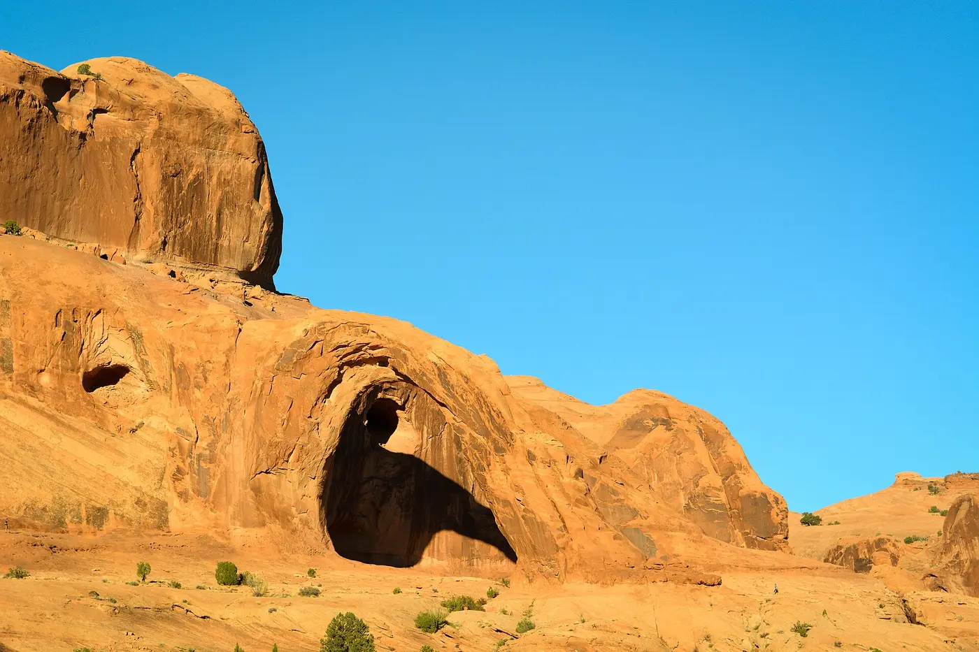
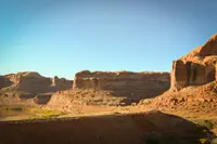
Past the tracks, cairns lead up a wash, over a low sandy pass, and across sand and slickrock toward the base of a tall, slabby cliff. There the route crosses sloping slabs with a long cable anchored to posts. Past this cable, at 0.7 mile by Visit Utah’s log, Corona Arch comes into sight above Bootlegger Canyon. That guide names this spot the best turnaround for anyone queasy about heights. A second cable follows, running up steps chopped into a sandstone slab. Above it a five-step metal ladder climbs over a small ledge to a twisted juniper and a higher bench. From there it is an easy walk along broad slickrock, around the head of a cul-de-sac canyon, to the arch.
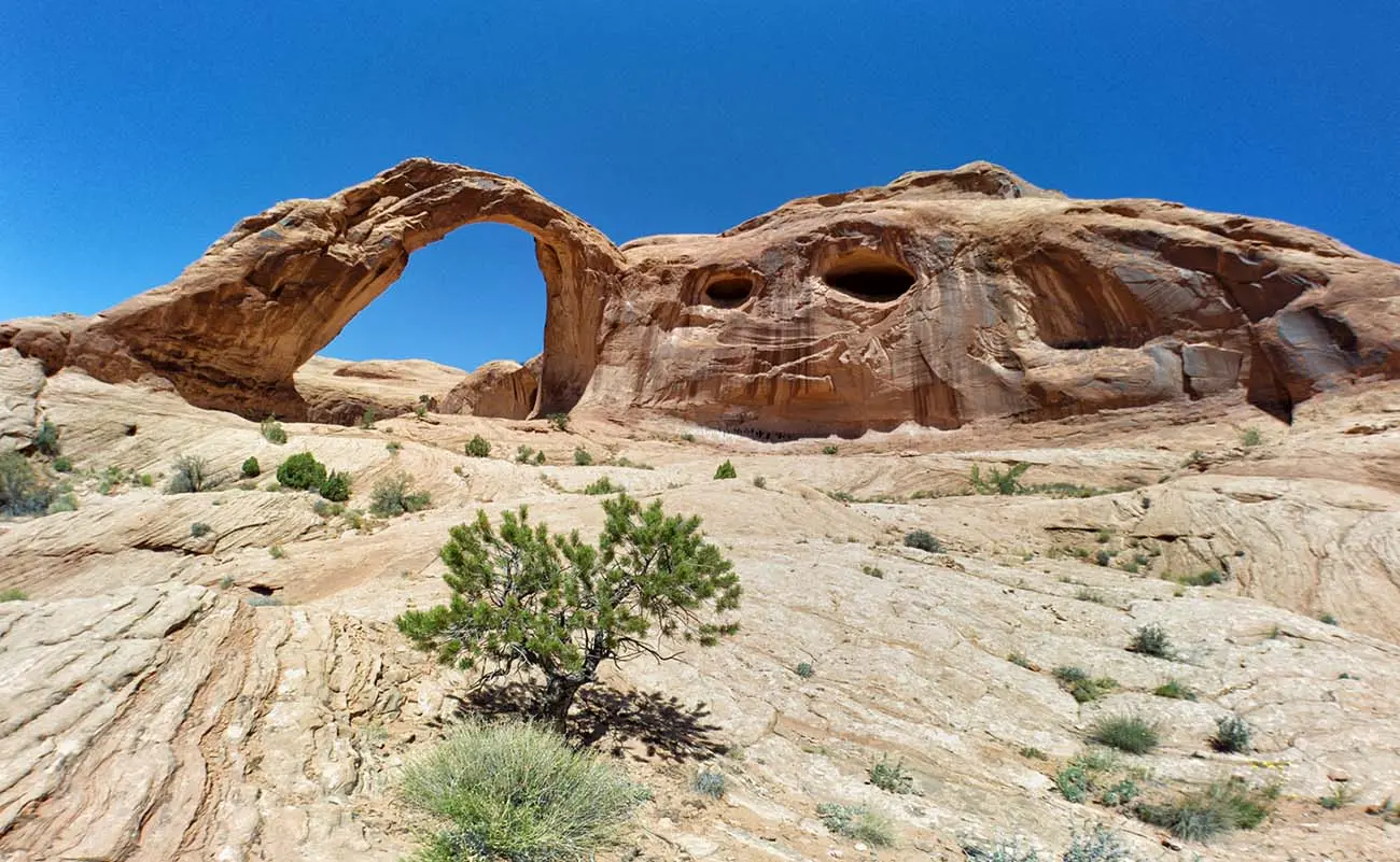
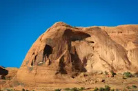
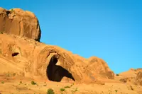
Other arches stand along the way. Visit Utah names Pinto Arch, a pothole arch high on the canyon rim, and Bowtie Arch, which towers above the trail to the left. Discover Moab lists Bowtie and Goldbar. Bowtie formed, in Visit Utah’s account, when a pothole above, usually filled with water, eroded down into a cave below.
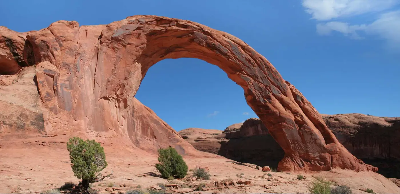
Corona Arch, also called Little Rainbow Bridge, is cut from Navajo Sandstone. Visit Utah and the Moab Times-Independent give its opening as 140 feet across by 105 feet high. The 2017 Federal Register notice described “a partly freestanding arch with a 110-foot by 110-foot opening.” Visit Utah suggests that on hot days a visitor lie down in the arch’s long, narrow shadow to get a true measure of its size and fragility. There is little other shade. The route takes sun all day except beneath overhanging cliffs in late afternoon, and summer temperatures in Moab can pass 100 degrees, with the rock hotter still. Leashed dogs are allowed, and many children have finished the hike, though the trail skirts numerous drop-offs. The BLM puts traffic at more than 80,000 hikers a year. The Federal Register notice estimated about 40,000 visitors to the arch.
Dune sand and river cobbles
Mathis, writing in Moab Happenings in November 2019, read the trail as a section through time. The trailhead sits in the Kayenta Formation, laid down by broad, shallow rivers crossing arid country just before the Navajo Sandstone was deposited. At 0.2 mile, where the trail turns sharply right, the underside of an overhang shows mud cracks, formed as clay-rich sediment shrank while drying and later filled with sand from the layer above.
Above that lies the Navajo, deposited in a massive dune field approximately 185 million years ago. Near the cables it shows crossbedding, the inclined laminations that formed on dune faces as the dunes migrated in the wind. At 0.6 mile the broad bench to the right is a Colorado River terrace capped with cobbles. It is the highest in the area, deposited approximately 200,000 years ago when the river ran about 300 feet higher than it does now, and cobbles washed down from it lie beside the trail. Beneath Bowtie Arch is a hanging garden, a seep where plants grow on vertical and overhanging rock. Corona Arch itself formed in a fin, a thin rib of sandstone between small drainages in front of and behind it. Weathering and erosion opened the hole.
The potash line through Bootlegger Canyon
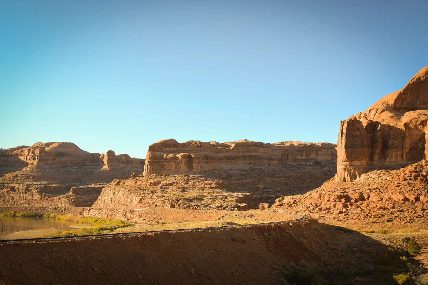
The tracks at the register box were built in 1961 and 1962 as the Denver & Rio Grande Western’s Cane Creek Branch, to serve the Texas Gulf Sulphur Company’s new potash mine on the Colorado River. Morrison Knudsen won the contract in July 1961 over 29 other bidders. Railroad, contractor, and company officials held a brief groundbreaking on the afternoon of August 14, 1961, on the Moab side of the planned tunnel. Crews drove that tunnel south from Moab Canyon, and on June 26, 1962, the Salt Lake Tribune reported that Morrison-Knudsen had “holed through” 7,059 feet to the head of Bootlegger Canyon. The 1961 plans called for tunnel rock to serve as ballast for the line down Bootlegger Canyon. At the canyon mouth, the track was to pass through an 800-foot cut, with walls more than 100 feet high, blasted through a feature known as “Dome Rock.”
The branch was finished in September 1962 and went into service in 1965, when the mine began operating. In 1970 the gassy, hot underground workings were shut down and converted to a solution mine. Trains still haul potash, which is used as a water softener and fertilizer, from what Visit Utah calls North America’s largest potash deposit. Mathis identifies the mine as Intrepid Potash’s.
Five trailhead signs and a Rotary check
The footpath came later. Russ von Koch arrived at the BLM’s Moab office as a recreation planner in 1983. Six months later the Atlas uranium mill closed, and the area then had none of the campgrounds, ranger stations, or trail systems it would later have. In the mid-1980s, as Grand County looked for a new economy after the uranium bust, von Koch went to work on trails.
“I worked with Mike Price, a geologist, and formed the Moab Trails Committee and inventoried hiking routes around Moab… Those became the Moab trail system,” he told the Times-Independent on his retirement in 2012. He said the path to Corona Arch, along with Hidden Valley, was part of the initial system he helped create in 1986. “We didn’t have any money at the BLM, so we went to the Rotary Club… and were able to get $1,000 to buy trailhead signs and visitor boxes for five different trails.”
The rope swing and the rule
The arch itself still belonged to the State of Utah in 2012, when a YouTube video titled “World’s Largest Rope Swing” showed a group of friends rigging a rope and swinging from the span. It was shot by Provo filmmaker Devin Graham for his DevinSuperTramp account, and by 2018 it had drawn more than 27 million views. That fall, a Sandy outfitter, Utah High Adventure, took about 100 clients to the arch at more than $200 each.
On January 17, 2013, the School and Institutional Trust Lands Administration sent the company a letter putting the area off-limits to commercially guided outings. SITLA’s general counsel, John Andrews, gave two reasons. The property was to be traded to the BLM, which did not want to inherit a site with a lot of that activity, and the state faced liability if someone was hurt. The letter did not reach private parties. “People can jump off of anything they wish,” Andrews said. The outfitter’s owner, Thad James, planned to ask the BLM for permission once the land changed hands. “Most likely we won’t get it, but we will at least try,” he said, and of the arch: “It felt like it was made just for jumping.”
The video drew imitators. In 2013 Kyle Lee Stocking, a 22-year-old Utah resident, fell to his death from the arch after miscalculating the length of rope he needed. In May 2014, in a land exchange in which Utah traded 25,000 acres in Grand County for 35,000 acres in Uintah County, the BLM acquired Corona Arch along with Morning Glory Arch.
The BLM’s decision to close the arch to roped activities for two years was signed on January 6, 2015, and the closure took effect May 14. A permanent restriction was signed on May 5, 2016. When the BLM proposed a rule to enforce it that October, it received thirty comment letters: 24 in favor and six opposed, the opponents citing a need for less regulation of recreation. The final rule, published July 6, 2017, and effective August 7, bars ropes, cables, webbing, anchors, and climbing aids within a 31-acre area around the arch, covering everything from zip-lining to rappelling and swinging. Violators face fines, up to 12 months in jail, or both. The notice also warned that ropes “sawing” on the rock could damage the spans. Edwin L. Roberson, the BLM’s Utah state director, wrote that “people setting up and using swings and rappels from the arches endanger both themselves and those viewing from below.” Visit Utah adds that airplanes once flew through the opening, a practice also now banned.
The trail was designated a National Recreation Trail the following spring. The BLM dates the designation to May 30, 2018. The Times-Independent reported that Interior Secretary Ryan Zinke recognized it on May 31, one of 19 trails named on the 50th anniversary of the National Trails System Act.
Notable Events
- 1962Morrison Knudsen finished the D&RGW Cane Creek branch and D&RGW's own track crews laid the track. utahrails.net
- 1986Von Koch said the path leading to Corona Arch was among the trails in the initial system he helped create. moabtimes.com
- 2012A video of climbers rigging a rope and swinging from the arch, shot by Provo filmmaker Devin Graham, went viral. moabtimes.com
- 2013Kyle Lee Stocking fell to his death from the arch; the report says he miscalculated the rope length. moabtimes.com
- 2014The BLM acquired Corona Arch in May of 2014 from the State of Utah. blm.gov
- 2015On November 5, 2015, the BLM Moab Field Office sought public comment on a proposed permanent restriction of Corona Arch and Gemini Bridges to rope use, including ziplining, highlining, slacklining, climbing, rappelling and rope swinging. blm.gov
- 2015The finding of no significant impact and decision record for the temporary restriction were signed. gpo.gov
- 2016BLM published the proposed supplementary rule; it received thirty comment letters during the public-comment period. gpo.gov
- 2017A rule was published in the Federal Register restricting Corona Arch from roped activities. blm.gov
- 2018The Corona Arch Trail was designated as a National Recreation Trail on May 30, 2018. blm.gov
- SITLA sent Utah High Adventure a letter declaring the area off-limits to commercially guided outings; the restriction did not apply to private individuals. moabtimes.com
People
- Christina Price, Moab Field Office manager and principal author of the final supplementary rule.
- Edwin L. Roberson, State Director named at the end of the final supplementary rule.
- Katie Stevens, Information contact for the proposed permanent restriction environmental assessment.
- Kyle Lee Stocking, Utah resident who died falling from the arch while repeating rope-swing activity (2013).
- Lance Porter, BLM Canyon Country district manager who welcomed the Corona Arch trail recognition.
- Ryan Zinke, U.S. Secretary of the Interior who recognized Corona Arch Trail as a National Recreation Trail.
- Mike Price, Geologist who worked with von Koch to form the Moab Trails Committee and inventory hiking routes.
- Russ von Koch, BLM recreational planner who said he helped create the initial trail system including the Corona Arch path (1986).
- Devin Graham, Provo filmmaker who shot the viral arch rope-swing video (2012).
- John Andrews, SITLA general counsel who explained the decision to halt commercial outings.
- Thad James, Utah High Adventure owner who planned to ask BLM for permission to use the arch after the land exchange.
Sources
- blm.gov/visit/corona-arch-trail
- discovermoab.com/places-to-go/outside-the-parks/corona-arch
- visitutah.com/things-to-do/hiking/moab-hiking/corona-arch
- blm.gov/press-release/blm-seeks-public-comment-proposed-permanent-restriction-roped-activities-corona-arch
- utahrails.net/drgw/cane-creek-branch.html
- moabhappenings.com/Archives/Geology201911-CoronaArch.htm