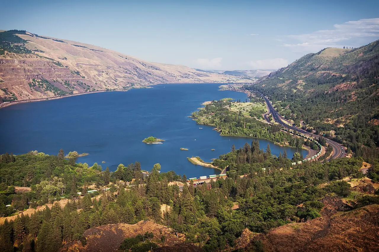

Rowena Crest Trailhead
Hood River, Oregon, Oregon. Scenic Viewpoint on Historic Columbia River Highway State Trail.
Details
- Where
- Hood River, Oregon, OR. No street address stated. Directions
- Getting there
- Take exit 69 off I-84 from Mosier and head east about 7 miles on Highway 30, or take the Rowena exit (#76) and head west on Highway 30 up the famous Rowena Curves.
- Access
- There are no restrooms at Rowena Crest. Visit Lower Mayer for public facilities. No dogs allowed in the Tom McCall Nature Preserve.
- Managed by
- Oregon State Parks.
Rowena Crest is a stunning viewpoint and trailhead along the Historic Columbia River Highway that looks down on Mayer State Park and the Columbia River Gorge. The view includes the iconic Rowena Loops — the horseshoe curves that wind up to the viewpoint, a true engineering marvel.
Notable Events
- 1919The firm of A. D. Kern began grading this section by late 1919, taking the highway down from Rowena Point to Rowena Canyon and Rowena Creek. npgallery.nps.gov
- 1921A basalt masonry pedestrian alcove with concrete caps just east of and below Rowena Crest Overlook gave drivers a view of the Columbia River and the bottomland near Rowena. npgallery.nps.gov
- 1921The Rowena Loops, designed by J. H. Scott of the Oregon State Highway Dept. and built by A. D. Kern of Portland. npgallery.nps.gov
- 1922On 27 June 1922 the Columbia River Highway from Portland to The Dalles was officially completed; Simon Benson, rake in hand, helped spread the hot stuff over the roadway near Rowena. npgallery.nps.gov
People
- John A. Elliott, Engineer who determined the eastern section be built to the western end's gentle turns and grade.
- Samuel C. Lancaster, Engineer who designed the highway's western end; his design standards inspired the loops.
- J. H. Scott, Locating engineer and designer of the Rowena Loops, Oregon State Highway Dept.
- Mark A. Mayer, East Coast industrialist and local orchardist who donated 260 acres to the state for Mayer State Park.
- Simon Benson, Helped spread the paving over the roadway near Rowena at the highway's completion (27 June 1922).
Sources
- stateparks.oregon.gov/index.cfm?do=park.profile&parkId=221
- commons.wikimedia.org/wiki/File:Columbia_River_from_Rowena_Crest_Viewpoint_looking_east.jpg
- npgallery.nps.gov/GetAsset/51ba64ac-e576-44cf-b3a4-11ce51588267
- hmdb.org/m.asp?m=112250
- hmdb.org/m.asp?m=112249
- usgs.gov/media/images/flood-basalt-lava-flow-stacked-layers-viewed-eastward-across