
Hickison Petroglyph Recreation Area
Austin, Lander County, Nevada. HISTORIC & CULTURAL SITE.
Details

- Where
- Off U.S. Highway 50, Austin, NV 89310. Directions
- When
- Open 24 hours a day, seven days a week.
- Getting there
- The recreation area is located along U.S. Highway 50, 24 miles east of Austin Nevada.
- Fees
- Free.
- Access
- The cultural resources at this site are protected by federal law against damage, defacement, removal, etc., and visitors should take care to help protect these sites. The native rock should not be carved, painted or otherwise modified in any way.
- Walk-in or reserve
- All 16 campsites are first-come, first-served.
- Phone
- 775-635-4000
- Managed by
- Mount Lewis Field Office.
- Coordinates
- 39.44868000000000, -116.73784999999999.
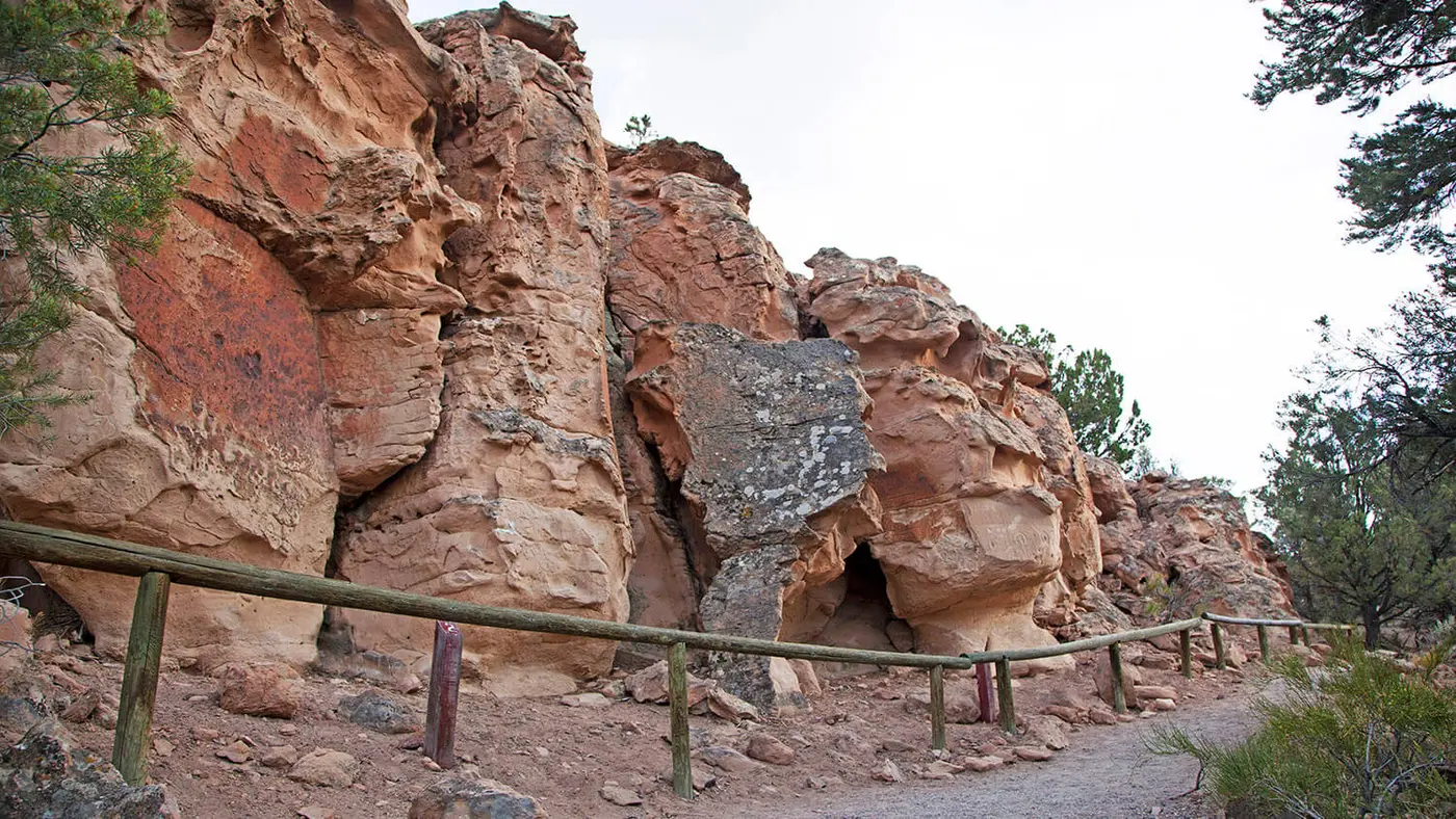
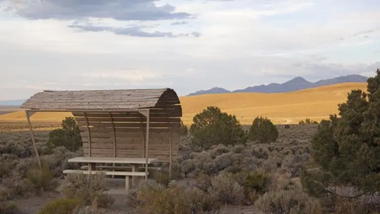
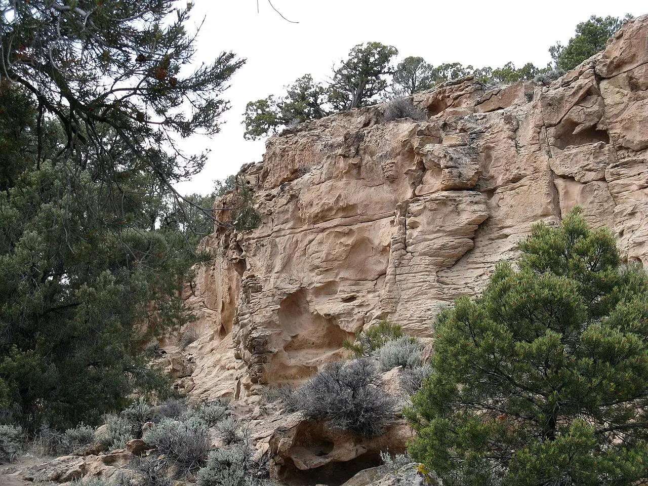
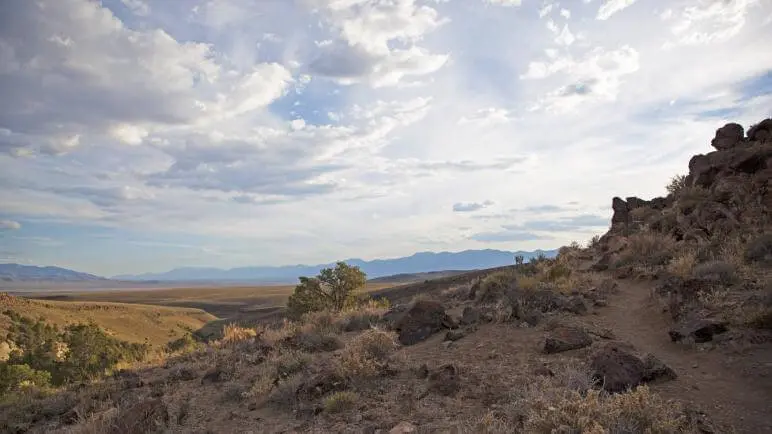
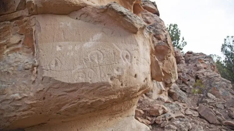
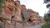
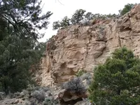
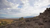
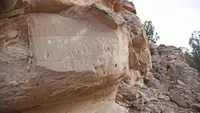
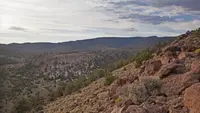
A graded dirt road leaves U.S. Highway 50 and runs about a mile into a canyon in the hills above Big Smoky Valley. At its end, picnic tables sit among bushy piñon trees. The Bureau of Land Management places the turnoff 24 miles east of Austin. Richard Moreno, writing for the Nevada Appeal in 2006, put it at about 20, and the Online Nevada Encyclopedia at around 30 miles southeast. The elevation is about 6,500 feet. Moreno set the site in the Simpson Park Mountains, and the encyclopedia at the northern end of the Toiyabe Range. Directly southwest of the parking lot rises a sandstone cliff, and carvings are cut into it.
The cliff, the boulders, and the overlook
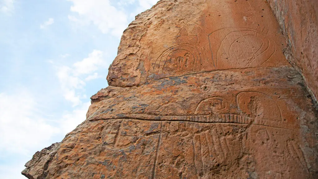
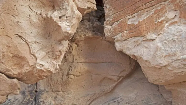
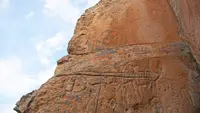
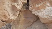
A self-guided trail of half a mile leads past many of the petroglyph panels. Numbered stops mark the way, and photographs on Wikimedia Commons run from Stop 1 to Stop 11a. On the cliff face Moreno counted “dozens more horseshoe-shaped carvings as well as various squiggles, circles and patterns” than he had seen on earlier stops. He had passed through several times before he noticed the rest. Across the canyon more symbols are carved high on the walls. Several large boulders near the picnic area carry a figure resembling “some kind of multiple-legged creature” and intricate grid patterns.
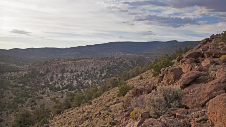
A longer route, the 1.6-mile Hickison Petroglyph Recreation Area Interpretive Trail, climbs 250 feet. Part of the ascent is by stairs, to overlooks above the canyon. Travel Nevada describes a 360-degree view from the top over Big Smoky Valley and the Toiyabe Range. Matted buckwheat and false dandelion have been photographed along the way. Moreno thought the scenery itself was “perhaps that’s what really attracted those early people who carved the petroglyphs.” The rock is protected by federal law, and the BLM asks that it not be carved, painted, or otherwise altered.
Sixteen sites in the piñons
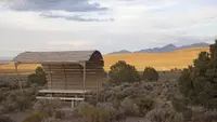
The campground has 16 sites, all first-come, first-served and free. Some are pull-through spaces, and each has a barbecue and a fire ring. Services are limited to pit toilets, trash collection, and a day-use picnic area. The BLM sets a 14-day stay limit and lists hiking and horseback riding among the activities. The area is open all day and all year. The Online Nevada Encyclopedia warns that snow and mud can make it difficult to reach in winter, and Travel Nevada notes that road conditions “can change rapidly any time of year.”
Three readings of a horseshoe
The National Park Service states that ancient peoples used the site around 10,000 years ago. Travel Nevada assigns that span to the Western Shoshone. It describes Big Smoky and Monitor valleys as then holding water and marsh that drew wildlife, with people following the seasons through the region. No one is sure what the carvings mean, and the explanations have shifted.
The state historical marker on the highway, No. 137, was erected in 1981 by the Nevada State Park System and the Austin Chamber of Commerce. It reads the site as a hunting ground. About a mile northwest, it says, a natural pass between two low buttes may have served for ambushing migratory deer herds, and three petroglyph panels are found there. Trapping, killing, and processing the deer required the “concerted, cooperative efforts of several families.” According to the marker, the carvings were added seasonally by the group’s shaman “as omens to insure a successful hunt.” The archaeologist Trudy Thomas reached a similar reading because she took the site’s most common motif to represent “hoof prints.”
Alanah Woody, writing for the Online Nevada Encyclopedia in 2009, set out an alternate reading. In it the marks are vulviforms, representations of female genitalia. The site would then have been a place for girls’ puberty rituals, or for “a female cult of affliction centered on reproductive disorders.” Woody wrote that similar marks are generally found on soft, white volcanic tuff and are often repeated in large numbers, which may point to ritual. She allowed that “perhaps the soft rock was easier for the initiates to carve.” She also noted that no historic ethnographic record shows girls producing rock art at puberty. That ritual centered on instruction by older women in the duties of womanhood. Moreno, for his part, reported that many archaeologists believe the Hickison glyphs represented fertility, and that some symbols seem to suggest the seasons and the sun.
The State Historic Preservation Office has since revised the text of roughly 260 markers and will replace the plates as funding allows. Its new text for No. 137 widens the hunt to bighorn sheep as well as deer, driven through passes and canyons. It notes that bighorn bones and horn dominate archaeological sites in the region. The bighorn later suffered catastrophic declines across the West from diseases carried by domestic sheep in the 19th century. The proposed plate lists every reading: “ceremonial, female puberty markers; ritual hunting magic symbols; and rock art or simply graffiti.”
Hickerson, Hickison, and the Lincoln Highway
The summit takes its name from a rancher whose ranch road passed over it. The Online Nevada Encyclopedia and Travel Nevada give his name as John Hickerson. The preservation office gives it as John Hickison. Travel Nevada admits, “we’re not quite sure how the spelling changed.”
The road he used became part of a longer one. Beside the state marker stands a small marker commemorating the Lincoln Highway. That route was conceived in 1912 and formally dedicated October 31, 1913, as the first road to cross the United States. In 1925 named routes gave way to numbers, and this stretch became U.S. 50. Before it closed, the Lincoln Highway Association ordered 3,000 concrete markers cast. Each had a rectangular head on a hexagonal post, with the highway’s logo, a bronze medallion, and arrows showing the route. In July 1986 Life magazine called the 287 miles of U.S. 50 from Ely to Fernley the “loneliest road” in America, with nothing to see along it.
The association’s 1916 road guide called a coast-to-coast trip “something of a sporting proposition” of twenty to thirty days. It told motorists to wade through water before driving into it, and to carry full camping equipment west of Omaha.
Notable Events
- 1913The Lincoln Highway, which the small marker at the site commemorates, was conceived in 1912 and formally dedicated October 31, 1913 as the first road to cross the United States. noehill.com
- 1925In 1925 the named trail was replaced by numbers, and the highway the recreation area stands on took the US 50 number from the Lincoln Highway. noehill.com
- 1981Erected 1981 by Nevada State Park System and Austin Chamber of Commerce. hmdb.org
People
- John Hickerson, rancher after whom the site was named.
- Trudy Thomas, interpreted the site as a hunting locality.
- John Hickison, rancher; the summit is named after him because the road to his ranch passed over it.
Sources
- travelnevada.com/indian-culture/hickison-petroglyph-recreation-area
- commons.wikimedia.org/wiki/Category:Hickison_Petroglyph_Recreation_Area
- blm.gov/visit/hickison-petroglyph-recreation-area
- recreation.gov/camping/gateways/2026
- nevadafireinfo.org/s/2026-Stage-1-restriction-order-NV-BMD-2.pdf
- web.archive.org/web/2015/https://www.onlinenevada.org/articles/hickison-summit