
.jpg)
Cathedral Gorge State Park
Panaca, Lincoln County, Nevada. State Park; Open seven days a week, 365 days a year.
Details

- Where
- Panaca, Lincoln County, NV. No street address stated. Directions
- When
- Open seven days a week, 365 days a year.
- Getting there
- The visitor center is located at the park entrance off U.S. 93.
- Fees
- Day use entrance fee: $5.00 per vehicle (Non-NV Vehicles $10.00 per vehicle); Camping: $15.00 per vehicle, per night (Non-NV Vehicles: $20.00 per vehicle, per night) + $10.00 for sites with utility hook ups; Bike in: $2.00 per bike.
- Access
- Stay on trails. Pets are welcome on a leash of not more than six feet. Light fires only in the fire rings and grills provided. Quiet hours are 10 p.m. - 7 a.m. The use of drones or any remote controlled aircraft is not allowed.
- Phone
- 775-728-8101
- Website
- parks.nv.gov
- Managed by
- Nevada State Parks.
- Established
- Cathedral Gorge became one of Nevada's first four state parks in 1935; Governor James Scrugham set aside the area for preservation in 1924.
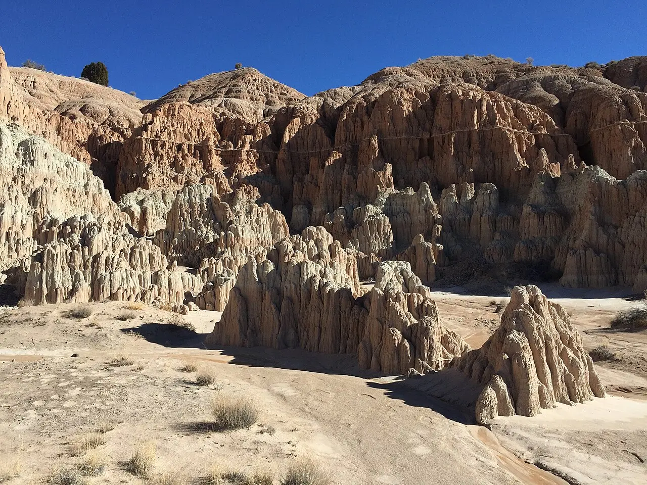
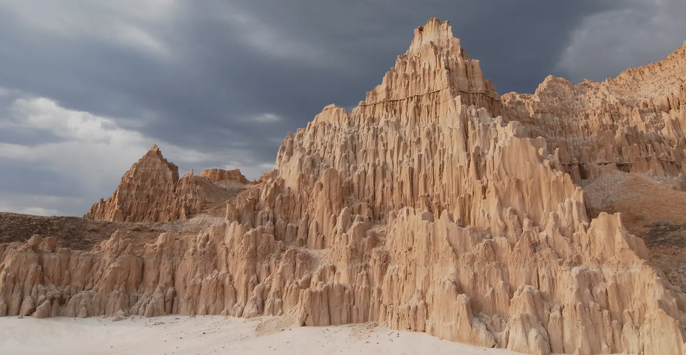
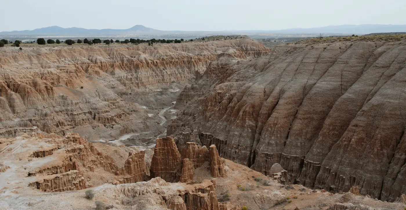
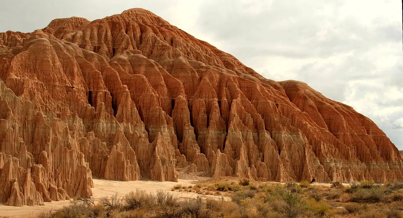
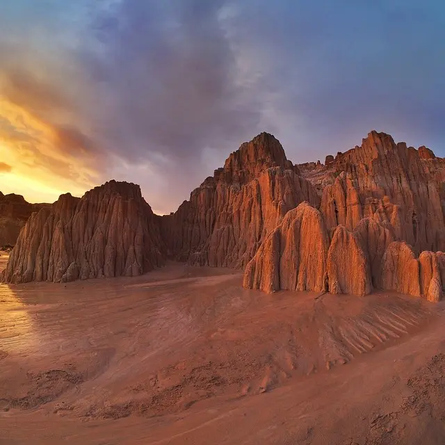
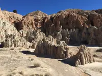
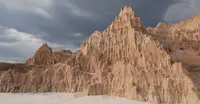
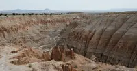
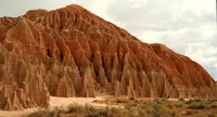
The regional visitor center stands at the park entrance off U.S. 93, at the west end of State Route 319, two miles northwest of Panaca in Lincoln County. From the lot the cliffs show buff-colored, cut into spires and fluted walls of soft bentonite clay. The center keeps interpretive displays and information on the other parks of eastern Nevada. A historical marker beside it tells the park’s story in a few paragraphs. Nevada State Parks gives the park close to 2,000 acres; Wikipedia gives 1,792.24. It lies at about 4,760 feet by Wikipedia’s figure and 4,800 by Nevada Magazine’s, and it is open every day of the year.
Slot canyons and the stairs at Miller Point
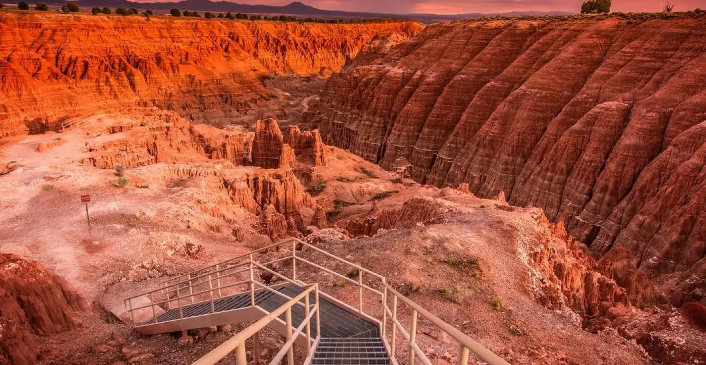
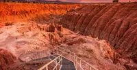
Six trails cross the park. The Bullionville Trail runs 0.2 mile from the visitor center to the Bullionville Cemetery. The Nature Loop, half a mile, leads from the campground across two washes to the slot canyons of the day-use area, with interpretive signs along the way. The Juniper Draw Loop makes a flat, sandy circuit of three miles around the formations of the valley floor. The New Ridge-line Trail, 4.2 miles, splits from it, winds through the formations, then follows the ridge line around the park. The Eagle Point Trail follows a ridge for 0.8 mile to a view over the whole park. The Miller Point Trail climbs a mile through the canyon, by a metal staircase at the end, to the overlook at Miller Point, where a ramada and a historical marker stand at the top. Deer are seen there now and then in late fall and winter.
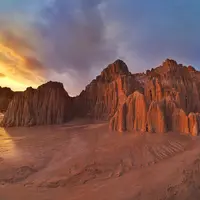
The narrow slot canyons are known locally as “caves.” Visitors crawl through tunnels into hidden chambers that stay cool in summer heat. Dawn Andone, the eastern region interpreter for Nevada State Parks, called the slot canyons the park’s big draw when she spoke to St. George News in 2021. “They’re totally different from slot canyons you see in Utah,” she said. Staff have taken down ropes that visitors strung in the crevices. One rope, in an opening reached by “the rabbit hole,” keeps finding its way back up. “We don’t encourage people to climb that rope,” Andone said. “Visitors can use it at their own risk.”
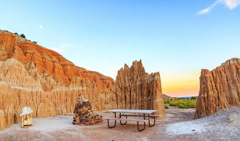
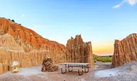
The campground has 22 sites by the state’s count. Each has a table, a grill, and a shade ramada, and electric hookups are available. Water, flush restrooms, and showers are open all year. Trees that are not native to the park have been planted around the campground for shade. In 2021 Andone described a 26-site campground that is nearly always full, with an overflow area in use, from Presidents Day to early June and from September to Thanksgiving. When she started in 2009, the park had about 35,000 visitors a year. By 2021 it had about 100,000, with the same staff. Dogs are allowed on a leash no longer than six feet. Drones are not allowed. Quiet hours run from 10 p.m. to 7 a.m. Park staff lead programs through the year, among them a Full Moon Hike on October 24, 2026, and Bullionville History Walks on Nevada Day, October 31, 2026.
Ash, a lake, and bentonite clay
The clay began as volcanic ash. Eruptions of the Caliente Caldera Complex, south of the park, laid it down in layers sometimes hundreds of feet thick. By the park’s account, the eruptions ended about five million years ago. Block faulting then opened a depression, now Meadow Valley, and the depression filled with a freshwater lake. Streams carried eroded ash and pumice into the water. More faulting drained the lake and left the soft sediments open to wind and rain. Wikipedia dates the lake to about five million years ago, in the Pliocene, and calls the canyon beds the Panaca Formation. The visitor-center marker puts the lake at “more than a million years ago.” It says the drained valley held a thousand feet of sediments and gravel, and that rivulets of rainwater and snowmelt began carving the gullies during the most recent ice age.
Little grows on the eroding slopes. On the valley floor, primrose and Indian ricegrass hold small sand dunes in place. Narrowleaf yucca, juniper, barberry, sagebrush, greasewood, white sage, shadscale, and four-winged saltbush grow there as well, and rabbitbrush lines the roadsides and walkways. Dark, bumpy patches around rocks and plants are cryptobiotic soil, which the park calls “desert glue.” This crust of bacteria, algae, lichens, mosses, and microfungi can take 100 years to recover once it is stepped on. Black-tailed jackrabbits, kit foxes, and kangaroo rats live in the park, along with roadrunners, kestrels, and ravens. In summer the Great Basin rattlesnake may be seen. Temperatures fall below freezing in winter and rise above 100°F in summer.
Bullionville and a gulch renamed
The park’s history page says the land was once home to the Fremont, Anasazi, and Southern Paiutes. White settlers arrived in the late 19th century. The visitor center sits on the site of Bullionville, where ore from Pioche was smelted because water was close at hand. A historical marker near the site says the town had 500 people by 1875, with five mills and the first iron foundry in eastern Nevada. That same year a water works went in at Pioche, and the mills eventually moved away. “Although a plant was erected here in 1880 to work the tailings deposited by the former mills, this failed to prevent the decline of Bullionville,” the marker reads. Andone said the mines had no economic use for the gorge and treated it as a garbage dump.
The name came from Bullionville. The visitor-center marker credits Mrs. Earl Godbe, a resident of the camp in the 1890s, whom St. George News describes as a mining foreman’s wife riding into the gorge on horseback. The eroded siltstone spires reminded her of European cathedrals, and she suggested the name Cathedral Gulch. Before that the place had been Panaca Gulch, according to a marker at Miller Point cited by St. George News. The Miller’s Point marker as transcribed by the Historical Marker Database reads instead: “Cathedral Gorge Named by Mrs. W. S. Godbe 1894.” Gulch later became Gorge. Andone said she suspects the change was a marketing ploy. “Who wants to go to a gulch?” she said.
Ladders, Easter pageants, and a juniper bowery
“In 1911, Nephi and Elbert Edwards, two teenage boys from Panaca, began exploring the nooks and crannies of Cathedral Gorge,” an interpretive sign at Miller Point explains. “They and their brothers built a series of ladders through cave-like crevices and crawlways.” In the 1920s the cliffs served as a backdrop for open-air plays and annual Easter ceremonies. The visitor-center marker calls them Biblical pageants. In the early 1920s the Edwards families led a movement to preserve the gorge and found a willing listener in Governor James Scrugham. The state’s history page says Scrugham set the area aside in 1924. The Miller’s Point marker says he designated it a state park in 1926. The Nevada Legislature created the park in 1935, under Governor Richard Kirman. It was one of Nevada’s first four state parks, with Valley of Fire, Kershaw-Ryan, and Beaver Dam. All but Valley of Fire lie in Lincoln County. Andone said Valley of Fire claims to be first because its dedication came first, and that the two parks still have a little rivalry over the question.
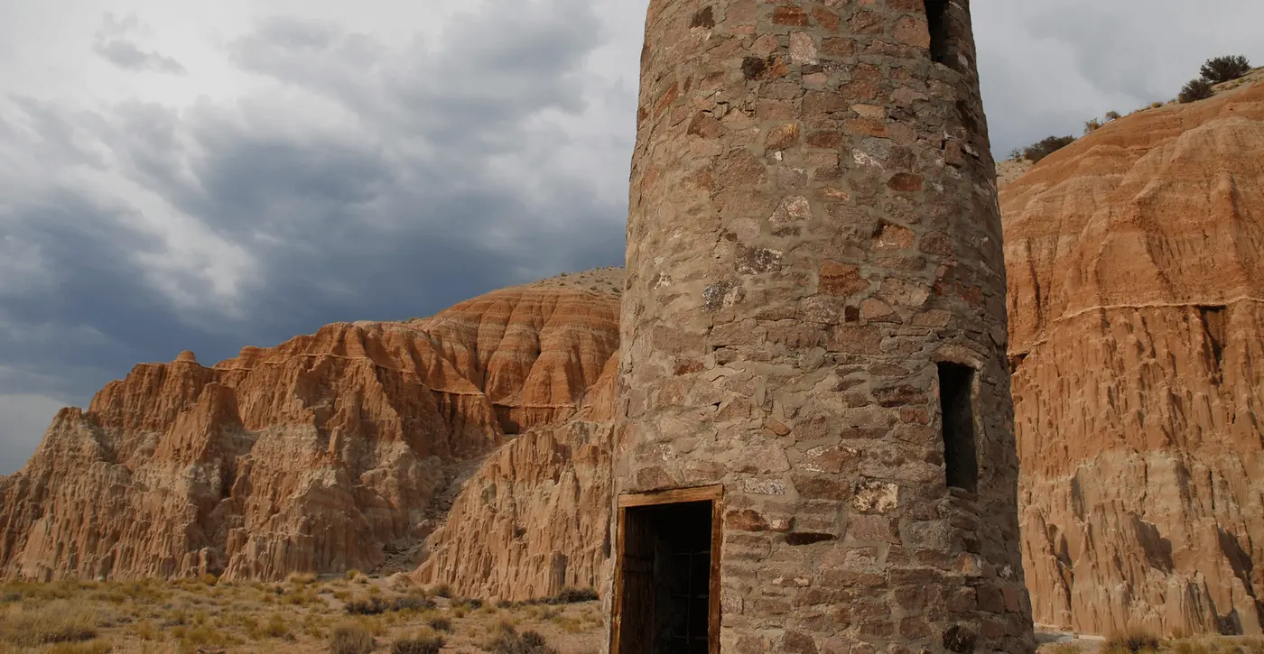
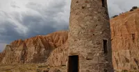
Civilian Conservation Corps crews arrived in 1934. They built picnic pavilions, a bathroom, a stone water tower, and a bowery of juniper logs at Miller Point. The point was named for Col. Thomas Miller, then head of CCC operations in the area. The Miller’s Point marker records that the Union Pacific Masonic Club gave the name on February 22, 1935, and that St. John Lodge No. 18, F & A M, dedicated the point on August 18, 1935. The park’s own dedication took place at the bowery, and Scrugham, by then a U.S. congressman, spoke there. The CCC worked in the gorge through 1935. Another crew came in the early 1940s, mostly for flood control.
The CCC picnic facilities are still in use. The stone water tower and stone rest room at the entrance to the day-use area are not. None of the CCC structures is on the National Register of Historic Places; they are protected because they stand inside the park. Andone said some visitors tell her their grandparents met because of the Cathedral Gorge CCC camp.
Notable Events
- 1890sMrs. Earl Godbe, wife of a mining foreman from Bullionville, suggested the name Cathedral Gulch for the area, which at first was known as Panaca Gulch. stgeorgeutah.com
- 1894Named by Mrs. W. S. Godbe. hmdb.org
- 1911Nephi and Elbert Edwards, two teenage boys from Panaca, began exploring the Gorge. hmdb.org
- 1920sThe Edwards families led the movement to preserve and protect the Gorge. hmdb.org
- 1920sDuring the 1920s, Cathedral Gorge provided the background for open-air plays and annual Easter ceremonies. stgeorgeutah.com
- 1924Governor James Scrugham set aside the Cathedral Gorge area for preservation. parks.nv.gov
- 1926Designated a state park by Gov. Jas G. Scrugham. hmdb.org
- 1930sThe Civilian Conservation Corps built the original picnic facilities. parks.nv.gov
- 1934Civilian Conservation Corps members arrived to build picnic pavilions, a bathroom, a water tower and a bowery of juniper logs at Miller Point, which was named for Col. Thomas Miller, head of CCC operations in the area. stgeorgeutah.com
- 1935Created a State Park by the Nevada Legislature. hmdb.org
- 1935Dedicated by St. John Lodge No. 18 F & A M. hmdb.org
People
- Jas G. Scrugham, Governor who designated a state park (1926).
- Mrs. W. S. Godbe, Named Cathedral Gorge (1894).
- Elbert Edwards, teenage explorer of the gorge who with his brothers built ladders through the crevices (1911).
- Mrs. Earl Godbe, early visitor from Bullionville who suggested the name Cathedral Gulch (1890s).
- Nephi Edwards, teenage explorer of the gorge who with his brothers built ladders through the crevices (1911).
- James Scrugham, Governor who set aside the area for preservation (1924).
- Col. Thomas Miller, head of CCC operations in the area; Miller Point was named for him (1934).
- Richard Kirman, governor under whom Cathedral Gorge officially became a state park (1935).
Sources
- parks.nv.gov/parks/cathedral-gorge
- parks.nv.gov/learn/park-histories/cathedral-gorge-history
- en.wikipedia.org/wiki/Cathedral_Gorge_State_Park
- commons.wikimedia.org/wiki/File:2015-01-15_11_35_58_Eroded_bluffs_in_Cathedral_Gorge_State_Park,_Nevada.JPG
- stgeorgeutah.com/opinion/cathedral-gorge-day-a-unique-landscape-that-has-gone-from-a-garbage-dump-to-an/article_041a494e-1ff5-52a6-a899-a46172b7546a.html