Scenic drives and byways in Arizona
Scenic drives and byways in Arizona, each compiled from its own sources: length, season, road surface, and the towns on it. No ratings; every entry carries its status.
Point at a dot to see the place.Tap a dot to see the place. Road map of Arizona.
- Apache Trail Historic RoadTortilla Flat · Historic roadState Route 88, the Apache Trail, a wagon road built to haul freight to Roosevelt Dam, still runs five unpaved miles beyond Fish Creek Vista in Arizona's Tonto country.
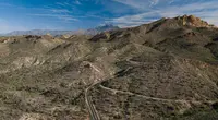
- Black Hills Back Country BywayBetween Safford and Clifton · Type II bywayA 21-mile convict-built dirt road through the volcanic Black Hills between Safford and Clifton, Arizona, crossing the Gila River on a 1918 double-arch concrete bridge.

- Coronado Trail National Scenic BywayClifton · National scenic bywayThe Coronado Trail carries U.S. 191 from the copper pit at Clifton and Morenci up over the Mogollon Rim to Springerville, through what ADOT counts as 460 curves.
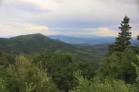
- Desert to Tall Pines Scenic RoadYoung · Scenic bywayA partly unpaved back road from the Mogollon Rim to Roosevelt Lake in Gila County, Arizona, crossing the Salt River on a one-lane Parker truss bridge built in 1920.
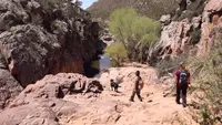
- Parker Dam Road Back Country BywayParker · Back country bywayThe Parker Dam Road "Thread of Life" highlights the scenic, natural, historic, and prehistoric values along an 11 mile road that travels along the California shore of the Colorado River.
- Swift Trail ParkwaySafford · Scenic driveClimbs more than 7,000 feet over 35 miles with views of the surrounding landscape.
Scenic Drives in all eleven states; next door in California, Utah, Colorado, and New Mexico.