Apache Trail Historic Road
Tortilla Flat, Arizona. Historic Road.
Details
- Where
- Tortilla Flat, AZ. No street address stated. Directions
- When
- SR 88 is OPEN at Fish Creek Vista (Milepost 222).
- Getting there
- From Phoenix, travel south on Interstate 10 and turn east on US Route 60. At Apache Junction head north on State Route 88, the Scenic Road.
- Access
- Only high-clearance vehicles and no trailers are currently signed for; the 1.5-mile section at Fish Creek Vista is steep and more winding and narrow than other parts of the road.
- Phone
- (928) 467-3200
- Website
- azdot.gov
- Managed by
- Department of Transportation.
- Established
- Constructed in 1904 to provide construction access for the Roosevelt Dam, which was completed in 1911.
In Flatiron Park, at 100 North Apache Trail in Apache Junction, a bronze plaque stands with the Superstition Mountains behind it. In the spring of 2021, desert marigolds grew at its base. The Apache Trail Chapter of the Daughters of the American Revolution placed it and dedicated it on February 19, 2020. It names the road beside it “Apache Trail / State Route 88 / Arizona’s First Historic Highway.”
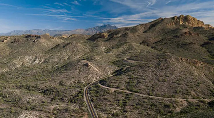
From the park the highway runs northeast. It passes Goldfield, a ghost town that the chapter’s account calls “a commercialized tourist site reminiscent of an old mining town,” and Lost Dutchman State Park with its hiking trails. Then it enters the Tonto National Forest. North of the road the land rises steeply into the Four Peaks Wilderness, and south of it into the Superstition Wilderness, with steep-sided canyons and rock outcroppings along the way. Past Tortilla Flat and Fish Creek, the road reaches Theodore Roosevelt Dam at the confluence of the Salt River and Tonto Creek. Near the dam is Tonto National Monument and its cliff dwellings, which the DAR account says were built and occupied by Salado people in the 14th century.
The sources do not agree on where the road ends or how long it is. The Arizona Department of Transportation’s list of historic roads gives 49 miles, from Apache Junction by way of Roosevelt to the junction with US 60 near Globe. The department’s list of scenic roads gives 40. Recreation.gov and the DAR marker page end the trail at Roosevelt Dam, where it meets State Route 188. In 1980 the Superstition historian Tom Kollenborn ended it at Highway 60-70, some four miles east of Miami.
Pavement’s end at Fish Creek
The road was built and maintained in sections, and the pavement stops partway. State crews first graded the single-lane, 12-foot road for drainage and safety in 1915. In 1936 they widened it to 16 feet and graveled it. In 1949 and 1950 they widened the southern sections to 22 feet and chipsealed them between Apache Junction and the Fish Creek Bridge, “to finally accommodate motor vehicles moving in opposite directions,” in ADOT’s words. Of the rest, the department writes: “Most of the final hair-raising section between Fish Creek Bridge and Roosevelt Lake has never been paved.”
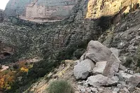
Today the unpaved stretch runs from Fish Creek Vista at milepost 222 to milepost 227, near Reavis Trailhead Road. ADOT notes that much of the route east of Tortilla Flat keeps its original historic character. The first 1.5 miles at Fish Creek Vista are steeper, narrower, and more winding than any other part of the highway. Recreation.gov describes the road there hanging on the side of a high-walled canyon, above precipices “that sink sheer for hundreds of feet below.” ADOT’s alert for the road reports four-wheel-drive-only and no-trailer signs posted. Its project page says that conditions can change with severe weather or rockfall, and it asks drivers to be confident in their vehicles before they start down. Kollenborn wrote of the curves and grades: “Even today as we drive the Apache Trail it certainly can challenge our skill as a driver.”
Fire, flood, and five closed years
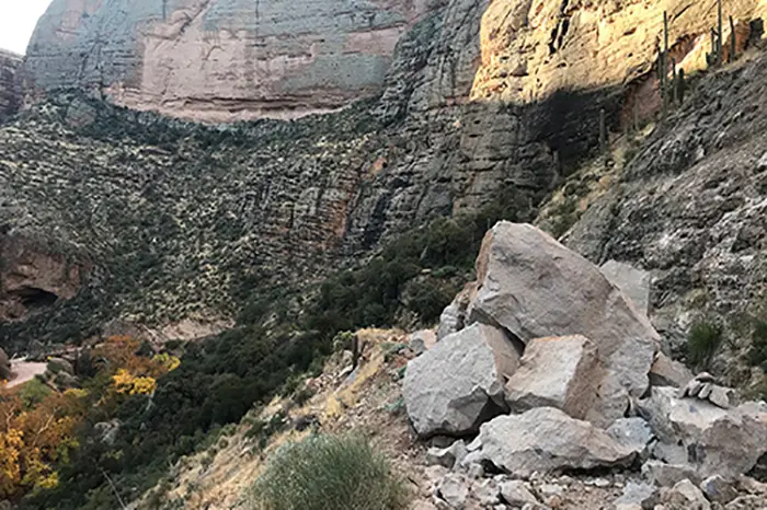
In June 2019 the Woodbury Fire burned almost 124,000 acres of the Tonto National Forest. That September a storm dropped about six inches of rain on the burn scar. The runoff tore up large parts of the road, and the worst damage fell between Fish Creek Vista and milepost 227, where a rockslide left the road impassable. Arizona’s Family reported that the unpaved section then stayed closed for about five years for lack of funding.
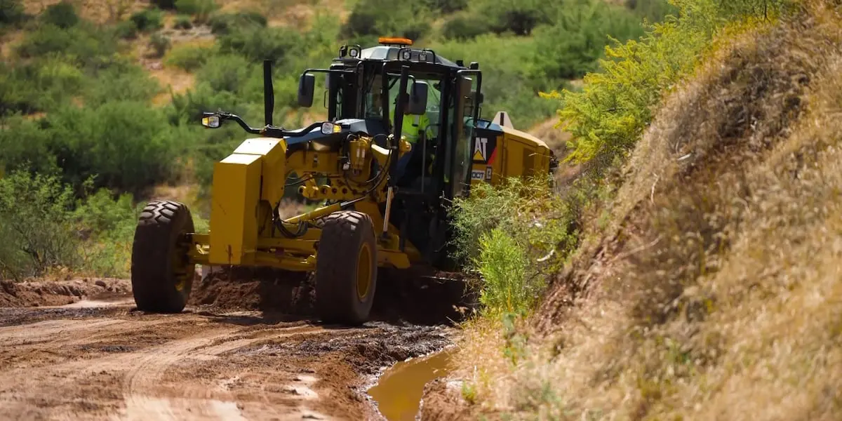
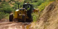
In October 2023 ADOT finished a study that recommended $33.7 million in work: chipseal across the five miles, widening to 15 feet in the steeper places, more drainage capacity, bridge repairs, and new pullouts. That plan has no dedicated funding. The department spent $4 million on an interim project instead. Crews removed boulders on Fish Creek Hill, mitigated rockfall between Fish Creek Vista and Fish Creek Bridge, repaired retaining walls, put up new signs, and replaced damaged culverts. Because SR 88 follows an easement through federal land, the U.S. Forest Service reviewed the design. The road reopened in September 2024.
Monsoon storms struck again in July 2026. A rain gauge near Reavis Trailhead recorded more than 8 inches over a single weekend, and one near Fish Creek Hill recorded more than 5. The storms tore up a stretch roughly six miles past Tortilla Flat. “There was a ton of rain that came in between like 5 and 8 inches in those sections, and that’s a lot of water in a short amount of time and a tall task for any roadway to handle,” said ADOT’s Doug Pacey. Crews cleared rockfall and clogged culverts and regraded the surface, and the section reopened within the month. John Buber, general manager at Tortilla Flat, said it felt like “déjà vu,” because people “don’t know you can actually get all the way to it.” He also said: “Tortilla Flat is open. We’re good. We’re ready to rock. Been here since 1904, and we’re not stopping now.”
Apache and Pima crews on the Tonto Wagon Road
The route itself is far older than 1904. Kollenborn wrote that the Salado used it to reach the Salt River Valley around 900 A.D. Later Native peoples followed it between winter homes in the desert lowlands and summer homes in the mountains. Apaches and Yavapais also used it for raids against the Pimas on the Salt and Gila Rivers. After Camp McDowell was founded on the Verde River in 1864, the Pimas became allies of its soldiers. The footpath through the mountains to Tonto Basin was then called both the Tonto Trail and the Yavapai Trail.
Plans for the road began on the river in the early 1880s. A young man ran the Salt from near the present dam site to Phoenix in a cataract boat and reported many good places for a dam. The Maricopa County Board of Supervisors then ordered a feasibility study, carried out by William “Billy” Breakenridge, a Tombstone lawman; James H. McClintock, later Arizona’s official historian; and John H. Norton. Breakenridge also scouted a route for a wagon road. His report favored a site just below the mouth of Tonto Creek. Congress funded the dam in March 1903 but set aside no money for a haul road, so the Salt River Valley towns drew up a bond plan of their own.
According to Kollenborn, work began on August 29, 1903, with 200 Apache laborers just below the dam site. On November 11 a second camp opened at Government Well, about 25 miles from Mesa, with some 200 Pima laborers. He gives the completion date as September 3, 1905, the length as 62 miles from the Mesa railhead to the dam site, and the cost as $551,000. He also reports that more than a million and a half pounds of freight crossed the road in its first month.
A Historic American Buildings Survey inventory card prepared by Clayton B. Fraser in 1987 tells it differently. In Fraser’s account, Phoenix and Mesa raised $71,500 from bond issues in 1903. Bureau of Reclamation engineers routed the road alongside the ancient trail. Construction engineer Louis C. Hill supervised the grading and took on Apache laborers to speed the work. The road was finished in March 1905 at a total cost of $206,000. Fraser quotes one source calling the road “almost as great a monument to (Hill’s) engineering ability as the Roosevelt Dam itself.”
The Red Terror and the Sunset Limited
Kollenborn lists the road’s firsts. The first Concord stage made its run over the Mesa-Roosevelt Road on June 10, 1905. On August 23 a Knox automobile known as the “Red Terror” drove from Mesa to Government Wells. The first so-called tourist group came through on October 10. On November 23 a stagecoach wrecked between Mormon Flat and Fish Creek Hill, the road’s first major accident.
While the dam was under construction, from 1906 to 1911, traffic on the road was tightly regulated. Once the dam was done in 1911, the road drew tourists. Until 1915 it was known as the Mesa-Roosevelt Road or the Tonto Wagon Road, and newspapers sometimes called it the Roosevelt Road. Shortly after 1915 it became the Apache Trail. Kollenborn writes that historians “appear to agree in general” that the name came from E.E. Watson, a Southern Pacific railroad agent. Watson was promoting the Sunset Limited and offered its transcontinental passengers a side trip over the road. The National Park Service dates the railroad’s marketing to 1916. Its passengers were driven from Globe to Apache Junction on an overnight trip, and along the way they explored the Tonto cliff dwellings, which President Roosevelt had made a national monument on December 19, 1907. Kollenborn closes his account with words he attributes, with a hedge, to Roosevelt: “The Apache Trail combines the grandeur of the Alps, the glory of the Rockies, the magnificence of the Grand Canyon and then adds an indefinable something that none of the others have.”
On September 9, 1927, the road became one of Arizona’s original ten state highways. Major rehabilitation in the early 1920s replaced its bridges, and later dams on the Salt forced some sections onto new alignments.
The arch at Alchesay Canyon
One structure from the first construction remains. At milepost 241.10, half a mile northeast of Roosevelt, the road crosses Alchesay Canyon on a reinforced concrete arch built in 1904–05. Its span is 18 feet, and its total length is 22.5. Fraser called it “little more than a culvert, actually.” The bridge has solid concrete parapets and rough formwork. On the downstream side its wingwalls extend to carry a switchback through the narrow canyon. It was one of the last pieces of the road to be finished, and Fraser identified it as the oldest dateable vehicular bridge in Arizona.
Fraser inspected the bridge on February 20, 1987. Five days later, on February 25, the Apache Trail was dedicated at Lost Dutchman State Park as Arizona’s first historic highway.
Notable Events
- 1903Construction began with two hundred Apache laborers working below the dam site on the Salt River. ajpl.org
- 1903A Government Well work camp employed about 200 Pima laborers. ajpl.org
- 1905The Tonto Wagon Road was completed at a cost of $551,000 and ran from the Tonto Dam site to the Mesa railhead. ajpl.org
- 1905The first Concord stage made a run over the Mesa-Roosevelt Road. ajpl.org
- 1905A stagecoach accident between Mormon Flat and Fish Creek Hill was the road's first major accident. ajpl.org
- 1906The road was highly regulated during Roosevelt Dam construction, then became a favorite tourist attraction. ajpl.org
- 1915The road became known as the Apache Trail. ajpl.org
- 1915State transportation workers first graded the single-lane, 12-foot-wide road for drainage and safety. azdot.gov
- 1916The Southern Pacific Railroad began marketing the Apache Trail as a tourist automobile trip between Globe and Apache Junction. nps.gov
- 1927The road became one of the original 10 state highways designated by the Arizona State Highway Department. azdot.gov
- 1936Gravel was applied to the road newly widened to 16 feet. azdot.gov
- 1949Southern sections were widened to 22 feet and chipsealed between Apache Junction and Fish Creek Bridge. azdot.gov
- 1987The Apache Trail was officially dedicated as Arizona's first historic highway at Lost Dutchman State Park. ajpl.org
- 2019The Woodbury Fire consumed almost 124,000 acres of Tonto National Forest. azdot.gov
- 2019A storm dumped approximately six inches of rain on the fire scar; runoff severely damaged the road, including a large rockslide. azdot.gov
- 2023ADOT completed a study recommending $33.7 million in improvements to make the road more accessible and resilient to severe weather. azdot.gov
- 2024ADOT completed the interim reopening from Fish Creek Vista to milepost 227 near Reavis Trailhead Road. azdot.gov
- The Salado used the trail to penetrate the Salt River Valley around 900 A.D. ajpl.org
People
- E.E. Watson, Southern Pacific railroad agent whom historians appear to agree in general coined Apache Trail.
- James H. McClintock, Conducted the county dam feasibility study.
- John H. Norton, Conducted the county dam feasibility study.
- Theodore Roosevelt, President who may have described the Apache Trail's beauty, as this source hedges the attribution.
- William “Billy” Breakenridge, Conducted the county dam feasibility study and also explored a possible wagon-road route.
- Louis C. Hill, Bureau of Reclamation construction engineer who supervised grading of the access road.
Sources
- azdot.gov/about/historic-and-scenic-roads/list-scenic-roads
- azdot.gov/projects/southeast-district-projects/state-route-88-apache-trail
- recreation.gov/camping/gateways/13563
- azdot.gov/about/historic-and-scenic-roads/list-historic-roads
- nps.gov/places/confluence-of-change-wayside.htm
- historical-markers.arizonadar.org/2020-02-19-apache-trail
- ajpl.org/apache-junction-history/stories-of-the-superstitions/the-apache-trail
- npgallery.nps.gov/GetAsset/0823b80d-c6c1-4046-b3d9-a853ab72c841