Desert to Tall Pines Scenic Road
Young, Gila County, Arizona. Scenic byway; Year round.
Details

- Where
- Young, Gila County, AZ. No street address stated. Directions
- When
- Open 24/7; check ADOT's website for road closures and updates.
- Getting there
- Begins at the Miami Gardens crossroads where State Route 188 meets U.S. Route 60 just west of Globe; follows State 188 to its junction with 288.
- Fees
- None.
- Access
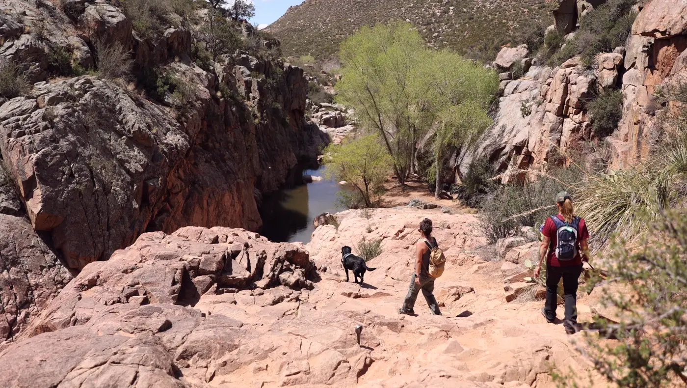
- A standard SUV is recommended. While the road is passable with a sedan in good weather, some mountainous sections receive little sunlight and might remain muddy or icy for several days after a storm.
- Phone
- 928-462-4300
- Website
- arizonahighways.com
- Managed by
- Tonto National Forest, Pleasant Valley Ranger District.
- Established
- 1989.
Thirty-two miles east of Payson on State Route 260, Forest Road 512 turns south off the Mogollon Rim and passes a grove of aspen. This is the north end of the Desert to Tall Pines Scenic Road. Arizona Highways writes that it is “informally known as the Young Highway,” and the Gila County and federal byway pages give the local name as the Globe-Young Highway. Forest Road 512 becomes State Route 288 and runs south through the Tonto National Forest to State Route 188 north of Globe.
Sources disagree on the length. Arizona Highways, the Arizona Department of Transportation, and the Forest Service give 74 miles. The federal America’s Byways site gives 76. The National Scenic Byway Foundation gives 67. The Gila County account measures from the mining country north of Globe to the Rim and counts “about 90 miles.” The federal site says to allow at least four hours, and Arizona Highways says the road “isn’t a drive you can do before lunchtime.”
Down from the Rim on Forest Road 512
Large sections of the road are unpaved, and some lack guardrails. Arizona Highways recommends a standard SUV. A sedan can make it in good weather, but some mountain stretches get little sunlight and may stay muddy or icy for several days after a storm. The Forest Service notes heavy snow in several areas during winter and lists no potable water along the route.
Arizona Highways describes the drive from north to south, with mileages it calls approximate. South of the aspens the road enters the first of two areas burned by wildfire, where saplings are coming up among the dead ponderosas. At Mile 14 the road crests a hill with the Mogollon Rim to the right. The U.S. Geological Survey describes the Rim as the eroded, dissected southwestern edge of the Colorado Plateau, a steep escarpment about 2,000 feet above a lower, stepped plateau, running about 80 miles. The road is narrow, with frequent pullouts. At the pullout near Mile 19, scorched trees stand on the left and dense forest on the right.
The Gila County account, written from the other direction, has Forest Road 512 climbing the Naegelin Rim to the Colcord Mountain lookout, with a view across the Tonto Basin. The Naegelin Rim is named, that account says, for a local rancher who “had managed to stay out of harm’s way during the Pleasant Valley feud.”
Young, a mile up
The road descends into Young. The Gila County account places the town in the middle of the nearly three-million-acre Tonto National Forest, “just short of a mile above sea level,” some 65 miles from the byway’s southern start. Arizona Highways counts fewer than 700 residents and notes that outside electricity did not reach Young until the mid-1960s. The Gila County account calls it “a cow town first and foremost, dependent on the always unpredictable business of ranching for its survival.”
The sources disagree about food. Arizona Highways says the town has no restaurants and suggests eating a picnic lunch there. The federal byway text mentions “a good meal at either of Young’s two restaurants.” The Gila County version of the same passage replaces those with “good wine at Bruzzi Vineyard.”
The Arizona Department of Transportation and the Forest Service both list the Pleasant Valley Cemetery in Young as a common stop.
Over the Sierra Ancha to Roosevelt Lake
South of Young the road climbs again. A vista point near Mile 31 looks back at the Rim and down on the town. Then the canopy opens, and small trees and bushes replace the tall pines. In the Gila County account the road crosses a brushy, forested plateau to the Honey Creek Divide. The Sierra Ancha Wilderness lies to the east and the Salome Wilderness to the west. Sierra Ancha is Spanish for “wide range,” and the account says the range is home to “uncommonly large numbers of mountain lions, black bears, and other big mammals.”
Less than a mile below the divide, Forest Road 487 branches east to Workman Creek and its waterfalls. The account says that road is best suited to four-wheel drive. It climbs through manzanita, mahogany, and ponderosa pine, skirts sheer cliffs, and reaches the top of Aztec Peak, at 7,694 feet the highest point in the Sierra Ancha. From the top the view takes in Devils Canyon, Mystery Spring, the Mazatzal Mountains, and the Mogollon Rim to the north. Salado cliff dwellings, the account says, “dot the range.”
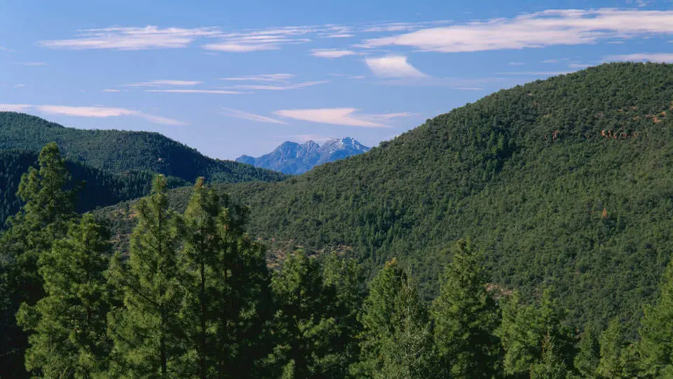
On the main road near Mile 41, McFadden Peak (7,135 feet) fills the view as the road starts down toward the desert. The road passes streams in riparian areas, where Arizona Highways says birds and deer may be seen. It then comes out above Roosevelt Lake, with red cliffs and mountains to the south and Four Peaks to the west. The pavement begins on this grade, and the turns are sharp.
The lake behind Roosevelt Dam was one of the earliest major water reclamation works in the United States. The Gila County account credits an Arizona businessman, A. J. Chandler, who had long lobbied for a reservoir to water the fields of what is now the Valley of the Sun. President Theodore Roosevelt pressed for the National Reclamation Act of 1902, which authorized federal funding of “reservoirs and mainline canals impracticable for private enterprise.” The dam bearing his name was dedicated in 1911. Below the lake, ponderosa gives way to saguaro and prickly pear.
A Parker truss from 1920
About 30 miles north of Globe, the road reaches the Salt River near the head of Roosevelt Lake. An ADOT account from January 2025 describes the approach heading north: a rocky cliff on the right and the river on the left. The bridge is a long-span steel Parker truss. Its footings are set directly into the solid rock of the shoreline. Its concrete deck, between steel pipe guardrails, takes one vehicle at a time. ADOT reports few alterations since it was built.
The bridge dates to 1918. That year the newly formed Bureau of Public Roads, a predecessor of the Federal Highway Administration, began scouting an earth road through the Tonto and Crook National Forests. The road was to run from the Apache Trail near Roosevelt 44 miles north to Young, and a bridge over the Salt was one of its major parts. The design was finished in 1919, and the bridge carried traffic by the end of 1920.
It holds number 37 in ADOT’s historic bridge inventory for Gila County. ADOT calls it the earliest documented Bureau of Public Roads bridge in Arizona. It is also the earliest and longest through-truss bridge in the state still in its original location, and one of four Parker trusses in ADOT’s statewide inventory.
In 1959 a state resolution made the road a state route “from S.R. 88 north approx 50 miles to & through Young.” The National Scenic Byway Foundation records a Forest Service Byway designation in 1989. On July 13, 2001, Arizona named it a state Scenic Road, covering State Route 288 and Forest Road 512. Arizona Highways calls it a National Scenic Byway, and it appears on the federal America’s Byways site, though the state’s designation table enters no federal designation for it. South of the bridge, State Route 188 runs about 15 miles to the crossroads of Miami Gardens, where it meets U.S. Route 60 just west of Globe.
Salado, Apache, and a lieutenant’s basin
According to the Gila County account, few people have ever lived in this country. The Salado people settled the rocky bowl between the Mogollon Rim and the Sierra Ancha “only in small numbers.” The Apaches who followed hunted its elk and deer but seldom stayed in one place more than a few weeks. Today, across the hundreds of square miles that State Route 288 passes through, only a few hundred people live year-round.
Lieutenant John Gregory Bourke, a U.S. Army officer who served here in the early 1870s, called the Tonto “a weird scene of grandeur and rugged beauty.” He added: “The ‘Basin’ is a basin only in the sense that it is all lower than the ranges enclosing it — the Mogollon, the Matitzal [Mazatzal] and the Sierra Ancha — but its whole triangular area is so cut up by ravines, arroyos, small stream beds and hills of very good height, that it may safely be pronounced one of the roughest spots on the globe.”
In 1927 the Globe Business and Professional Women’s Club wrote a poem about the winding roads between Globe and distant Jerome. In it they called the Sierra Ancha “that land of feud and mystery/and of beautiful birds in song.”
Notable Events
- 1902President Theodore Roosevelt pressed for the act that authorized federal funding for reservoirs and mainline canals. fhwaapps.fhwa.dot.gov
- 1911The dam that created Theodore Roosevelt Lake was dedicated. fhwaapps.fhwa.dot.gov
- 1918The Bureau of Public Roads began scouting a new earth road through the Tonto and Crook National Forests from the Apache Trail near Roosevelt north to Young. azdot.gov
- 1918According to ADOT's historic inventory description, the bridge story started in 1918. azdot.gov
- 1919The bridge design for the new road was completed. azdot.gov
- 1920The bridge began carrying traffic by the end of 1920. azdot.gov
- 1959Resolution establishes a state route from SR 88 north approximately 50 miles to and through Young. azhighwaydata.com
- 1960sThe isolated community of Young received outside electricity. arizonahighways.com
- 1989From the Desert to Tall Pines Scenic Road was designated a Forest Service Byway. nsbfoundation.com
- 2001Desert to Tall Pines Scenic Road designated a state Scenic Road. azsos.libguides.com
People
- A.J. Chandler, Arizona businessman who lobbied for the reservoir project that created Theodore Roosevelt Lake to supply agricultural fields.
- John Gregory Bourke, U.S. Army lieutenant who served in the area and described the Tonto Basin (early 1870s).
- Naegelin, Local rancher for whom Naegelin Rim was named; the source says he stayed out of harm's way during the Pleasant Valley feud.
- Theodore Roosevelt, President who supported the reservoir project and pressed for the National Reclamation Act (1902).
Sources
- fs.usda.gov/r03/tonto/recreation/desert-tall-pines-scenic-byway
- arizonahighways.com/young-highway
- discovergilacounty.com/blog-categories-adventure/from-the-desert-to-tall-pines-explore-this-gila-county-scenic-byway
- fhwaapps.fhwa.dot.gov/bywaysp/byway/50187
- azdot.gov/about/historic-and-scenic-roads/list-scenic-roads
- nsbfoundation.com/sb/from-the-desert-to-tall-pines-scenic-road
- azdot.gov/adot-blog/other-salt-river-bridge
- arizonahighways.com/young-highway
- pubs.usgs.gov/fs/0159-00/report.pdf