Gresham
Multnomah County, Oregon.
Gresham, a suburban city in East Multnomah County, Oregon, began as Powell’s Valley or Campground and packed berries as its main industry for fifty years.1
Details
- Last checked
- October 6, 2026.
Point at a dot to see the place.Tap a dot to see the place. Road map of Gresham.
In Gresham
The Calendar
History
Powell’s Valley and the Campground
Gresham runs from a northern tip on the Columbia River near Blue Lake Park to the rural edges of Multnomah and Clackamas Counties, with Portland on its west.1 The Oregon Encyclopedia counts it as the fourth largest city in Oregon, with an estimated 114,247 people in 2020.1
The land had been part of the seasonal hunting and camping grounds of an upper branch of the Clackamas Chinook, whose villages on the Columbia River were devastated by disease before white settlers arrived in numbers in the mid-nineteenth century.1 In 1851 the brothers Jackson and James Powell took adjoining land claims on the site of present-day Historic Downtown Gresham, beside a main route from Portland to the Oregon Trail that is now Powell Boulevard and U.S. Highway 26.1 Other settlers followed and formed a rural community known as Powell’s Valley or Campground, after a camp meeting ground where people gathered at the crossing of two main roads to hear circuit riders preach.1 Through a clerical error the settlement received two post offices in 1884, Campground and Gresham, and when the Postal Service revoked Campground, Gresham became the official name.1 The name honors U.S. Postmaster General Walter Quintin Gresham, who never visited the town.1
Fir Mills, Cuthbert Raspberries, and the Springwater Line
Dense old-growth Douglas-fir made early farming impossible, and as many as five lumber mills worked the area from the 1860s through the 1890s.1 As the land was cleared, families turned to corn, grain, potatoes, lettuce, and hops.1 In the 1910s farmers began growing filberts, strawberries, and Cuthbert raspberries, and berry farming, processing, and packing were the town’s main industry for fifty years.1
The Springwater Division rail line from Portland arrived in 1903 and brought a surge of residents, and in 1919 a group of wealthy businessmen laid out the summer community of Ambleside on the line east of town.1 A city council formed in 1904, and Gresham was incorporated the following year.1 The 1940 state guide, Oregon: End of the Trail, found Gresham at 295 feet with 1,635 people, the business center of an extensive berrying area and the scene of the Multnomah County Fair.2 That fair, with horse races and exhibition halls, was held downtown from 1907 to 1969 and moved to the Portland Expo Center in 1970.1
Miyo Iwakoshi and the Orient Sawmill
In 1897 Miyo Iwakoshi, her younger brother Rikichi, and her adopted daughter Tama Nitobe settled east of Gresham with her Scottish husband, Andrew MacKinnon, and the Oregon Encyclopedia says they may have been one of the first Japanese families in Oregon.1 MacKinnon founded the Orient Sawmill, which gave its name to the community of Orient, now within the city limits, and both were likely named in honor of Iwakoshi.1 Iwakoshi helped other Issei settle where nonwhite immigrants were often kept from owning land, and immigrants bought property through citizen children or white friends.1 Under Executive Order 9066 many Japanese and Japanese American farmers were removed to concentration camps during World War II, whites took over their properties, and the community that came back was fractured and reduced.1
Subdivisions on the Berry Fields
In the early 1960s Interstate 80N, now Interstate 84, replaced the stretch of U.S. Highway 30 along Gresham’s northern boundary, and as California berries out-competed Oregon farms, farmers sold their land to developers.1 The city annexed Rockwood, Powell Valley, Orient, and Pleasant Valley, and its population went from 3,944 in 1960 to 65,235 in 1990.1 Mt. Hood Community College opened in northeast Gresham in 1966 on open land at the semi-rural eastern fringe.1
The Roberts House and the Carnegie Library
The Oregon Encyclopedia names the 1868 home of John and Ruth Roberts, near Powell Boulevard and Wallula Avenue, as the oldest of the town’s few surviving historic structures.1 Near the north boundary, the 1874 Zimmerman House is part of the Zimmerman Heritage Farm Museum.1 In 1911 residents donated money for a lot at North Main Avenue and Fourth Street, a condition of the Carnegie Foundation, which then paid for a library.3 Folger Johnson, lately arrived in Portland from New York, chose the Tudor style, with false half-timbering and brickwork laid in herringbone.3 The library opened on the afternoon of March 1, 1913, with Clarisse H. Haile as librarian, and after renovations finished in 2012 it reopened as the Gresham Historical Museum.3 A meandering stretch of Johnson Creek runs through the city among a series of buttes, all within the Boring Volcanic Field.1
Within 30 Miles
Measured in a straight line from the town, nearest first.
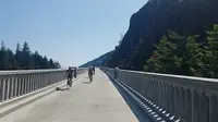
- Historic Columbia River HighwayTroutdale · National historic landmarkThe Historic Columbia River Highway, built 1913 to 1922 from the Sandy River near Troutdale to The Dalles, was laid out by an engineer who surveyed first for "the beauty spots."
- Dabney State Recreation AreaTroutdale · State recreation areaA state park on the Sandy River outside Troutdale, Oregon, where a summer swimming beach, an 18-hole disc golf course and the take-out for a seven-mile float share the same shaded bank.
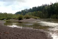
- Day in DamascusDamascus · Annual community carnivalDay in Damascus is the Damascus Civic Club's July carnival at its privately owned Centennial Park on Highway 212, where local candidates take turns in a dunk tank.

- Camas DaysCamas · Weekend celebrationCamas Days, a two-day July street festival in downtown Camas, Washington, begun in 1974, where Camas and Washougal council members take part in bathtub races outside City Hall.
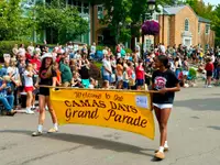
- Big Eddy, Washougal RiverWashougal · ParkBig Eddy is a county-owned swimming beach on the Washougal River near Washougal, Washington, where a deep summer pool sits above the run's one class IV rapid.
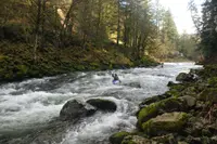
- Dougan Falls Swimming HoleWashougal · Parking lotDougan Falls, where the Washougal River in Skamania County, Washington, drops 19 feet sideways into a deep pool used for summer swimming at the end of the pavement.
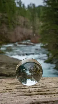
- Naked FallsWashougal · Day use areaThe second largest waterfall on the Washougal River, a decades-long hotspot for kayakers and cliff divers, with day use and riverside camping on the crystal clear Washougal.
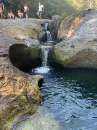
- Sandy Swimming HoleWashougal · Swimming holeThe Sandy Swimming Hole Park is located at the upper end of lower Washougal River Greenway. Facilities include restrooms, picnic tables, a beach, a boat launch for non-motorized boats, and parking. Swimming is permitted, with no lifeguard on duty.
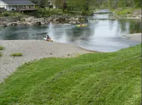
- Milwaukie FestMilwaukie · Annual weekend-long summer festivalMilwaukie's signature events bring long-time residents and newcomers together to enjoy each other's company and celebrate what makes the city unique. The city hosts the following signature events each year: Arbor Day, Umbrella Parade & Tree Lighting, Winter Solstice & Christmas Ships, Earth Day.
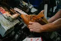
- Danner boot factory toursPortland · In-person factory tourFree, scheduled tours of Danner's working boot factory in Northeast Portland, Oregon, where six visitors at a time watch hides tested, uppers stitched down, and liners dunked for leaks.
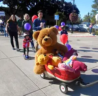
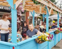
- Multnomah Days Festival & ParadePortland · One-day open-airA one-day street festival and parade in Portland's Multnomah Village, begun by local merchants about 1920, whose parade admits no motorized vehicles or floats.
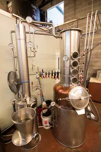
- Stone Barn BrandyworksPortland · Craft spiritsStone Barn Brandyworks makes craft spirits that capture the essence of the Northwest. We are a human-scale distillery invested in our people, ingredients, and products. Our spirits are fermented and distilled in our Southeast Portland distillery, using local and organic ingredients whenever possible. We started out in 2009 making fruit brandy and liqueurs inspired by the European tradition.
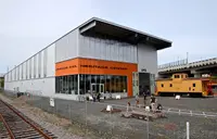
- Oregon Rail Heritage Center (Oregon Pacific Railroad excursions)Portland · Train ridesAll roundtrip excursions depart from the Oregon Rail Heritage Center and travel along the east bank of the Willamette River. After passing the iconic Oaks Amusement Park, the train returns to the ORHC. Each ride lasts approximately 40 minutes.
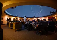
- Harry C. Kendall PlanetariumPortland · PlanetariumOMSI's 200-seat, 52-foot domed theater, one of the most technologically advanced planetariums in the Pacific Northwest, with daily planetarium presentations and evening laser shows.
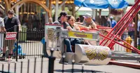
- Multnomah County FairPortland, OR · County fairMultnomah County's fair, begun by Gresham granges more than a century ago, now runs three days each late May inside Portland's Oaks Amusement Park, staged entirely by volunteers.
44 more within 30 miles on the road map.
Nearby towns: Hillsboro, Hood River, and Longview. All the towns of Oregon. More of Oregon: Town Festivals.