
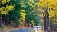
Historic Columbia River Highway
Troutdale, Multnomah County, Oregon. National Historic Landmark; Spring through fall.
Details

- Where
- Troutdale, Multnomah County, OR. No street address stated. Directions
- When
- 9 a.m. to 6 p.m.
- Getting there
- From Troutdale at Interstate 84 exit 17, the road follows the Sandy upstream through Corbett to the Portland Women's Forum State Scenic Viewpoint.
- Fees
- Day-use parking permit required; purchase a 1-day permit on site.
- Access
- Parking is extremely limited, especially on weekends and holidays; do not park in no-parking areas and check current trail and road conditions.
- Walk-in or reserve
- A timed-use permit is required for visitors using the I-84 Exit 31 Multnomah Falls parking lot during the summer peak.
- Phone
- 541-387-4010
- Managed by
- Oregon Parks and Recreation Department.
- Established
- 1916.
From the Sandy River to Crown Point
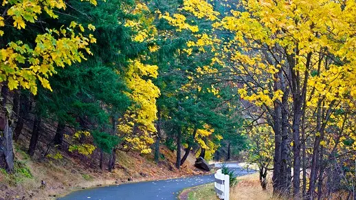
At Troutdale, exit 17 off Interstate 84, signs lead through town and over the Sandy River onto the old road. It follows the Sandy upstream for several miles, then climbs past orchards, cane berry and blueberry fields through Springdale and Corbett, with glimpses of Mount Hood. Lewis and Clark camped on the banks of the Sandy in 1805. TripCheck, the state’s road-information service, says the river then ran gritty with ash from Mount Hood’s 1802 eruption. Most of the road between the Sandy and Larch Mountain Road predates the highway. It was part of the farm-to-market system that radiated out of Portland into eastern Multnomah County. The highway’s own mileposts begin farther west. A 1924 state log set Historic Mile Post 0.00 at SW Washington Street and SW Broadway in downtown Portland, so the Sandy River Bridge at Troutdale is reckoned at 14.2.
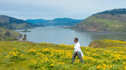
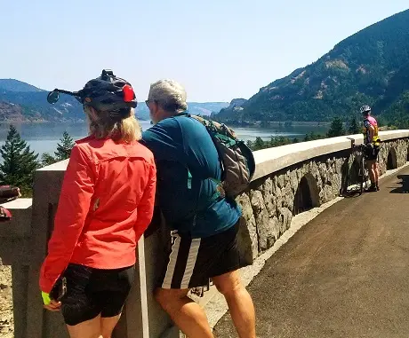
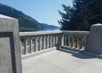
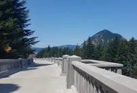
Past Corbett the road reaches its first cliff-top view of the Gorge, at the Portland Women’s Forum State Scenic Viewpoint on Chanticleer Point, 725 feet above the river. The stone guard walls and arches here are the highway’s standard work. Below lie the basalt cliffs that Ice Age floods cut through ancient lava flows between 18,000 and 13,000 years ago. A mile on, Vista House sits atop Crown Point. It was built in 1918 as a memorial to Oregon pioneers, was dedicated in May of that year, and holds displays on the building of the highway. The Gorge opens out from its rotunda.
Five falls in eight miles
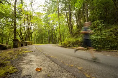
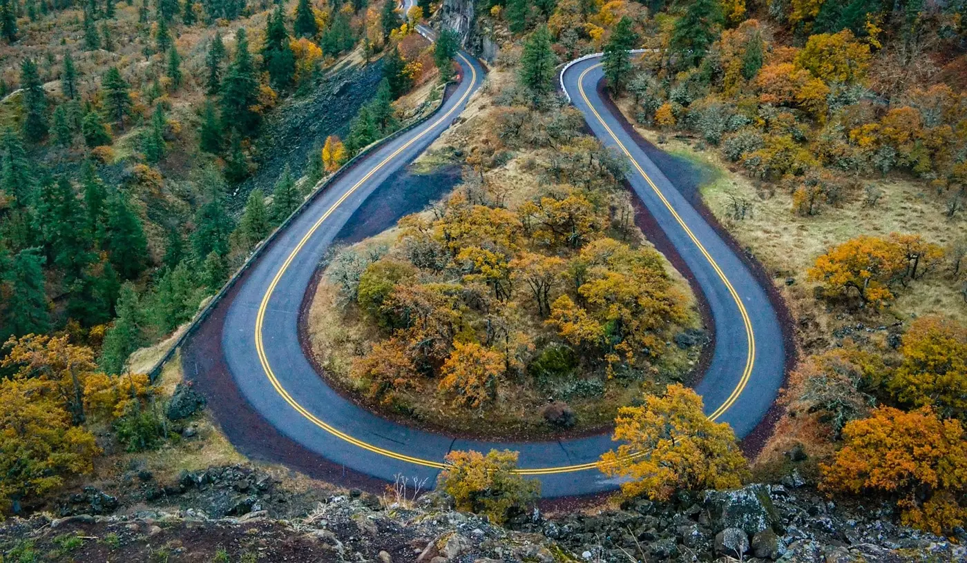
Crown Point stands about 600 feet above the road’s descent. To get motorists down it, Lancaster engineered what TripCheck calls “figure-eight loops,” gentle arcs laid out for early-century touring cars. The road drops into shade, moss, and fern. In 8 miles, by Travel Oregon’s count, it passes the base of five falls: Latourell, Shepperd’s Dell, Bridal Veil, Wahkeena, and the 620-foot Multnomah. Many have viewing areas and bridges close enough for the mist to reach. A trail climbs from Multnomah Falls Lodge to the lower cascade and then zigzags to the top. TripCheck dates the lodge to 1925, and the National Historic Landmark nomination calls it a 1926 Cascadian-style restaurant and interpretive center. Farther on, Horsetail Falls drops close enough to the road to mist a car’s windows. Oneonta Gorge shelters more than fifty species of plants in its damp, cool walls.
The landmark nomination counts eight reinforced-concrete bridges in this section, each of its own design, along with box culverts dating from 1915. Mortared masonry guard walls line the outside curves. Guard rocks set atop the retaining walls mark the edge of the pavement. Since 1987, state masons have recast concrete spindles, replastered decorative panels, repointed stone, and reset fallen guard rocks. At Oneonta the road was moved slightly in 1948 to bypass the Oneonta Tunnel. It now crosses the creek on a 1948 girder span, and the 1915 bridge still stands beside it.
The Forest Service calls this waterfall corridor the most popular segment of the highway, “bumper to bumper” on weekends. There is no parking on the shoulder. The small lot beside the historic road at Multnomah Falls is run by Sasquatch Shuttle, which charges first-come, first-served. In summer, from late May to early September, the larger lot at I-84 Exit 31 requires a timed-use permit, and the 2026 permit season has ended. The Columbia Gorge Express bus stops at the falls on its run between Portland’s Gateway Transit Center and Hood River. The Forest Service lists the Multnomah Falls restrooms as closed for renovation through November 2026. A 2017 wildfire damaged several hikes along the route and cut into parking.
The middle miles and the Twin Tunnels
East of Dodson the drivable old road gives out, and the byway runs about 25 miles on Interstate 84. At exit 40, the visitor center at Bonneville Lock and Dam has an underwater window onto the fish ladder. At Cascade Locks the Pacific Crest Trail comes down out of the mountains and crosses the Bridge of the Gods to Washington.
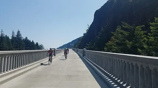
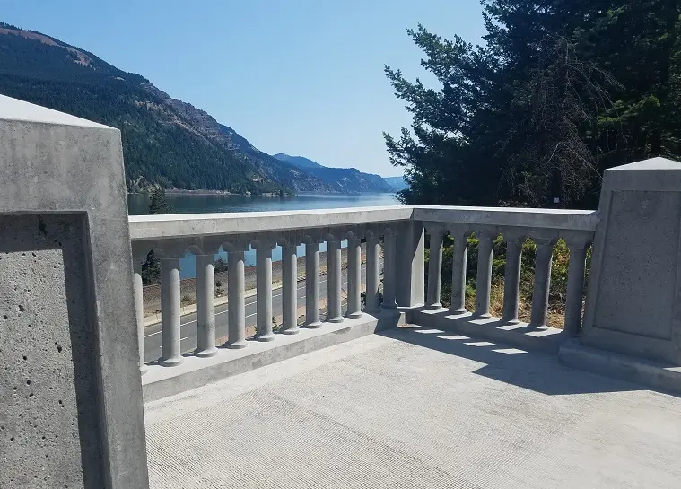
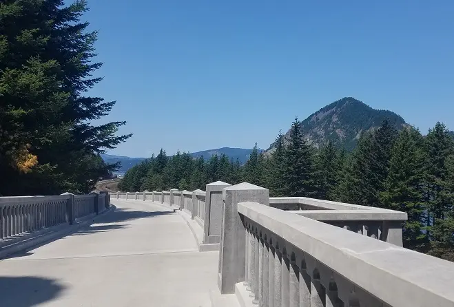
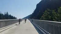
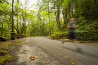
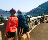
Through these miles the abandoned highway survives in pieces as the Historic Columbia River Highway State Trail, open to walkers and cyclists and closed to cars. Oregon Parks and Recreation runs the trail with the Department of Transportation. Three paved segments add up to more than 12 miles. The Bonneville segment runs from John B. Yeon State Scenic Corridor to Cascade Locks. The Mitchell Point segment, nearly 6 miles from Wyeth to Viento, rounds Shellrock Mountain on the 500-foot Summit Creek Viaduct and passes four falls: Starvation Creek, Cabin Creek, Hole-in-the-Wall, and Lancaster. The original Mitchell Point Tunnel was destroyed by the interstate. The state broke ground in spring 2021 on a 655-foot replacement with five arched windows recalling the first, and its page gave 2024 as the scheduled opening.
The Twin Tunnels segment runs between Hood River and Mosier. State Parks gives its length as 4.5 miles and Travel Oregon as 5. From the Mark O. Hatfield West Trailhead it rolls through fir forest and past viewpoints to the Mosier Twin Tunnels. On the east side the country turns semi-arid, and the last mile runs through ponderosa pine. When the interstate opened, this stretch was closed, the tunnels were filled with rock, and the road was abandoned. Clearing them took several months. The workers turned up graffiti dating to 1921, left by drivers snowbound in the tunnels for several days.
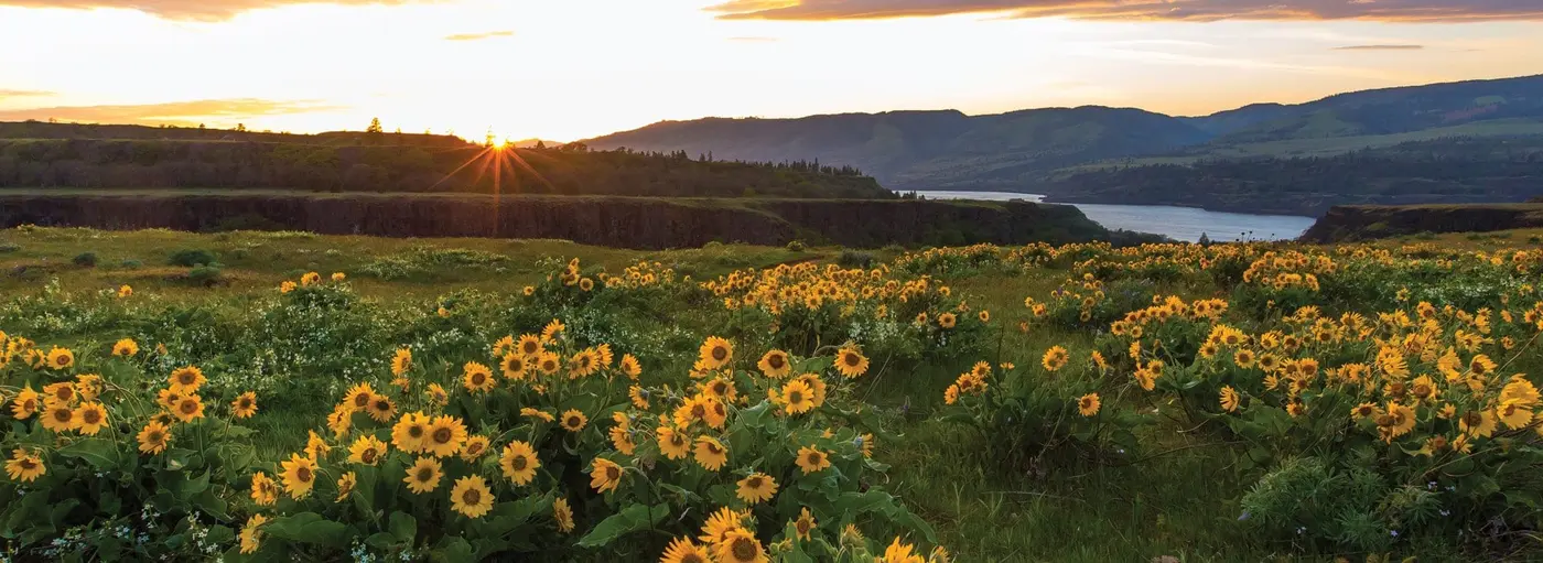
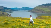
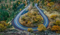
Past Mosier the byway returns to the old road, and TripCheck says the “two Oregons” meet here: the wet western Gorge gives way to the dry plateau. At Rowena Crest, footpaths lead into the Tom McCall Preserve, known for its spring wildflowers and for several plants found only in the Gorge. The road then snakes down the Rowena Loops, a descent featured in several car commercials. From Mosier to The Dalles the highway keeps its original line except for half a mile near Tooley Lake, and its four bridges from 1920 and 1921 are intact. It ends at The Dalles, long a Native American gathering place, where the Columbia Gorge Discovery Center serves as the interpretive center for the National Scenic Area.
Two Sams at Chanticleer Point
The Troutdale Historical Society says the idea came from the Washington side of the river. Sam Hill, a wealthy entrepreneur, had driven the highways of Europe while attending the first International Road Congress in Paris, and he came home and lobbied in Washington for a road along the Columbia. Washington turned him down, so he took the idea to Oregon. In 1913 Oregon authorized its first state highway commission to build a state highway system, and the Columbia River Highway was part of that system. That same year, at the Chanticleer Inn on the point where the Women’s Forum viewpoint now stands, Hill and the engineer Samuel C. Lancaster looked over the Gorge and began mapping the route.
Lancaster stated his method plainly. “On starting the surveys, our first business was to find the beauty spots, or those points where the most beautiful things along the line might be seen in the best advantage, and if possible to locate the road in such a way as to reach them,” he wrote in 1913. The Troutdale society quotes his wish that “not one tree was felled, not one fern crushed unnecessarily.” Of Multnomah Falls he wrote that “it charms like magic; it woos like an ardent lover; it refreshes the soul; and invites to loftier, purer things.”
In 1914 Multnomah County set aside $75,000 to hire him and relied on revenue bonds to pay for its portion of the road. The county roadmaster was the timber baron John B. Yeon, who handled rights-of-way across private land, construction costs, and labor disputes. He also took up the question of how motorcycle officers patrolling the finished highway would be dressed. Letters to him from Chas. Cooper & Sons, Civilian and Military Tailors, came with a sketched uniform and with concern that the cloth be of fleece wool grown in Oregon. The roadbed itself was built largely by local farmers and country people. They worked alongside Italian stonemasons and the Warren Company’s asphalt layers, who paved the road with a new mix of crushed rock and asphalt. An Oregon Historical Society photograph shows road workers protesting on the highway on April 25, 1914. The road was laid 24 feet wide, with 18 feet of pavement and a 3-foot shoulder on each side. Simon Benson, a retired lumberman and hotelier, bought scenic sites along the line, Multnomah Falls among them, and gave them to the state.
The Oregon Encyclopedia dates the first section’s opening to 1915, which made the road the first paved highway in the Pacific Northwest. On June 7, 1916, Oregonians came to Multnomah Falls by rail to dedicate it, and the Troutdale society gives 1916 as the opening. The county’s portion was largely complete that year. Lancaster wrote to the American Roadbuilders Association that it “may be compared to the German Rhine between Mayenze [sic] and Cologne.” Frederick Villiers of the Illustrated London News wrote: “It possesses the best of the great highways of the world… It is the King of Roads.” Another nickname, the Forest Service notes, was “A Poem in Stone.” Work in Hood River and Wasco counties was paid for with federal funds and Oregon fuel-tax money, and the road reached The Dalles in 1922.
Bypassed, buried, and brought back
By the 1930s the road could not keep up with traffic. Its pavement was spread to the full 24 feet sometime in the 1930s or 1940s to carry larger cars and trucks. Engineers designed a water-level route to bypass much of the old highway, and two lanes of it reached The Dalles by 1953. The Troutdale society says the public had been assured the old road would be maintained, but by 1953 many pieces had been “carelessly destroyed.” By 1970 the new route was a four-lane freeway, first designated Interstate 80N and later Interstate 84. The Oregonian later wrote that the old highway was “almost entirely destroyed in the 1960s.” The designers had kept two stretches: the western road from the Sandy River to Ainsworth, for its falls and trails, and the eastern road from Mosier to The Dalles. In 1983 only 55 discontinuous miles were left of the original 73.8.
Private citizens and public agencies pressed for a study, and in 1981 the National Park Service convened one. In 1982 the highway’s Hood River Bridge was destroyed, and the loss built support for saving the rest of the route. The road and its designed landscapes went on the National Register of Historic Places in 1983. In 1984 the American Society of Civil Engineers named it a National Historic Civil Engineering Landmark. The Columbia River Gorge National Scenic Area, designated in 1986, began the work of reconnecting the route. The highway became an All-American Road in 1999. The Oregon Encyclopedia and State Parks date its National Historic Landmark designation to 2000. The Troutdale society says the National Park Service named it a landmark in 1984. The landmark designation noted that the Park Service had made Lancaster’s design standards the cornerstone of its “Lying Lightly on the Land” philosophy for national park roads. The state trail became a National Recreation Trail in 2002.
On June 7, 2016, exactly a hundred years after the first dedication, Oregon came back to the base of Multnomah Falls to dedicate the road again. Dignitaries arrived in classic cars and period dress, and an impersonator of Sam Hill led the ceremony. The Royal Rosarians came with the outgoing Rose Festival Queen, Kahedja Burley, while flower girls scattered rose petals. Thomas Lauderdale of Pink Martini and a Daughters of the American Revolution chorus led the crowd in “Roll On, Columbia, Roll On.” “People from all over the world will come here - this time on bikes,” said former Governor Ted Kulongoski. Ten of the 73 miles were still unconnected, and closing them would take a tunnel blasted through rock and an 800-foot viaduct. The ceremony ended with a giant American flag unfurled over Benson Bridge, lifting in the wind off the falls.
Notable Events
- 1913Oregon's first state highway commission was authorized to build a system including the Columbia River Highway. fhwa.dot.gov
- 1913The seventy-four-mile highway was built from the Sandy River near Troutdale to The Dalles. oregonencyclopedia.org
- 1914Multnomah County earmarked $75,000 to hire engineer Samuel Lancaster to begin its portion of the highway. multco.us
- 1915The first road section opened, making the Columbia River Highway the first paved highway in the Pacific Northwest. oregonencyclopedia.org
- 1916Oregonians arrived by rail at Multnomah Falls to officially dedicate the new Columbia River Highway. oregonlive.com
- 1916The highway opened in 1916, according to the historical society's account. troutdalehistory.org
- 1950sBy the 1950s automobile technology and society's wishes had outpaced the highway; its slow contemplative design was deemed inadequate for fast-moving industry. troutdalehistory.org
- 1953Two lanes of a new water-level route designed to bypass much of the old highway were completed to The Dalles. oregonencyclopedia.org
- 1953Despite assurances of preservation during construction of a newer highway, many pieces of the old road had been destroyed by 1953. troutdalehistory.org
- 1960sThe article says the Columbia River Highway was almost entirely destroyed in the 1960s for construction of Interstate 84. oregonlive.com
- 1980sLocal activists and political leaders took measures to restore and preserve sections of the highway. troutdalehistory.org
- 1981Prompted by private citizens and local, state, and federal agencies, the National Park Service convened professionals to study the highway and produced guidance for maintenance, conservation, and reuse. oregonencyclopedia.org
- 1983The road and its associated designed landscapes were listed in the National Register of Historic Places. oregonencyclopedia.org
- 1984The American Society of Civil Engineers designated the highway a National Historic Civil Engineering Landmark. oregonencyclopedia.org
- 1999The highway became a National Scenic Byway-All American Road. oregonencyclopedia.org
- 2016Oregon returned to Multnomah Falls to rededicate the now-historic highway for a new generation, exactly one hundred years after its original dedication. oregonlive.com
People
- John B. Yeon, Retired lumberman and Multnomah County roadmaster who oversaw construction.
- Samuel Lancaster, Engineer who surveyed the Gorge and wanted the highway built around its vistas rather than merely through it.
- Samuel C. Lancaster, Engineer and landscape architect who teamed with Samuel Hill to create the highway.
- Samuel Hill, Entrepreneur and Good Roads promoter who teamed with Samuel C. Lancaster to create the highway.
- Simon Benson, Retired lumberman and hotelier who bought scenic sites along the highway, including Multnomah Falls, and donated them to the state for preservation.
- Arthur Babitz, Former Hood River mayor discussing the transformative potential of reconnecting the highway in a promotional video for the project.
- Barack Obama, President whose message hailed Oregon's effort to repurpose the historic highway.
- Barbara Roberts, Former Oregon governor speaking at the Multnomah Falls rededication ceremony.
- Jeff Merkley, U.S. senator represented at the rededication despite not attending.
- Kahedja Burley, Outgoing Rose Festival Queen appearing with the Royal Rosarians at the rededication.
- Ron Wyden, U.S. senator represented at the rededication despite not attending.
- Ted Kulongoski, Former Oregon governor speaking at the highway rededication ceremony (2016).
- Thomas Lauderdale, Pink Martini musician who joined a Daughters of the American Revolution chorus to lead the rededication crowd in a sing-along.
- Frederick Villiers, Illustrated London News commentator who praised the highway as the King of Roads.
- Sam Hill, Wealthy entrepreneur who lobbied for a road along the Columbia after attending the International Road Congress in Paris.
Sources
- traveloregon.com/things-to-do/trip-ideas/scenic-drives/the-historic-columbia-river-highway
- oregon.gov/odot/regions/pages/historic-columbia-river-highway.aspx
- tripcheck.com/Pages/Scenic-Byways-Historic-Columbia-River
- fhwaapps.fhwa.dot.gov/bywaysp/byway/2141
- stateparks.oregon.gov/index.cfm?do=park.profile&parkId=113
- fs.usda.gov/r06/columbiarivergorge/recreation/historic-columbia-river-highway
- oregon.gov/odot/waterfall-corridor-permits/pages/default.aspx
- npgallery.nps.gov/GetAsset/51ba64ac-e576-44cf-b3a4-11ce51588267
- oregonencyclopedia.org/articles/columbia_river_highway