
Dabney State Recreation Area
Troutdale, Multnomah County, Oregon. State Recreation Area.
Details

- Where
- Troutdale, Multnomah County, OR. No street address stated. Directions
- When
- June - Aug: 7am to 10pm. Sept - May: 7am - dusk.
- Getting there
- On the Sandy River southeast of the Stark Street Bridge on the Historic Columbia River Highway (Hwy 30).
- Fees
- Day-use parking permit required (purchase 1-day permit on site).
- Access
- Swift currents and hidden obstructions beneath the surface. Do not swim, float, paddle or boat without a life jacket. Two life jacket loaner stations on site, with life jackets of various sizes available. No pets are permitted. Alcohol is permitted in the park and picnic area; not on the beach or below Stark Street Bridge.
- Walk-in or reserve
- Picnic shelter can be reserved for events up to 50 people, online or by phone.
- Phone
- 503-695-2261
- Website
- stateparks.oregon.gov
- Managed by
- Oregon Parks & Recreation Department.
- Established
- 1945-1968.
- Coordinates
- 45.5173423, -122.353424.
Dabney State Recreation Area lies on the Sandy River southeast of the Stark Street Bridge, on the Historic Columbia River Highway a few miles out of Troutdale. Cars stop first at an entrance booth, where the day-use fee is paid in cash or by check. When the booth is closed, a fee machine takes credit cards only. Parking is limited and goes to whoever arrives first, and on summer days the lots can fill early.
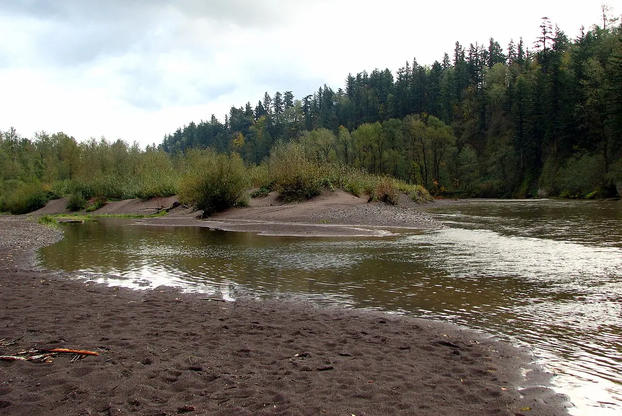
The beach below Stark Street Bridge
The main picnic area sits in shade near the beach and is set with barbecue grills. More tables and grills are scattered through the rest of the park, which Travel Oregon gives as 138 acres. The beach fills quickly in summer with swimmers, tubers and people lying in the sun. Two loaner stations hold life jackets in various sizes, and the state’s posted advice is plain: do not swim, float, paddle or boat without one, because of swift currents and hidden obstructions beneath the surface. Drinking is allowed in the park and picnic area. It is not allowed on the beach or below the Stark Street Bridge. No pets are permitted, and Travel Oregon notes that the rule is enforced.
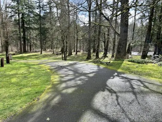
Away from the water there is a single reservable picnic shelter, wired for electricity and sized for 50, next to a volleyball court and horseshoe pits. An 18-hole disc golf course runs through the grounds and is played year-round. The state park page calls it “one of the most technical and challenging courses in the Northwest.” The park map shows an Upper Trail and a Lower Trail, a Riverfront Trail, an Island Trail, a Sturgeon Trail and a Shelter Loop, with a boat launch on the river. Visitors come for bird watching and nature walks. Bicyclists often start or finish rides on the old highway here. Anglers work the Sandy’s deep turns and cobbled bottoms for salmon and steelhead. At closing time the gate is locked.
Seven miles down from Oxbow
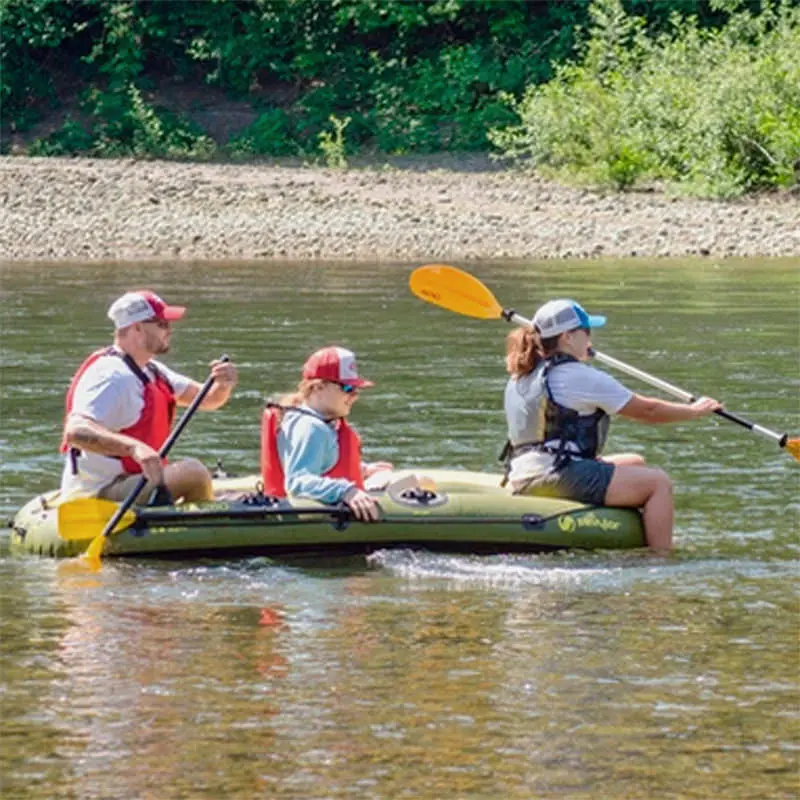
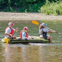
Many people who reach the beach have come down the river rather than the road. The park map gives the float from Oxbow Regional Park to Dabney as 7 miles, about three to five hours. From Dabney on to Lewis & Clark it is 4 miles, about two to four hours. Both times vary with weather and the level of the river. The 12.5 miles of the Sandy between Dodge Park and Dabney are designated an Oregon State Scenic Waterway and a federal Wild and Scenic River.
That stretch changed course in a storm cycle in December 2025. On May 7, 2026, the Multnomah County Sheriff’s Office River Patrol Unit issued an advisory. South of Camp Angelos, the main channel had run east of a prominent wooded island. After the storms the main current moved to the west side of that island and was pulling boats and swimmers toward “strainers,” fallen and submerged trees lying in the new channel. Water depth, submerged rocks and the new timber had made small rapids. “Recent patrols have documented several abandoned inner tubes caught in the newly formed debris fields,” the advisory said. It also warned that satellite imagery and GPS maps had not yet been updated to show the new channel. The patrol posted warning signs at Oxbow and at Dabney.
The salmon and steelhead the anglers fish for once had less river to use. Far upstream, Marmot Dam, 47 feet tall, was built across the Sandy in 1912 and 1913. Together with a smaller diversion dam on the Little Sandy, it kept fish from some 280 miles of habitat. Portland General Electric judged fish passage too costly and took the dams out instead. Contractors finished demolishing Marmot Dam on September 20, 2007, and the Little Sandy dam came out the following summer. The Oregon Department of Fish and Wildlife estimated the 2017 spring Chinook return to the Sandy at 8,124 adults, the biggest run since 2004.
The Dabneys’ summer house
The name comes from a subdivision. Richard T. Dabney and his wife Martha came to Oregon in 1887 and prospered on investments in timber and real estate. Richard was an enthusiastic promoter of the Columbia River Highway and proposed a large hotel at Crown Point. The hotel was never built. The Dabneys kept a summer house on the land that is now the park until his death in 1916.
The ground was platted as Dabney Park, and the state later took the park’s name from that plat. In 1945 Multnomah County gave the state the first 70 acres for park purposes. In 1946 the county vacated every street in the platted Dabney Park. The rest of the park was gathered by gift and purchase through 1968.
The quick Sand river
The Sandy rises at Reid Glacier on the southwest slope of Mount Hood. It runs 55 miles west and north and joins the Columbia just east of Troutdale. The Clackamas Tribe lived along it. When the first American explorers arrived, the river was still carrying large volumes of volcanic ash and sand from Mount Hood’s last major eruption, which probably occurred in the 1790s.
On November 3, 1805, William Clark reached its mouth. “I arrived at the entrance of a river which appeared to Scatter over a Sand bar,” he wrote, “the bottom of which I could See quite across and did not appear to be 4 inches deep in any part.” He tried to wade across, “but to my astonishment found the bottom a quick Sand, and impassable.” He called to the canoes for a ride, ate a meal of goose and venison, and then walked about a mile and a half upriver with Meriwether Lewis. Clark called it the “quick Sand river,” and the Troutdale city history gives the expedition’s name for it as the Quicksand River. The river first appeared on a map prepared by that expedition.
Notable Events
- 1805William Clark called the river the quick Sand river after getting stuck crossing the shallows at its mouth, and the river first appeared on a map prepared by the expedition. oregonencyclopedia.org
- 1805Lewis and Clark explored the area on November 3, 1805, commenting on the large amount of sand flowing from the Sandy, which they named the Quicksand River. troutdaleoregon.gov
- 1916Richard Dabney, a promoter of the Columbia River Highway whose proposed Crown Point hotel came to nothing, kept a summer house at the park site with Martha until his death in 1916. stateparks.oregon.gov
- 1945The first tract was a gift of 70 acres for state park purposes from Multnomah County in 1945. npshistory.com
- 1946All of the streets of the platted Dabney Park area were vacated by the county in 1946. npshistory.com
- 2007The decommissioning of the hydropower project began in 2007 and contractors finished the demolition of Marmot Dam on September 20 of that year, the biggest dam removal in Oregon to date. oregonencyclopedia.org
People
- Richard T. Dabney, Original owner of the park land; came to Oregon in 1887, prospered in timber and real estate, promoted the Columbia River Highway, and kept a summer house at the site (1887 to Oregon; summer house at the site until his death in 1916).
- Martha Dabney, Original owner of the park land with her husband Richard T. Dabney.
Sources
- stateparks.oregon.gov/index.cfm?do=park.profile&parkId=110
- oregonstateparks.reserveamerica.com/camping/dabney-state-recreation-area/r/campgroundDetails.do?contractCode=OR&parkId=402251
- en.wikipedia.org/wiki/Dabney_State_Recreation_Area
- mcso.us/public-information/multnomah-county-sheriffs-office-river-patrol-issues-safety-advisory-sandy-river
- traveloregon.com/things-to-do/outdoor-recreation/sports/world-athletics-championships/dabney-state-recreation-area
- stateparks.oregon.gov/index.cfm?do=main.loadFile&load=_siteFiles%2Fpublications%2F%2Fdabney-web.105740.pdf
- stateparks.oregon.gov/index.cfm?do=main.loadFile&load=_siteFiles%2Fpublications%2F%2F44294_Gorge_Brochure%28web%29092931.pdf
- oregonencyclopedia.org/articles/sandy-river
- troutdaleoregon.gov/community/page/discovery-and-naming-sandy-river