Corvallis
Benton County, Oregon. County seat.
Corvallis is the Benton County seat where Marys River meets the Willamette; it briefly served as territorial capital in 1855, and its college was designated in 1868.1,2
Details
- Founded
- Joseph C. Avery filed a plat for Marysville on February 25, 1851, using part of his 1845 land claim, and William F. Dixon platted adjoining land soon after.3
- Name
- In 1853 Avery renamed Marysville as Corvallis, a name he is credited with making from Latin words for ‘heart of the valley’, to avoid confusion with Marysville, California.4
- County seat
- Corvallis was named seat of the newly created Benton County in February 1851.1
- Last checked
- October 6, 2026.
Point at a dot to see the place.Tap a dot to see the place. Road map of Corvallis.
In Corvallis
The Calendar
History
Where the Marys Meets the Willamette
Corvallis stands on the west bank of the Willamette River just below the mouth of Marys River, and Oregon State University dominates the town.1,2 The 2020 count put its population above 59,922.2 The site was the longtime home of the Mary’s River band of the Kalapuya, and malaria killed about 90 percent of the Kalapuya between 1830 and 1833, before the first white settlers came in the early 1840s.2
Avery’s Little Fields
In 1940 the Federal Writers’ Project guide said James L. Mulkey, Johnson Mulkey, and William F. Dixon arrived in 1845 and Joseph C. Avery in 1846, while the city and the Oregon Encyclopedia date Avery’s 640-acre claim to 1845.1,2,4 Avery ran a free canoe ferry to draw settlers, and in the winter of 1847-1848 he chained off 12 acres around his cabin for town lots, a tract called Little Fields.1,4 Dixon worked as a cabinet maker, and in 1848 he started a ferry across the Willamette River.3,5 In 1849 Avery came back from the California gold fields and opened a store, and Wayman St. Clair and Eldridge Hartless opened another general store facing the river near Jackson Avenue that same year.1,3 Avery filed a plat for Marysville on February 25, 1851, using part of his 1845 claim, and Dixon soon platted an adjoining part of his own land.3 That February the town became seat of the newly created Benton County, and it was incorporated in 1857.1,2 In 1853 Avery renamed Marysville to avoid confusion with Marysville, California, and the city credits him with coining Corvallis from Latin words for ‘heart of the valley’.4
Steamboats and a Brief Capital
In October 1851 the sidewheeler Canemah became the first steamboat to reach Corvallis, and the town became a place where Portland freight was moved onto pack trains bound for the mines of southern Oregon and California.6 By 1852 boats were carrying local grain and produce to Portland, and the Canemah charged 20 cents a bushel to haul wheat from the Corvallis warehouses of Avery and Company.6 In January 1855 the legislature voted to move the territorial seat to Corvallis, and the Canemah brought the legislators’ baggage upriver to a great demonstration.1 Asahel Bush brought his presses from Salem and printed the Oregon Statesman here until June, when the capital went back to Salem and he took the paper with him.1 In 1860 a man at Corvallis built the Hay Burner, a scow driven by cattle on a treadmill; on its first trip downstream it walked ashore at McGooglin’s Slough, and it never had the power to come back against the current.6 The U.S. Army Corps of Engineers began clearing the channel in 1871, and after the canal and locks at Willamette Falls opened in 1873, boats from Portland no longer had to unload around the falls.6
Rails, a Bank, and the College Farm
The 1940 guide dates the railroad’s arrival to 1878; the Oregon Encyclopedia dates it to 1880, when Henry Villard finished a line from Portland on the west side of the river.1,2 T. Egerton Hogg’s Oregon Pacific Railroad opened to traffic in 1884, but the entrance to Yaquina Bay proved overly shallow, and in 1890 the line defaulted on its bonds and went into receivership.7 W.B. Hamilton and Zephin Job opened the town’s first bank in 1886, and it failed in 1893, brought down by the national panic and its heavy stake in the Oregon Pacific.8 A horsecar named Daisy began running on June 19, 1890; crews took up the rails on February 10, 1900, and the Sunday Oregonian called the line a “dilapidated reminder of boom times.”9 The 1940 guide traces Corvallis College, founded in 1858, to a school started in 1852, while the Oregon Encyclopedia’s account of the university begins with Corvallis Academy in 1856.1,10 Proslavery immigrants from Southern and Border States had founded the school, and on October 27, 1868, after a push by faculty member William Moreland and state senator C.B. Bellinger, the legislature made it Oregon’s land-grant institution.2,10 The state took full control in 1885, and in 1889 the college moved out of downtown into a new three-story brick building just west of it.10,11 Between 1890 and 1908 Coote planted trees around the Administration Building, now Benton Hall, and lined the Lower Campus paths with American elms, and many of those trees still stand.11
The Van Buren Bridge, Camp Adair, and the Mills
The Benton County State Bank marker counts 1,817 people in 1900 and 4,552 in 1910, while the Oregon Encyclopedia gives 1,819 in one passage and 1,527 in another for 1900.2,8 Voters made Corvallis a dry town in 1905, and it stayed dry until Prohibition was repealed in 1933.2 After 65 years the ferry stopped when the Van Buren Street Bridge opened on March 11, 1913, and the historic district documentation calls that bridge the oldest swing span bridge in Oregon.5,12 After the attack on Pearl Harbor, troops trained on campus, and the army’s Camp Adair north of town brought business to the city.2 The postwar housing boom raised Oregon’s lumber production in the mid-1950s, making hundreds of jobs in the woods and mills west of town, and the population more than doubled between 1950 and 1970, to 35,056.2 Hewlett-Packard opened a large plant northeast of town in 1976; it employed some six thousand workers in the mid-1990s and has since cut to about two thousand.2 Trains stopped running on First Street in the 1970s, and the last rails came out in 2002, when workers found them under the old pavement.3
Within 30 Miles
Measured in a straight line from the town, nearest first.
- Philomath Frolic & RodeoPhilomath · RodeoA three-night professional rodeo and timber-town celebration in Philomath, Oregon, held since 1953, where children wade a pool to catch rainbow trout with their bare hands.
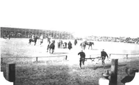
- Linn County FairAlbany, OR · County fairLinn County's three-day July fair at the Fair & Expo Center in Albany, Oregon, where county commissioners dish ice cream for seniors before the Thursday-night rodeo.
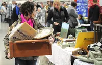
- Linn County Flea MarketAlbany · Linn county fair & expo center buildingThe Juntique Marketplace, everything from junk to antiques.
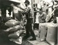
- Thompson's Mills State Heritage SiteShedd · State heritage siteThompson's Mills, on the Calapooia River two miles east of Shedd, is Oregon's oldest water-powered grist mill, and a water right older than statehood still turns its machinery for visitors.
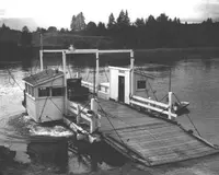
- Buena Vista FerryJefferson · FerryA cable-guided electric ferry carries cars, bicycles, and walkers about 720 feet across the Willamette at Buena Vista, Oregon, on a crossing begun by the town's founder.
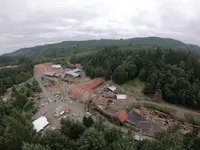
- Hull-Oakes Lumber CoMonroe · Steam-driven sawmillA sawmill at the end of Dawson Road in Benton County, Oregon, that cuts Douglas-fir timbers up to 85 feet long and ran on steam until 2013.
- Alsea River Fish HatcheryAlsea · State fish hatcheryA state fish hatchery on the North Fork Alsea River in Oregon's Coast Range, built with New Deal relief labor, where winter steelhead climb a ladder into the trap.
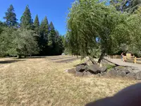
- Monroe FestivalDowntown Monroe · FestivalA free one-day Saturday festival in downtown Monroe, Oregon, pouring Southern Willamette Valley wine, beer and spirits beside a blueberry pie contest and vintage log trucks.
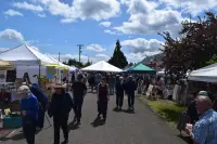
- Oregon State Open Fiddle Contest (OOTFA), Lebanon ORLebanon · Oldtime fiddlers' contestContestants play several tunes of different styles before a panel of judges with the public invited; the fiddler is accompanied by up to three rhythm players, and contests are divided into age divisions.
- Linn County Pioneer PicnicBrownsville · Oregon’s oldest continuing celebrationOregon's oldest continuous pioneer celebration, a free three-day June picnic in Brownsville's Pioneer Park on the Calapooia, never canceled since its first reunion in 1887.
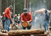
- July 4th Festival and Grand ParadeMonmouth · July 4th festivalMonmouth and Independence, Oregon, share a two-day Fourth of July whose modern form began in 1973 as a mock Winter Olympics held in summer.
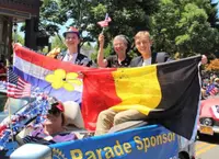
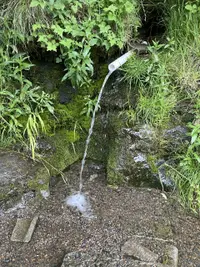
- Kings Valley Hwy Spring, Monmouth, ORMonmouth · Roadside springA roadside spring between mileposts 15 and 16 on Kings Valley Highway, south of Monmouth, Oregon, where cold water runs year round from a short PVC pipe set into a hillside.
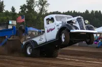
- Harrisburg Harvest FestivalHarrisburg · Tractor and truck pullA two-night truck and tractor pull a mile north of Harrisburg, Oregon, where a seventy-year-old Allis Chalmers and trucks of over 1,500 horsepower hook to the pulling sled.
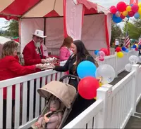
- Lebanon Strawberry FestivalLebanon · FestivalA four-day June festival at Cheadle Lake Park in Lebanon, Oregon, held since 1909, where the Saturday parade ends in free slices of a shortcake billed as the world's largest.
- Hop & Heritage FestivalIndependence · Annual harvest celebrationA September harvest festival in downtown Independence, Oregon, once the Hop Capital of the World, where beers brewed with hops picked hours earlier pour in the town that grew them.
11 more within 30 miles on the road map.
Nearby towns: Cottage Grove. All the towns of Oregon. More of Oregon: Fairs & Rodeos, Scenic Drives, and Old-Time Music.
Sources
- Oregon: End of the Trail (1940), p. 157 archive.org/details/oregonendoftrail00writrich/page/157
- Related Entries oregonencyclopedia.org/articles/corvallis
- Early Town Development (historical marker) hmdb.org/m.asp?m=117488
- Corvallis History corvallisoregon.gov/community/page/corvallis-history
- The Corvallis Ferry (historical marker) hmdb.org/m.asp?m=117447
- River Transport (historical marker) hmdb.org/m.asp?m=117465
- Corvallis and Eastern Railroad oregonencyclopedia.org/articles/corvallis_eastern_railroad
- Benton County State Bank (historical marker) hmdb.org/m.asp?m=117442
- Corvallis streetcar system oregonencyclopedia.org/articles/corvallis_streetcar_system
- Oregon State University oregonencyclopedia.org/articles/oregon_state_university
- Oregon State University (historical marker) hmdb.org/m.asp?m=108382
- CORVALLIS DOWNTOWN HISTORIC DISTRICT tile.loc.gov/storage-services/master/pnp/habshaer/or/or0500/or0530/data/or0530data.pdf