Camp Verde
Yavapai County, Arizona.
Camp Verde is a Yavapai County, Arizona town on the site of Fort Verde, whose farms once fed the copper miners of Jerome.1,2
Details
Point at a dot to see the place.Tap a dot to see the place. Road map of Camp Verde.
In Camp Verde
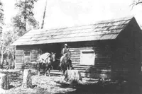
- Apache Maid CabinCamp Verde · Rustic forest service cabin rentalRustic Forest Service facility at the eastern base of Apache Maid Mountain, 2 hours north of Phoenix, Arizona, and 45 minutes north of Camp Verde, Arizona, in the shade of a ponderosa pine forest just south of the Mogollon Rim.
- Childs Trailhead (Verde Hot Springs)Camp Verde · Dispersed camping areaA free, primitive camp on the Verde River below the ruins of the 1909 Childs Power Plant, with the burned resort of Verde Hot Springs a wade upstream.
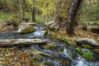
- Fossil Creek Wild and Scenic RiverCamp Verde · Wild and scenic riverA spring-fed creek in a 1,600-foot canyon southeast of Camp Verde, Arizona, where a century of hydropower diversion ended in 2005 and travertine dams have begun to regrow.
- World's Largest KokopelliCamp Verde · StatueThis statue stands 32-feet tall. In case you're wondering a Kokopelli is the Navajo Indian God of wealth and fertility. The statue stands in front of the Krazy Kokopelli Trading Post in Camp Verde.
The Calendar
History
Fort Verde Ground
A marker near Camp Verde says the original military and historic buildings of Fort Verde still stand, and it calls Camp Verde the oldest settlement in the Verde Valley.1 The Historic American Buildings Survey photographed an officer’s house at the post.3 The National Register nomination for Pecan Lane described Camp Verde as a Yavapai County town of approximately 7200 people.2
From Camp Lincoln to the Last Garrison, 1864–1891
In the summer of 1864 hay cutters from Prescott harvested the lush black grama of the Middle Verde.2 In February a settlement party of 19 men and six wagons of supplies set out, and the marker dates the first settlers’ arrival in the valley to February, 1865.1,2 The party split, and one faction, led by Parrish, favored a plot on the Verde upstream.2 The settlers petitioned the Army for protection from Indian attack, and the marker says the military followed in August, 1865.1,2 The Army moved its encampment upstream and named it Camp Lincoln, where the men lived on inadequate food with almost no pay or supplies.2 Pauline Weaver, the prospector and scout whom a Prescott marker names the first settler on the site of Prescott, died at Camp Verde on June 21, 1867.4 The site bred malaria-carrying mosquitoes; the camp was renamed in 1868, and in 1871 the military moved Camp Verde to higher ground.2 General George Crook led a campaign against the Yavapai and Apache in 1872-1873, and following the removal of the native population in 1875 the valley attracted many new Euroamerican farmers.2 A Sedona marker counts soldiers from Camp Verde among that town’s early tourists, who sought its cooler temperatures and Oak Creek as a break from the camp.5 The government abandoned the fort in 1881, occasionally regarrisoned the post, by then called Fort Verde, and saw the last garrison depart in 1891.2 From 1884 to 1914 mail riders and carriers delivered mail 52 miles from Camp Verde to Payson, braving weather, rough terrain and the Verde River.6
Feeding Jerome
As the Army left, farmers eyed the 18 square miles of the military reservation, and the copper camp of Jerome, 20 miles west, became a market for produce and meat.2 The government’s 1895 announcement opening the land to private entry set off a run on the General Land Office, as squatters rushed to record their claims.2 In 1910 the town’s 269 people devoted themselves to feeding miners in Jerome and smelter workers in Clarkdale and Clemenceau.2 Irrigated land in the Middle Verde fell from 7,000 acres in 1901 to 5,747 acres in 1920.2 The Pecan Lane nomination says farms near the smelters were most affected by the pollution and damage in distant Camp Verde was harder to gauge; in April 1925 the United Verde Extension Mine commissioned a study, and a 1925 report by Thompson found plants in excellent foliage and no signs of smoke injury.2 A marker in Camp Verde records a link belt power shovel, one of three made in Ames, Iowa, in 1920, that worked the Camp Verde Salt Mine in 1928.7
Pecan Lane
Homesteader James D. Price patented the Pecan Lane property in 1904, the year a one-story barn went up beside the Eureka Ditch.2 Robert W. Wingfield built a stone farmhouse there in 1917, the first sizable farm travelers saw entering Camp Verde from the north.2 The UVX bought Wingfield’s house and acreage in 1926, and that year Noah Haydon moved onto the place with his son Carl and daughter-in-law Eva.2 In 1927-1928 Eva Haydon planted pecan seedlings, growing the trees from seeds in one-gallon cans from a Camp Verde store, from nuts a relative brought from Texas.2 When the UVX closed in 1943, Noah lost his job and the family sold most of the land to Buster and Alma Tatum, who raised flowers, melons, corn, apples, peaches and milk cows.2 Three rows of pecan trees still distinguish Pecan Lane, the eastern row approximately 1700 feet long.2
Within 30 Miles
Measured in a straight line from the town, nearest first.
- Wet Beaver Creek day useRimrock · Day-use picnic siteOnce listed as a campground, Beaver Creek is now a day-use site popular for picnicking and birding year round, and water play in the summer. The area has limited space and can get over-crowded on hot days and holiday weekends.
- Page Springs CellarsCornville · WineryFamily-owned Arizona winery and vineyard tucked into the volcanic landscape overlooking pristine Oak Creek Canyon, just 15 minutes south of Sedona in the Verde Valley; produces Rhone style wines, working primarily with Syrah, Petite Sirah, Grenache and Mourvedre.

- Page Springs Fish HatcheryCornville · State-run fish hatcheryA state trout hatchery on Lower Oak Creek near Cornville, Arizona, where springs at a constant 68 degrees grow out fingerling trout on James Page's old ranch.
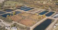
- Verde Valley FairCottonwood · County fairCottonwood's spring fair, begun in 1965 as a calf sale on a downtown ball field, where Verde Valley 4-H and FFA youth still show and auction their livestock.

- Verde Valley Old Time Fiddlers jamCottonwood · Old-time fiddle jamArizona Old Time Fiddlers chapter meeting with weekly jams.
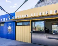
- Merkin VineyardsCottonwood · Winery and trattoriaWinery and trattoria with on-site production facility, vineyard, restaurant, and tasting room in Cottonwood, Arizona.
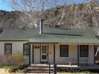
- Sycamore CabinDugas · Cabin electricA 1938 CCC-built ranger's residence on the edge of Sycamore Creek, with a riparian area just outside the back door.
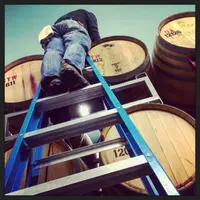
- Chateau TumbleweedClarkdale · Tasting roomsChateau Tumbleweed is a winery and tasting room on State Route 89A in Clarkdale, Arizona, that owns no vineyards and trucks most of its fruit up from Willcox.
- Crescent Moon Ranch CabinSedona · Ranch houseA 1930s ranch house of Oak Creek cobbles on the old OK Ranch below Cathedral Rock in Sedona, rented by the night beside the steel water wheel that once lit it.
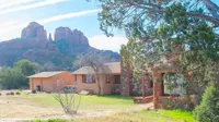
- Verde Canyon RailroadClarkdale · Scenic excursion railroadScenic excursion railroad through Arizona with open-air cars.
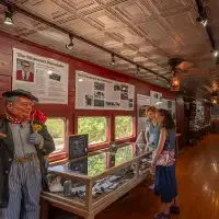
- Caduceus CellarsJerome · Tasting roomThe Jerome, Arizona, tasting room of Caduceus Cellars, the winery Tool singer Maynard James Keenan founded in 2004, pours Arizona-grown wine from vineyards as high as 4,900 feet.
- The Gold King Mine Ghost TownJerome · Ghost townA mining-camp ghost town a mile north of Jerome, Arizona, where Don Robertson's hundred-odd vehicles weather beside an 1890 mine shaft and a 1914 sawmill still cuts lumber.
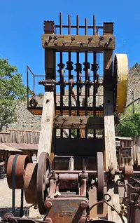
- Slide Rock State ParkSedona · 43-acre historic apple farm located in oak creek canyonOriginally a homestead apple farm, Slide Rock State Park is one of our most popular recreation spots. Escape the heat in the cool waters of Oak Creek.
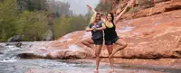
- Grasshopper Point Swimming & Picnic AreaSedona · Day-use siteA Forest Service day-use swimming hole on Oak Creek, about two miles north of Sedona, Arizona, where two waterfalls spill into a pool beneath a black and red cliff.
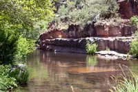
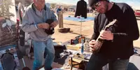
- Peddlers Pass Old Time Farmers and Flea MarketPrescott Valley · Flea marketOur flea market named best in Arizona is open every weekend all year round something for everyone always something new always something different so come on out and join the fun
1 more within 30 miles on the road map.
Nearby towns: Cottonwood, Jerome, and Payson. All the towns of Arizona. More of Arizona: Town Festivals, Swimming Holes, and Roadside Attractions.
Sources
- Camp Verde (historical marker) hmdb.org/m.asp?m=40814
- National Register nomination, Pecan Lane Rural Historic Landscape npgallery.nps.gov/GetAsset/a0847a0a-a2f2-46ac-97ab-7601a01e6d2e
- Camp Verde, Officer’s House, Camp Verde, Yavapai County, AZ loc.gov/pictures/item/az0132
- Pauline Weaver (historical marker) hmdb.org/m.asp?m=33051
- Early Tourism (historical marker) hmdb.org/m.asp?m=133684
- Camp Verde Arizona to Payson Arizona Mail Trail (historical marker) hmdb.org/m.asp?m=67417
- Power Shovel (historical marker) hmdb.org/m.asp?m=251643