Cottonwood
Yavapai County, Arizona.
Cottonwood is a town in Yavapai County in the Verde Valley of Arizona that grew as the “in between” town to the company towns of Clarkdale and Clemenceau.1
Details
Point at a dot to see the place.Tap a dot to see the place. Road map of Cottonwood.
In Cottonwood
The Calendar

History
Concrete on North Main
Forty-two of the 57 properties in Cottonwood’s commercial district were built mainly of concrete, and the National Register nomination notes that some scraps in them came from farm equipment, a sign of the town’s change from farming village.1 The Cottonwood Commercial Historic District holds 53 buildings and 4 structures, and its boundary marks the approximate extent of the historic downtown.1 The town lies in eastern Yavapai County, five miles from Jerome on Mingus Mountain, which the nomination calls one of the nation’s largest producers of copper ore.1
Farmers Under the Cottonwoods
In 1871 the Cottonwood locality became part of the Rio Verde Reservation, and with its native population removed, the valley drew Euroamerican settlers.1 The nomination says pioneers who settled in the mid 1870s found a situation nearly ideal for farming.1 The Writers’ Program state guide names James Oliver Bristow as the first permanent settler, who arrived with his family in 1875 and sheltered them in a dug-out until he could build a better house.2 R. W. Pleasant and Issac C. Jones established the Hickey Ditch in 1874, and it delivered irrigation water to as many as 175 acres.3 General Land Office surveyors who came through in May 1877 reported that the farmers called their settlement “Cottonwood,” after its lofty deciduous trees.1 The government established a post office on March 6, 1879, and that June the man later called the “father of Cottonwood” arrived at the age of 20.1
Between the Smelters
In 1894 the United Verde built a smelter on the mountain above Jerome, and when it began to sink into the mine workings, the company broke ground in 1912 for a new one in the valley two miles north of Cottonwood.1 The smelter towns of Clemenceau and Clarkdale were company towns laden with restrictions, while Cottonwood drew entrepreneurs who wanted to do business without local regulation.1 One newcomer applied to paint houses in Clarkdale, was told they were not hiring Italians, and settled in Cottonwood.1 The company town that grew near the UVX smelter was named Verde, then Clemenceau, and the state guide records that the United Verde Extension Mining Company smelter there opened in 1918 and closed for good in January 1937.1,2
Charles Stemmer and Alonzo Mason laid out Main Street in 1908, but up to March 1917 the business section was only Mason’s store and post office.1 Then the promise of the UVX smelter set off a boom in 1917, lots in the new additions sold briskly for $125, and builders rushed in until a local paper joked about the carpenters.1 When the valley’s copper industry surged during World War I, so did the downtown, and a census conducted by the State in mid 1918 counted 64 business people in town.1 A fire on December 3, 1917, destroyed five buildings that held seven businesses.1 The newly formed Cottonwood Progressive Association, part chamber of commerce and part city council, organized a fire-fighting unit, put up a fire house, and laid in 300 ft of hose.1 With two exceptions, none of the buildings from before 1920 still stands.1
Stills, a Jail, and River Cobbles
Around 1928 Sheriff George Ruffner stepped up county raids on Cottonwood’s distillers.1 Townspeople worried about a lawless reputation lobbied for a jail, and river cobbles, a sheathing material that appeared in 1929, were first used on the Cottonwood Jail at 1101 N. Main, built by a Prescott contractor.1 The CWA and WPA then used cobbles on the Cottonwood Bridge about 1934, the Del Monte Wash Bridge about 1935, and the Cottonwood Community Civic Club in 1939.1 Leslie Mahoney designed the Civic Club, and donations from 54 local business people helped pay for it.1 When the Writers’ Program compiled its Arizona guide, it listed Cottonwood at 3,310 feet with 800 people and called it one street wide, a place cowboys came to from the range and prospectors from their camps in the mountains.2
A Quonset Hut and a Late Charter
The nomination says the Depression changed the economy of Cottonwood and the middle Verde Valley.1 An airport was developed in the 1920s and 1930s a mile south of Cottonwood, and in town the Marianna building at 826 N. Main became the mess hall.1 In 1947 a Quonset hut that had been used to train World War II Naval cadets was moved from the Cottonwood airport to North Main, where it showed huge, 16-light display windows.1 The same freedom from local regulation that drew business was a major reason Cottonwood did not incorporate until 1960.1 In 1973 the farmland along the Hickey Ditch was sold to the State of Arizona and became Dead Horse Ranch State Park.3 The ditch’s water now fills the park’s lagoons and irrigates its green recreation areas.3
Within 30 Miles
Measured in a straight line from the town, nearest first.
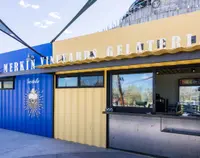
- Chateau TumbleweedClarkdale · Tasting roomsChateau Tumbleweed is a winery and tasting room on State Route 89A in Clarkdale, Arizona, that owns no vineyards and trucks most of its fruit up from Willcox.
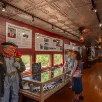
- Verde Canyon RailroadClarkdale · Scenic excursion railroadScenic excursion railroad through Arizona with open-air cars.
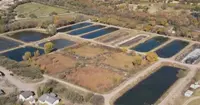
- Page Springs Fish HatcheryCornville · State-run fish hatcheryA state trout hatchery on Lower Oak Creek near Cornville, Arizona, where springs at a constant 68 degrees grow out fingerling trout on James Page's old ranch.
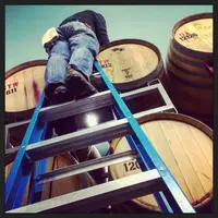
- Page Springs CellarsCornville · WineryFamily-owned Arizona winery and vineyard tucked into the volcanic landscape overlooking pristine Oak Creek Canyon, just 15 minutes south of Sedona in the Verde Valley; produces Rhone style wines, working primarily with Syrah, Petite Sirah, Grenache and Mourvedre.

- Caduceus CellarsJerome · Tasting roomThe Jerome, Arizona, tasting room of Caduceus Cellars, the winery Tool singer Maynard James Keenan founded in 2004, pours Arizona-grown wine from vineyards as high as 4,900 feet.
- The Gold King Mine Ghost TownJerome · Ghost townA mining-camp ghost town a mile north of Jerome, Arizona, where Don Robertson's hundred-odd vehicles weather beside an 1890 mine shaft and a 1914 sawmill still cuts lumber.
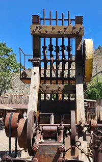
- Crescent Moon Ranch CabinSedona · Ranch houseA 1930s ranch house of Oak Creek cobbles on the old OK Ranch below Cathedral Rock in Sedona, rented by the night beside the steel water wheel that once lit it.
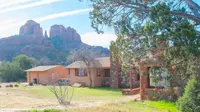
- Slide Rock State ParkSedona · 43-acre historic apple farm located in oak creek canyonOriginally a homestead apple farm, Slide Rock State Park is one of our most popular recreation spots. Escape the heat in the cool waters of Oak Creek.

- World's Largest KokopelliCamp Verde · StatueThis statue stands 32-feet tall. In case you're wondering a Kokopelli is the Navajo Indian God of wealth and fertility. The statue stands in front of the Krazy Kokopelli Trading Post in Camp Verde.
- Fort Verde DaysCamp Verde · Annual homecomingCamp Verde, Arizona's annual homecoming fires artillery at the Indian Wars post the town grew around, and in 2026 marks its 70th year.
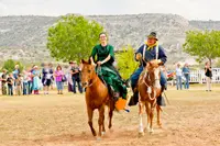
- Wet Beaver Creek day useRimrock · Day-use picnic siteOnce listed as a campground, Beaver Creek is now a day-use site popular for picnicking and birding year round, and water play in the summer. The area has limited space and can get over-crowded on hot days and holiday weekends.
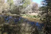
- Grasshopper Point Swimming & Picnic AreaSedona · Day-use siteA Forest Service day-use swimming hole on Oak Creek, about two miles north of Sedona, Arizona, where two waterfalls spill into a pool beneath a black and red cliff.
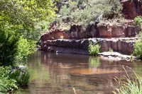
- Yavapai County FairChino Valley · County fairThe Yavapai County Fair, held each September at the Prescott Rodeo Grounds in Prescott, Arizona, has run on the same ground since its first fair in October 1913.
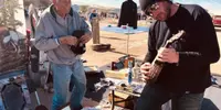
- Peddlers Pass Old Time Farmers and Flea MarketPrescott Valley · Flea marketOur flea market named best in Arizona is open every weekend all year round something for everyone always something new always something different so come on out and join the fun
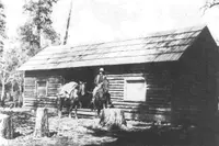
- Apache Maid CabinCamp Verde · Rustic forest service cabin rentalRustic Forest Service facility at the eastern base of Apache Maid Mountain, 2 hours north of Phoenix, Arizona, and 45 minutes north of Camp Verde, Arizona, in the shade of a ponderosa pine forest just south of the Mogollon Rim.
2 more within 30 miles on the road map.
Nearby towns: Jerome, Camp Verde, and Payson. All the towns of Arizona. More of Arizona: Wineries, Fairs & Rodeos, and Old-Time Music.
Sources
- National Register nomination, Cottonwood Commercial Historic District npgallery.nps.gov/GetAsset/9149b602-c1ab-43a4-aaee-564f77b4dd43
- Arizona: A State Guide (1940), p. 330 archive.org/details/arizonastateguid00writmiss/page/330
- The Hickey Ditch Diverts Water (historical marker) hmdb.org/m.asp?m=250265