Jerome
Yavapai County, Arizona.
Jerome is a Yavapai County, Arizona, town that began to slide down its mountainside after dynamite was set off in the Black Pit in 1925.1,2
Details
- Founded
- The first mining claims and a mill site were located in 1875 by the town’s account, while the state road agency credits the first official copper claims in 1876 to Angus McKinnon and Morris A. Ruffner.1,3
- Name
- The camp was named for Eugene Jerome, a major financier of the United Verde Copper Company.1
- Last checked
- October 6, 2026.
Point at a dot to see the place.Tap a dot to see the place. Road map of Jerome.
In Jerome
- Caduceus CellarsJerome · Tasting roomThe Jerome, Arizona, tasting room of Caduceus Cellars, the winery Tool singer Maynard James Keenan founded in 2004, pours Arizona-grown wine from vineyards as high as 4,900 feet.
- The Gold King Mine Ghost TownJerome · Ghost townA mining-camp ghost town a mile north of Jerome, Arizona, where Don Robertson's hundred-odd vehicles weather beside an 1890 mine shaft and a 1914 sawmill still cuts lumber.
History
Houses on Stilts above the Verde Valley
Jerome stands in Yavapai County on a hillside at over 5,000 feet in the Black Hills, about 100 miles north of Phoenix on State Highway 89A.1 The state guide found the town hanging on the side of Mingus Mountain, its frame houses “a jumble on stilts,” where many householders could lean out of kitchen windows and scratch matches on their neighbors’ chimneys.4 The guide placed English speakers in Yeager Canyon, Slavs on the Hogback below, and Mexicans in Bitter Creek beyond the business district.4 In 2010 the census counted about 444 people in what the town now calls an artistic community.1
Claims on Cleopatra Hill
Native American tribes who later lived in the area worked the ore body on the hills around Jerome for pigments to color their bodies, blankets and clothes.1 By the town’s account the first mining claims and a mill site were located in 1875 at the base of two cone-shaped hills later called Cleopatra Hill and Woodchute Mountain; the state road agency dates the first official copper claims to 1876, by Angus McKinnon and Morris A. Ruffner.1,3 The state guide instead names the ranchers John Ruffner and August McKinnon, from near Prescott, and allows that the rediscovery of the copper may have belonged to McKinnon or to the Indian scout Al Sieber.4 Frederick A. Tritle, a future Arizona Territory governor, bought the claims in 1880 and in 1883 formed the United Verde Copper Company with Frederick F. Thomas, a mining engineer from San Francisco.3 The money came from Eugene Jerome of New York, the company’s secretary, who by the guide’s account insisted that the camp be named for him and who never visited the town named for him.3,4 The post office opened in 1883, the year United Verde’s first smelter began operation, with Frederick E. Thomas as first postmaster.2
Clark’s Smelter and the Fires
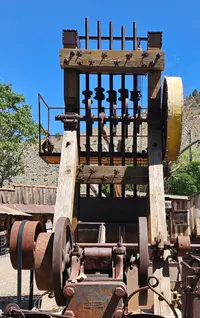
Tritle broke a road from Ashfork to haul in his smelter, which the state guide saw exhibited at Clarkdale; the town says the small blast furnace produced nearly $1 million in copper and is on display today in Jerome.1,4 The works closed by 1887, and the town dates William Clark’s purchase of a majority of the stock to 1888, the state guide dates his purchase to 1886, and a town marker to 1883.1,4,5 Clark built a narrow-gauge road into Jerome from the Santa Fe freight branch finished in 1894, and installed a smelter that could handle half a million pounds of ore a month.4 In 1888 he promoted the Montana House, which the guide calls in its early days the largest stone structure in Arizona, with room for a thousand men.4 Between 1890 and 1900 the population rose from a couple hundred people to almost 3,000.6 During the latter part of the nineteenth century at least five major fires burned the frame town, and in 1900, the guide says, Pancho Villa had two hundred burros bringing water to it.1,4 The madam Belgian Jennie Bauters lost her first house to fire in 1897 and her second in 1898, and her third, built in 1898, survived the fire of 1899.7 Over the resistance of George W. Hull, by the town’s account Jerome’s largest landowner, residents short of water and firefighting equipment petitioned Yavapai County, and the town was incorporated March 8, 1899.1,5 The New-York Tribune called it the “wickedest town” in 1898, and the guide says saloons and gambling halls wore thick stone shutters for protection against gunfire.4,8
Little Daisy, Strikes, and the Black Pit
In 1900 J. J. Fisher laid claim to the Little Daisy in Bitter Creek, which became the United Verde Extension Mine in 1910.4 In 1907 the miners struck for the first time and won an eight-hour day and a daily wage of $2.75.4 The United moved its smelter to Clarkdale in 1915, but the World War demand for copper kept the town prosperous.4 In 1917, the guide reports, several hundred miners and outside agitators in an I.W.W. strike were loaded on boxcars with the aid of guns and pickaxes and shipped to the southeastern desert country of Arizona.4 In 1925 two hundred and fifty pounds of dynamite were set off in the Black Pit, and the town began to slide down the mountainside at 3/8ths of an inch per month.2 A marker says the jail crept 225 feet in the mid 30’s to settle in the middle of Hull Avenue and the road was altered to go around it; the postal history says it skidded three hundred feet before tipping over.2,9 Some 15,000 people were reported in 1929, the 1930 census found 4,900, and the United Verde Extension Company was dissolved in 1938 by the guide’s account and in 1939 by the postal history’s.2,4 The Big Mine closed on January 30, 1953, and by the late 1950s fewer than 100 people remained.1,10
Saving Main Street
Jimmy Brewer, curator of the Tuzigoot National Monument, told the town council that if they did nothing, all they would have left of their town was “a pile of rubble,” and the Jerome Historical Society held its first annual election on March 15, 1953.10 In 1956 the society got Phelps Dodge to agree that no more buildings would be torn down in the main part of town, and bought most of uptown Jerome, securing Main Street.10 Buildings were restored, and in 1970 Jerome was designated a National Historic Landmark.11 The mansion James S. Douglas built in 1916 on the hill above his Little Daisy Mine is now a museum of the Jerome area’s history.12 Legend has it that the jail kept moving to its final resting place, though the marker says it was pushed there from Hull Avenue, where it can be seen today.9
Within 30 Miles
Measured in a straight line from the town, nearest first.
- Chateau TumbleweedClarkdale · Tasting roomsChateau Tumbleweed is a winery and tasting room on State Route 89A in Clarkdale, Arizona, that owns no vineyards and trucks most of its fruit up from Willcox.
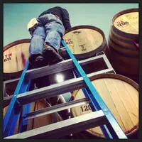
- Verde Canyon RailroadClarkdale · Scenic excursion railroadScenic excursion railroad through Arizona with open-air cars.
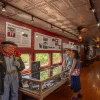
- Merkin VineyardsCottonwood · Winery and trattoriaWinery and trattoria with on-site production facility, vineyard, restaurant, and tasting room in Cottonwood, Arizona.

- Verde Valley Old Time Fiddlers jamCottonwood · Old-time fiddle jamArizona Old Time Fiddlers chapter meeting with weekly jams.
- Verde Valley FairCottonwood · County fairCottonwood's spring fair, begun in 1965 as a calf sale on a downtown ball field, where Verde Valley 4-H and FFA youth still show and auction their livestock.

- Page Springs Fish HatcheryCornville · State-run fish hatcheryA state trout hatchery on Lower Oak Creek near Cornville, Arizona, where springs at a constant 68 degrees grow out fingerling trout on James Page's old ranch.
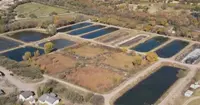
- Page Springs CellarsCornville · WineryFamily-owned Arizona winery and vineyard tucked into the volcanic landscape overlooking pristine Oak Creek Canyon, just 15 minutes south of Sedona in the Verde Valley; produces Rhone style wines, working primarily with Syrah, Petite Sirah, Grenache and Mourvedre.

- Yavapai County FairChino Valley · County fairThe Yavapai County Fair, held each September at the Prescott Rodeo Grounds in Prescott, Arizona, has run on the same ground since its first fair in October 1913.
- World's Largest KokopelliCamp Verde · StatueThis statue stands 32-feet tall. In case you're wondering a Kokopelli is the Navajo Indian God of wealth and fertility. The statue stands in front of the Krazy Kokopelli Trading Post in Camp Verde.
- Crescent Moon Ranch CabinSedona · Ranch houseA 1930s ranch house of Oak Creek cobbles on the old OK Ranch below Cathedral Rock in Sedona, rented by the night beside the steel water wheel that once lit it.
- Peddlers Pass Old Time Farmers and Flea MarketPrescott Valley · Flea marketOur flea market named best in Arizona is open every weekend all year round something for everyone always something new always something different so come on out and join the fun
- Fort Verde DaysCamp Verde · Annual homecomingCamp Verde, Arizona's annual homecoming fires artillery at the Indian Wars post the town grew around, and in 2026 marks its 70th year.
- Slide Rock State ParkSedona · 43-acre historic apple farm located in oak creek canyonOriginally a homestead apple farm, Slide Rock State Park is one of our most popular recreation spots. Escape the heat in the cool waters of Oak Creek.

- Territorial DaysChino Valley · CelebrationChino Valley's four-day Labor Day festival in Yavapai County, Arizona, marks Arizona's first territorial capital at Del Rio Springs with a parade, pancakes and an FFA corn dinner.
- Wet Beaver Creek day useRimrock · Day-use picnic siteOnce listed as a campground, Beaver Creek is now a day-use site popular for picnicking and birding year round, and water play in the summer. The area has limited space and can get over-crowded on hot days and holiday weekends.
6 more within 30 miles on the road map.
Nearby towns: Cottonwood, Camp Verde, and Payson. All the towns of Arizona. More of Arizona: Wineries and Factory Tours.
Sources
- Town of Jerome Arizona jerome.az.gov/jerome-then-and-now
- Arizona Memory Project azmemory.azlibrary.gov/nodes/view/370
- Behind the Place Name: Jerome azdot.gov/adot-blog/behind-place-name-jerome
- Arizona: A State Guide (1940), p. 332 archive.org/details/arizonastateguid00writmiss/page/332
- Jerome, Arizona (historical marker) hmdb.org/m.asp?m=108878
- Arizona Memory Project azmemory.azlibrary.gov/nodes/view/287340
- Jennie’s Place (historical marker) hmdb.org/m.asp?m=33152
- Jerome News (1906-1912) azmemory.azlibrary.gov/nodes/view/289381?showbacklinknav=206992
- Jerome’s Famous Sliding Jail (historical marker) hmdb.org/m.asp?m=71963
- Jerome Historical Society azmemory.azlibrary.gov/nodes/view/124
- Jerome, Arizona (historical marker) hmdb.org/m.asp?m=33149
- Jerome State Historic Park azmemory.azlibrary.gov/nodes/view/171729