Payson
Gila County, Arizona.
Payson is a town below the Mogollon Rim in northern Gila County, Arizona, where the town dates its rodeo to 1884.1
Details
- Founded
- The town says the Payson Townsite was established in 1882 with a population of 40, while the 1940 state guide gives the founding as 1886.1,2
- Name
- The town says the postmaster named it in 1884 for Senator Louis Edward Payson, head of the congressional Post Office and Post Roads; the 1940 guide says Surveyor-General John H. Hise named it for his patron, Illinois Representative Louis Edwin Payson.1,2
- Last checked
- October 6, 2026.
Point at a dot to see the place.Tap a dot to see the place. Road map of Payson.
In Payson
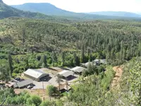
- Tonto Creek Fish HatcheryPayson · Fish hatcheryA state trout hatchery near the headwaters of Tonto Creek beneath the Mogollon Rim, where visitors feed trout at a show pond and all of Arizona's Apache trout are hatched.
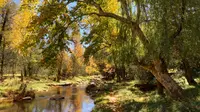
- Water Wheel Falls, East Verde RiverPayson · 1.6-mile out-and-back trailA 1.6-mile out-and-back trail north of Payson along Ellison Creek and the East Verde River.
The Calendar
History
Below the Mogollon Rim
Payson stands where State Routes 87 and 260 cross, 90 miles north of Phoenix, at an elevation of about 5,000 feet below the Mogollon Rim.1 The town’s boundaries enclose 20.46 square miles in northern Gila County, and the Tonto National Forest surrounds it.1 Tourism, home building, and retirement now drive its economy, and its major employers include the Payson Unified School District, Mazatzal Casino, and Banner Payson Medical Center.1 The local historical society defines the Rim Country as a 50-mile radius around the town and says the area is named after the Mogollon Rim, an escarpment that rises 2000 feet above the foothills and canyons.3
Union Park, Green Valley, Payson
Yavapai from the west and Tonto Apaches from the north and east held this country until they were confined to reservations in the 1870s.3 Cattle ranchers and miners followed, and Strawberry, Pine, Gisela, Young, and Payson grew up to serve them.3 By the town’s account, the Payson Townsite was established in 1882 with a population of 40 and was first known as Union Park, though residents called it Green Valley.1 The town also says its first post office opened in 1884 and the postmaster renamed the town for Senator Louis Edward Payson, then congressional head of the Post Office and Post Roads.1 The 1940 Arizona state guide dated the founding to 1886 and gave another account: Surveyor-General John H. Hise platted the place and named it for Louis Edwin Payson, the Illinois Representative who got him his appointment and who never visited the town.2 The historical society says the name was given in 1884 for an Illinois congressman who sponsored a bill establishing the post office.3
Cow Town and the August Doin’s
The town says logging, ranching, and mining carried its economy in the early years.1 From 1884 to 1914, mail riders and carriers braved weather, rough terrain, and the Verde River to carry the mail 52 miles from Camp Verde to Payson.4 The historical society says that in 1884 local cowboys met near the village to hold a rodeo, which became an annual event called “The August Doin’s” and has been held every summer since.3 The town now bills it as the “World’s Oldest Continuous Rodeo.”1 The 1940 guide recorded that a fort was built during the Indian wars and that for many years the town served as a retreat for men fighting in the ranchmen’s feuds.2 In 1940 the guide found the town, then of 487 people, “as real a cow town” as ever, with a few frame stores, a log hotel, and neither dude ranches nor dude cowboys.2 Until a few years before, the guide said, the rodeo had been held in the main street, where horses had always been raced, and the dances ran all night.2 By the historical society’s account, so many cattle, sheep, and goats were brought in from the 1890s on that the land eroded, and the government formed the Tonto National Forest in 1907.3
Payson Dew and the Boardman Store Fire
Zane Grey came to Payson in 1918 and hired a guide from the pioneer Haught family to take him to the top of the Rim.3 Arizona banned liquor in 1915, stills sprouted in the canyons, and Vernon Haught said 30 to 40 of them were operating in the Payson area.5 The historical society calls Prohibition “a blessing in disguise” in country where most people earned $500 a year.5 Frenchy Choquette, or Paquette in some sources, sold whisky from a building called “The Dive” and later sold it to the Women’s Club, so the revenue agents who raided it one afternoon found women washing dishes after a luncheon meeting.5 When agents left Globe for Payson, phone calls with a special ring spread the word, and in Star Valley mules hung with bells were scattered across the countryside to warn the men at the stills.5 In the summer of 1938 the gasoline cook stove at Delsie Dee Journigan’s hamburger stand exploded, and fire took the Boardman store, a red sandstone building that had housed the first bank and now held the safe with the rodeo’s gate receipts.6 The Sunday afternoon crowd out in Wilbanks’ field saw the smoke as the events were coming to a close, the rodeo stopped while the men raced to put out the fire, and soon the interior was gutted and the safe was too hot to open.6
The Beeline, the 1970 Flood, and the Ranger Station
The road built over the Mazatzal Mountains in the 1920s took at least 5 hours from the Valley, and the first paved road, Highway 87, the Beeline, did not arrive until 1958.3 Over Labor Day weekend in 1970 a tropical storm named Norma sent walls of water down Tonto, Christopher, Horton, and Dick Williams Creeks, and a marker in town, which calls it the deadliest natural disaster in Arizona history, lists the dead who have been identified.7 Payson was incorporated in 1973.1 The Rim Country Museum complex stands on the site of the first headquarters of the Payson Ranger District, where buildings were first placed in 1907; the ranger office dates from 1932 and the ranger’s family house from 1933.8 A memorial credits William H. Goettl, a pioneer in the air conditioning industry who died in 1979, with restoring Zane Grey’s Cabin by his own sweat.9 On the lot where J.W. Boardman built his rock store, refrigerator boxcars warehoused groceries in the early 1970s, and in 2001 the Town of Payson bought the property for a historic park.10
Within 30 Miles
Measured in a straight line from the town, nearest first.
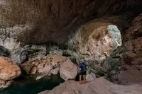
- Pine Creek Trailhead (Tonto Natural Bridge)Pine · Hiking trailTonto Natural Bridge State Park is located in central Arizona near Payson. It is believed to be the largest natural travertine bridge in the world. There are four hiking trails, a picnic area, and a group use area. The park provides habitat for animals, insects, and birds as well as Interpretive exhibits including artifacts on the history of Tonto Natural Bridge, plus information about travertine, prehistoric inhabitants, and the historic Goodfellow Lodge.
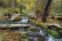
- Fossil Creek Wild and Scenic RiverCamp Verde · Wild and scenic riverA spring-fed creek in a 1,600-foot canyon southeast of Camp Verde, Arizona, where a century of hydropower diversion ended in 2005 and travertine dams have begun to regrow.
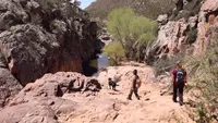
- Childs Trailhead (Verde Hot Springs)Camp Verde · Dispersed camping areaA free, primitive camp on the Verde River below the ruins of the 1909 Childs Power Plant, with the burned resort of Verde Hot Springs a wade upstream.
- Desert to Tall Pines Scenic RoadYoung · Scenic bywayA partly unpaved back road from the Mogollon Rim to Roosevelt Lake in Gila County, Arizona, crossing the Salt River on a one-lane Parker truss bridge built in 1920.
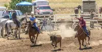
- Pleasant Valley DaysYoungThrough one weekend each July the town of Young remembers the infamous Pleasant Valley War and celebrates local history with three days of history, heritage, roping, a parade, food and drink.
Nearby towns: Camp Verde, Cottonwood, and Jerome. All the towns of Arizona. More of Arizona: Old-Time Music, Fairs & Rodeos, Factory Tours, and Swimming Holes.
Sources
- Payson, AZ paysonaz.gov/community
- Arizona: A State Guide (1940), p. 452 archive.org/details/arizonastateguid00writmiss/page/452
- Rim Country- A Brief History rimcountrymuseum.org/rim-country-history
- Historic Mail Trail (historical marker) hmdb.org/m.asp?m=36063
- Prohibition and “Payson Dew” rimcountrymuseum.org/prohibition-and-payson-dew#:~:text=%22The%20manufacture,%20sale%20or%20transportation,Payson%20Dew%22%20moonshine%20was%20born.
- The Rodeo Searched for a New Home rimcountrymuseum.org/the-rodeo-searched-for-a-new-home
- The Great 1970 Rim Country Flood Disaster (historical marker) hmdb.org/m.asp?m=157859
- Ranger Station (historical marker) hmdb.org/m.asp?m=67407
- William H. Goettl Memorial (historical marker) hmdb.org/m.asp?m=157857
- Site of Rock Store (historical marker) hmdb.org/m.asp?m=67405