Helena
Lewis and Clark County, Montana.
Helena, Montana’s capital in Lewis and Clark County, began in 1864 as a gold camp along the crooked path of Last Chance Gulch.1,2,3
Details
Point at a dot to see the place.Tap a dot to see the place. Road map of Helena.
In Helena
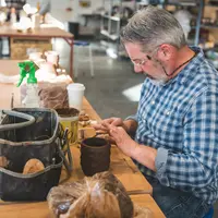
- Archie Bray Foundation for the Ceramic ArtsHelena · FoundationA ceramic arts residency and public grounds on a former brickyard three miles from downtown Helena, where artists have worked beside the Western Clay beehive kilns since 1951.
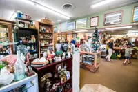
- Golden Girls Antiques MallHelena · Antique storeA two-floor antique mall of more than fifty dealer booths on Last Chance Gulch in Helena, where a poet found the typewriter that started his Typewriter Series.
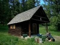
- Indian Flats CabinHelena · CabinA 1944 Forest Service guard station, moved in 1969 to a hollow below Indian Flats in Montana's Big Belt Mountains, now rented by the night.
- Last Chance Bookstore and Paperback ExchangeHelena · New and used books and paperback exchangeWelcome to Last Chance Bookstore New and Used Books and paperback Exchange
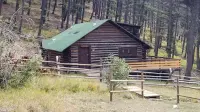
- Lost Horse CabinHelena · CabinLost Horse Cabin, a Forest Service rental in the Divide Mountains 35 miles west of Helena, sleeps eight beside an intermittent creek four miles east of the Continental Divide.
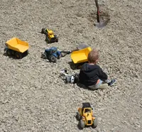
- Montana Blue Jewel MineHelenaSapphire gravel fee dig: six screened five-gallon buckets for $150 CASH; the customer screens the buckets; tools and screening stations provided; reservations required.
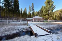
- Moose Creek CabinHelena · National forest cabinA two-bedroom log cabin in the Tenmile Creek drainage west of Helena with access to hiking, picnicking, skiing, snowmobiling, and hunting.
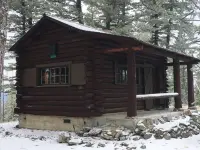
- RiminiHelena · Ghost townOriginally named Young Ireland; several of Rimini's old buildings are inhabited today and make up the Rimini community.
- Spokane Bar Sapphire MineHelena · Sapphire mine and rock shopVisitors find sapphires in many colors at the Spokane Bar Sapphire Mine. The natural Sapphire crystal structure is hexagon with triangle terminations which are often flat. The most commonly found color is green-blue. Blue sapphire is the best known color. Ruby is a red sapphire which is one of the most prized. Other finds, though uncommon, are diamond, topaz, citrine, and ruby.

- Strawberry CabinHelena · Cabin nonelectricLookout-and-log cabin at the top of Strawberry Butte (6,100 feet) in the heart of the Elkhorn Mountains; an excellent example of a C-46 one room cabin plan designed by William Fox.
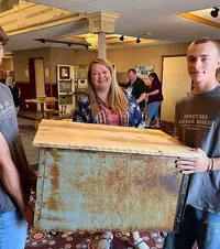
- Sweet Bee Vintage MarketHelena · Vintage marketsA twice-yearly vintage and makers market in the ballroom of Helena's Moorish Revival Shrine temple, carrying on a Civic Center sale its organizers count back 44 years.
- Upcountry Vintage & Antique MarketHelena · Antiques & vintage marketA twice-yearly antique and vintage market at the Lewis & Clark County Fairgrounds in Helena, Montana, which began in an 1887 barn on a ranch in East Helena.
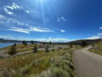
- White Sandy beachHelena · CampgroundWhite Sandy is located on the west side of Hauser Lake at the confluence of Prickly Pear creek. It is in an ideal location for outdoor recreation, wildlife watching, water sports, camping and swimming.
The Calendar

History
Four Miners in Last Chance Gulch
Helena’s Main Street runs along the bottom of Last Chance Gulch, and its crooked path weaves between the original mining claims of the 1864 gold camp.1,2 The city, Montana’s capital, sits against Mount Helena and Mount Ascension and looks out over the Prickly Pear Valley.1 A marker in town tells how, in 1864, four miners coming back from an unsuccessful prospecting trip decided to take one “last chance” and struck pay dirt a few hundred yards south of where it stands.4 The West Main Street district history dates that first strike to June 1864, while the 1939 Federal Writers’ Project guide places the discoveries late in the summer of 1864.1,5 By January 1865 about 700 people lived in the Helena area, many of them in tents while log cabins went up.6
In October 1864 the name Last Chance was judged unsuitable, and the 1939 guide says one John Somerville dominated a meeting and won adoption of Helena, the name of his home town in Minnesota.1 The miners and bullwhackers disliked his pronunciation and shifted the stress to the first syllable, and their pronunciation became the accepted one.1 A later National Register nomination says only that a meeting of residents at Colonel Wood’s cabin chose the name in late 1864.7
Fire, Lime Kilns, and Reeder’s Alley
Fire was a constant threat, and in 1869 the downtown burned and was replaced over the next few years by brick and granite business houses.2 In the wake of fires that swept Helena in the late 1860s and 1870s, many residents looked to safer areas, and an addition rose around Courthouse Square and along North Rodney Street during the 1870s.7 A short way up Grizzly Gulch, Joseph O’Neill built lime kilns beginning in the late 1860s, the first in 1868 by one account, and they supplied the mortar and plaster for Helena’s earliest buildings.5,8 Louis Reeder, a Pennsylvania brick mason who came to Helena in 1867, built some thirty-five housing units in stone and brick for single miners between 1875 and 1884.9 The place was already known as Reeder’s Alley when Reeder died after a fall in 1884.9
Capital, Railroad, and Silver
The state guide and the Capitol campus marker give 1875 as the year Helena became territorial capital, while the Helena Historic District text says Helena claimed it from declining Virginia City in 1874.1,2,10 The following year, by that same text, Helena received one of the nation’s five U.S. Assay Offices, a sign that hard-rock gold and silver mining had replaced placer mining.2 The city incorporated in 1881, and the Northern Pacific Railroad arrived in 1883.2,6 Silver and lead from Wickes, Corbin, and Elkhorn fed the boom, and by 1888 Helena held 11,500 people and, the 1939 guide reported, was said to be the richest city per capita in the United States, with some fifty millionaires.1,7 The newly rich built mansions on the West Side and in Kenwood and Lennox, with turrets, cupolas, and porte-cocheres, iron deer on the lawns, and stone lions at the entrances.1 At statehood in 1889 the county courthouse became Montana’s first capitol, and voters chose Helena as permanent state capital in 1894.10 In that fight, the 1939 guide records, Helena was backed by W. A. Clark and Anaconda by Marcus Daly, and Helena won by less than 1,000 votes.1 In 1893 the federal government devalued silver, the building boom ended, and many who had put their money into elaborate new houses left.1,7 Officials broke ground in 1899 on a site that east side booster Peter Winne had offered the state $4,000 to choose, and the 1902 Montana State Capitol now stands at the center of a sixty-acre campus.10
Dams, a Federal Reserve Branch, and the 1935 Earthquakes
Building the Canyon Ferry, Hauser, and Holter dams on the Missouri River between 1900 and 1910 brought a brief return of prosperity, with many Helena people employed on the dams and in the mines.1 A Helena branch of the Federal Reserve Bank opened in 1921 after lobbying by Norman B. Holter, and its marker says Helena was the smallest town in the country to host such a bank.11 In the fall of 1935 a series of earthquakes caused four deaths and property damage the 1939 guide put at $4,000,000.1 Some buildings had to be tied together with long rods run from wall to wall.1 In the South-Central district the earthquake claimed most of Catholic Hill, and wood siding replaced fallen brick veneer while stucco hid the cracks.12 The earthquakes destroyed the first Federal Reserve building, and Montana architect George Shanley designed its Art Moderne replacement, completed in 1938.11
Kilns, Alleys, and Placer Ground
Many downtown buildings have been lost to fires, earthquakes, and urban renewal, and in the 1970s Urban Renewal took the old red-light district and dozens of homes.2,12 Twenty-three pensioners lived at Reeder’s Alley in 1961, when its buildings were rescued from demolition, and the Helena Historic District entry calls it the town’s most complete remaining block of the territorial period.9 The West Main Street district keeps 19 residences and 4 lime kilns, only two buildings have gone up there since 1895, and some houses are still owned by descendants of early pioneers.5,8 Much of the city stands on old placer diggings, and traffic on Main Street now wheels over the ground that drew the first miners.4
Within 30 Miles
Measured in a straight line from the town, nearest first.
- East Helena Valley RodeoEast Helena · VenueThe July rodeo in East Helena, Montana, run by volunteers since a barber pitched it to the VFW in 1963, now held on grounds built in 58 days.
- Little Red Truck Vintage MarketEast Helena · Juried market of vintageA traveling vintage and artisan market that sets up six weekends a year from Missoula to Cody, Wyoming, named for its founder's cherry-red 1966 Ford.
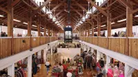
- Broadwater Hot Springs & FitnessHelena, MT · Wellness retreatJust ten minutes from downtown Helena, Broadwater Hot Springs & Fitness invites you to slow down and soak in the moment. Feel the warmth of natural mineral waters, the energy of our fitness community, and the comfort of good food and local beer shared with friends.

- Jefferson County MuseumClancyHands-on exhibits tell the stories of Jefferson County and the people who built its communities, with local history, mining, ranching, and railroad exhibits.
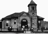
- Clancy DaysClancy · FestivalClancy Days is a one-day street festival in Clancy, Montana, held the second Saturday in June, where fire trucks toss candy from the parade and wooden pucks stand in for rubber ducks.
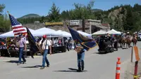
- Tizer Botanic Gardens & ArboretumJefferson City · Botanical garden and arboretumMontana's only full-time operated Botanical Garden and Arboretum nestled in the heart of the Elkhorn Mountains near Jefferson City; the gardens sit on six acres along Prickly Pear Creek with a nursery, gift shop, wedding venue, and creekside cabins.
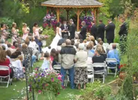
- Marysville PicnicMarysville · Family-fun eventHistorical buildings open for viewing. Free kids fun area. Local vendors. Barron of beef and burger barn lunch for purchase. As well as cold beer, soda, and frozen treats. Pie auction and raffle. Watermelon eating contest and egg toss. Rock drilling exhibition and good ol’ small town community fun.
- Bar Gulch CabinTownsend · CabinA one-room rental cabin in the Big Belt Mountains near Townsend, built in the 1930s for mining but kept for recreation, with an antique cook stove and no running water.
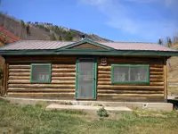
- Finn Creek Farm & U-PickBoulder · FarmA 40-acre diversified farm on Amazon Road, five miles from Boulder, Montana, where visitors pick honeyberries by appointment and bet on chicken races run for local charities.
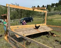
- Eagle Guard StationTownsend · Guard stationA three-room log cabin built by miners in 1895 in Montana's Elkhorn Mountains west of Townsend, now a Forest Service rental, with its original sod roof intact beneath a 1911 roof.
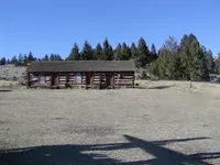
- Free Enterprise Radon Health MineBoulder · Radon therapy mineA former uranium mine on a hillside above Boulder, Montana, where since 1952 visitors have ridden an elevator eighty-five feet down to sit and breathe radon gas.
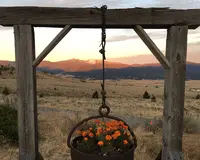
- Kading CabinElliston · Cabin nonelectricA Forest Service cabin in a non-isolated setting where summer and fall visitors can escape the pace of town.
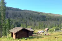
- Basin DayBasin · Basin dayBasin Day is a one-day August street celebration in Basin, a Jefferson County gold camp of about 200 people, where stick pony races, a duck race and a cake walk raise money for the town.
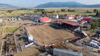
- Jefferson County RodeoBoulder · County fair and NRA rodeoBoulder, Montana's county fair and rodeo, held each August on a former state institution ranch, where the carousel horses were cast partly from townspeople's melted pots and pans.
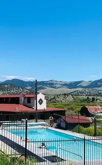
- Boulder Hot SpringsBoulderHistoric Inn, Spa, and Retreat Center in Boulder, Montana. The natural geothermal pool, mineral baths, and steam rooms are an important part of the spa facilities, with massages, healthy outdoor exercise, nutritious food to meet individual needs, and a natural environment of healing.
3 more within 30 miles on the road map.
Nearby towns: Butte. All the towns of Montana. More of Montana: Flea Markets, Lookouts & Cabins, and Fairs & Rodeos.
Sources
- Montana: A State Guide Book (1939), p. 156 archive.org/details/montanastateguid00federich/page/156
- Helena Historic District historicmt.org/items/show/51
- Helena Historic District (historical marker) hmdb.org/m.asp?m=186276
- The Founding of Helena (historical marker) hmdb.org/m.asp?m=186777
- Helena West Main Street Historic District historicmt.org/items/show/53
- National Register nomination, Helena South-Central Historic District npgallery.nps.gov/NRHP/GetAsset/2c2afcc9-c5d4-42dd-92e6-240499c476a1
- National Register nomination, Helena Historic District (Boundary Increase) npgallery.nps.gov/NRHP/GetAsset/30b0e576-eae8-47fe-9670-9a9db204d2e2
- National Register nomination, Helena West Main Street Historic District npgallery.nps.gov/NRHP/GetAsset/7ba281e0-f6b6-4570-885c-ec6f944c7183
- Reeder’s Alley: Helena Historic District historicmt.org/items/show/9
- Montana State Capitol Campus Historic District (historical marker) hmdb.org/m.asp?m=186907
- Federal Reserve Bank (historical marker) hmdb.org/m.asp?m=187311
- Helena South-Central Historic District (historical marker) hmdb.org/m.asp?m=188519