The Dalles
Wasco County, Oregon. County seat.
The Dalles, settled at the foot of Columbia River rapids, ended the overland Oregon Trail and lost those rapids to a dam in 1957.1,2
Details
- Founded
- Settlement began with Daniel Lee and Henry Perkins’s Wascopam Mission in 1838, and Dalles City was platted in 1855 and incorporated on January 26, 1857.1,3
- Name
- The name comes from dalles, a fur traders’ word for a river’s narrow, rocky channels; French Canadian traders called these rapids Les Grandes Dalles de la Columbia.1
- County seat
- Dalles City became the seat of Wasco County when the county was created on January 11, 1854.1
- Last checked
- October 6, 2026.
Point at a dot to see the place.Tap a dot to see the place. Road map of The Dalles.
In The Dalles
The Calendar
History
The Great Mart and Wascopam Mission
The Dalles is the county seat and, by the Oregon Encyclopedia’s count, the largest city in Wasco County, on a bend of the Columbia River at the foot of what were once a series of dangerous rapids.1 For more than ten thousand years Native people gathered on the banks here to fish and trade, and the Wasq’ó-pam (Wasco), the People of the Horn-bowl, lived in the area; their descendants are now members of the Confederated Tribes of Warm Springs.1 In October 1805 the Corps of Discovery camped at the mouth of Que-Nett Creek, today called Mill Creek, at the gathering place Lewis and Clark called the “Great Mart of all this Country.”1,4 Fur traders used the word dalles for places where a river runs through narrow, rocky channels, and French Canadian traders of the Hudson’s Bay Company called these rapids Les Grandes Dalles de la Columbia.1 In 1940 the state guide Oregon: End of the Trail glossed the name as French for flagstones and counted 5,885 people in the town.5 American missionaries Daniel Lee and Henry Perkins established Wascopam Mission on March 21, 1838, and by 1841 it was a stop for emigrants at the end of the overland Oregon Trail.1,2 Pioneers bound for the Willamette Valley rafted the Columbia through the rapids until the Barlow Road opened an overland route around Mount Hood, in 1845 by the Oregon Encyclopedia’s date and after 1846 by the Fort Dalles Museum’s.1,2 In 1906 Ezra Meeker dedicated a marker naming The Dalles the End of the Oregon Trail; it now stands in The Dalles City Park.1
Fort Dalles on the Bluff
The Army set a small post on a bluff above the river near Wascopam Mission in 1850, first named Camp Drum, and designated it Fort Dalles in 1853.6 After the territorial and U.S. governments forced area tribes to sign treaties in 1855, the fort served as the main depot for campaigns against tribes east of the Cascade Mountains from 1856 to 1858.1,6 Captain Thomas Jordan directed the new buildings from an 1850 house plan book by Andrew Jackson Downing, and his civilian clerk, Louis Scholl, designed and provided plans for practically every aspect of construction.2,6 The Oregon Encyclopedia’s town article has the fort abandoned by 1857 and its fort article has it abandoned in the summer of 1867, and Congress cut the ten-square-mile reservation in 1867 and 1871 to let the city grow.1,6 The Gothic Revival Surgeon’s Quarters of 1856, which cost a little less than $5,000, is in the museum’s words the last remaining structure of Fort Dalles; a group of women in The Dalles campaigned to save it in 1903, and it opened as a museum in 1905.2,6
Dalles City, Gold, and Fire
Dalles City became the county seat when Wasco County was created on January 11, 1854, was platted in 1855, and was incorporated on January 26, 1857.1,3 It took the name The Dalles on March 22, 1860, and a city marker counts it the third oldest incorporated city in Oregon.1,7 Gold was discovered in the interior in 1860, the earliest miners reached the city in 1862, and miners wintered in The Dalles, frequenting saloons.3 As huge wool clips and wheat yields came into The Dalles, the French brothers of Vermont founded in 1877 the French and Company Bank, which a National Register nomination calls the leading banking house.8 When the Northern Pacific Railroad reached The Dalles in 1883, salmon packers rushed to set up canneries there.9 The Umatilla House hotel, completed in 1857, was the meeting place for steamboat men, miners, sheep and cattlemen, and freighters until owner H.B. Salisbury ordered it destroyed on June 30, 1930.10 Fire burned from Second and Washington in 1871 and returned again and again; the district nomination records that a building boom followed each fire and names 1891 as the date of the worst.3 The rebuilt downtown stands as The Dalles Commercial Historic District, roughly bounded by the Columbia River and Laughlin, Fifth, and Union streets.11
On April 7, 1922, a crowd packed the new three-story Civic Auditorium and Veterans Memorial to honor Wasco County’s nearly three thousand veterans of World War I.12 The celebration lasted late into the evening, with couples dancing across the maple-floor ballroom to a ten-piece orchestra.12
The Dam at Celilo
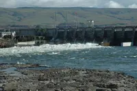
The Army Corps of Engineers built The Dalles Dam two miles east of the city between 1952 and 1957, and when it went into operation on March 10, 1957, its backwater lake submerged the rapids and Celilo Falls.1,13 The Oregon Encyclopedia puts the federal payment to the tribes for their Celilo fishing rights at $23.5 million, the Oregon History Project at nearly $27 million, and HistoryLink at $26.8 million.13,14,15 The Harvey Aluminum smelter began operations in 1958, its fluoride emissions damaged cherry crops, and it closed again in 2000.1 The city had about 16,000 people in 2020, and the Oregon Encyclopedia lists its top employers as the Mid Columbia Medical Center, School District #21, the Oregon Cherry Growers, and the Army Corps of Engineers.1 Google located a data storage facility in The Dalles in 2006, drawn by inexpensive hydroelectric power and the city’s fiber-optic network.1
Within 30 Miles
Measured in a straight line from the town, nearest first.
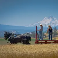
- Dufur Threshing BeeDufur · FestivalA harvest weekend in Dufur, Oregon, begun in 1971 by a farmer who noticed passing motorists stopping to watch him work his wheat fields with horses.
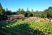
- Syncline WineryLyle · Estate wineryWelcome to our farm and winery in the beautiful Columbia River Gorge Join us for tasting and bottle service in the cellar and gardens.
- Klickitat Canyon DaysKlickitat · Annual town festivalThe annual festival of Klickitat, Washington, held the last full weekend of July since the 1970s, ends with a thousand numbered ducks floating down the river into town.
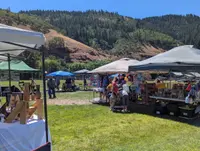
- Huckleberry FestivalBingen · Community festivalBingen, Washington, has held its free, three-day Huckleberry Festival since 1962, with huckleberry pie, a parade dressed in purple and a reptile show kept out of the afternoon heat.
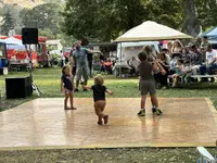
- Stonehenge Memorial & Klickitat County Veterans MemorialGoldendale · Full-scale replica of stonehengeA full-scale concrete replica of Stonehenge on a bluff above the Columbia near Maryhill, Washington, raised by Sam Hill as a World War I memorial to Klickitat County's dead.
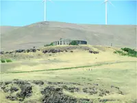
- Macks Canyon Recreation Site (BLM), Deschutes River, Sherman County, ORLower Deschutes River · BLM recreation siteThe Macks Canyon archaeological site is a large, prehistoric village locale overlooking the Deschutes River in north-central Oregon. The site is characterized by shallow, circular, semi-subterranean house depressions, surface artifacts, and riverine shell deposits.
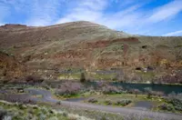
- Hood River Fruit LoopHood River · Self-guided tour of our fruit loop stands along a scenic 35 mile driveA 35-mile self-guided drive through Oregon's Hood River Valley past some thirty farm stands, cideries, and lavender fields, organized by growers in 1992 around a printed map.
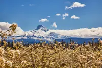
- Mt. Hood Scenic BywayHood River · Scenic bywayThe glacier-caked summit of Oregon's highest peak creates a dramatic centerpiece for this 100-mile/161-kilometer route that skirts the mountain through fruit valleys and thick fir forest.
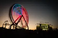
- Hood River County FairHood River, OR · County fairThe Hood River County Fair, a four-day July fair on Wyeast Road near Odell, Oregon, where 4-H livestock were once penned beneath a high school grandstand.
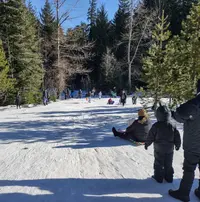
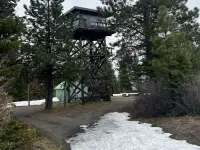
- Fivemile Butte LookoutMt. Hood · LookoutA 1957 fire lookout cabin on Fivemile Butte, Mt. Hood National Forest, rented by the night and reached in winter on skis or snowshoes from Billy Bob Sno-Park.
- Spring Creek National Fish HatcheryUnderwood · National fish hatcheryA federal salmon hatchery on the Washington shore of the Columbia at Underwood, where tule fall Chinook climb a stepped ladder each September to the spring water that raised them.
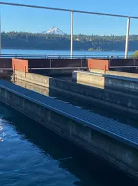
- Goldendale Community DaysGoldendale · Summer celebrationGoldendale's summer celebration on Main Street and the Klickitat County Courthouse lawn, which reached its 100th year in 2026 and began, the mayor says, as a world-record turnout attempt.
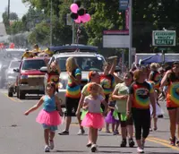
- Maryhill WineryGoldendale · Destination winerySet above the Columbia River Gorge, surrounded by vineyards and open sky, where Washington wine comes into focus and where the wines are crafted and blended.
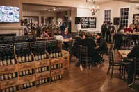
- Klickitat County FairGoldendale, WA · County fair and pro rodeoThe Klickitat County Fair and Rodeo, held the third weekend of August in Goldendale, Washington, began in 1881 with a pavilion, race course, and grandstand behind a high fence.
- Sherman County FairMoro · County fairSherman County's late-August fair on the hill above Moro, Oregon, held since 1909, where the barns and scales give way to a Friday rodeo and Saturday demolition derby.
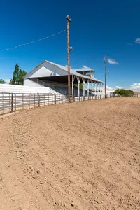
6 more within 30 miles on the road map.
Nearby towns: Hood River. All the towns of Oregon. More of Oregon: Holiday Celebrations, Town Festivals, and Factory Tours.
Sources
- The Dalles oregonencyclopedia.org/articles/the_dalles
- Old West Museum — Fort Dalles Museum fortdallesmuseum.org/history
- National Register nomination, The Dalles Commerical Historic District (1997 Update); npgallery.nps.gov/GetAsset/aa3c5865-2bcd-4828-8da9-bc2da51cc1f3
- Dalles of the Columbia, 1805 oregonhistoryproject.org/articles/historical-records/dalles-of-the-columbia-1805
- Oregon: End of the Trail (1940), p. 268 archive.org/details/oregonendoftrail00writrich/page/268
- Fort Dalles oregonencyclopedia.org/articles/fort_dalles
- The Dalles City Hall 1908 (historical marker) hmdb.org/m.asp?m=112441
- National Register nomination, French, Edward, House npgallery.nps.gov/NRHP/GetAsset/NRHP/92001319_text
- Seufert Brothers Cannery oregonencyclopedia.org/articles/seufert_brothers_cannery
- Umatilla House (historical marker) hmdb.org/m.asp?m=112109
- National Register record, The Dalles Commercial Historic District npgallery.nps.gov/AssetDetail/NRIS/86002953
- The Dalles Civic Auditorium and Veterans Memorial oregonencyclopedia.org/articles/the_dalles_civic_auditorium_and_veterans_memorial
- The Dalles Dam (oregonencyclopedia.org) oregonencyclopedia.org/articles/the_dalles_dam
- The Dalles Dam (oregonhistoryproject.org) oregonhistoryproject.org/articles/historical-records/the-dalles-dam
- The Dalles Lock and Dam historylink.org/file/21191