Fivemile Butte Lookout
Mt. Hood, Wasco County, Oregon. Lookout.
Details

- Where
- 6780 Highway 35, Attn: Hood River Ranger Station, Mt. Hood, OR 97041. Directions
- When
- Check-out is 11am, check-in is 3pm.
- Season
- Available year-round; winter access up to 3 miles from Billy Bob Sno-Park by ski, snowmobile, or snowshoe.
- Getting there
- From Dufur, Oregon, travel west on Valley Road for about 18 miles to the junction of Forest Service Roads 44 and 4430, at Billy Bob Sno-Park. Turn right on Forest Service Road 4430-120, then turn left and follow to the spur road 122.
- Fees
- $85 per night up to 4 people.
- Access
- Site Temporarily Closed - Fire closure in place for Grasshopper Fire; check fs.usda.gov/r06/mthood/alerts/closure-place-grasshopper-fire for current status.
- Walk-in or reserve
- Visit Recreation.gov or call 877-444-6777 to make a reservation up to 6 months in advance.
- Phone
- 541-467-5100
- Website
- recreation.gov
- Managed by
- Mt. Hood National Forest.
- Established
- 1957.
- Coordinates
- 45.410068, -121.468758.
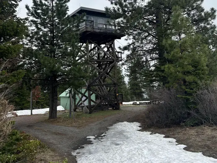
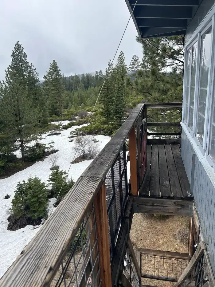
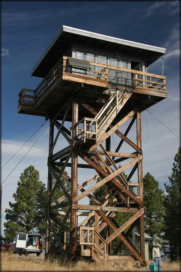
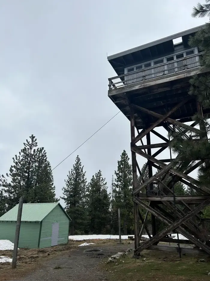
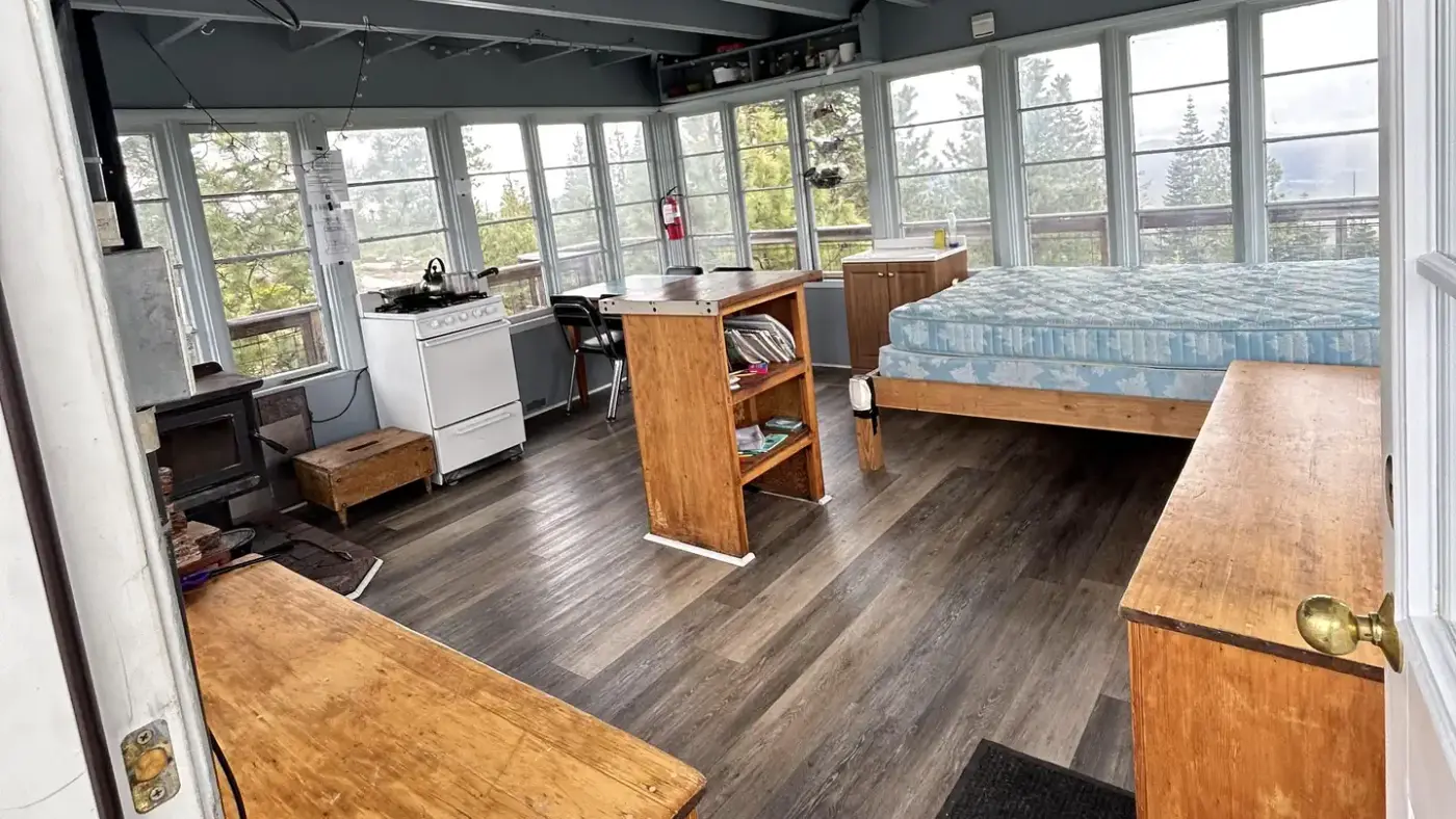
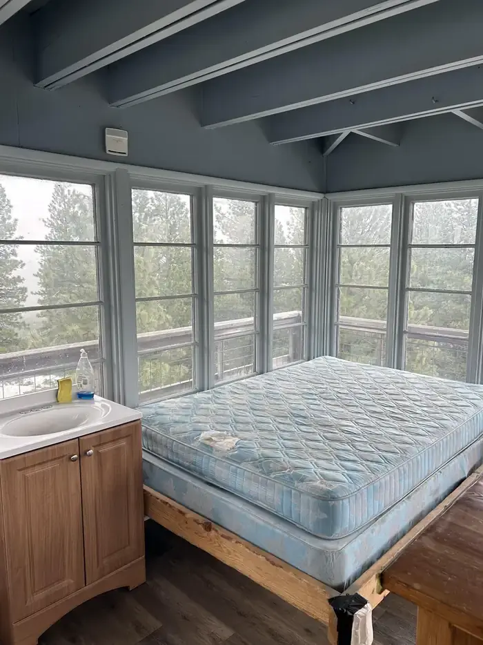
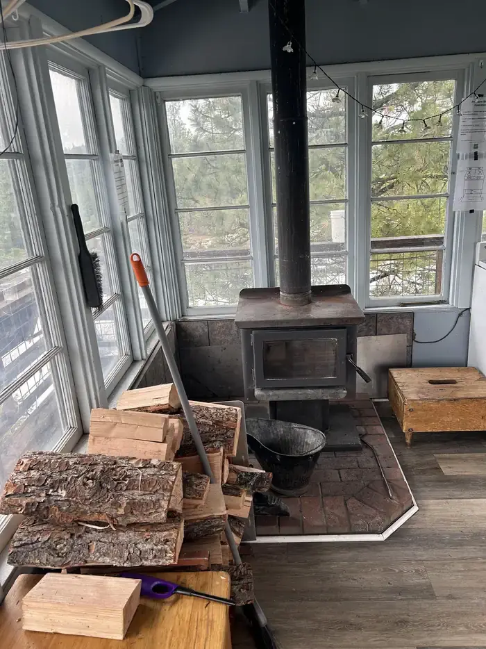
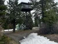
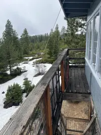
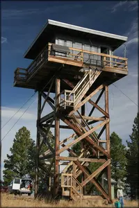
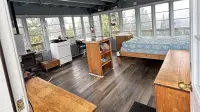
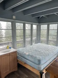
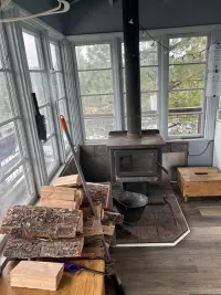
The cabin sits atop a tower on Fivemile Butte, 4,627 feet up on the Barlow Ranger District of the Mt. Hood National Forest, with a wooden catwalk around it. The room inside is 14 feet by 14. It holds a small single bed, a wood stove for heat, and a table with a chair. The Forest Service lists one chair; Recreation.gov and Travel Oregon list chairs. Meals are cooked on a propane stove, and the lights run on solar power.
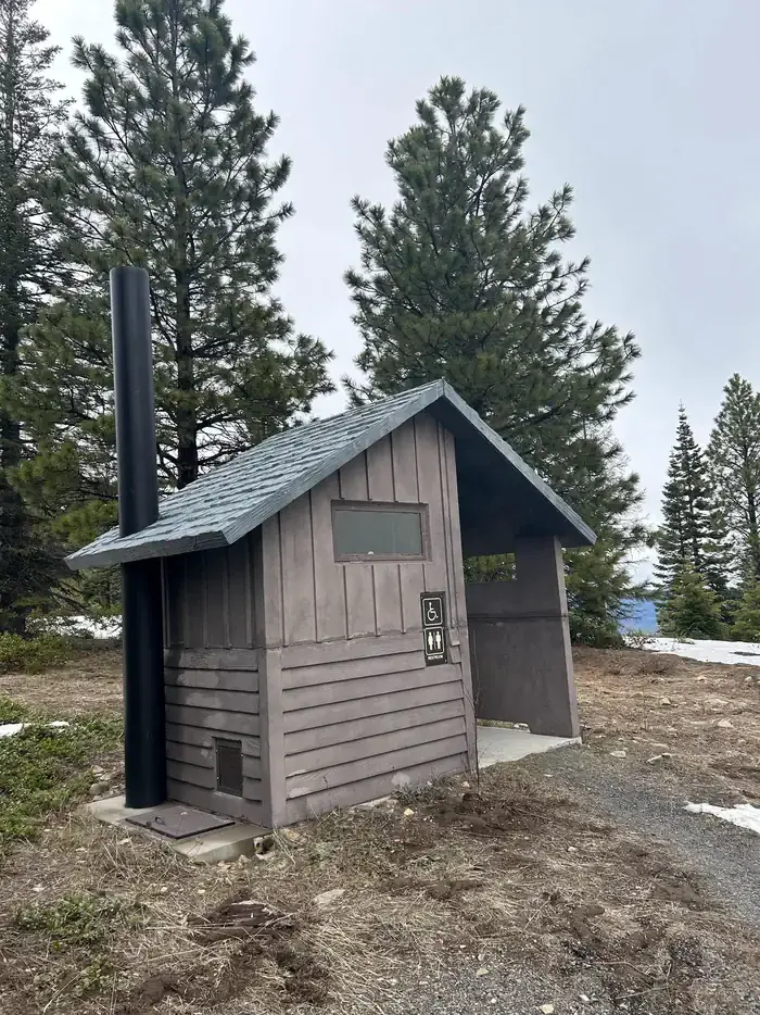
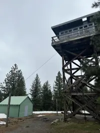
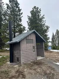
There is no water on the butte. Guests bring what they need for drinking, cooking and washing, along with their own bedding, lantern, dish soap and garbage bags, and they carry all trash back out. A rope and pulley lifts gear and firewood up the tower. On the ground are an outhouse with a vault toilet, a woodshed, a fire ring, and room for a tent. One combination opens both the tower and the woodshed, and it arrives in the reservation’s confirmation email. The firewood is for indoor use only. Recreation.gov warns that the steps and catwalk can turn slippery, and that the tower may sway in strong winds.
Pines, creeks and camp robbers
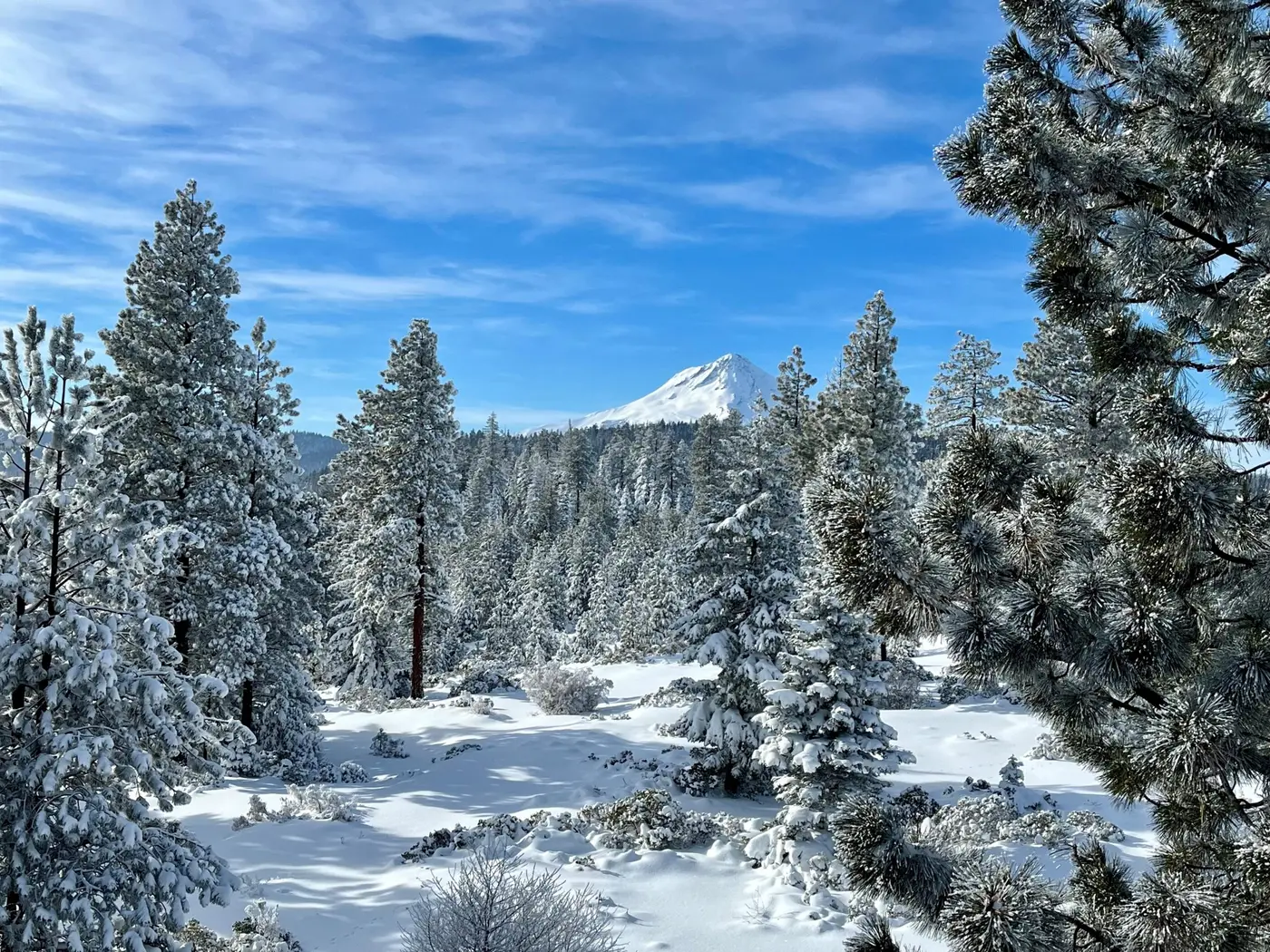
Ponderosa pine, Douglas fir and western hemlock close over the mountainside and shade numerous creeks. The Forest Service advises carrying binoculars on the trails to watch for golden eagles, wild turkeys, grouse and “the brilliant blue flash of camp robbers, the common nickname for Steller’s jays.” Elk, deer, coyote, cougars and bears come to the creeks “for a drink or a meal.” Near the lookout, Eightmile Trail follows Eightmile Creek. It passes through and around a riparian area, old-growth pine forest, and meadows dotted with wildflowers. In summer visitors hike, ride horses and mountain bike here.
Basalt lies beneath the forest. The Oregon Department of Geology and Mineral Industries mapped this country between 2011 and 2023, and one plate of its map carries the butte’s name: the Fivemile Butte and northern part of the Flag Point quadrangles. The oldest rocks exposed in the mapped area belong to the Columbia River Basalt Group, which the state’s geologists call the youngest flood basalt province in the world. Upper Miocene and lower Pleistocene volcanic rocks lie on top of it. They record part of the volcanic and tectonic building of the northern Oregon Cascade Range over the past 9 million years. The mapped area lies on the eastern slopes of that range, about 15 miles east-northeast of Mount Hood volcano.
Three miles from Billy Bob Sno-Park
From Dufur, Dufur Valley Road runs west about 18 miles to the junction of Forest Roads 44 and 4430 at Billy Bob Sno-Park. From there, Road 4430-120 and spur 122 lead to the end of the road at the lookout. The route is about 3 miles long and is marked with orange and blue diamonds. It is not plowed, signed or patrolled. In summer guests unlock a gate and drive to the foot of the tower. In winter the gate stands open, but from December 1 through April 1 the forest roads are closed to vehicles wider than 48 inches. Depending on the snow, the closure can last later into the year. In those months visitors park at the Sno-Park and cover the 3 miles on skis, snowshoes or snowmobiles. Travel Oregon puts the trek at about three to four hours.
Hunters use the lookout in winter, and lookout guests share the trails with other skiers and snowmobilers. Recreation.gov asks winter guests to be experienced in backcountry travel and survival skills. The Forest Service page for the lookout, last updated August 13, 2026, listed the site as temporarily closed under the fire closure for the Grasshopper Fire.
Snow on an L-4
The Forest Service built the first lookout here in the 1920s. By its account, this was a small cab on a 30-foot pole tower. The National Historic Lookout Register says only that it was a pole tower, and it spells the place Five Mile Butte. On October 30, 1932, The Sunday Oregonian reported: “New standard lookout cabins have been constructed at Flag Point and Five-Mile butte, 20 miles southwest of headquarters.” According to the register, the new cabin was an L-4 set on a 30-foot pole tower. On November 11, 1933, Robert Snyder took panorama photographs of the view from it. In 1936 the station’s telephone ring was one long, two short, one long. A compilation of the station’s records, which notes that its own source is lost, gives a line from 1937: “On the headwaters of the Five Mile Creek a large white coyote was sighted by the lookout.”
Heavy snow destroyed the L-4 in 1942. The register says it collapsed under snow ten years after it went up and was replaced with another L-4 on a stronger tower. The Forest Service calls that replacement a non-typical L-4. In 1957 the present cab took its place, which the Forest Service describes as an R-6 Flat Top. Recreation.gov and Travel Oregon tell the story more briefly. They pass over the 1942 rebuilding and say that a non-typical lookout structure was rebuilt at the site in 1957.
The Barlow District’s historical report for 1957 recorded the work in an entry dated February 4, 1958: “A new 15’ 4” lookout house was fitted to a new 14’ tower 30 feet high on Five Mile L.O.” The register also places the R-6 cab on a 30-foot tower, while the Forest Service and Recreation.gov describe the cabin as sitting atop a 40-foot tower. The register listed the lookout on September 4, 2011, under the numbers US 914 and OR 118, on the nomination of Howard Verschoor. It now rents for $85 a night for up to four people, and the Forest Service states that the fees go directly to the maintenance and preservation of the lookout.
Notable Events
- 1920sThe Forest Service established a small cab on a 30-foot pole tower. fs.usda.gov
- 1932A standard L-4 replaced the earlier lookout. fs.usda.gov
- 1932An L-4 cab atop a 30' pole tower was erected; it collapsed under snow ten years later. web.archive.org
- 1933Robert Snyder took the lookout's panorama photographs on November 11. oregonlookouts.weebly.com
- 1936The compilation lists the station's telephone ring for this year as one long, two short, one long. oregonlookouts.weebly.com
- 1937The compilation records, with its own hedge that the source is lost, that a large white coyote was sighted on the headwaters of the Five Mile Creek. oregonlookouts.weebly.com
- 1942The standard L-4 lookout built in 1932 was destroyed by heavy snow, and a non-typical L-4 replacement was rebuilt. fs.usda.gov
- 1957The present R-6 Flat Top style lookout replaced a non-typical L-4 replacement. fs.usda.gov
- 1957Travel Oregon states that a non-typical lookout structure was rebuilt at the site. traveloregon.com
- 1957This R-6 cab on a 30' tower was built and is in the rental program. web.archive.org
- 1958The Barlow District historical report for 1957 records that a new lookout house was fitted to a new tower 30 feet high on Five Mile L.O. oregonlookouts.weebly.com
- The 1932 L-4 cab collapsed under snow and was replaced with another L-4 on a stronger tower. web.archive.org
People
- Robert Snyder, took the panorama photographs of the view from the lookout (November 11, 1933).
Sources
- recreation.gov/camping/campgrounds/234248
- oregon.gov/dogami/pubs/pages/gms/p-gms-128.aspx
- oregonlookouts.weebly.com/five-mile-butte.html
- web.archive.org/web/2023id_/https://nhlr.org/lookouts/us/or/fivemile-butte-lookout
- nhlr.org/lookouts/us/or/fivemile-butte-lookout
- fs.usda.gov/r06/mthood/recreation/fivemile-butte-lookout
- traveloregon.com/things-to-do/destinations/parks-forests-wildlife-areas/fivemile-butte-lookout