Grants Pass
Josephine County, Oregon. County seat.
Grants Pass, the Josephine County seat on the Rogue River, began as a stage stop said to be named for General Grant’s capture of Vicksburg.1,2
Details
- Name
- The 1940 Federal Writers’ Project guide says road builders named the place when a messenger told them of General Grant’s capture of Vicksburg; the Oregon Encyclopedia says a stagecoach stop was named Grant for that 1863 victory, with “Pass” added to tell it apart from Grant County.1,2
- County seat
- Grants Pass is the seat of Josephine County, in 1885 by the National Register nomination’s account or in 1887, replacing Kerby, by the Oregon Encyclopedia’s.1,3
- Last checked
- October 6, 2026.
Point at a dot to see the place.Tap a dot to see the place. Road map of Grants Pass.
In Grants Pass
- Southern Oregon Flea MarketGrants Pass · Flea marketThe Grants Pass flea market is located at the Josephine County Fairgrounds in the event building. Also being held in the parking lot during the summer months.
- Sundance DistillingGrants Pass · DistilleryBrandan and Barbara Conover operate a local distillery in Grants Pass. They craft all of their products in-house, boasting a selection of around 20 items.
- Wooldridge Creek WineryGrants Pass · Oregon's first combined winery & creameryOregon's only combined winery and creamery; the creamery was founded in 2015 and uses only local, organic milk.
The Calendar
History
The Caveman Over the Rogue
Since 1971 a seventeen-foot fiberglass caveman on an eight-foot pedestal has stood over Grants Pass, and the 1931 bridge over the Rogue River is called Caveman Bridge.1 From 1922 the city was headquarters of the Oregon Caveman Club, whose members promoted tourism dressed in animal skins and horsehair wigs.1 Grants Pass is the county seat of Josephine County, on the Rogue about thirty miles northwest of Medford.1 In 1920 engineer John Hampshire gave the city a sign proclaiming “It’s the Climate!”, and that motto remains in place today.1 The town’s economy now rests on high technology, medical care, tourism, retirement services, and wood products.1
Ferries and a Stage Stop
The town stands on land once occupied by the River Takelma peoples, who were forcibly removed by war and treaty in 1853, after a disease epidemic.1 The Fort Vannoy marker near Grants Pass says the Hudson’s Bay Company used a ford of the Rogue there as early as 1827, and that in 1850 a Mr. Long built the first permanent non-Indian dwelling in the Rogue Valley near it and started a ferry.4 James Vannoy and James Tuff bought the ferry in 1851; the marker dates Vannoy’s donation land claim to 1853, while the National Register nomination has James N. Vannoy filing it in 1852.3,4 In October 1855 settlers converged at the ford behind hastily erected cover, which, the marker says, was never truly fortified but served as headquarters for the Oregon Volunteers during the 1855-1856 Indian Wars.4 In 1851 Joel Perkins also came to the Rogue and set up a ferry and general store, and a settlement called Perkinsville grew along the river.5 The 1940 Federal Writers’ Project guide says the town began as a stop on the California Stage route and was named by road builders working over the pass when a messenger told them of General Grant’s capture of Vicksburg.2 The Oregon Encyclopedia tells it differently: settlers named a stagecoach stop on the Sacramento-to-Portland route Grant, for his 1863 victory at Vicksburg, and added “Pass” to tell it apart from Grant County.1
Rails and Fires on G Street
The Oregon & California Railroad was completed to Medford in late 1883, and on December 7, 1883, a man named Bourne filed a plat for the “town of Grants Pass.”1,3 In 1885 the boundary between Jackson and Josephine counties was redrawn to put a railhead in Josephine County, and Perkinsville and other settlements were abolished in favor of Grants Pass.1,5 The National Register nomination says Grants Pass, until then part of Jackson County, became the county seat in 1885; the Oregon Encyclopedia says it was incorporated as the Josephine county seat in 1887, replacing Kerby.1,3 In the 1880s the town built a railroad depot, a courthouse and jail, a Methodist church, a brewery, a dam for power and water, and, by the encyclopedia’s account, the first county bridge across the Rogue River.1 Population went from 250 in 1880 to 1,432 in 1890 and 3,897 by 1910.1 A marker Charles A. Wing put up in 1949 stands on the site of what it calls the first brick building in Grants Pass, built by John W. Howard in 1886.6 Before 1890 the buildings facing the depot were simple one- or two-story wood structures, and one account quoted in the nomination called the town “a fire trap of the most destructible style.”3 A series of fires beginning in 1894 burned the business district again and again, among them one that swept G Street in October 1899 and two major fires in 1902.3 Merchants slowly rebuilt in masonry, and the National Register nomination describes the G Street Historic District in the downtown core as an intact collection of late 19th century buildings.3
Gold Dust, Orchards, and Sugar Beets
Mining and agriculture dominated the town’s economy until about 1930, and the Grants Pass Irrigation District, formed in 1916, widened the crops to apples, pears, berries, alfalfa, cherries, grapes, hops, and melons.1 In 1916 the Oregon Utah Sugar Company raised a large beet factory from over 700,000 bricks made by local brick maker C.E. Woolfolk, and it began operating on “Sugar Day,” October 24, 1916.7 Without enough land and water, the plant did not survive its second year and was moved to Toppenish, Washington; by the end of 1918 only broken bricks and its cement foundations remained, part of which still lies under the Fruitdale Grange parking lot.7 In 1911 Portland realtor H.L. Chapin set out to build a railroad from Grants Pass to Crescent City on the California coast, and residents laid ten miles of track to Wilderville in 1914, but war work after 1917 left the line unfinished.8 In 1940 the Federal Writers’ Project guide counted 4,666 people and found sawmills and wood-working plants numerous, with miners still coming in from the back country to sell their dust to local banks.2 On Saturday nights, the guide said, ranchers, miners, and lumberjacks mingled with townsmen and tourists along the lighted streets.2
Depression, Timber, and the Courts
The Great Depression sent many locals into New Deal programs or small-scale mining, and public works projects built a new post office whose two New Deal murals remain inside.1 The Rogue Theatre, designed by Robert Keeney, opened on November 9, 1938, closed on New Year’s Eve 1999 as the last of the original downtown movie houses, and reopened as a regional performing arts center.9 Timber overtook mining until federal policies cut the yield in the last quarter of the twentieth century, and the loss of timber funds and low property tax revenues brought public safety layoffs and, in 2007, a countywide library closure.1 A challenge to the city’s camping ban reached the U.S. Supreme Court in 2024, where in Johnson v. Grants Pass the court ruled 6-3 that the ordinance did not violate the Eighth Amendment, and in 2025 city councilors revoked funding to address homelessness.1
Within 30 Miles
Measured in a straight line from the town, nearest first.
- National Rooster Crow WeekendRogue River · FestivalA late-June weekend in Rogue River, Oregon, held since 1953, whose main event counts how many times each entered rooster crows in thirty minutes.
- Gold Dust Day Heritage CelebrationGold Hill · Community eventGold Hill, Oregon, holds its Gold Dust Day on the first Saturday in June, with a parade down 2nd Avenue and free raft rides on the Rogue River.
- Cantrall-Buckley ParkRuch · County parkA county park of 88 acres on the Applegate River near Ruch, Oregon, laid out around a pioneer swimming hole and run for twenty years by its neighbors.
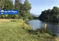
- Valley View WineryJacksonville · Winery/vineyardSouthern Oregon's Premier Winery - Established in 1972. Home to award winning Domaine Rogue wines.
- Jackson County FairCentral Point · County fairThe Jackson County Fair, held each July at The Expo in Central Point, Oregon, traces to an 1859 Agricultural Show in Jacksonville, where a Talent man's grape took a blue ribbon.

- TouVelle State Recreation SiteCentral Point · Day-use state recreation siteA Rogue River day-use park at the foot of Table Rock with picnicking, fishing, boat launch, swimming, and a 2-mile trail
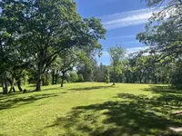
- Divers Hole Day Use (USFS Rogue River-Siskiyou NF), Josephine County, ORSelma, Oregon · Day-use recreation siteA free, unimproved swimming hole 8.5 miles west of Selma, Oregon, where the Wild and Scenic Illinois River widens into a deep pool beside Forest Road 4103.
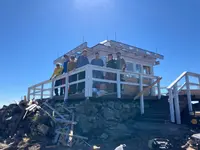
- Acorn Woman Peak LookoutJacksonville · Fire lookout (USFS rental)A 14-foot-square L-4 fire lookout on a Siskiyou ridge above the Applegate Valley, rented by the night, with its Osborne Firefinder still at the center of the room.
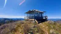
- Foris Vineyardsnear Cave Junction, Oregon in the Illinois Valley region · Estate winery and tasting roomForis Vineyards, a family estate winery near Cave Junction, Oregon, seven miles from California, pours its wines in a stone tasting room built from gold-mine tailings.
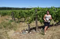
- Forks State Park, West Fork Illinois RiverCave Junction · State park near medfordA day-use state park just south of Cave Junction, Oregon, where the east and west forks of the Illinois River meet, enlarged in the 1970s by a lawyer's gifts of land.
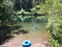
- Oregon Old Time Fiddlers monthly jam, Roxy Ann GrangeMedford · Monthly old-time fiddlers jam
- Butte Creek MillEagle Point · Water-powered flour millA water-powered grist mill on Little Butte Creek in Eagle Point, Oregon, built in 1872 and burned on Christmas morning 2015, again grinding on its original French buhr stones.
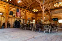
- Bigfoot TrapRuch · The only bigfoot trap in the worldThe only bigfoot trap in the world, on the Collings Mountain Trail, which features spectacular views of the Siskiyou Crest and Applegate Lake.
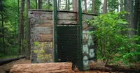
- Bolan Mountain LookoutCave Junction · L-4 style lookoutA one-room glass fire lookout on the Siskiyou crest south of Cave Junction, Oregon, burned to its foundation in the 2020 Slater Fire and was rebuilt by volunteers in 2024.
Nearby towns: Jacksonville, Roseburg, and Gold Beach. All the towns of Oregon. More of Oregon: Fairs & Rodeos, Town Festivals, and Flea Markets.
Sources
- Grants Pass oregonencyclopedia.org/articles/grants_pass
- Oregon: End of the Trail (1940), p. 326 archive.org/details/oregonendoftrail00writrich/page/326
- National Register nomination, Grants Pass G npgallery.nps.gov/GetAsset/eeec29e9-5a97-4c94-a415-692663df8a02
- Fort Vannoy (historical marker) hmdb.org/m.asp?m=112767
- The Perkinsville Ferry (historical marker) hmdb.org/m.asp?m=100215
- The First Brick Building in Grants Pass (historical marker) hmdb.org/m.asp?m=91926
- Mormon Sugar Beet Factory Site (historical marker) hmdb.org/m.asp?m=112529
- The Famous Rogue River Valley oregonhistoryproject.org/articles/historical-records/the-famous-rogue-river-valley
- Rogue Theatre oregonencyclopedia.org/articles/rogue_theatre