Clovis
Fresno County, California.
Clovis, a Fresno County city founded in 1891, is named for Clovis M. Cole, who became known as the “Wheat King of the United States.”1,2
Details
- Founded
- A historical marker in town says the San Joaquin Valley Railroad was directly responsible for the founding of the City of Clovis.3
- Name
- The town is named for Clovis M. Cole, a pioneer who spent nearly all of his life in the vicinity and developed thousands of acres of wheat in Fresno County.4
- Last checked
- October 6, 2026.
Point at a dot to see the place.Tap a dot to see the place. Road map of Clovis.
In Clovis
The Calendar
History
The Depot from the Tarpey Ranch
The Tarpey Depot was built in 1892 as one of three depots on the San Joaquin Valley Railroad, and it now houses the Clovis Tourism and Information Center.1,2 It first stood on the Tarpey Ranch, just southeast of what is now the corner of Ashlan and Clovis Avenues, and over the years it has been a freight and passenger depot, the La Paloma Winery office, a post office, and a polling place.2
Clovis lies in the northeast quadrant of the Fresno-Clovis Metropolitan Area in the San Joaquin Valley, and one city page puts its population at close to 129,000 across more than 28 square miles.4 Another city page gives the figure as approximately 115,000, more than double the 1990 count.1 The city lists its economic base as retail sales and services and light manufacturing.4
Cole’s Wheat
Padre Martin explored the area in 1806 looking for a mission site, and gold rush miners of 1849 came after him, displacing the Native American tribes who lived in the foothills and along the rivers.1 When the gold ran out, the miners took up small farms in the foothills, and after the Civil War large cattle grazing lands were developed.1 Stephen H. Cole’s family arrived in 1872, and two years later he gave his sixteen-year-old son, Clovis, four horses, which the boy used to haul lumber down from the Sierra Nevada.1 Cole saw that the grazing land on the valley floor would suit dry grain farming, so he bought land to grow grain for feed and seed, and in time he farmed 50,000 acres and became known as the “Wheat King of the United States.”1 In 1880 he bought the 480 acres that would become the City of Clovis.1
Pollasky’s Railroad
When the railroad trusts raised their rates, valley farmers looked for another way to ship grain, and the city says that in 1890 Marcus Pollasky, a 26-year-old Chicago railroad developer, and a group of Fresno citizens raised more than $100,000 to build the independent San Joaquin Valley Railroad.1 The marker E Clampus Vitus put up in 1971 dates Pollasky’s company to 1891 and says he planned for the line to cross the mountains and open the valley to direct traffic with the East.3 The city says Cole sold most of the land the railroad used, including a depot site, while the marker says Pollasky promised Cole a depot in exchange for right-of-way and that Cole donated land for the townsite.1,3 In 1891, just before the first tracks were laid, Pollasky and his investors founded the town and named it for Clovis M. Cole.1 The line ran 26 miles from Fresno to Millerton, now Friant, which the San Joaquin Valley Railroad marker calls Hamptonville, and the Tarpey Depot marker says it was sold to Southern Pacific in 1893.1,2,3
The Shaver Flume and the Mill
While the railroad was being built, a group of Michigan lumbermen began acquiring thousands of acres of timber in the mountains east of Clovis, and in time they dammed a creek to make Shaver Lake and built a 42-mile flume from the foot of the dam to the valley floor.1 The Tarpey Depot marker credits the flume to the Fresno Flume and Irrigation Company and dates its completion to 1894.2 A 40-acre mill and finishing plant grew up in the empty fields of Clovis, with a planing mill, box factory, warehouses, dry kiln, offices, workhorse stables, pastures, and cottages, and the saloons came after.1,4 In 1894 the first school opened in the waiting room of the Tarpey Depot, and the next year the first permanent schoolhouse went up on the northeast corner of 2nd and Pollasky.1 The three-story Hoblitt Hotel went up in 1900 on the northwest corner of Fourth and Pollasky, with a bathtub and a lavatory on each floor.1
Old Town and the Last of the Line
Clovis incorporated in 1912, and under Southern Pacific the old valley line kept running at a profit for decades.1 Ken Curtis, who played Festus Haggen on “Gunsmoke” from 1962 to 1975, moved to the Clovis area in 1980 and appeared in the 1991 Clovis Rodeo the day before he died.5 Local artist Samantha Cowen made a steel and concrete statue of him as he looked in the show and donated it to the City of Clovis in 1992.5 The city has announced it will begin work on a Historic Preservation Board and a Historic District.6 The city says several structures besides the Clovis Hotel survive from the turn-of-the-century town, and the Tarpey Depot marker calls the depot the last remnant of the San Joaquin Valley Railroad.1,2
Within 30 Miles
Measured in a straight line from the town, nearest first.
- The Big Fresno Flea MarketFresno · Swap meetA weekend swap meet in the Butler Parking Lot of the Big Fresno Fairgrounds, where the vendors of the Sunnyside Swap Meet went after that market's land was sold in 2021.

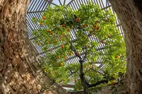
- Forestiere Underground GardensFresno · Underground garden and hand-excavated homeA hand-dug complex of rooms, courts, and passageways beside Fresno's Shaw Avenue, where Baldassare Forestiere planted citrus and grapevines below ground level over about forty years.
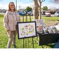
- Blossom DaysSanger · Fest & car showThe Sanger District Chamber of Commerce's free spring street festival in downtown Sanger, Fresno County, where nearly 400 cars filled the Webber Realty Car Show in 2026.
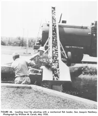
- San Joaquin HatcheryFriant · Fish hatcheryA major producer of trout and inland salmon, San Joaquin Hatchery is also a great place to visit. Along the San Joaquin River, just downstream of the Friant dam, San Joaquin Hatchery has picnic grounds among the garden of California native vegetation. Take a photo with the enormous wood-carved rainbow trout!
- Reedley FiestaReedley · Annual two-day community celebrationEntertainment and booths at Pioneer Park, a community art show, coronation, live music, pancake breakfast, run/walk, Rotary parade and frog jump contest.
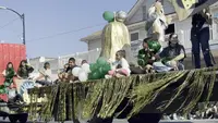
- Kingsburg Swedish FestivalKingsburg · Swedish festivalThe Kingsburg Swedish Festival fills downtown Kingsburg, California, every third weekend in May with pea soup, a Maypole and a parade, beneath a water tower shaped like a coffee pot.
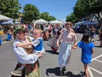
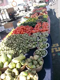
- Madera Flea MarketMaderaA Wednesday and Sunday swap meet on about 35 acres of the Madera, California, fairgrounds, family run since 1987, where Oaxacan produce shares lettered rows with work boots.
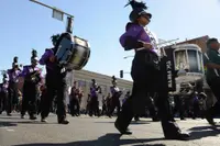
- Old Timers Day Parade and CelebrationMadera · Parade and festivalMadera, California, has paraded stagecoaches, fire trucks, and bands down Yosemite Avenue since 1931, when the day honored anyone living in the county by 1890.
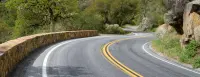
- Kings Canyon Scenic Byway (Highway 180)Dunlap · Scenic byways or routesBeginning in the Sierra Nevada foothills near Dunlap, the Kings Canyon Scenic Byway traverses 50 spectacular miles leading to Roads End, all along Highway 180. The byway begins in the foothills outside of Fresno and then enters the Grant Grove area of Kings Canyon National Park. It then descends through Sequoia National Forest, then ends at the Cedar Grove area of Kings Canyon National Park.
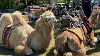
- Raymond ParadeRaymond · Parade and craft fairRaymond's parade, held the third Saturday of April in the Madera County foothills, began in 1986 as a learners' parade and still steps off at high noon.
- Mid-Sierra Loggers JamboreeNorth Fork · Annual mid-sierra loggers jamboreeNorth Fork's own Nate Hodges was again named Champion Logger at the 66th Annual Mid-Sierra Loggers Jamboree held July 4-5 at the North Fork Recreation Center; this marks the 17th time Hodges has captured the Champion Logger title.
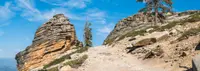
- Sierra Vista Scenic BywayNorth Fork · National scenic bywayLocated in the Sierra National Forest, the Sierra Vista Scenic Byway is a designated member of the National Scenic Byway System. The entire route meanders along National Forest roads, from North Fork to the exit point on Highway 41 past Nelder Grove, and without stopping takes about five hours to drive.
All the towns of California. More of California: Town Festivals, Fairs & Rodeos, and Scenic Drives.
Sources
- About Clovis (clovisca.gov) clovisca.gov/tourism/plan_your_stay/about_clovis.php
- Tarpey Depot (historical marker) hmdb.org/m.asp?m=101992
- The San Joaquin Valley Railroad (historical marker) hmdb.org/m.asp?m=28017
- About Clovis (clovisca.gov) clovisca.gov/government/about_clovis.php
- Ken Curtis (1916-1991) (historical marker) hmdb.org/m.asp?m=284948
- Historic Preservation (clovisca.gov) clovisca.gov/services/planning_development/planning/projects/historic_preservation.php