Bend
Deschutes County, Oregon. County seat.
Bend is the Deschutes County seat in central Oregon, where two Great Lakes firms opened sawmills on opposite sides of the Deschutes River.1,2
Details
Point at a dot to see the place.Tap a dot to see the place. Road map of Bend.
In Bend
- Cascade Lakes Scenic BywayBend · Scenic bywayThe Cascade Lakes Scenic Byway runs 66 miles from Bend past Mount Bachelor and a chain of volcanic lakes to Oregon 58, through lava fields where Apollo astronauts trained.
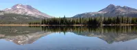
- Fall River HatcheryBend · State fish hatcheryA state trout hatchery on spring-fed Fall River south of Bend, Oregon, whose 1973 virus outbreak led the state to chemically treat the entire river.
- The Last BlockbusterBend · Roadside oddityThe world's last Blockbuster video store, in a Bend, Oregon, strip mall at U.S. 20 and Revere Avenue, still rents discs and displays Russell Crowe's Robin Hood hood.

History
Mill B Stacks on the Deschutes
Three smokestacks from Mill B have stood on Bend’s skyline since the 1920s, above the ground along the Deschutes River where the mills once worked around the clock.5 The city stands at 3,623 feet between the eastern side of the Cascades and the high desert, and gives its population as around 100,000.6 The guide gave Bend 8,848 people and called it the chief industrial city of central Oregon.1
Farewell Bend and the Drakes
Anthropologists Beatrice Blythe and Robert J. Suphan identify the Bend area as the homeland of the Juniper-Deer-Eater Band (Hunipui) of the Northern Paiute.7 The city’s account has the Wana Łama, Wasq’u, and Northern Paiute tribes living here until the Warm Springs Treaty of 1855 led to the Warm Springs Reservation.8 The Klamath Trail, likely established in the middle Archaic, followed the Little Deschutes and Deschutes rivers to the Bend area on its way to the Columbia River.7
The 1940 guide says the bend was the only place for many miles where the Deschutes River could be easily forded, and that early travelers bound for the Willamette Valley named the curve “Farewell Bend,” of which the second word stuck.1 Better routes later drew travel away, and by the guide’s account the place was forgotten except by a few cattlemen who ranged stock there.1 The guide says that in 1900 A. M. Drake, an easterner come west for his health, visited the place with his wife, and Mrs. Drake liked it so well that they decided to stay.1 The guide counts 21 people in 1900, and in 1904 the Pilot Butte Development Company platted the town and sold lots.1,3 Arthur L. Goodwillie built a house on Brooks Street in 1904, and when Bend incorporated in 1905 he was elected its first mayor at twenty-six.8,9
The Rail Race and Two Pine Mills
After 1909, says the guide, growth turned steady as 300,000 acres were opened to homesteading.1 In 1911 the Oregon Trunk of the Great Northern and the Deschutes Railroad of the Union Pacific raced their lines up the Deschutes River, and the Great Northern line reached Bend that year.1,2 The Bend Water, Light and Power Company dammed the river in 1910 and finished a powerhouse in 1913.10 The guide has Tom Shevlin, the Yale football player, arriving in 1915 to build the Shevlin-Hixon mill in the year work began on the Brooks-Scanlon mill, and the city also gives 1915, while the Oregon Encyclopedia has both mills opening on opposite sides of the river in 1916.1,2,8 Shevlin-Hixon began heavy cutting on more than 200,000 acres of company-owned ponderosa pine, and each mill was soon producing around 200 million feet of lumber a year.11 By the guide’s figures Bend grew from 536 people in 1910 to 5,415 in 1920, which it called a record in the United States for the decade, while the Oregon Historical Society gives 5,414, and 8,821 by 1930.1,11
William P. Downing, who came from Bemidji, Minnesota, in 1902, sold lunches to millworkers, opened a restaurant on Bond Street, and saw his hotel finished in 1920 after costs ran over.12 By the spring of 1917 the Amateur Athletic Club Association had 500 members, all of whom contributed to the new gymnasium, and the association raised $50,000. Before the building officially opened, it served as an auxiliary hospital with forty cots during the influenza epidemic of 1918.13 The Pilot Butte Inn, designed by John E. Tourtellotte of Boise, opened on the river in 1917, and Eleanor Roosevelt was reported to have enjoyed a planked trout in its dining room.3 In 1940 the guide listed the home of Klondike Kate, once a singer and dancer in Dawson, a shake house on a lava-rock foundation at 231 Franklin Ave.1
Cutover, Fire, and the Old Buildings
In 1937 the Bend Chamber of Commerce warned of severe economic depression without sustainable forestry, and by the early 1950s the forests were depleted and the large mills shut down.11 The smaller mills that remained turned to plywood, particle-board, and molding, and the Oregon Encyclopedia counts nearly seventy years of pine manufacturing on the ground now called the Old Mill District.2,11 Also in 1937, a fire that state officials suspected was arson left the south wing of the county’s rented quarters in the former Central School an empty shell, and a W.P.A. grant built a new courthouse in 1940.4 The Oregon Historical Society records the Pilot Butte Inn as the first Deschutes County property placed on the National Register of Historic Places, in 1973, and it was demolished that same year.3 In the early 1990s Goodwillie’s house was considered for demolition to make room for a parking lot. Instead the City of Bend bought it and moved it fifty feet to the south, and it stands at the edge of Drake Park.9 The dam, 14 feet high and holding back Mirror Pond, is essentially unaltered, and the marker calls its powerhouse one of the oldest surviving buildings in Bend.10
Within 30 Miles
Measured in a straight line from the town, nearest first.
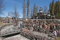
- Petersen Rock GardenRedmond · Rock gardenThe 91-year-old Petersen Rock Garden outside Redmond was bustling Saturday afternoon as the historic attraction reopened after an extensive renovation.
- Deschutes County Fair & RodeoRedmond · County fair and rodeoCentral Oregon's five-day county fair and NPRA rodeo on Redmond's Airport Way grounds, which began in 1906 as a show for the Deschutes Netted Gem potato.

- Steelhead Falls Trail (BLM), Deschutes River, Crook County, ORTerrebonne · TrailA 20-foot cascade tumbles over a rocky stretch in the Deschutes River.
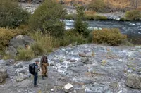
- East Lake Hot SpringsEast Lake · Hot springs boating siteHot springs on East Lake in Newberry National Volcanic Monument, reached by boat from the East Lake ramp.
- Fall River Guard StationBend · Guard station cabinA 600-square-foot Civilian Conservation Corps guard station in Deschutes National Forest, rented by the night, whose back door opens on the spring-fed headwaters of the Fall River.
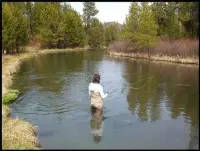
- La Pine Frontier DaysLa Pine · 4th of july celebrationA four-day Fourth of July celebration in La Pine, Oregon, begun in 1976 and now held on old Finley Ranch pasture, where mowers race and children fish stocked trout.

- Prineville Western DaysPrineville · FestivalA two-day vendor festival in Prineville's Pioneer Park, held each June on Crooked River Roundup rodeo weekend, where the Saturday parade down Third Street comes to an end.
- White Fir Springs Thunderegg BedPrineville · Public rockhound collection areaThundereggs filled with colorful jasper in shades of red, yellow, tan and creamy white; they can be difficult to remove from the hard rhyolite matrix, so bring hand tools adequate for breaking rock.
- Crook County FairPrineville, OR · County fairThe Crook County Fair, four free August days on Prineville's south-end fairgrounds, began in 1904 as a horse race and small exhibits beside a track that remains.

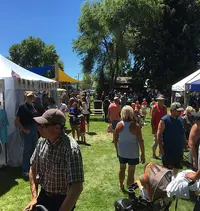
- Prideville FestivalPrineville, Oregon · Pride festJoin Prideville to show our "Small Town, Big Pride" at this year's 6th annual Pride fest in downtown Prineville.

- Lower Crooked River Back Country BywayPrineville · Back country bywayAn Oregon state highway located in Deschutes County and Crook County. OR 27 traverses the Crooked River Highway No. 14 of the Oregon state highway system. Known as the Lower Crooked River Back Country Byway, OR 27 has the distinction of being one of the only state highways in Oregon which is partially paved.
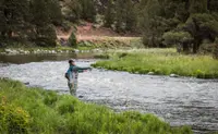
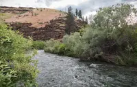
- South Fork John Day River Back Country BywayDayville · Back country bywayThis gravelled Back Country Byway parallels the Wild and Scenic South Fork John Day River through its incised canyon for a distance of 50 miles from its northern terminus at Dayville to the northern border of Malheur National Forest to the south.
Nearby towns: Prineville. All the towns of Oregon. More of Oregon: Scenic Drives, Factory Tours, and Roadside Attractions.
Sources
- Oregon: End of the Trail (1940), p. 392 archive.org/details/oregonendoftrail00writrich/page/392
- Timber Industry oregonencyclopedia.org/articles/timber_industry
- Pilot Butte Inn, Bend oregonhistoryproject.org/articles/historical-records/pilot-butte-inn-bend
- Deschutes County Courthouse (historical marker) hmdb.org/m.asp?m=157846
- Today’s Old Mill District (historical marker) hmdb.org/m.asp?m=113932
- About the City of Bend bendoregon.gov/about
- © Ward Tonsfeldt and Paul G. Claeyssens, 2004. Updated and revised by OHP staff, 2014 oregonhistoryproject.org/narratives/central-oregon-adaptation-and-compromise-in-an-arid-landscape/finding-central-oregon/prehistory
- Historic Preservation bendoregon.gov/government/departments/community-development/planning-division/historic-preservation
- Goodwillie House oregonencyclopedia.org/articles/goodwillie_house
- Bend Dam and Powerhouse (historical marker) hmdb.org/m.asp?m=157894
- Shevlin-Hixon Mill, Bend, Oregon oregonhistoryproject.org/articles/historical-records/shevlin-hixon-mill-bend-oregon
- Downing Hotel (historical marker) hmdb.org/m.asp?m=157558
- Bend Amateur Athletic Club Gymnasium oregonencyclopedia.org/articles/bend_amateur_athletic_club_gymnasium