.jpg)

Cascade Lakes Scenic Byway
Bend, Deschutes & Klamath County, Oregon. Scenic byway; Closed December through March.
Details

- Where
- Bend, Deschutes & Klamath County, OR. No street address stated. Directions
- Getting there
- The byway begins on Bend's west side, where OR-372 quickly begins its climb toward Mt. Bachelor.
- Fees
- Parking fees for more than a few hours near trailhead markers; permits required.
- Access
- Northern terminus in Bend at NW Century Drive.
- Phone
- 800-949-6086
- Website
- traveloregon.com
- Managed by
- Oregon Department of Transportation.
Where Century Drive leaves Bend, an oversized wood sign announces the “Cascade Lakes Recreation Area.” A small beaver, painted white, is etched into its top. Below are destinations and distances, beginning with “Bachelor Butte,” 20 miles off, followed by the lakes along the highway and Pringle Falls. Every figure runs about a mile long, because the highway has been realigned since the sign went up. No agency claims it.
Past the sign runs the Cascade Lakes Scenic Byway, Forest Route 46, two lanes and 66 miles through Deschutes and Klamath counties on the east side of the Cascade Range. Out of town it is Oregon Route 372, and signs and maps also call it the Cascade Lakes Highway or Century Drive. Wikipedia puts the northern terminus in Bend at NW Century Drive. The National Scenic Byway Foundation starts the byway 4.5 miles out, at the Deschutes National Forest boundary. The southern end is the junction with Oregon Route 58, about 40 miles southeast of Oakridge. Beyond Mt. Bachelor the road closes in winter, December through March by Wikipedia’s account. Travel Oregon and TripCheck give June through October as the season to drive it, and three to five hours to do so.
Up Century Drive to Bachelor
Just inside the forest boundary, Forest Road 41 turns off to the Deschutes River and two waterfalls, Benham and Dillon. A few miles west, a vast lava flow that pushed the river off its course lies in view of the road. The lower byway runs through ponderosa pine. The Cascades catch the Pacific’s moist air on their western slope, and this side lies in the rain shadow. TripCheck counts as many as 250 sunny days a year here. As the road climbs, the forest turns to a mix of pine, fir and hemlock. The Forest Service keeps an information stop for the byway at Arlies Rock, the North Gateway Information Viewpoint, with a short interpretive trail.
Around a curve, the cone of Mt. Bachelor fills the horizon. The ski area there had a rope tow in 1958 and its first chairlift in 1961. Travel Oregon now gives it nearly 3,700 acres of lift-served terrain, a vertical drop of 3,365 feet, and snow that often lasts into June. In summer the lift carries visitors to the Pine Marten Lodge for a sunset dinner. TripCheck has the Pine Marten Express taking sightseers on to the 9,065-foot peak, where the view reaches from Mt. Adams in Washington to Mt. Shasta in California.
The road descends to Dutchman Flat, which faces Broken Top and the Three Sisters. TripCheck says the panorama appeared in “Homeward Bound” and “Rooster Cogburn,” among other films. On Broken Top, glaciers have cut into the mountain and laid open the inside of a stratovolcano.
Sparks Lake to Crane Prairie
The lakes came from the same two forces. In TripCheck’s account, Ice Age eruptions beneath the glaciers melted holes in the ice, and water gathered behind lava dams and moraines, in craters, and in basins the ice had scoured. The count varies by source: more than 150 lakes according to the Federal Highway Administration, more than 100 according to TripCheck, and “dozens” according to Travel Oregon.
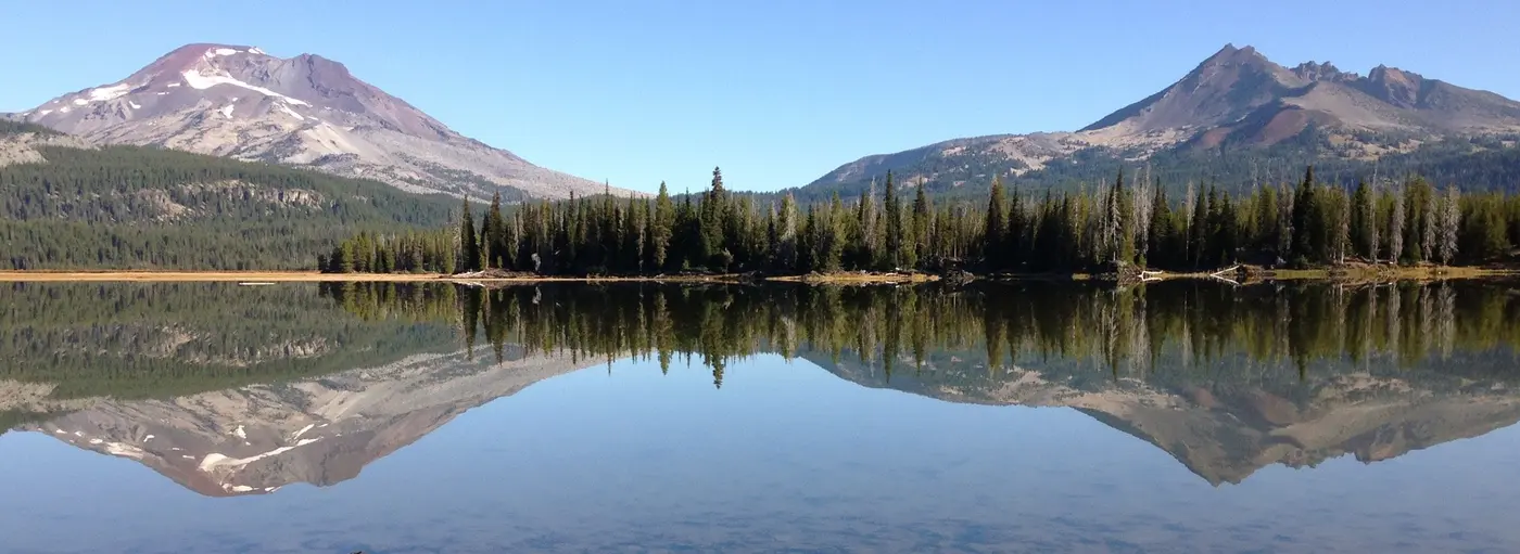
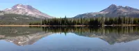
Todd Lake comes first, set between Bachelor and Broken Top. Next the road skirts a wet meadow at the north end of Sparks Lake, where TripCheck advises watching for elk and deer at dawn and dusk. Much of the lake’s shore is jagged lava. Travel Oregon gives its size as about 250 acres. The Bulletin of Bend, in 2008, gave 779 acres at 5,400 feet. The photographer Ray Atkeson, Oregon’s photographer laureate, made Sparks a favorite subject, and a loop trail near the boat ramp bears his name. The Bulletin measured it at 2.5 miles on the east side, with the first quarter mile or so accessible by wheelchair.
Devils Lake, emerald green and about 9 feet deep in the middle, lies over a shallow bottom of white pumice. TripCheck says the water is clear enough that boats on its surface seem to float in midair. A jumble of lava boulders tumbles down from Devils Hill above it. There archaeologists have found evidence of Native American encampments, along with pictographs thousands of years old.
A few miles south, Elk Lake has a marina, a lodge, cabins, a campground and boats rented by the hour. A historic guard station there is staffed by volunteers who give out information and, in TripCheck’s words, “lots of stories.” In 2008 the lodge was serving root beer floats and ice cream. The Forest Service’s Beach Picnic Area on the shore faces South Sister. Hosmer Lake, beside Elk, is fly-fishing only and electric motors only. Its brook trout and landlocked Atlantic salmon cruise the channels in full view of anyone in a boat overhead.
Lava Lake, 370 acres and spring-fed, has a resort that rents motorboats, rowboats, paddle boats and canoes. At Little Lava Lake the Deschutes River begins as a small creek and sets out on its 250-mile run to the Columbia. The byway follows it through a meadow to Crane Prairie Reservoir, known for fast-growing rainbow trout called “cranebows.” TripCheck puts the record at over 19 pounds. An osprey observation point is a short walk from a parking area, and summer is the time to see adults feeding their young. Sandhill cranes also use the reservoir.
Near Cultus Lake, about 50 miles from Bend, a Bulletin writer stopped for lunch in 2008 at a window table in the Cultus Lake Resort. He ordered the Frisco Burger, made with Swiss cheese, onions and sourdough bread sprinkled with Parmesan, and credited the menu to “probably owner and chief cook Sandy Campbell.” Big Cultus covers 785 acres, deep and cold, with lake trout in its holes in summer, and ski boats and jet skis on its surface.
South of Crane Prairie, Century Drive branches east past Wickiup Reservoir toward Sunriver. The byway goes on south to Davis Lake, formed when a lava flow cut off Odell Creek, and ends at Route 58 near Crescent and Odell lakes.
A red road and its names
The name Century Drive has more than one explanation. Kelly Cannon-Miller of the Deschutes Historical Museum says that early plans for roads to the lakes, mostly for recreation, drew in several influential townsmen, Sawyer and McKay among them. She credits the name to a judge and attorney, Haley Ellis: “It was his idea to call it Century Drive.” The original route from Bend to Highway 58 ran 100 miles, she says, “so you get a century.” Travel Oregon calls the road a former 100-mile red cinder loop. TripCheck says it was a 100-mile dirt road in the days of the horse and buggy. Wikipedia says it got the name when it was paved with red volcanic rock for Oregon’s centennial. TripCheck also places Kit Carson, John C. Fremont and Nathaniel J. Wyeth on the route.
The road was still under construction in 1949. That spring, the public roads administration, the Oregon highway commission and the Forest Service agreed to make $150,000 available to restore the grade and surface of 8.6 miles between Bend and Elk Lake, with any surplus going toward Dutchman Flat. By November the Bend Bulletin reported the road cindered from the end of the oil west of Bend to the Bachelor Butte area. F. W. Riddle of Springfield had put in the low bid to grade five miles. For the Bureau of Public Roads survey, William Pfaff ran the line under engineer James O’Hearne. The line over Devils Pass had been changed to spare Devils Lake, because the original plan called for a fill across part of it. Cover rock for oiling the unit in 1950 was under contract to the Roger Bros. firm, with Nick Toole producing it on a sub-contract.
According to the Nugget of Sisters, the byway was among the last of Central Oregon’s red cinder roads. Bob Bryant, retired regional manager for the Oregon Department of Transportation, explained that the soft cinders could not carry rising traffic. Century Drive from Bend to Mt. Bachelor was rebuilt in 1991. “I was as sad as anyone to see us paving over the old red roads,” Bryant said.
Astronauts at Devils Lake
In the mid-1960s, astronauts preparing for the Apollo missions trained in the lava fields along the highway. On Apollo 15, Jim Irwin carried rock from the area to the moon. Travel Oregon describes it as a sliver from Devils Hill. TripCheck describes it as a rock from a volcanic dome near Devils Lake, placed on the lunar surface in 1971, “the only earth rock on the moon.” The byway was designated a National Scenic Byway in 1998.
The beaver on the sign
The Department of Transportation installed the sign on Century Drive in 1969, but Cannon-Miller says the records do not show how it came to be or who paid for it. “Its design imitates the state heritage marker program signs, affectionately called ‘Beaver Boards,’” she said. Even so, it is not in the inventory of Oregon Heritage Markers.
In 1997 a contractor named Brian Gilbride, building a house on Steve Stenkamp’s street, mentioned that the sign had blown over in a windstorm months before. Stenkamp had been mayor of Bend in the mid-1990s. He asked the transportation department, the city, Deschutes County and the Forest Service about the sign, and none had a record of it. The best he could surmise was that a tourism agency, since gone, had set it up in the late 1960s. He and Gilbride got it out of the dirt with donated help. Pacific Power gave the poles and Les Mombert lent a boom truck. Ron Robinson Construction drilled the holes, and Jim Olson’s concrete business supplied the concrete. “As we were putting the sign back up we were getting lots of honks and waves,” Stenkamp said.
He has kept it since, trimming brush around it against wildfire, and has continued after Gilbride’s death. In the week of July 25, 2025, the Bend artist and graphic designer Sue Carrington repainted the fading beaver while Stenkamp watched. University of Oregon supporters have asked him to swap it for a duck. “It is the state animal of Oregon. It is going to stay a beaver,” he said. “And if it falls over again we’ll put her back up.”
Notable Events
- 1949Under an agreement by the public roads administration, Oregon highway commission and forest service, $150,000 would be available in the coming season to improve the north end, restoring grade and surface on 8.6 miles between Bend and Elk lake. bendbulletin.com
- 1950Cover rock for oiling this unit in 1950 was under contract to the Roger Bros, firm, with Nick Toole producing the rock under a sub-contract; this is not proof that the oiling was completed. oregonnews.uoregon.edu
- 1960sAs NASA readied for its moon-landing missions in the 1960s, astronauts trained in the lava fields near Devils Lake; James Irwin carried a sliver of rock from Devils Hill on Apollo 15 and left it on the moon. traveloregon.com
- 1969The Department of Transportation installed the sign, but records are unclear about how it came to be or who funded it; it is not in the Oregon Heritage Markers inventory. bendbulletin.com
- 1971In 1971 Apollo 15 astronaut Jim Irwin placed an earth rock from a volcanic dome near Devils Lake on the lunar surface, the only earth rock on the moon. tripcheck.com
- 1991Red cinder roads such as Century Drive from Bend to Mt. Bachelor were rebuilt in 1991; funding was becoming available during that time for repaving roads such as the Old McKenzie and the Cascade Lakes Highway. nuggetnews.com
- 1997Stenkamp’s involvement began with a chance meeting of contractor Brian Gilbride. bendbulletin.com
- 1998The byway received National Scenic Byway designation in 1998. nsbfoundation.com
- The route was cindered from the end of the oil west of Bend to the Bachelor butte area. oregonnews.uoregon.edu
- The line over Devils pass had been changed to preserve Devils lake; the original plan called for a fill across part of the scenic lake. oregonnews.uoregon.edu
People
- Brian Gilbride, Contractor who organized re-erecting the fallen route sign with Stenkamp.
- Jim Olson, Concrete mixing business owner who donated concrete for restoring the sign.
- Les Mombert, Local businessman who lent a boom truck for restoring the sign.
- Steve Stenkamp, Former Bend mayor and private caretaker who spearheaded refreshing the route sign (Started in 1997).
- Sue Carrington, Local artist and graphics designer who volunteered to repaint the beaver on the route sign.
- McKay, Influential local person involved in early plans for roads to the lakes, mostly for recreation.
- Sawyer, Influential local person involved in early plans for roads to the lakes, mostly for recreation.
- F. W. Riddle, Springfield bidder who submitted the low bid for grading five miles of Cascade Lakes highway.
- James O'Hearne, Engineer ‘in change’ (as printed) of the Cascade Lakes highway survey for the bureau of public roads.
- Nick Toole, Produced rock under a sub-contract with the Roger Bros, firm.
- William Pfaff, Ran the line for the bureau of public roads’ Cascade Lakes highway survey.
- Jim Irwin, Apollo 15 astronaut who placed a rock from near Devils Lake on the moon (1971).
- John C. Fremont, early explorer who traveled the route.
- Kit Carson, early explorer who traveled the route.
- Nathaniel J. Wyeth, early explorer who traveled the route.
Sources
- en.wikipedia.org/wiki/Cascade_Lakes_Scenic_Byway
- traveloregon.com/things-to-do/trip-ideas/scenic-drives
- fs.usda.gov/r06/deschutes/recreation
- commons.wikimedia.org/wiki/Category:Cascade_Lakes_Scenic_Byway
- traveloregon.com/things-to-do/trip-ideas/scenic-drives/cascades-lakes-scenic-byway
- tripcheck.com/Pages/Scenic-Byways-Cascade-Lakes
- fhwaapps.fhwa.dot.gov/bywaysp/byway/2144
- fs.usda.gov/r06/deschutes/recreation/cascade-lakes-welcome-station
- nuggetnews.com/story/2025/06/04/news/remembering-sisters-in-the-60s-those-red-roads/37797.html