Baker City
Baker County, Oregon. County seat.
Baker City, Oregon, at the southern end of Baker Valley, took the county seat from Auburn in 1868, when a crowd from Baker came for the records with a wagon.1,2,3
Details
- Founded
- Attorney Royal A. Pierce platted the town in 1865, after Auburn’s gold played out, though the Oregon Encyclopedia’s Chinatown article gives 1864 as the founding year.2,4
- Name
- Baker City and Baker County are named for Edward Dickinson Baker, Oregon’s first senator, killed in the Civil War.2
- Last checked
- October 6, 2026.
Point at a dot to see the place.Tap a dot to see the place. Road map of Baker City.
In Baker City
- Birds on a Wire MercantileBaker City · Craft & antique mallBaker City's largest general merchandise store and first craft and antique mall, showcasing treasures from over 60 local vendors in a restored 1910 grocery warehouse.
- Elkhorn Drive Scenic BywayBaker City · Scenic driveA 106-mile loop through the Elkhorn Mountains west of Baker City, Oregon, that tops out at 7,392-foot Elkhorn Summit, the second-highest paved road in the state.

- Snake River-Mormon Basin Back Country BywayBaker City · Back country bywayA 150-mile byway through the rangelands of eastern Oregon's Baker and Malheur counties, with options for high-clearance two-wheel drive vehicles. Steep canyons, prominent cliffs, and rock outcrops line the route.

The Calendar
History
Gold Below the Elkhorns
The four-faced clock in the tower of Baker City Hall, a Renaissance Revival building of rock-faced volcanic tuff, once glowed bright red at the curfew hour to send youngsters home.1 The town, home to 10,099 people in 2020, lies at an elevation of 3,440 between the Elkhorns on the west and the Wallowas on the east.2 In October 1861 four miners, Henry Griffin, David Littlefield, William Stafford, and G.W. Schriver, found gold a couple of miles south of the present town.2 In June 1862 the camp of Auburn was laid out about eight miles southwest, and that September it was named county seat of Baker County.5 By 1865 Auburn’s gold had played out, and that year attorney Royal A. Pierce platted the land that became the heart of Baker City, where William F. McCray, Auburn’s first postmaster, moved his post office and variety store to Front Street.2
Town and county take their name from Edward Dickinson Baker, Oregon’s first senator, whom the Oregon Encyclopedia calls the only sitting member of Congress killed in the Civil War; he was shot eight times leading troops at Ball’s Bluff, Virginia, on October 21, 1861.2,6 In a June 7, 1979, letter, Phillip C’de Baca of the Pet’s Rest Cemetery in Colma, California, reported that it had found Oregon’s memorial to Senator Edward Baker abandoned in its barn and asked if Oregon might like it back; the monument still stands in the courthouse.6
The County Records Leave Auburn by Wagon
In 1868 the county seat moved from Auburn to Baker, then on the main transportation route and becoming a center for cattle, grain, and timber; the 1940 guide says a crowd from Baker came with a team and wagon and had the county offices loaded and on the road very early in the morning, before Auburn knew.3,5 The Oregon Encyclopedia instead names Baker City county seat the year after Pierce’s 1865 plat.2 The town was incorporated as Baker City in 1874.3
Despite poor roads, Baker did a thriving trade in mining supplies and provisions, freighted over mountain roads to the camps of Rye Valley, Willow Creek, and the Mormon Basin.3 The 1940 guide records that the city commissioners in 1881 forbade small boys to shoot marbles or ride velocipedes on the sidewalks and made one citizen move his potato patch off a lot on a principal street.3 The guide counts 1,197 people in 1880, 166 of them Chinese and only 143 female, while the National Register nomination gives 1,258.3,7
Chinatown on Auburn Avenue
Chinatown filled a block of Auburn Avenue between Resort Street and the Powder River, where a joss house was built in 1883.4,8 In Baker County a thousand Chinese dug the 125-mile Eldorado Ditch to carry water to dry placer mines.4 Sanborn fire insurance maps showed over 50 structures in Chinatown by 1903, among them 22 dwellings, 5 stores, and a brick temple with a life-size Chinese idol on its second floor.4 Its residents had moved on by the mid-1940s, the last of its buildings came down in the 1970s, and of the Chinese cemetery, whose remains were almost all returned to China, one marked grave stands in a memorial.2,4
Rails, Logs, and Hard Rock
The 1940 guide dates the first Oregon Short Line train at Baker to August 19, 1884, while the Oregon Encyclopedia has that line meeting the Oregon Railway & Navigation Company near Huntington on November 12, 1884, opening markets from Portland to Omaha.2,3 In 1889 David Eccles, Charles W. Nibley, and George Stoddard incorporated the Oregon Lumber Company, with a large mill on the south side of town, and began the narrow gauge Sumpter Valley Railway to haul logs from the ponderosa forests.2 The population was 6,663 by 1890, and in 1893, the year the White Swan mine was claimed, the nomination finds Baker City entering its second boom while the rest of the nation was in depression.7 In 1895 the mines near Baker shipped $1.3 million in gold, and in 1896 the railway reached Sumpter, thirty miles southwest, and fed a boom in hard-rock mining.2,7
Known as the Queen City of the Inland Empire, Baker City was the third largest city in Oregon in 1900 by the Oregon Encyclopedia’s count and the fourth, behind Portland, Salem, and Astoria, by the Oregon History Project’s.2,9 Most of the city’s prominent buildings went up between 1900 and 1920, among them City Hall in 1903, the Cathedral in 1905, the County Courthouse in 1908, and the former Post Office in 1909.7 In 1907 the Sumpter boom collapsed, and Baker City suffered with it.7
Baker, Then Baker City Again
Residents voted in 1910 to shorten the name to Baker, a change the nomination dates to 1911 and the 1940 guide to about 1912, and a vote in 1989 restored Baker City.2,3,7 Federal timber fed three lumber mills in town through the twentieth century, until Ellingson Lumber Company, the last big-log mill, closed in 1996.2 In 1987 community leaders began planning the National Historic Oregon Trail Interpretive Center to bring tourism to a depressed natural resource-based economy; it opened in 1992 and closed in 2022 for renovations.10 The Old Post Office, set on a foundation of Baker County granite with terra cotta from Indiana above, served from 1910 until 1968 and was restored for law offices in 1982.11
Within 30 Miles
Measured in a straight line from the town, nearest first.
- Sumpter MarketsSumpter · Flea marketVendors and food booths located all over town; antiques, vintage, new, or hand crafted items.
- Huckleberry FestivalNorth Powder · Small town festivalAn annual July festival in North Powder, Oregon, for the wild huckleberry of the surrounding mountains, where the Wolf Creek Grange serves the fruit in milkshakes.
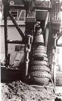
- Sumpter Valley Dredge State Heritage AreaSumpter · State heritage areaIn a pond at the south edge of Sumpter, Oregon, sits the last of three gold dredges that turned Sumpter Valley into miles of rock piles. Visitors may climb aboard.
- Peavy CabinBaker City, OR · Historic log cabin rentalRustic single-room log cabin on the Wild and Scenic North Fork John Day River; sleeps four with wood stove, gas range, and vault toilet; trailhead access to the North Fork John Day Wilderness and the Elkhorn Crest National Recreation Trail.
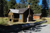
- Anthony Lake Guard StationNorth Powder · Historic civilian conservation corps log cabin rentalHistoric 1930s CCC log cabin near Anthony Lake and the Elkhorn Crest Trail with hot shower, electricity, flush toilet, and well-equipped kitchen.
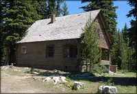
- Antlers Guard Station CabinWhitney · Historic civilian conservation corps guard station cabin rentalCozy, rustic cabin with two small rooms - a combined bedroom and living room and a kitchen. The Guard Station, a historical site constructed by the Civilian Conservation Corps (CCC), is located adjacent to the scenic North Fork Burnt River and is only a couple of miles from the historic Whitney area.
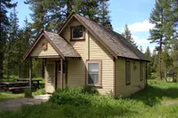
- Two Color Guard StationMedical Springs · Large cabin (forest service guard station rental)A large cabin along Wild and Scenic Eagle Creek below the Eagle Cap Wilderness, with a view from the back porch over a riparian meadow toward the creek; Two Color Campground is nearby.
Nearby towns: Joseph. All the towns of Oregon. More of Oregon: Flea Markets, Scenic Drives, and Town Festivals.
Sources
- Baker City Hall (historical marker) hmdb.org/m.asp?m=108191
- Baker City oregonencyclopedia.org/articles/baker_city
- Oregon: End of the Trail (1940), p. 252 archive.org/details/oregonendoftrail00writrich/page/252
- Baker City Chinatown oregonencyclopedia.org/articles/baker_city_chinatown
- Related Entries oregonencyclopedia.org/articles/auburn
- From Pet Cemetery to Baker County: A Forgotten Monument Finds a Home ohs.org/blog/from-pet-cemetery-to-baker-county.cfm
- National Register nomination, Baker City, OR npgallery.nps.gov/NRHP/GetAsset/NRHP/78002277_text
- Baker City Chinese History (historical marker) hmdb.org/m.asp?m=108158
- News Article, As if by Magic oregonhistoryproject.org/articles/historical-records/news-article-as-if-by-magic
- National Historic Oregon Trail Interpretive Center oregonencyclopedia.org/articles/national_historic_oregon_trail_interpretive_center
- Old Post Office (historical marker) hmdb.org/m.asp?m=108042