Ennis
Madison County, Montana.
Ennis, in Madison County, Montana, began as the homestead of William Ennis in 1863.1,2
Details
- Founded
- Visit Montana says Ennis began as the homestead of William Ennis in 1863.1
- Last checked
- October 6, 2026.
Point at a dot to see the place.Tap a dot to see the place. Road map of Ennis.
In Ennis
- Bear Creek Cabin (Beaverhead-Deerlodge National Forest, MT)Ennis · Cabin rentalA Forest Service rental cabin at the historic Bear Creek Ranger Station east of Cameron, Montana, where each May busloads of schoolchildren come to pan for rocks.
- Ennis National Fish HatcheryEnnis · Broodstock hatcheryA federal rainbow trout broodstock hatchery in the Gravelly Range foothills southwest of Ennis, Montana, where adult trout are kept for eggs shipped to hatcheries across the country.
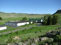
- Kobayashi BeachEnnis · Day-use areaThe main public access point on Ennis Lake and a popular place to spend a summer afternoon.
- Madison Valley History Association MuseumEnnis · Small-town museumDiscover the heritage of Madison Valley at our museum in Ennis, Montana.
The Calendar

History
Benches Under the Madison Range
Ennis stands in Madison County, Montana, in the Madison Valley, where the Madison Range rises along an active fault on the valley’s east side.2 The flat benches that run for miles along the valley are the remains of old channels of the Madison River, and the highest bench is the oldest.2
Beaver Streams and the Ennis Homestead
Beginning in the 1830s, American trappers caught beaver in the streams that empty into the Madison River.2 The state highway marker in Ennis says that by the 1840s the Blackfeet and the beaver had all but disappeared from the area.2 According to Visit Montana, Ennis began in 1863 as the homestead of William Ennis, and other ranchers, farmers, and businessmen soon settled nearby.1 The great-grandparents of Richard “Pokey” Armitage, a fourth-generation Armitage from the Madison Valley, homesteaded what became known as the Armitage Flats, south of Cameron, and the family name is still recognized in the Ennis community through the William K. Armitage Gymnasium and Armitage Street.3
The Vigilante Trail
A Montana Department of Transportation marker says that for Ennis a good road was as important as the railroad.4 In 1923, businessmen and promoters in Madison, Jefferson, and Silver Bow counties formed the Vigilante Trail Association, and its trail provided a connection between West Yellowstone and Butte.4 The route was marked with a round red, white, and blue shield bearing the vigilante symbol 3-7-77.4 The 160-mile road ran past Virginia City and Alder Gulch and along the Madison River, which promoters called “the fisherman’s paradise of the West.”4 The 1939 Federal Writers’ Project guide listed Ennis at a highway junction, at an altitude of 4,927 feet, with 278 people.5 On August 17, 1959, a magnitude 7.5 earthquake struck the southern end of the Madison Range near Hebgen Lake, and the landslide it set off dammed the Madison River and formed Earthquake Lake.2
Within 30 Miles
Measured in a straight line from the town, nearest first.
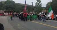
- Irish DaysVirginia City · Community eventIrish Days, a June weekend in Virginia City, Montana, when the Ancient Order of Hibernians paint a green stripe down Wallace Street and honor acting territorial governor Thomas Francis Meagher.
- Thompson-Hickman MuseumVirginia CityA little museum, built in the 1920s, houses some of the most interesting Virginia City artifacts. We have an extensive photo collection showing much of Virginia City from the 1860s, rare guns, artifacts from the Chinese era, geological rock examples, fascinating oddities and much more. We also offer for sale; books, prints and postcards with a historic theme.
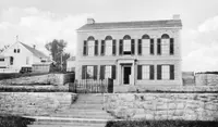
- Virginia CityVirginia City · Preserved gold mining townPreserved placer-gold town at the head of the richest placer strike in the Rocky Mountains; managed as public attractions by the Montana Heritage Commission with shops, restaurants, saloons, lodging, museums, train rides, and living history weekends.
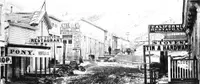
- Red Rock Mine and Garnet GalleryAlderRoadside garnet-screening stop on Montana Highway 287 between Alder and Virginia City with water tanks and shade building.
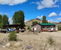
- Lone Mountain RanchBig Sky · Luxury guest ranchFor over 100 years, Lone Mountain Ranch has given travelers the true experience of Yellowstone Country.
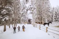
- Crail Ranch Homestead MuseumBig Sky · Historic homestead museumA preserved historic homestead in Big Sky's Meadow Village that tells the story of the area's earliest settlers and ranching heritage.
- Sheridan DaysSheridan · Festival/daysA four-day event with three nights of live music, anchored to Main Street and the Base Ball Park in Sheridan, MT.
- Upper Canyon Outfitters & Guest RanchAlder · Montana dude ranch lodging and guided tripsFamily-owned & operated, in Montana's Ruby Valley along the Ruby River.
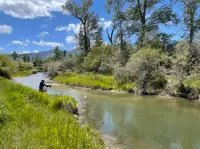
- Vigilante CabinAlder · CabinThe Vigilante cabins were built by the Civilian Conservation Corps in the 1920s and were first used as a guard station. The middle house, which is the largest, is available by reservation public use. The remaining outbuildings are still used by Forest Service personnel throughout the year. The cabin lies a short walking distance away from the upper Ruby River.
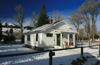
- Garnet Mountain Fire LookoutBozeman · Fire lookout cabinA 1962 fire lookout cab on the 8,245-foot summit of Garnet Mountain above Gallatin Canyon, rented by the night to four sleepers, its walls lined with windows.
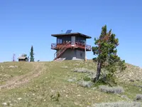
- Eldridge Guard StationWest Yellowstone · Primitive, rustic, log structureA primitive log guard station on Taylor Fork Road north of West Yellowstone, rented year-round, reached in winter by a two-mile ski from a plowed trailhead.
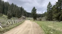
- Nine Quarter Circle RanchGallatin Gateway · Montana dude ranchAdjacent to Yellowstone in a secluded mountain valley, a ranch that looks and operates much as it did 100 years ago for family riding, fly fishing, and hiking.
Nearby towns: Dillon, West Yellowstone, and Butte. All the towns of Montana. More of Montana: Lookouts & Cabins, Town Festivals, and Fairs & Rodeos.
Sources
- Ennis Annual 4th of July Parade and Rodeo visitmt.com/events/ennis-annual-4th-of-july-parade-and-rodeo-43979
- The Shining Mountains (historical marker) hmdb.org/m.asp?m=192667
- 4th of July Rodeo Parade — Ennis Chamber of Commerce ennischamber.com/4th-of-july-rodeo-parade
- Motoring Through Paradise: The Vigilante Trail (historical marker) hmdb.org/m.asp?m=141491
- Montana: A State Guide Book (1939), p. 362 archive.org/details/montanastateguid00federich/page/362