Great Falls
Cascade County, Montana. County seat.
Great Falls, in Cascade County, Montana, is the city Paris Gibson platted in 1883 at the falls of the Missouri, where he was drawn by the river’s power.1,2
Details
Point at a dot to see the place.Tap a dot to see the place. Road map of Great Falls.
In Great Falls
- Antiques of MontanaGreat Falls · Antique storeAntiques of Montana - On 10th Avenue South in Great Falls, this shop celebrates Montana history with rustic furniture, estate collectibles and regional antiques that capture timeless Western character.
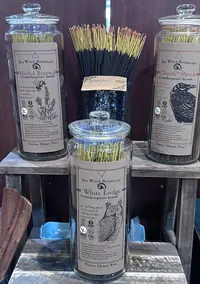
- Cassiopeia BooksGreat Falls · Independent bookstoreIndependent bookstore in downtown Great Falls, Montana, offering new, used, and out-of-print books, plus journals, stickers, cards, gifts, and Sea Witch Botanicals incense.
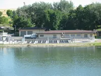
- Giant Springs Trout HatcheryGreat Falls · Day-use state parkA state trout hatchery beside Giant Springs in Great Falls, Montana, rearing fish on spring water that rises at 54 degrees from limestone some 400 feet down.
- Great Falls Farmers MarketGreat Falls · Farmers' marketNon-profit Saturday market with over a hundred vendors weekly, organized under the mission "Growing Commerce Through Community."

- Swap-A-RamaGreat Falls · Flea marketSwap-A-Rama is a June flea market in the Art Deco exhibit halls of Montana ExpoPark in Great Falls, begun in 2023 and since joined by a December Christmas market.
The Calendar

History
Five Falls and a Portage
Five dams now hold the Missouri at Great Falls, where a 360-foot drop in the river once gave the young town a ready source of power.3,5 The city lies on a gentle slope of sandy plain in a bend of the Missouri River, opposite the mouth of the Sun River, and its courthouse still serves Cascade County.3,4
Capt. Meriwether Lewis first saw the Great Falls of the Missouri on June 13, 1805, after informants’ accounts of a single fall had led the captains to expect a short portage.3,5 Instead he found a run of five, and the Corps hauled canoes and gear 18 miles over the plains on a rude cart that used a boat’s mast for an axle and sections of cottonwood for wheels.3,5 On the evening of July 4 the last small store of liquor was doled out, and the men sang and danced until a brisk thunderstorm stopped them.3
Paris Gibson’s Plat
The Federal Writers’ Project guide says Paris Gibson, a Minneapolis man, first visited the spot in 1880, while the downtown historic district tour says he looked over the plain by the cataracts in 1882 and pictured a metropolis there.3,6 Backed by James J. Hill, Gibson returned in the spring of 1883 with Robert Vaughn and H. P. Rolfe, and they platted the townsite and named it Great Falls.2,3 Rolfe made the streets of the 160-block plat wide enough for freighters to turn their wagons around, and piles of rocks marked the corners on ground where, his wife recalled, grass and sagebrush grew and nothing indicated that a city would rise.6 Johnstown stood across the river near historic-era Chippewa-Cree encampments, and the West Bank marker calls it the earliest permanent Euro-American settlement; the growing city slowly absorbed it.7,8 In 1884 Worden Wren opened the first store in a canvas tent as a branch of Murphy, Maclay and Co., which sold everything from flour and fine teas to window glass and blasting powder.6,9 Ed Simms, whom the state historic preservation office calls the first and perhaps most influential black resident of Great Falls, arrived in 1886.10
Rails, Smelters, and Dams
In October 1887 the Great Northern Railway arrived at Great Falls, then a young city of 1,200 people.3 Great Falls was incorporated as a city on November 28, 1888, and elected Gibson its first mayor; a silver smelter built near the Giant Springs that year did not last long once silver was demonetized.3 By 1890 nearly 4,000 people lived in Great Falls, and the Federal Writers’ Project guide counts Black Eagle Dam, which generated 9,000 and later 25,000 horsepower, as the first of four hydroelectric units near the city.3,9 In 1892 the Boston and Montana Consolidated Copper and Silver Mining Company, later acquired by the Anaconda Company, put its smelter on a treeless bluff above the river, and in 1916 electrolytic copper and zinc refineries and a wire and cable factory replaced the original plant.3,11 By 1912 the Rainbow and Volta plants together generated 140,000 horsepower, and a company organized by John D. Ryan, with offices in Great Falls, controlled them.3 Ryan, president of the Anaconda Company, and James J. Hill, president of the Great Northern Railway, sat on the board of the Great Falls Townsite Company, which had the 1911 Rainbow Hotel built, and Ryan explained that they designed it for the much larger city they expected Great Falls to become.12
Homesteaders, Refineries, and the War
The downtown district nomination says Great Falls lost population for the first time between 1900 and 1910, because of the national depression.9 Newcomers poured in during the 1910s as mining boomed; the Northside tour says the city grew from 17,000 to 26,000 between 1910 and 1920, while the downtown nomination gives a population of 24,121 for the same period.9,11 When the use of copper declined, the city kept growing as the center of a large agricultural area, and 4,500 new citizens arrived, many of them fleeing failed homesteads.3,9 In January 1930 the Great Falls Family Welfare Association collected household goods and 27,000 pieces of clothing for the destitute.9 The Federal Writers’ Project guide counted 28,822 people and reported that the metal refineries and the wire and cable mill ran at capacity through the summer of 1937, employing more than 2,500 men, until employment fell off that fall.3 In 1892 Republicans elected William Morgan constable, possibly the first black man elected to office in Montana, and the state historic preservation office says that by the 1930s Great Falls had the highest percentage of black residents of any Montana city.10 Beginning in 1941, the Army’s Air Transport Command flew daily from Great Falls to Fairbanks.9
Central Avenue, the Northside, and the West Bank
The Central Business Historic District counts 103 contributing buildings built between 1886 and 1951, and in August 1921 thirty-six hundred people watched Nomads of the North at the grand opening of the Liberty Theatre.6 On the Northside, more than 200 homes and buildings date from 1885 to 1945 and stand along boulevards shaded by trees planted between 1888 and 1913; in April 1903 the Tribune reported 20,000 elm and ash trees budding.2,9 The Sunburst Oil Refinery operated on the West Bank from 1923 to 1933, and two buildings remain there from that early oil boom.7 The Cascade County Courthouse, built of grey sandstone quarried nearby, was dedicated on July 4, 1903, under a dome made entirely of copper, and during World War II lookouts used that dome to watch for possible Japanese air attacks.4
Within 30 Miles
Measured in a straight line from the town, nearest first.
- First Peoples Buffalo Jump State ParkUlm · State park and national historic landmarkSee one of the largest buffalo jump sites in the country. Explore the visitor center and interpretive trails that tell the story of the people, the animals, and the landscape of the buffalo culture.
- Belt MuseumBelt · MuseumBelt Museum Inc., housed in the historic Belt Jail, a late-1890s one-story native-stone jail built to serve a small coal mining town and listed on the National Register of Historic Places Inventory. The museum interprets the local history of Belt, Montana, Cascade County, and the surrounding coal country.
- Power Harvest FestPower · CommunityPower Harvest Fest is a non-profit organization that is vital to community enrichment activities for the town of Power, Montana.
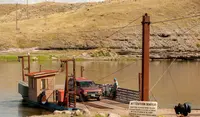
- Carter FerryFort Benton · Cable ferryA free two-car cable ferry across the Upper Missouri in Chouteau County, Montana, run by the county since 1917 and called over with a honk of the horn.
- Sun River Valley Fun DaySimms · Community organizationThe Sun River Valley's Fun Day fills Main Street in Simms, Montana, every second Saturday in August, from a Lions Club pancake breakfast to a rubber duck race down a ditch.

All the towns of Montana. More of Montana: Flea Markets and Fairs & Rodeos.
Sources
- Great Falls West Bank Historic District (historical marker) hmdb.org/m.asp?m=143676
- Great Falls Northside Residential Historic District historicmt.org/items/show/46
- Montana: A State Guide Book (1939), p. 146 archive.org/details/montanastateguid00federich/page/146
- Cascade County Courthouse: Great Falls Northside Residential Historic District historicmt.org/items/show/195
- A “great” Set of Falls (historical marker) hmdb.org/m.asp?m=80319
- Great Falls Central Business Historic District historicmt.org/tours/show/10
- Great Falls West Bank Historic District historicmt.org/items/show/207
- National Register nomination, Great Falls Northside Residential Historic District npgallery.nps.gov/NRHP/GetAsset/8327df66-87d9-43fb-91bf-259b58154a5c
- National Register nomination, Great Falls Central Business Historic District npgallery.nps.gov/NRHP/GetAsset/1aad086e-a12e-4ed6-87a2-fb2b0e59c8f8
- Great Falls mhs.mt.gov/Shpo/AfricanAmericans/Places/PropertyRecords/Great-Falls
- Great Falls Northside Residential Historic District historicmt.org/tours/show/14
- Rainbow Hotel: Great Falls Central Business Historic District historicmt.org/items/show/190