Berkeley
Alameda County, California.
Berkeley, a city on the eastern shore of San Francisco Bay in Alameda County, grew on Peralta rancho land and took its name from an Irish philosopher-bishop.1,2
Details
Point at a dot to see the place.Tap a dot to see the place. Road map of Berkeley.
In Berkeley
The Calendar
History
The Peralta Rancho and the Squatters
The state guide found Berkeley on a wide plain that stretched gently upward to a low range of hills on the east shore of San Francisco Bay, with the buildings of the University of California at its upper edge.2 The ground was originally part of the Rancho San Antonio, granted to the Peralta family in 1820 by the Spanish Governor de Sola, and the city lies mostly within the section that belonged to Domingo Peralta.1,2 Cattle ranching was the primary economic activity of the region up to a drought in 1864.1 American squatters had a false survey made that cut off 7,000 acres of redwood timber and all the waterfront, drove off Peralta cattle, and had Jose Domingo Peralta jailed for trying to eject them.2 In 1853 American speculators bought title to what is now Berkeley for $82,000, and the same year the first American building, a roadhouse, went up near San Pablo Avenue and Delaware Street.2
Bishop Berkeley’s College Town
In 1853 Henry Durant opened the Contra Costa Academy in Oakland; under Samuel Hopkins Willey it became the College of California in 1860, and in 1869 the nucleus of the new university.2 The trustees named the town for George Berkeley, Bishop of Cloyne, the Irish philosopher who had crossed the Atlantic to found a school for the Indians, judging his ideals proper for a young college town.2 A charter was granted in 1868, and by the time organization was complete a faculty of 10 was ready for 40 students.2 When the new campus opened in 1873 most students commuted, and in 1874 Durant and Hiram Graves formed the Berkeley Railroad and Ferry Company.1 In 1874 only a few houses stood south of the campus, and two years later the population was 948.2 Berkeley was incorporated as a town in 1878, and the 3.84-mile Berkeley Branch Railroad ran from Oakland to central Berkeley.1
Reservoir, Streetcars, and the 1906 Exodus
After 1884, when a large reservoir was built and water pipes were laid, the town grew rapidly.2 The Oakland and Berkeley Rapid Transit Company began running in 1891, and by 1906 the streets were paved, the Santa Fe had built a station, and the Key Route ran 38-minute service to San Francisco.2,3 In a film Otis M. Gove shot from a moving streetcar in north Berkeley in 1906, a pedestrian refuses to get off the tracks, and as the driver and conductor try to remove him an irate woman and a man come running to his aid.3 After the San Francisco earthquake and fire of 1906 many refugees settled in Berkeley for good, and the 1939 guide puts the population at 23,378 in 1905 and 38,117 in 1907.2 In 1909 the citizens adopted a new charter, and a City Hall designed by Bakewell and Brown, standing on the site of the Town Hall that burned in 1904, served from 1909 to 1977.1,4 At its cornerstone-laying on June 27, 1908, University President Benjamin Ide Wheeler called the new building “our town-house.”4
The 1923 Fire, the Factory Waterfront, and the Shipyards
In September 1923 a fire that started in the hills and was fanned by a strong wind destroyed most of the city north of the campus, and afterward a deputy fire warden kept watch day and night from a tower in the hills.2 In 1923 the city also adopted the council-manager form of government.2 August Vollmer, a professor of police administration at the University of California, headed the police department and brought the city national notice, and his officers were known locally as “Ph.D. policemen” or “supercops.”2 In 1939 the state guide counted 82,109 people and a factory district along the waterfront from Emeryville to Albany producing $50,000,000 worth of commodities a year, with an annual payroll of $5,000,000.2 During the Great Depression the University kept many citizens employed, although working-class neighborhoods in West Berkeley suffered more.5 World War II brought a population boom to Berkeley, where wartime housing projects were built for military personnel and civilians moved in to work at local shipyards.5
Landmarks and the Old Rail Lines
The historic core of the campus, from Founders’ Rock to South Hall, Sather Gate and North Gate, is California Registered Historical Landmark No. 946, marked in 1985.6 Oscar Wenderoth designed the 1914 Main Post Office, where Suzanne Scheuer painted a mural of figures from California’s Spanish and pioneer periods in 1936-1937 for the Treasury Relief Art Project.7 On four city blocks downtown, the Berkeley High School Campus Historic District keeps William C. Hays’s Beaux Arts buildings of 1922 and three Art Deco buildings designed by Gutterson & Corlett in the 1930s.8 Local streetcars stopped running in 1948, and downtown declined until BART and its Downtown Berkeley Station reversed the downward development spiral.1 The Santa Fe used a strip of land in Poets Corner from 1902 to 1979, and after the tracks were uprooted the city made it open space.9
Within 30 Miles
Measured in a straight line from the town, nearest first.
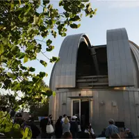
- Chabot Space & Science CenterOakland · Space and science centerOakland's home for STEAM education, located within Redwood Regional Park, with an Observatory, Planetarium, and exhibition galleries.
- Oakland Coliseum Swap MeetOakland · Swap meet and public marketAn open-air swap meet on a former drive-in lot in East Oakland, open seven days a week, where the old movie screen still stands over the kiddy train.
- Alameda Point Antiques FaireAlameda · Antique showA monthly antiques faire on the old runways of Naval Air Station Alameda, where more than 800 dealers may sell only goods at least 20 years old.
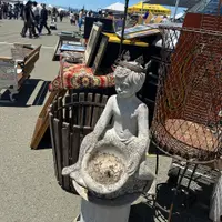
- Hercules Cultural FestivalHercules · Cultural festivalAn annual free cultural festival in Hercules, California, revived in 2023 after a decade's hiatus, where a Polynesian troupe dances a haka to live drums.
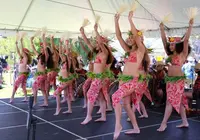
- The Roxie TheaterSan Francisco · Nonprofit cinemaOne of the oldest continuously operated cinemas in the United States, programmed as an art and independent cinema house since 1976.
- Pear and Wine FestivalMoraga · Community eventCelebrates the Moraga Valley’s pear-orchard heritage.
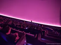
- Morrison PlanetariumSan Francisco · Planetarium75-foot-diameter all-digital dome at the California Academy of Sciences, presenting immersive planetarium shows fueled by scientific data of the latest observations and theories about the universe.
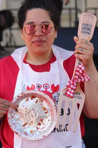
- Cherry FestivalSan Leandro · FestivalA one-day street festival and parade in downtown San Leandro, California, dating to a 1909 bumper crop of cherries, where every food vendor must put a cherry item on the menu.
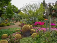
- The Ruth Bancroft GardenWalnut Creek · Botanical garden and plant nurseryThe Ruth Bancroft Garden houses a unique and diverse collection of cacti, succulents and drought tolerant plants from around the world. The many large mature specimens located throughout the 3.5 acre garden serve as an excellent example of just how stunning a dry garden can be.
- Solano Swap MeetConcord · Open-air marketA lively open-air market where you can shop for bargains, fresh produce, clothing, antiques, and more, with great food, unique finds, and a fun, family-friendly atmosphere every weekend on the West Wind Solano Drive-In lot.
- Benicia Torchlight Parade and Fourth of July PicnicBenicia · Annual torchlight paradeAn evening parade down First Street in Benicia, California, each July 3, begun by the volunteer fire department when handheld torches were its only light.
- Holiday Parade and MarketBenicia · Holiday parade & marketBenicia's downtown Christmas parade and holiday market, staged on First Street by Benicia Main Street, where in 2025 Santa rode an Army Jeep handing out candy canes.
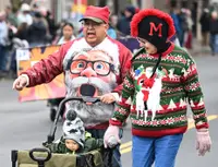
- Fourth of July Parade, Festival & FireworksConcord · July 4th celebrationConcord's Fourth of July in Contra Costa County, California: pancakes and a parade looping Todos Santos Plaza, then a free, alcohol-free festival and fireworks at Mt. Diablo High School.
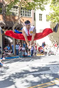
- Castro Valley Fall FestivalCastro Valley · Community traditionA free two-day street festival in Castro Valley, California, held since 1972, whose stages one local musician has booked for nearly 30 years.
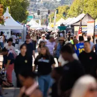
- Downtown Hayward Street PartiesHayward · Summer celebrationFree summer street parties on B and Main streets in downtown Hayward, California, held third Thursdays from June through August, with a marketplace of businesses run by local youth.
7 more within 30 miles on the road map.
Nearby towns: Benicia, Concord, Fairfield, and Sebastopol. All the towns of California. More of California: Flea Markets and Old-Time Music.
Sources
- A R C H I V E S & A R C H I T E C T U R E , L L C PO Box 1332 ohp.parks.ca.gov/pages/1054/files/berkeley%20shattuck%20context%2005-28-2015.pdf
- California: A Guide to the Golden State (1939), p. 176 archive.org/details/californiaguidet00federich/page/176
- A trip to Berkeley, Cal loc.gov/item/00694420
- Berkeley City Hall (historical marker) hmdb.org/m.asp?m=52398
- 1598 University Avenue berkeleyca.gov/sites/default/files/documents/2023-02-02_LPC_Item%2011_%20with%20attachment_1598%20University.pdf
- University of California Berkeley Campus (historical marker) hmdb.org/m.asp?m=290973
- United States Post Office (historical marker) hmdb.org/m.asp?m=54260
- BERKELEY HIGH SCHOOL CAMPUS HISTORIC DISTRICT ohp.parks.ca.gov/ListedResources/Detail/N2379
- Garden History (historical marker) hmdb.org/m.asp?m=153776