
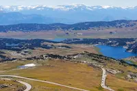
Beartooth Highway
Red Lodge, Carbon County, Montana. Road.
Details

- Where
- Red Lodge, Carbon County, MT. No street address stated. Directions
- Season
- Memorial Day to October 15 (weather dependent).
- Getting there
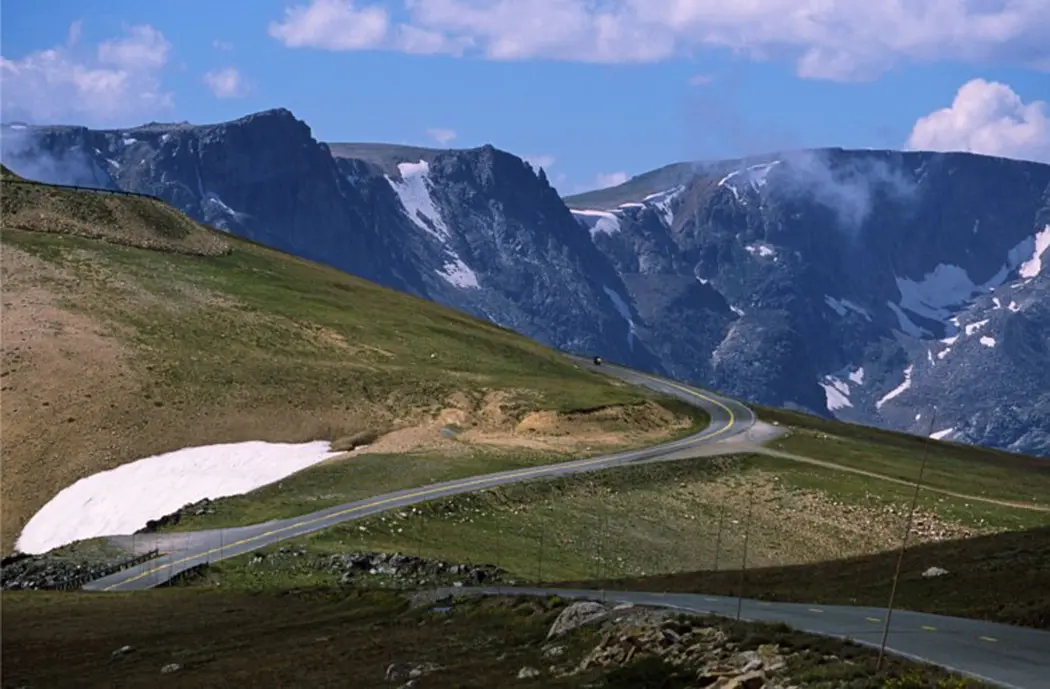
- Driving south from Red Lodge, MT, the highway enters the Custer Gallatin National Forest and climbs switchbacks to the Montana/Wyoming state line, enters the Shoshone National Forest, and climbs to Beartooth Pass at 10,947 feet.
- Access
- Potable water is not available at this site.
- Phone
- 406-446-2103
- Website
- fs.usda.gov
- Managed by
- Beartooth Ranger District.
- Established
- Construction began in 1932; completed June 14, 1936.
Up Rock Creek and over the plateau
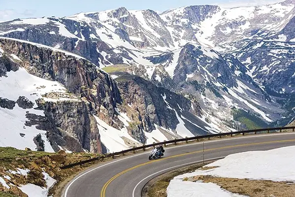
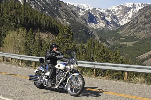
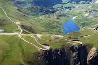
South of Red Lodge, U.S. 212 follows Rock Creek up its glacial valley into the Custer Gallatin National Forest. Holly Matkin, writing in Distinctly Montana, puts the start of the highway about nine miles south of town. Visit Montana places it just south of Red Lodge at the forest boundary. The forest is lodgepole pine. Then the road folds back on itself in a run of switchbacks, with only a strip of steel guardrail between the pavement and the canyon floor. According to Matkin, the curves still carry names from the men who built them in the early 1930s: Frozen Man Curve, Deadman’s Curve, Mae West Curve, Primal Curve.
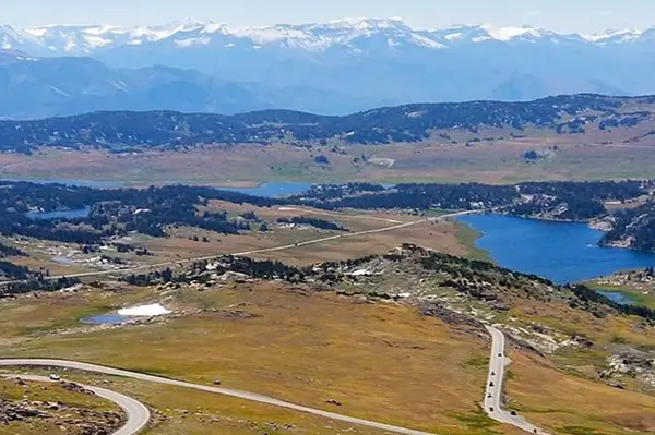
The Forest Service directs drivers to stop at Vista Point, a pullout above the main canyon of Rock Creek. Its geology page notes that many of the forms glaciers cut can be seen from there: cirques, arêtes, hanging valleys, U-shaped valleys. The moraines and outwash the ice left behind lie lower, at the head of the valley near Red Lodge. Above the switchbacks the road reaches the Montana–Wyoming line and enters the Shoshone National Forest. About 30 miles out of Red Lodge it crosses the 45th parallel, halfway between the equator and the North Pole. Twin Lakes lie just beyond.
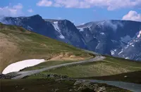
The road passes the Beartooth Basin ski area, which opened in the 1960s. Matkin calls it one of the oldest alpine ski training areas in North America. Visit Montana notes that visitors cross-country ski here in June and July. Off to one side stands a sharp spire the Apsaalooke (Crow) call “Na Piet Say,” bear’s tooth. The Shoshone National Forest says the range, and so the highway, takes its name from that rock. The West Summit overlook at Beartooth Pass sits at 10,947 feet, about 1,000 feet above tree line by Matkin’s account.
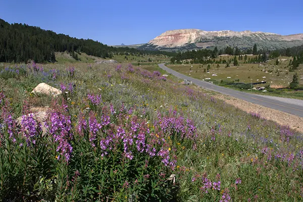
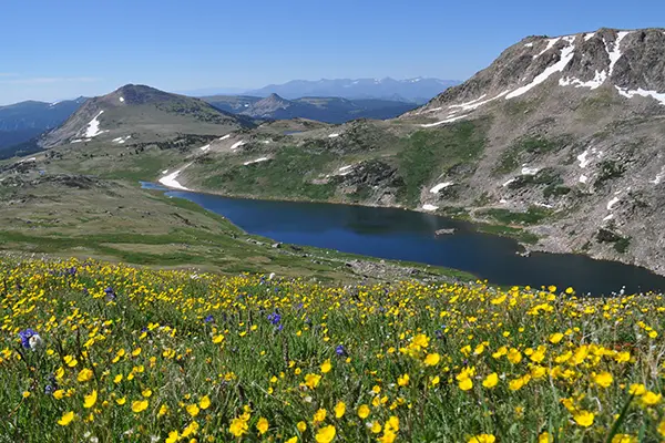
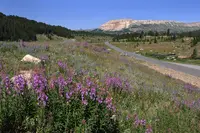
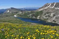
This high country is alpine tundra, cut by glacial cirques and lakes. The Forest Service says snow usually stays at the higher elevations until early to mid-July. The Red Lodge Chamber of Commerce writes that some plants up here convert sunlight to heat and many conserve water the way desert plants do. In late June and July the tundra flowers with shooting stars, columbine, and Indian paintbrush.
West of the pass, a geology road log from GeoWyo lists the stops in order. Gardiner Lake Pullout and Trailhead comes first, then the Top of the World Store, Beartooth Falls, the lookout tower on Clay Butte, an overlook facing Pilot and Index Peaks, and the Clarks Fork Valley overlook. Pilot and Index are Absaroka volcanic rock, carried south-southeast on the Heart Mountain Detachment 48.9 million years ago. At Lake Creek Falls, the creek drops 35 feet through a narrow gorge cut in granite. The walkway across it was a bridge on the original highway, one of five preserved from that construction. GeoWyo says its abutments were hand-chiseled and fitted by the Civilian Conservation Corps. A steel bridge built downstream in 1974 now carries the traffic. The road then crosses back into Montana to Cooke City. The northeast entrance to Yellowstone lies four miles past it, beyond Silver Gate.
The Forest Service allows a minimum of two to three hours for the drive. The Red Lodge Chamber says to plan on at least three. Interpretive signs, pullouts, and trailheads line the corridor, and the chamber offers a self-guided brochure titled Highway to the Sky. Campgrounds sit at both ends and on the plateau. The two near Cooke City, Colter and Soda Butte, take hard-sided campers only. Grizzly and black bears live in these mountains, along with moose, elk, bighorn sheep, mountain goats, mountain lions, and bobcats. The Forest Service warns that every hike leaving Beartooth Pass enters bear country, and it tells hikers to carry bear spray.
Rock from near the beginning
The highway runs along the edge of the Absaroka-Beartooth Wilderness, which Congress designated in 1978. The Red Lodge Chamber gives its size as 943,377 acres; the Shoshone National Forest gives 943,648. The chamber counts 20 peaks over 12,000 feet and more than 950 alpine lakes. GeoWyo counts 26 such peaks across the whole range. Granite Peak, Montana’s highest point at 12,799 feet, is among them. The Shoshone forest notes several “grasshopper glaciers” in the wilderness, holding millions of grasshoppers frozen in the ice.
The road climbs onto the plateau from the east at Quad Creek. According to the U.S. Geological Survey, zircon crystals in the rock there have been dated to as old as 3.96 billion years. Only western Australia and northern Canada have produced older ages. GeoWyo describes the find as a four-billion-year-old zircon in a quartzite at Quad Creek. Jon Axline, historian at the Montana Department of Transportation, puts the plateau’s gneiss, granite, and schist at about 3.3 billion years, the oldest exposed rock in Montana. Beartooth Butte and Clay Butte are what erosion left of the sedimentary layers that once covered the plateau. The Forest Service dates the first alpine glaciers here to about 1.6 million years ago.
From the Black and White Trail to Flag Day
The Rock Creek Valley and the Beartooth Mountains were part of the aboriginal territory of the Apsaalooke. Matkin writes that Indigenous peoples crossed the range for at least 12,000 years. In 1881, General Phillip Sheridan and an escort of 120 men, bound for Yellowstone, crossed part of what became the road’s path.
Red Lodge began as a mail stop on the Meeteetse Trail in 1884. A Montana Highway Department marker in Liver-Eating Johnston Park, beside U.S. 212 on South Broadway, tells the town’s story. It says the Rocky Fork Coal Company opened the first large-scale mine there in 1887. Matkin dates the company’s mine to 1886. By the 1920s, Matkin writes, just over 4,500 people lived in Red Lodge. She says the mines closed during the early part of that decade and unemployment soared. The marker says production declined after World War I and the mines had closed by 1932. On the far side of the range, Cooke City’s mines hauled ore 60 miles through Yellowstone to the railroad at Gardiner, tearing up the park road. Matkin presents the new highway as the answer to that problem as well. One reader, signing as Montana BOB, replied below her article that the highway “had absolutely nothing to do with Cooke City and reducing ore trucks in YNP.”
Dave Vickery, writing in Raised in the West, traces the first attempts to 1915. That year promoters pushed the Black and White Trail from Bearcreek over Mount Maurice to Cooke City. By 1919 a rough five-mile road led to the top of Line Creek Plateau. Two years later, new federal money was limited to highways linking large population centers, which ended the trail’s chances. A new plan for a route across the Beartooth Plateau followed in 1924. In 1927, after years of lobbying by Montana’s congressional delegation, the Federal Bureau of Public Roads ordered a survey, which was finished that October.
Matkin writes that President Herbert Hoover signed the National Park Approaches Act in January 1931. Citing the Federal Highway Administration, she adds that the Red Lodge–Cooke City route was the first park road it funded. She has the first contracts let five months later and work starting that summer. Vickery and the Forest Service date the start of construction to the spring of 1932.
Vickery’s father, Fred, and his uncles Ted and Jim were among the local men who signed on for steady wages. Their first job was clearing the right of way along the survey markers up Rock Creek. Pick-and-shovel men earned an average of 50 cents an hour; skilled operators on draglines and bulldozers earned up to 75. Crews worked from both directions. The Rock Creek side, up the switchbacks to the plateau, was the hardest stretch. Morrison-Knudsen of Boise, Idaho, finished it by the end of the 1932 season. McNutt and Pyle of Portland, Oregon, built the 25 miles from the state line north to meet that road near Twin Lakes. The work meant bridging creeks and crossing fields of glacial boulders. It took until December 1933, and it bankrupted the company. The Winston Brothers of Minneapolis built the 17 miles from the Montana line to the park boundary near Silver Gate. By the end of the 1935 season all 68 miles were finished, with guardrails and a gravel surface.
Matkin counts two deaths on the job. She also writes that the $2.5 million road came in on schedule, at slightly less than half what the federal government had expected. It opened on Flag Day, June 14, 1936. Matkin writes that visitors came from as far as California and Maine to be among the first across. By 1939 an average of 400 vehicles used the road each weekday, and well over 1,000 a day on weekends and holidays. The marker in Red Lodge says the highway revived the town by linking it directly to Yellowstone.
Axline summed up the project in a few lines: “The Beartooth Highway opens a window in the spectacular scenic and natural environment of an alpine ecosystem that might not otherwise be available to most Americans. The Beartooth Highway is also a story of man versus nature in its construction. It was no easy task…”
Plows from both directions
Vickery calls maintenance the road’s greatest challenge. At first the Bureau of Roads and Yellowstone National Park kept it up and plowed it each spring. During World War II money ran short and the road over the mountains fell into disrepair. It was still gravel then. A reader named Bill Coddington wrote below Matkin’s article: “I remember as a child in the 40’s driving this with my parents on gravel surfaces. Quite a thrill!”
In the 1960s the Montana Department of Transportation took on the plowing. Vickery writes that since the 1990s Montana has maintained the road from Red Lodge to the Wyoming line, and the National Park Service the stretch from there to the park boundary. He puts Montana’s spending at close to $1.1 million a year, for plowing, rock removal, and guardrail repair.
The road also gained federal recognition. Charles Kuralt, the CBS On the Road correspondent, called it “the most beautiful roadway in America” in the Red Lodge Chamber’s version and “the most beautiful drive in America” in Vickery’s and Visit Montana’s. GeoWyo says the U.S. Department of Transportation named 68 miles of U.S. 212 an All-American Road in June 2000. Visit Montana and Matkin give the year as 2002. The highway was added to the National Register of Historic Places in 2014.
The road closes every winter. Matkin records drifts as high as 26 feet and says clearing them can take months. Each spring, Vickery writes, heavy snow equipment works in from both directions to open the road, usually by Memorial Day. The Red Lodge Chamber gives the season as Memorial Day weekend through early October. The Forest Service says October 15, depending on weather. While the highway is closed to cars, Visit Montana notes, snowmobilers may still travel the route.
Notable Events
- 1927After years of lobbying by Montana's Congressional delegation, the Federal Bureau of Public Roads ordered a survey for the proposed highway. raisedinthewest.com
- 1931Final funding came in 1931 with the National Parks Approaches Act, and construction began in the spring of 1932. raisedinthewest.com
- 1932Morrison-Knudsen of Boise, Idaho finished the Rock Creek side section by the end of the 1932 construction season. raisedinthewest.com
- 1933The segment from the Montana-Wyoming line was finished in December 1933, at the cost of the contractor's bankruptcy. raisedinthewest.com
- 1935By the end of the 1935 construction season the whole highway was done, with guard rails and a gravel surface in place. raisedinthewest.com
- 1936The state highway marker says the finished Beartooth Highway linked Red Lodge directly to Yellowstone National Park and revived the town. hmdb.org
- 1936The highway opened on a June day in 1936 after a $2.5 million investment. raisedinthewest.com
- 1939By 1939 an average of 400 vehicles a day used the new road on weekdays, and well over 1,000 a day on weekends and holidays. distinctlymontana.com
- 1960sIn the 1960s the Montana Department of Transportation accepted the job of plowing the highway from the state line south to the park. raisedinthewest.com
People
- Herbert Hoover, President who signed the National Park Approaches Act, funding this route as the first park road to receive funding.
- Phillip Sheridan, Civil War general whose 1881 party crossed part of the later roadway's path.
- Jon Axline, historian and interpretive marker coordinator at the Montana Department of Transportation who wrote the highway's history.
- Fred Vickery, local Red Lodge man who worked carving the highway, clearing the right of way along Rock Creek (1930s).
- Charles Kuralt, On the Road correspondent who dubbed the Beartooth Highway “the most beautiful roadway in America”.
Sources
- fs.usda.gov/r01/custergallatin/recreation/explore-forest/beartooth-scenic-byway-all-american-road
- fs.usda.gov/r01/custergallatin/recreation/us-hwy-212-corridor-beartooth-highway
- redlodge.com/itineraries/beartooth-highway
- raisedinthewest.com/archives/building-the-beartooth-highway
- distinctlymontana.com/beartooth-highway-then-and-now
- fs.usda.gov/r01/custergallatin/recreation/explore-forest/beartooth-scenic-byway-all-american-road
- fs.usda.gov/r01/custergallatin/natural-resources/geology/geology-beartooth-mountains