Cortez
Montezuma County, Colorado. County seat.
Cortez, seat of Montezuma County, Colorado, was laid out in 1886 to house the men digging tunnels and ditches to carry Dolores River water into the Montezuma Valley.1,2,3
Details
- Founded
- M.J. Mack, a water engineer for the Montezuma Valley Water Supply Company, laid out Cortez in 1886 on land owned by James W. Hanna.1
- Name
- Because the county’s ruins were then thought to be Aztec, Montezuma County was named for Moctezuma II and its seat for Cortez, the Spanish conquistador who vanquished him.3
- County seat
- Cortez is the county seat of Montezuma County.3
- Last checked
- October 6, 2026.
Point at a dot to see the place.Tap a dot to see the place. Road map of Cortez.
In Cortez
- Flying T WineCortez · VineyardA one-acre vineyard on the Tomac family's Flying T Ranch in McElmo Canyon near Cortez, Colorado, planted below Battlerock, where motocross champion Eli Tomac trained.
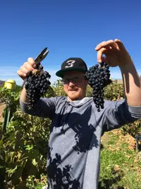
- Sutcliffe VineyardsCortez · Tasting roomSeven distinctive guest houses set among the red-rock canyons of Southwest Colorado — historic ranch homes, handcrafted cabins, or the architectural dwellings of Sky Village — near Mesa Verde, Canyons of the Ancients, and Hovenweep.
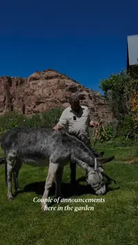
- Yellow Car Country WinesCortez · Fruit wines and meadA winery located in Cortez, CO making fruit wines and meads. The view is great. Come take a break, have a glass of wine, and take a bottle home with you.
The Calendar


History
A Town Laid Out for a Ditch
Cortez, the seat of Montezuma County, has a population of 8,482 and sits at the juncture of US Routes 491 and 160 and State Highway 145.3 On Christmas Day 1886, Matt Hammond pulled a wagon heavy with lumber for the first buildings onto the old cattle roundup ground.2 M.J. Mack, engineer for the Montezuma Valley Water Supply Company, had laid out the town on land owned by James W. Hanna, whom the city’s history calls the company’s president and a 1998 state marker its manager and co-owner.1,2 The town was built to house the men who would dig the tunnels, ditches, and laterals to divert Dolores River water into the Montezuma Valley, and by the spring of 1887 hundreds of them were at work.2 Drinking water was hauled from Mitchell Springs, some two miles south of town, and a well dug in the center of Main Street came up dry.2 On July 4, 1890, the first flowing water reached the town’s few residences through a forty-foot flume.3 When Montezuma County was established in 1889 its ruins were thought to be Aztec, so the county took the name of the emperor Moctezuma II and its seat the name of the Spanish conquistador who vanquished him.3
Sandstone on Main and Market
Peter Baxstrom, a stonemason from Sweden, arrived in 1884 and opened a quarry just west of Cortez on Hartman Draw.4 The Baxstrom brothers built the Stone Block on the corner of Main and Market in 1889; the city’s history has it completed by that year, while its marker says it stood idle for several years and was finished in the early 1890s.2,5 The brothers P.T. and H.M. Guillet ran Guillet Mercantile in the building, and by 1890 the sandstone Montezuma Valley National Bank stood on the corner just east.2,5 When the Hotel Clifton burned in 1907 and flames caught the Stone Block’s wooden balustrade, the Guillets soaked Navajo rugs in water and laid them over the balustrade and window frames to save the building.5 The county encyclopedia dates the Clifton’s burning to 1908 and says owner Johnny Brown and his wife rebuilt it as the Brown Palace Hotel, which it says still operates.3 A frame building put up for Dr. G.H. Harrington in 1886 also burned in the 1907 fire, and the two-story sandstone building raised in its place served as the post office until the early 1950s.6
Orchards, the 1911 Flood, and Beans
Between 1900 and 1910 storefronts sprang up among the earliest homes along Main and Market, land sold for $40 an acre, and the city’s history picks about 1909 as the valley’s best year.2 Irrigated land in the county grew from 2,122 acres in 1889 to 27,176 acres in 1909, and McElmo Canyon peaches took awards at the 1904 St. Louis World’s Fair.3 The Rio Grande and Southern reached Dolores in 1891, but its spur to Cortez was never completed, and the town depended on stage and freight lines.2 On July 10, 1911, storms washed out the flumes and laterals, and a wall of water down McElmo Creek cut a canyon within a canyon and carried whole orchards and wheat fields into Utah.2 The town shrank through the 1920s, and the Dust Bowl brought newcomers from Kansas, Missouri, Oklahoma, and West Texas who grubbed out sagebrush to grow beans on the farmlands to the north.2
The Calkins School
Pete Baxstrom built the first block of the Cortez Public School in 1909 with rock from the Baxstrom quarry, and his son Harry completed an addition that the National Register form dates to 1924 and the marker to 1923.4,7 In 1935 Works Progress Administration workers built the east addition and replaced the 1909 hipped roof and bell tower with a flat roof and stepped parapets.7,8 The National Register form calls it the only public school serving the city from 1909 to 1949, years in which the population nearly doubled between 1910 and 1930 to reach 921.4 It was named for Dr. Royal W. Calkins, a local physician and former Speaker of the Colorado House of Representatives, whom the marker credits with saving 42 lives in the influenza epidemic of 1918.7 Renamed the Calkins School after the 1949 school year, it became school district offices in 1968 and was listed in the National Register of Historic Places in March 2016.8
Oil, Uranium, and McPhee Reservoir
Oil strikes west of Pleasant View in 1948 and at Aneth, Utah, in 1956 made Cortez a supply center for the oil industry, and uranium prospecting brought money in through the 1950s.3 Main Street was paved in 1951, radio station KVFC first broadcast in 1955, and the population grew from 2,680 in 1950 to 6,764 in 1960.3 The energy boom went bust in the 1960s, Main Street businesses were boarded up, and the city’s history names tourism and government as the threads that emerged.2,3 The 1998 state marker records tourism emerging as a major industry in the 1980s and Cortez proclaiming itself the “archaeological capital of the United States.”1 In the 1980s the Bureau of Reclamation began damming the Dolores River for McPhee Reservoir, completed in 1995, which gives Cortez a long-term water supply.3
Within 30 Miles
Measured in a straight line from the town, nearest first.
- Escalante DaysDolores · Community celebrationDolores's town celebration in Flanders Park, held each August since 1976 beside a tribute noting that Father Escalante slept on that spot Aug. 13, 1776.
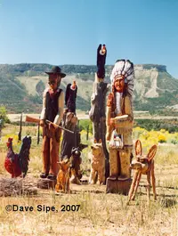
- Dave Sipe's Folk ArtMancos · Open studioA chainsaw carver's open studio, sculpture garden and museum on U.S. 160 outside Mancos, Colorado, where hundreds of grinning wooden figures spill from house, sheds and trailers.
- Mancos DaysMancos · Annual event68th Annual Mancos Days Celebration; July 24, 25, 26 2026; Theme: Mancos Ever After - Myth, Magic & Fairy Tales.

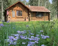
- Aspen Guard StationMancos · Forest service cabinA Civilian Conservation Corps log guard station in a fenced aspen grove north of Mancos, Colorado, that housed forest rangers, then visiting artists, and is now rented by the night.
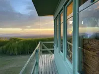
- Jersey Jim LookoutMancos · Fire lookout towerLive a little bit of history and enjoy an incredible view in Southwestern Colorado with an one- or two-night stay at the Jersey Jim Fire Lookout Tower. Formerly used to detect fires, the live-in tower rises from an aspen-lined meadow in the San Juan National Forest at almost 10,000 feet above sea level.
All the towns of Colorado. More of Colorado: Town Festivals, Wineries, and Fairs & Rodeos.
Sources
- Cortez (historical marker) hmdb.org/m.asp?m=153394
- Official Website cortezco.gov/318/History-of-City
- Montezuma County (coloradoencyclopedia.org) coloradoencyclopedia.org/article/montezuma-county
- National Register of Historic Places Registration Form historycolorado.org/sites/default/files/media/documents/2018/5mt12697.pdf
- Wilson (Stone Block) Building (historical marker) hmdb.org/m.asp?m=153368
- Cortez Post Office (historical marker) hmdb.org/m.asp?m=153365
- Cortez Public School (Calkins) (historical marker) hmdb.org/m.asp?m=153373
- Cortez High School (coloradoencyclopedia.org) coloradoencyclopedia.org/article/cortez-high-school