Oroville
Butte County, California.
Oroville, seat of Butte County, California, began in the winter of 1849-50 as the tent town Ophir City; its gold dredges later took nearly $30,000,000.1
Details
- Last checked
- October 6, 2026.
Point at a dot to see the place.Tap a dot to see the place. Road map of Oroville.
In Oroville
The Calendar
- Feather Fiesta DaysHometown celebrationSaturday, May 1 through Saturday, May 8, 2027; planning underway, activities anticipated.
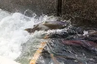
- Oroville Salmon FestivalCommunity-wide celebrationLast held September 26, 2026; next year’s date not yet stated.
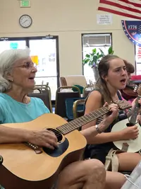
- Oroville Old-Time Fiddlers monthly jam (CSOTFA District 1)Circle jams & open mic performances4th Sunday of the Month - 2 - 5 pm 1335 Myers St., Oroville, CA 95965.
History
Ophir City and the County Seat
Oroville stands on the banks of the Feather River, where the river leaves the Sierra Nevada for the flat floor of the California Central Valley.2 The 1939 state guide says the town sprang up in the winter of 1849-50 as Ophir City, a tent town, when gold was discovered there.1 The city’s own history gives a different purpose, saying the town was established as the head of navigation on the Feather River to supply gold miners.2 Discoveries elsewhere emptied the place in 1852, but it boomed again when a canal brought water in 1856 to dry diggings nearby.1 At Bidwell’s Bar, where John Bidwell found gold on July 4, 1848, the diggings gave out and the whole population stampeded to Oroville.1 Bidwell’s Bar had been the second county seat of Butte County from 1853 to 1856, and Oroville became the seat in 1856, the year the canal brought water to the dry diggings.1,3 The guide counts 4,000 people that year, by its reckoning the fifth largest city in California, with horse races, two theaters, 65 saloons, and brothels and gambling houses at every other door.1 On February 26, 1857, the steamer Gazelle arrived at the levee to great excitement, but within three months boats ceased to run above rival Marysville.1
Chinatown and the Temple of 1863
Gold lured thousands of Chinese, and the 1939 guide says Oroville’s Chinatown was California’s largest in 1872.1 Special trains brought them until there were 7,000 in the mines and 3,000 more who lived off the camps.1 The temple, dedicated in the spring of 1863 for the 10,000 Chinese then living here, was paid for by the Emperor and Empress of China and built by local Chinese labor, according to the 1962 state marker.4 The 1939 guide records that the Chinese here were heavily taxed, robbed, even murdered, and that not more than 50 remained.1 Chinese residents deeded the temple to the City of Oroville in 1935; it first opened to visitors during California’s 1949 Centennial and is still used occasionally for worship.4,5
Dredges, Olives, and the Feather River Route
The 1939 guide dates California dredging to 1898, when W. P. Hammon and Thomas Couch floated what it calls the first successful bucket elevator dredge on the Feather River here.1 The National Register nomination for the old commercial district instead places a bucket-elevator gold dredger at Oroville around 1896.6 As many as 44 dredges worked at one time and took nearly $30,000,000 in gold within 20 years.1 One company offered to move and rebuild Oroville if it could wash out the gold-bearing gravel below the town.1 When mining died down, the town was found to stand in a thermal belt suited to semitropical fruits, and Mrs. Ehman of Oroville developed a commercial process for pickling ripe olives.1 In 1939 the Federal Writers’ Project guide found a quiet town of 3,698 ringed by olive groves and orchards, with fruit-packing houses, an olive-oil refinery, and what it called one of the largest ripe olive canning plants in the world.1 In the early 20th century the Western Pacific Railroad completed its all-weather Feather River Canyon route through the Sierra Nevada, and Oroville became a stop for the California Zephyr through its 20-year run.2 Ishi, the last member of the Yahi, appeared in Oroville around 1911, caught foraging for meat after forest fires, and the local sheriff took him into custody for his own protection.2,7
Montgomery Street, the Inn, and the Dam
The streets and blocks were laid out in 1855 and have not changed since; Montgomery Street was the main thoroughfare, and sixteen commercial buildings from 1856 to 1912 survive downtown.6 Six of the sixteen buildings in the Old Oroville Commercial District housed saloons at various times, and the nomination notes a place frequented by Black Bart, a legendary Western outlaw, on his visits to Oroville.6 Fire in 1904 gutted the interior of one building, which was immediately restored, and the August 1975 earthquake damaged others, whose walls were anchored to roof, ceiling, and floor in 1976.6 Work on the Oroville Inn began in 1929 and stopped in the Great Depression, two hundred residents finished it for its opening on June 1, 1930, and after years of disrepair it was restored in 2015.8 A marker dedicated May 8, 1993, the twenty-fifth anniversary of the completion of Oroville Dam, credits the dam with supplying water to Californians throughout two-thirds of the state.9 Bidwell Bar now lies under Lake Oroville, and its bridge remains, which the city calls the first suspension bridge in California; the state guide says the cables of California’s first suspension bridge were brought around the Horn and the bridge opened in 1856.1,2
Within 30 Miles
Measured in a straight line from the town, nearest first.
- Butte County FairGridley · County fairA four-day county fair in Gridley, California, on 26 acres that served as a military base in World War II, closing with a destruction derby that includes motorhomes.

- Red Suspenders DayGridley · Community-wide celebrationGridley, California's May celebration of its volunteer firefighters, run by the Chamber of Commerce, where teams push decorated beds down Virginia Street before the noon parade.
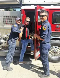
- Durham Parade and PicnicDurham · Community celebrationA parade and picnic held in Durham, Butte County, California, every May since 1917, said to have begun as a way to bring grown children home for Mother's Day.
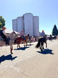
- Gold Nugget DaysParadise · Annual town celebrationParadise, California's late-April celebration of the 54-pound Dogtown Nugget of 1859, held since 1959, with a queen in a 1968 gold crown and a donkey derby.
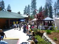
- Johnny Appleseed DaysParadise · Harvest festivalBilled as California's oldest harvest festival, Johnny Appleseed Days fills Paradise's Terry Ashe Park each October and began in 1888 as a temperance party over an acquired saloon.
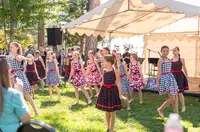
- South Yuba River SP gold panningPenn Valley · Gold panningModern-day gold seekers can play out the story of the gold rush using only bare hands and shallow gold pans. Visitors may keep any gold they find.
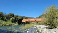
- Marysville Peach FestivalMarysville · FestivalA two-day peach festival on D Street in downtown Marysville, California, held the third weekend of July, where every food vendor must sell something made with peaches.

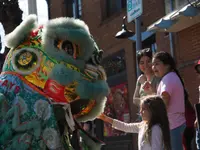
- Bok Kai Festival and ParadeMarysville · Annual parade and festivalAn annual parade and Bomb Day in Marysville, California, for Bok Eye, the Chinese water god, ending with numbered good-fortune rings fired over Chinatown.
Nearby towns: Nevada City and Grass Valley. All the towns of California. More of California: Town Festivals, Factory Tours, and Old-Time Music.
Sources
- California: A Guide to the Golden State (1939), p. 536 archive.org/details/californiaguidet00federich/page/536
- Oroville, CA orovilleca.gov/333/History
- Bidwell’s Bar (historical marker) hmdb.org/m.asp?m=100598
- Chinese Temple (historical marker) hmdb.org/m.asp?m=100599
- Oroville Chinese Temple and Museum Complex calisphere.org/institution/228/collections
- National Register nomination, Oroville, CA npgallery.nps.gov/GetAsset/9defae7d-6858-449d-9182-6f9f5fe21f76
- Community Events orovilleca.gov/341/Community-Events
- Historic Oroville Inn (historical marker) hmdb.org/m.asp?m=176288
- Oroville Dam (historical marker) hmdb.org/m.asp?m=101447