Mammoth Lakes
Mono County, California.
Mammoth Lakes, in Mono County, California, grew from a gold boom that began in 1877 into a town where recreation became the base of the economy.1
Details
- Last checked
- October 6, 2026.
Point at a dot to see the place.Tap a dot to see the place. Road map of Mammoth Lakes.
In Mammoth Lakes
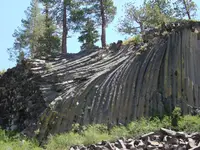
- Devils Postpile National Monument (Devils Postpile Trailhead)Mammoth Lakes · National monumentA 798-acre national monument in the Reds Meadow Valley near Mammoth Lakes, California, protecting a cliff of glacier-polished basalt columns up to 60 feet tall.
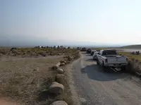
- Long Valley Recreational Hot SpringsMammoth Lakes · Natural hot springsUndeveloped natural hot springs on public land off Benton Crossing Road in California's Long Valley, a caldera left by a supereruption about 760,000 years ago.
The Calendar
History
Mammoth City under Mineral Hill
Opposite Mineral Hill, now called Red Mountain, near present Mammoth Lakes in Mono County, stood the mining camp of Mammoth City.2 The gold boom began in 1877, and in 1878-79 the camp in the gulch grew to perhaps a thousand people.1,2 John French opened a toll route from present-day Oakhurst to his mines in the basin, collecting tolls only in summer from 1879 to 1881, and the National Park Service credits it with helping the first settlement of the Mammoth Lakes area.3
Mammoth City served the smaller camps of Pine City, Mill City, and Mineral Peak, and it is said to have had 22 saloons, 13 stores, 2 breweries, 2 livery stables, 5 restaurants, and 2 newspapers.2 The marker on the site notes that a ten-foot-square tent or shack and a barrel of whiskey were all a saloon needed.2 The Mammoth Mining Co. shut down for good in the severe winter of 1879-80, and a Daily News report counted twenty pairs of snowshoes, each with a man on top, leaving one morning.2 The boom ended in 1881, when the Mammoth Mining Company’s property was sold at a sheriff’s sale.1
From Red Mountain to Red Meadow
Miners kept working Red Mountain on a small scale, and in 1927 the Mammoth Consolidated Mining Company began the last significant operation there.1 The Great Depression and a bank failure helped close it in 1933.1 Its principal partner, Arch Mahan, then bought the resort and pack station at Red Meadow and stayed in the local tourist trade for the rest of his life.1 The 1989 marker places his turn within a shift that began in the early 1900s, when scenery replaced mining and recreation became the base of the economy.1
Penney’s Tavern and the Rope Tows
In spring 1938 Frank Penny, Jr., and his wife, Nora “Bob” Penny, opened the first resort facility in “New Mammoth,” known as Penney’s Tavern.4 It held a restaurant, bar, general store, motel, rental cabins, and a dormitory, and it served as the town’s social center for over 40 years.4 After the Second World War it passed through a succession of owners as the “Mammoth Tavern,” and in 1973 its land was bought for a shopping mall.4 By the late 1970s many of its buildings had been moved and reused for other commercial or residential purposes.4
The year the Tavern opened, a permanent rope tow went up on the east slope of McGee Mountain, and a 1996 marker calls it the first in the Eastern Sierra.5 Dave McCoy organized and promoted skiing there, and the tow’s success moved him in 1941 to Mammoth Mountain.5 Within a few years the McGee tow was abandoned, though remnants of it can still be seen along the slopes of McGee Mountain.5
The Saloon, the Cabin, and the White Fence
In 1967 the state’s list of California Historical Resources entered Old Mammoth City, Sherwin’s Grade Toll Road, and the Piute historical excavations at Mammoth Lakes.6 A saloon built in Old Mammoth was taken apart in 1914 and reassembled as a line shack on the Longears Ranch on the Owens River.7 A Mammoth third-grade class found it empty and in disrepair in 1979, and with the Inyo National Forest’s help it was moved to its present site, marked in 1986.7 The log cabin Emmett Hayden, a map maker of the Eastern Sierra, built in the 1920s on the banks of Mammoth Creek now houses the Mammoth Museum.8 The museum still sells the original maps of the Hayden Map Company.9
Julia Townsend, wife of pioneer Bryant M. Townsend and mother of three, died in the severe winter of 1882, and deep snow and frozen ground kept her from burial until spring.10 Family accounts say she had wanted a home with a white picket fence, and her husband built one around her grave, a fence others have repainted and kept up since.10
Within 30 Miles
Measured in a straight line from the town, nearest first.
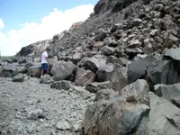
- Inyo NF obsidian digs (Glass Creek, Obsidian Dome, Deadman Creek)Highway 395 Corridor June Lake · Observation siteThree young lava domes of black obsidian and gray pumice on the Inyo National Forest north of Mammoth Lakes, California, dated by tree rings to a single eruption in 1350 CE.
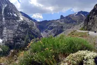
- Lee Vining Canyon Scenic BywayLee Vining · National forest scenic bywayThe Lee Vining Canyon Scenic Byway is located in east-central California and travels along California State Route 120 through theInyo National Forest to the Tioga Pass entrance of Yosemite National Park.
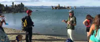
- Mono Lake South Tufa TrailheadLee Vining · State natural reserveAncient lake in the eastern Sierra Nevada, with spectacular views of the tufa towers formed over many years when the calcium-bearing freshwater springs and carbonate-rich lake water combined and precicipitated out as limestone.
All the towns of California. More of California: Holiday Celebrations.
Sources
- The Mammoth Consolidated Gold Mine (historical marker) hmdb.org/m.asp?m=59473
- Mammoth City (historical marker) hmdb.org/m.asp?m=50043
- Devils Postpile National Monument (U.S. National Park Service) nps.gov/depo/learn/historyculture/development-and-early-communities.htm
- The Tavern (historical marker) hmdb.org/m.asp?m=50039
- McGee Mountain Rope Tow #34 (historical marker) hmdb.org/m.asp?m=2951
- California Historical Resources ohp.parks.ca.gov/ListedResources?criteria=26&view=county
- Old Mammoth Saloon (historical marker) hmdb.org/m.asp?m=50059
- Mammoth Museum at the Hayden Cabin mammothmuseum.org
- Mammoth Museum at the Hayden Cabin mammothmuseum.org/support
- The White Fence at Old Mammoth (historical marker) hmdb.org/m.asp?m=141465