
Inyo NF obsidian digs (Glass Creek, Obsidian Dome, Deadman Creek)
Highway 395 Corridor June Lake, Mono County, California. Observation site.
Details

- Where
- Highway 395 Corridor June Lake, Mono County, CA. No street address stated. Directions
- When
- Open 24 hours/day.
- Getting there
- From the town of Mammoth Lakes drive west on Hwy 203 to the 395 junction. Take 395 north for 10 miles and take a left on Glass Flow Rd/Obsidian Dome Rd.
- Fees
- No fees are required for this site.
- Access
- Vehicle travel limited depending on snow. Dogs must be leashed in all developed recreation sites. Potable water is not available at this site.
- Walk-in or reserve
- No permit needed for incidental or small amounts collected for personal or family use; not for sale.
- Phone
- (760) 924-5500
- Managed by
- Inyo National Forest.
- Coordinates
- 37.757829, -119.026431.
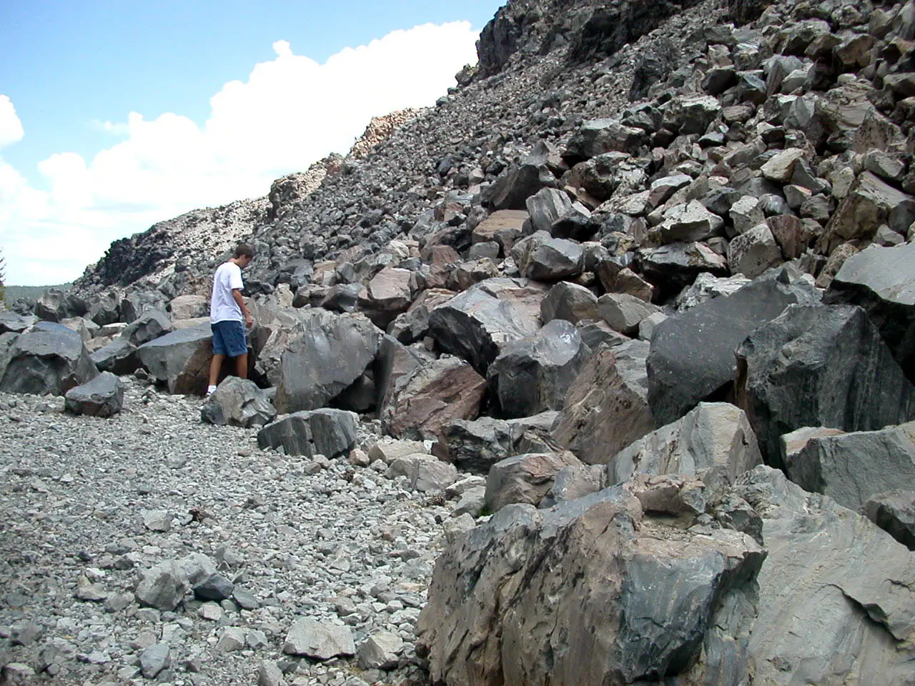
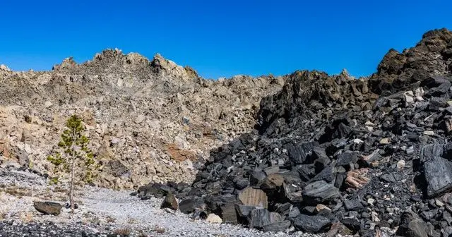
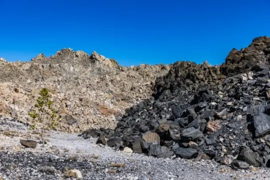
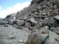
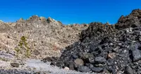
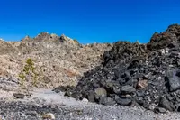
A dirt road leaves Highway 395 north of Mammoth Lakes and runs west into Jeffrey pine. The Forest Service puts the turn 10 miles up the highway from the Highway 203 junction, and the U.S. Geological Survey puts it at 11.0. From there the road bends about 2.7 miles around the flank of Obsidian Dome, a steep heap of volcanic glass. Its surface is jagged black obsidian mixed with pale gray pumice. Partway along, a parking area on the left looks onto part of the flow, where large chunks of obsidian are pocked with holes left by escaping gas. The Inyo National Forest lists the dome as an observation site. It is open 24 hours with no fee, there is no drinking water, and vehicle travel depends on the snow. In winter a groomed ski trail makes a 6-mile loop from the west side of the highway just north of Deadman Summit.
Two more domes from the same eruption stand to the south along a north–south line, at Glass Creek and at Deadman Creek. Between and around them, craters blown out by steam open in the forest floor.
The bulldozed trail up Obsidian Dome
The Survey’s field guide sends visitors to a fork in the road on the dome’s south side. There they park among large Jeffrey pines and walk up a bulldozed trail to the summit. The Forest Service gives the summit elevation as 8,556 feet. The Survey gives about 8,200 feet at the base and describes the flow as about a mile long, a little less than a mile wide, and about 400 feet high at the summit. The Mammoth Lakes visitor bureau gives the height as roughly 300 feet.
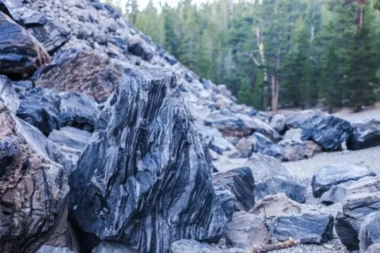
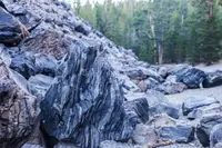
The obsidian blocks along the southern edge came from a vent about 0.6 mile to the north. From the first switchback, Glass Creek Dome is in view to the left, with an explosion crater below. Near the summit a patch of rock stands out much darker than the glass around it. It has the same chemical makeup but is full of bubbles. Geologists call this a squeeze-up: gas-rich magma from inside the flow was pushed to the surface, and the gas expanded into bubbles as the rock cooled. Elsewhere on the dome the obsidian carries stripes of flow banding.
Marble cake at Glass Creek
From the fork the field guide’s route goes back on foot to the middle branch of the road. It crosses Glass Creek and climbs to the left around an explosion crater, and the base of the Glass Creek flow then rises ahead on the right. A four-wheel-drive vehicle can ford the creek on the same branch. The north margin of this dome is made of large blocks in which two lavas are swirled together: crystal-poor black obsidian and crystal-rich light-gray pumice. The Survey compares the pattern to a marble cake and notes that the obsidian seems to flow around the pumice. Its analogy for how the rock formed is equal amounts of maple syrup and oatmeal, stirred briefly. In the pumice a close look finds white plagioclase, dark blades of hornblende, black shiny flakes of biotite, magnetic magnetite, and apatite, which the guide notes is the mineral teeth are made of.
The two lavas came from separate sources. The more fluid obsidian probably rose from the same Mono Craters system that fed Obsidian Dome. The pumice most likely came from the system that erupted Deer Mountain 115,000 years ago. That makes it the most recent material erupted from the Long Valley storage system, which is now believed to have cooled and crystallized too much to erupt on its own. The two most likely mixed during the eruption itself, with too little time to blend into a single new magma. Seen from Highway 395, the Glass Creek flow pours down the steep northwest wall of the Long Valley caldera, with the crest of the Sierra Nevada above it.
West of Obsidian Dome, where the dirt road becomes high-clearance, the Glass Creek Meadow Trailhead sits at about 8,200 feet, with parking in a dirt pullout off road 2S11. The trail follows a tributary into the Owens River Headwaters Wilderness, 14,721 acres of forested mountains and alpine meadows that Congress designated on March 31, 2009. Bicycles and motor vehicles are not allowed inside the wilderness boundary.
Deadman Creek and the buried rim
A Geological Survey professional paper on the Devils Postpile quadrangle describes how these domes grew. Each began with an explosion that threw up a cone of pumice lapilli around a pit. A nearly solid column of glassy lava then pushed up through the pit floor and spread sideways as it rose. The dome south of Deadman Creek is about three-quarters of a mile across. In spreading it almost entirely buried its first cone, and only a small remnant of the lapilli rim survives on its southwest side. The dome south of Glass Creek has none. The tops of both are a jumble of spires and loosely piled angular blocks of pumiceous obsidian. A small tree-covered dome north of Deadman Creek is slightly older, according to the paper. Debris from the later explosions covers it.
Upper and Lower Deadman Campground, 20 sites on the creek, was listed as closed in the Forest Service’s most recent posting. Big Springs Campground, between Mammoth Lakes and June Lake, serves as a base for fishing Deadman Creek.
A five-gallon bucket of glass
The Inyo National Forest allows rock and mineral samples to be gathered without a permit when the amount is small and for personal or family use. The forest’s measure for a small amount is what fits in a five-gallon bucket. The material cannot be sold, and it must be collected responsibly and only where it is abundant. Collecting is prohibited in wilderness areas, campgrounds, developed recreation sites, research natural areas, administrative sites, private inholdings, active timber operations, areas marked sensitive, and anywhere signed as closed. The trail into the Owens River Headwaters Wilderness falls under that rule, and so do the campgrounds along Glass Creek and Deadman Creek.
People have taken obsidian from this ground for centuries. The Mono Paiutes collected it to make sharp tools and arrow points. In modern times glassy rock has been hauled off for commercial scour and yard decoration. The glass of Obsidian Dome itself, the Survey notes, makes poor arrowheads because of its bubbles and small minerals.
Late summer, 1350
The domes rose from a single dike, a long crack filled with magma that the Survey likens to a curtain. The dike spread to about 6.8 miles long and in places about 33 feet wide, and the ground above it cracked and faulted. When the rising magma met groundwater, steam explosions blasted rock from a vent beneath what is now the South Deadman flow. The Forest Service credits a blast of this kind with starting Obsidian Dome. Stronger eruptions of pumice and ash followed at the South Deadman vent. A pyroclastic flow from that vent ran at least 3.7 miles and left deposits more than 32 feet thick along Deadman Creek.
The activity then moved north to the Obsidian vent, 3.1 miles away. The Glass Creek vent came last, and it produced the largest explosions of all. Its tephra lies more than 8 meters deep near the vent and more than 20 inches deep 7.5 miles away. The eruptions blanketed the surrounding forest in pumice. Once the magma had lost most of its gas, it oozed out quietly as the three domes. The dike crossed the rim of the caldera on its way, so Obsidian Dome stands outside it, Deadman Creek Dome inside, and Glass Creek Dome just north of the wall it flowed down. The whole episode probably lasted a few weeks to a few months.
Afterward, magma rose toward Deer Mountain but never reached the surface. Groundwater heated by it flashed to steam and blew out the Inyo Craters, along with two craters on the mountaintop. In the mid-1980s scientists drilled beneath the South Inyo Crater to reach the frozen top of the dike. Between about 2,000 and 2,140 feet down, the drill passed through a narrow band of shattered rock above the feeder dike. Some of those fragments matched the debris that had erupted onto the surface far above. Scientists have suggested that groundwater flooding the conduit quenched the magma early.
The first dates were rough. A log buried in the rim of the southernmost Inyo Crater gave a radiocarbon age of 650 years, plus or minus 200. Pines and firs about 400 years old were found growing inside the craters, and allowing a century for trees to take hold after the eruption, Rinehart and Huber placed the craters’ formation between 500 and 850 years ago in 1965. The Survey now calls the date of the three domes one of the best constrained prehistoric eruption dates in the world. Using tree rings, Millar and others found that the eruptions occurred in late summer 1350 CE.
Notable Events
- 1350Studies suggest the two Glass Creek magmas came from different storage areas and erupted in 1350 C.E. usgs.gov
- 1350Using tree rings, Millar and others found that the eruptions occurred in late summer 1350 CE. usgs.gov
- 1350Magma began rising beneath the southern end of the Mono-Inyo Craters volcanic chain and formed a series of lava flows, craters, layers of pumice and ash, and ground cracks between Mammoth Mountain and Obsidian Flow. usgs.gov
- 1350Explosive eruptions began at the South Deadman vent, then at the Obsidian vent, and then at the Glass Creek vent, located 5 km and 3 km to the north. usgs.gov
- Tephra, pyroclastic flows, and lava flows erupted from the Inyo chain at the Glass Creek, Obsidian, and South Deadman vents. usgs.gov
People
- Millar, Researcher who used tree rings with others to date the eruptions.
Sources
- fs.usda.gov/r05/inyo/recreation/obsidian-dome-observation-site
- fs.usda.gov/r05/inyo/permits/forest-products-permits
- fs.usda.gov/r05/inyo/recreation/owens-river-headwaters-region
- usgs.gov/volcanoes/mono-inyo-craters/science/geologic-history-inyo-craters-volcanic-chain
- usgs.gov/volcanoes/mono-inyo-craters/science/inyo-eruptive-episode-1350-ce-long-valley-caldera-california
- geo.libretexts.org/Bookshelves/Geography_(Physical)/California_Geography_(Patrich)/12%3A_The_Great_Basin/12.02%3A_NORTHERN_BASIN_-_MONO-INYO_CRATERS