Historic Route 66 (California segment)
Victorville, San Bernardino County, California. National Scenic Byway.
Details

- Where
- 13782 Bear Valley Road, Suite D-3 #267, Victorville, CA 13782. Directions
- Getting there
- Enter California Route 66 on Interstate 40 at the Colorado River to Exit 148/Five Mile Road; Right onto US-95; continue on Broadway; follow painted Route 66 roadway shields through the town of Needles to US 95 N to Goffs Road.
- Fees
- none.
- Access
- Follow Goffs Road to road closure at Fenner so take I-40 to Exit 78 and go south to Amboy.
- Phone
- 760-326-7000
- Website
- blm.gov
- Managed by
- San Bernardino County Department of Public Works.
- Established
- 2021.
- Coordinates
- 34.792121, -115.14516.
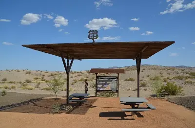
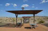
Westbound from Arizona, the road crosses the Colorado River with the Trails Arch Bridge in view, runs a short way on Interstate 40, and leaves it at Exit 148, Five Mile Road. On the southwest side of that overpass, two miles west of the river, the Bureau of Land Management keeps an interpretive site and kiosk for the California Historic Route 66 Needles to Barstow Scenic Byway. The BLM gives the byway’s length as 178 miles through the Mojave Desert section of California Route 66, following segments of the National Old Trails Highway and the Santa Fe Trail. The National Scenic Byway Foundation lists it at 144 miles. It passes through Needles, Goffs, Amboy, Ludlow, Newberry Springs, and Daggett, and it ends in Barstow.
Needles and Camp Ibis
Needles is the gateway town. Route 66 shields painted on the pavement lead along Broadway and through town, past brightly painted murals, old gas stations, motels, and a regional history museum. The restored El Garces Harvey House stands here. The National Scenic Byway Foundation calls it the “Queen Jewel” of the Fred Harvey chain, and it is listed in the National Register of Historic Places. The Foundation’s itinerary advises getting food and drink in Needles, because there is not much for at least 90 miles beyond.
Out of town the route takes US 95 north to Goffs Road, and the National Trails Highway runs north to Camp Ibis. Remains and an information plaque mark the site, which is one of three World War II Desert Training Center camps along the byway. The camp was established in 1942 to prepare troops for the deserts of North Africa. The BLM’s account says that between April 1942 and April 1944 more than one million soldiers trained at the Desert Training Center/California Arizona Maneuver Area. They served in 60 armored, infantry, and artillery divisions and in fighter pilot and heavy bomber squadrons. The BLM credits the vision and leadership of General Patton. The paved highway carried the equipment, troops, and supplies.
Trestles, a crater, and the Bagdad Café
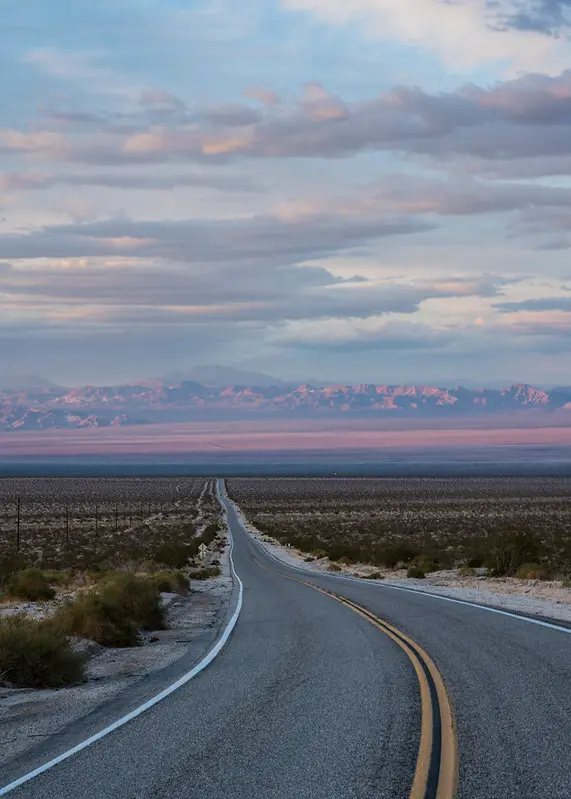
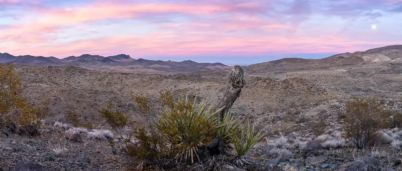
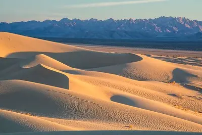
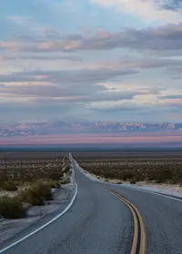
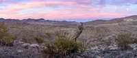
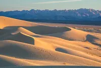
Beyond Goffs, the Foundation says, the next 150 miles and more are virtually undeveloped desert, popular with motorcyclists. The BLM writes that the land today appears much as it did when Route 66 was commissioned. The byway bisects Mojave Trails National Monument, 1.6 million acres of BLM land between Barstow and Needles, including more than 350,000 acres of Congressionally designated wilderness. The monument contains the longest remaining undeveloped stretch of Route 66 and some of the best preserved Desert Training Center sites. It connects Mojave National Preserve with Joshua Tree National Park. The preserve, another 1.6 million acres under the National Park Service, holds singing sand dunes, volcanic cinder cones, lava tubes, Joshua tree forests, and, in season, carpets of wildflowers.
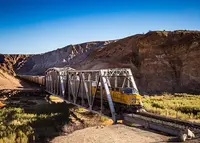
The road kept its original character here because Interstate 40 was built elsewhere instead of along the old right-of-way. The roadside engineering was made for the desert: berms to turn water and timber trestle bridges across the washes. The Foundation counts nearly 150 trestles. San Bernardino County, which maintains the road, counts 128 on the reach from Nebo Street at the east edge of Barstow to the Mountain Springs Road entrance on I-40. All were built more than eight decades ago, and the county reports that weather, flash floods, truck traffic, erosion, earthquakes, and animal life have worn every one of them.
One trestle shows the work involved. On February 15, 2024, Caltrans notified the county that a routine inspection had found Bridge Number 77, the Sombra Ditch bridge between Amboy Road and Kelbaker Road, deficient. County crews found its structural pilings degraded by 50 percent and closed it to all vehicles that day. The bridge was a wooden trestle built in 1930. Crews began excavating on February 28 and poured reinforced concrete footings on March 15. Between March 18 and March 20 they set new piles and supplemental bent caps. The bridge reopened on March 22, 2024.
Closures remain part of the drive. The BLM has posted an alert that Route 66 is closed between Mountain Springs Road and Kelbaker Road because of flood damage. The Foundation’s directions follow Goffs Road to the closure at Fenner, take I-40 to Exit 78, and turn south to Amboy.
Amboy lies about midway, roughly 66 miles from both Barstow and Needles. The California Historic Route 66 Association says it was first settled as a mining town in 1858 and formally established in 1883. The town has Roy’s café with its restored neon sign, a gas station, small motel cottages, and a desert church. Amboy Crater rises across the highway. It is a cinder cone of ash and cinders, 250 feet high and 1,500 feet across, in one of the youngest volcanic fields in the United States. It breaches on the west side, where basaltic lava spread over 24 square miles of lava lakes, collapsed tubes, sinks, and spatter cones. The cone was designated a National Natural Landmark in 1973. A trail climbs to the rim with rest stations along it, and the site has picnic tables, restrooms, and an ADA ramada overlook. The BLM warns that temperatures run very hot here and that visitors should carry plenty of water.
About 27 miles on is Ludlow, an old mining and railroad town with abandoned buildings, the Ludlow Cafe, and one motel. Newberry Springs grew up around abundant water. Its Bagdad Café appears in the 1987 movie of the same name and, the Foundation says, has a cult-like following among international visitors. Outside the Barn Dive Bar stands Newberry Nic, a sign man holding a pool cue. Daggett once prospered from its nearness to the Calico Mines, and several of its buildings predate Route 66. Near the end, the route joins I-40 to pass a military base and then follows signs to Main Street in Barstow.
The House of the Desert at Barstow
Barstow was named for William Strong Barstow, president of the Santa Fe Railroad. A series of murals along Main Street, which is Route 66 here, tells the town’s history. The road’s 1926 alignment ran beside the Harvey House Railroad Depot, and the National Park Service notes that this was no accident. The railroads had surveyed the most efficient paths through the topography, and Route 66 parallels the tracks for most of its length.
The depot’s first buildings, a wooden depot, restaurant, and hotel, went up in 1885 and burned in 1908. The NPS says the present building was designed by the architect Mary Colter and built from 1910 to 1913. The BLM gives 1911 as its completion and calls it the fourth Harvey House the Atchison, Topeka and Santa Fe Railway built along its right-of-way. It was named Casa del Desierto, House of the Desert. Its long, low lines, inset porches, arcades, and flanking buttresses follow what the NPS calls the Santa Fe style, a mix of 16th-century Spanish and Southwest American Indian architecture. Moorish towers and archways are worked in.
The Harvey system began after the railway’s successful eating house at Topeka in 1872. In 1878 the railway agreed to supply buildings while Fred Harvey supplied service, and by 1883 he controlled all meal service on the line from Topeka to El Paso. Telegrams sent from approaching trains let the staff have meals ready when passengers stepped down. The Harvey Girls, waitresses recruited from eastern states and rigorously trained, served those meals.
The depot was listed in the National Register in 1975 and has been recorded by the Historic American Buildings Survey. It was restored with Federal Transportation Enhancement Funds and local contributions, and the Route 66 Mother Road Museum was dedicated inside it on July 4, 2000. The museum shows photographs and artifacts tracing the road from pioneer trails and railroads through automotive history and the desert communities. Docents are on hand. On May 1, 2003, Hampton Inn Hotels posted a sign there naming it a “Roadside Attraction,” one of 66 such signs along the route’s 2,448 miles. The building also houses the Western American Railroad Museum and is open for self-guided tours.
Barstow’s Desert Discovery Center holds the Old Woman Meteorite, the second largest found in the United States. It was discovered in late 1975 in the southwestern Old Woman Mountains and weighed 6,070 pounds. It measures 38 inches long, 30 wide, and 34 high. It is mostly iron, with about 6 percent nickel and traces of cobalt, phosphorus, chromium, and sulphur. Dr. Roy Clarke of the Smithsonian verified it, and in 1980 the Smithsonian sent it back to the desert for permanent display.
From Beale’s road to U.S. 66
The road follows older routes. For thousands of years, Native Americans traveled trails from spring to spring across the High Desert to trade with tribes on the Pacific Coast. In 1857 Congress sent Lieutenant Edward Fitzgerald Beale to chart a wagon road along the 35th parallel to the Colorado River. Beale was certain it would become “the great emigrant road to California,” and the NPS calls his road the frontier antecedent of Route 66. Until 1883 the Mojave Road, 130 miles from the river to Camp Cady near Barstow, carried travelers between Prescott and the Port of Los Angeles. In the early 1880s the railway was built between Needles and Barstow. Wagon traffic, and later automobiles, moved to the railway line, and the old road fell out of use.
The first car crossed the High Desert in 1903. In 1911 San Bernardino County built the first road for cars across the Mojave. The Old Trails Road followed in 1912, and by 1918 the National Old Trails Road was the preferred auto route from New York to Los Angeles. Matthew J. Riordan, a pioneer lumberman of Flagstaff, laid out its final leg, the part closest to the later Route 66. At Topock, Arizona, automobiles were loaded onto railway flatcars and carried across the Santa Fe’s bridge to Needles. From there the road ran 164 miles across the Mojave to Barstow.
Cyrus Avery of Tulsa and John Woodruff of Springfield, Missouri, pressed for a link between Chicago and Los Angeles. The NPS dates the route’s numerical designation to the summer of 1926. The BLM gives the date as November 11, 1926, for a road of 2,448 miles across eight states. The NPS adds that the designation mostly assigned a number to existing state roads, most of them in poor condition. Realignment followed through the late 1920s and 1930s, and the road was fully paved by 1938.
In the Dust Bowl years, families from Oklahoma, Arkansas, Kansas, and Texas came this way toward farm work in California. The NPS counts the Needles-to-Barstow stretch among the hottest legs anywhere on Route 66. John Steinbeck’s The Grapes of Wrath gave the road the name “Mother Road.” Service stations, cafés, and motor courts rose with the traffic. Bobby Troup’s “Get Your Kicks on Route 66” was a hit in 1946, and vacationers filled the road through the 1950s and 1960s. President Eisenhower signed the interstate act on June 29, 1956. Interstate 40 was completed in 1979, and Route 66 was removed from the U.S. Highway System in June 1985.
In December 1990, California legislation designated “State Historic Highway Route 66,” which made signs permissible again. The California Historic Route 66 Association dates its history to that legislation. The NPS gives its founding as 1990, and the association’s own page says it has carried out its mission since 1991. At the association’s request, Caltrans put up the earliest historic directional signs, and they were stolen almost at once. The association later worked with the BLM on a corridor management plan. After eight years of their joint outreach, the Federal Highway Administration named the Needles-to-Barstow section a National Scenic Byway on February 24, 2021. The association counts 314 miles of Route 66 in California, nearly 90 percent of it drivable, and it kept a website for the road’s centennial year, 2026.
A schoolhouse on 113 acres at Goffs
Goffs began in 1883 as a railway siding, according to the history kept by the Mojave Desert Heritage and Cultural Association. In 1907 a short line connected it to the mines at Searchlight, Nevada. By 1911 there were enough railroaders’ children to open classes in a rented frame building, and in 1914 a mission-style schoolhouse went up. It taught 412 students before it closed in 1937. Searchlight had faded by 1923, and in 1931 Route 66 was moved six miles south of town. By 1937 Goffs had gone bust.
Dennis Casebier, a Kansan, first saw this desert as a Marine at Twentynine Palms in 1954. From 1960 he worked as a physicist at a Navy guided-missile laboratory in Corona. His work took him often to Washington, D.C., where he spent his evenings in the National Archives and the Library of Congress reading Army records on the East Mojave. In October 1975 he walked the Mojave Road from the Colorado River to Camp Cady, 130 miles in eight days, with friends meeting him at camp each night. He founded the Friends of the Mojave Road in 1981. In 1989 he and his wife, Jo Ann, bought 113 acres around the old schoolhouse. Volunteers restored the building to its 1914 condition, working from old photographs and interviews with more than 40 former students. All of the $133,850 it cost came from private donors.
The grounds now form an outdoor museum. Its pieces include the small Danby courthouse; a building from the Golden Queen Mine; a century-old Atlantic & Pacific boxcar used as a cookhouse; and a complete ten-stamp ore mill from Rosamond. “Stamp mills won the West,” Casebier said, “but they contained so much metal, most got scrapped out.” The library occupies a 1920s California Division of Highways maintenance station that was moved 18 miles to Essex after the realignment and brought back to Goffs in 1992. A twin built under the same contract still stands in Newberry Springs. In 1999 the library held 6,000 volumes, 35,000 historical photographs, and 600 oral histories.
That year a reporter for the Victor Valley Daily Press asked Casebier what it was like to live 30 miles from nowhere. “We are here,” he answered. “You are the one who lives far away.” He said 16,000 troops were stationed at Goffs during the war, and now and then one of them came back looking for his old camp. “We’ll sit on the porch and I’ll ask him, ‘Could you see the water tanks? How far were you from the railroad? How would you get into Needles?’” Casebier said. “You can still see rock streets those boys built during the war.”
Notable Events
- 1911San Bernardino County built the first road for cars to cross the Mojave Desert. blm.gov
- 1912The Old Trails Road, later named National Old Trails Road, was built and by 1918 was the preferred transcontinental auto route from New York to Los Angeles. blm.gov
- 1921The NPS account identifies the Federal Aid Highway Act as the official origin of Route 66. nps.gov
- 1926The Chicago to Los Angeles route was officially designated U.S. Highway 66, more popularly known as Route 66; the route extended 2,448 miles across eight states beginning in Chicago, Illinois and ending in Santa Monica, California. blm.gov
- 1926At its creation the road alignment ran adjacent to the Harvey House Railroad Depot. nps.gov
- 1930sMany families from Oklahoma, Arkansas, Kansas and Texas headed west for agricultural jobs in California during the Dust Bowl migration along the highway. blm.gov
- 1931Route 66 was redirected six miles south of Goffs. themojaveroad.org
- 1938During the late 1920s and 1930s work progressed to realign and straighten the highway and the road was fully paved by 1938. blm.gov
- 1942More than one million soldiers and 60 armored, infantry and artillery divisions, fighter pilot and heavy bomber squadrons trained at the Desert Training Center/California Arizona Maneuver Area; the route includes three WWII Desert Training Center sites. blm.gov
- 1985Interstate 40 was completed in 1979 and the route was removed from the U.S. Highway System in June 1985. blm.gov
- 1990The California Historic Route 66 Association was founded to promote preservation and enjoyment of Route 66. nps.gov
- 1992The Friends moved the former California Division of Highways maintenance building back to Goffs after its earlier move to Essex following Route 66 realignment. themojaveroad.org
- 2000The Route 66 Mother Road Museum was dedicated on July 4, 2000 in the historic Casa del Desierto, Harvey House, in Barstow, California. blm.gov
- 2021FHWA's National Scenic Byways Program designated the Needles to Barstow section of California Historic Route 66 a National Scenic Byway after eight years of outreach led by the California Historic Route 66 Association and BLM. blm.gov
People
- Bobby Troup, songwriter of the 1946 hit Get Your Kicks on Route 66 that helped immortalize the road.
- Dwight Eisenhower, President who signed the Federal-Aid Highway Act/National Interstate and Defense Highways Act into law on June 29, 1956 (June 29, 1956).
- John Steinbeck, author of The Grapes of Wrath, which nicknamed Route 66 the Mother Road.
- Matthew J. Riordan, Flagstaff pioneer lumberman who detailed the final leg of the predecessor route that most closely approximates U.S. Highway 66's orientation (1927 orientation).
- William Strong Barstow, president of the Santa Fe Railroad; the byway's western gateway town of Barstow was named after him.
Sources
- blm.gov/california-historic-route-66-needles-barstow-scenic-byway
- blm.gov/visit/route-66-piute-crossing
- dpw.sbcounty.gov/permits-applications/nth-route-66
- nsbfoundation.com/nb/california-historic-route-66-needles-to-barstow-national-scenic-byway
- fhwaapps.fhwa.dot.gov/bywaysp/byway/2489
- route66ca.org/about-us
- route66ca.org/contact
- route66ca.org