High Desert Discovery Scenic Byway
Burns, Harney County, Oregon. Scenic byway.
Details

- Where
- Burns, Harney County, OR. No street address stated. Directions
- Season
- Late spring through the fall; passable year round.
- Getting there
- Begins at Burns, at the junction of Highways 20, 78 and 395; from Burns, proceed south on Highway 205.
- Access
- Distance 127 miles; minimum time 5-7 hours.
- Website
- tripcheck.com
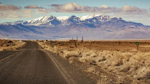
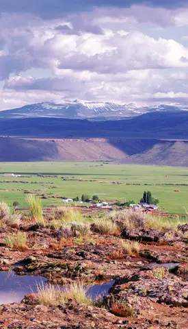
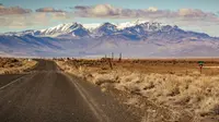
The byway starts in Burns at the junction of Highways 20, 78 and 395 and leaves southbound on Oregon 205. Burns is the county seat of Harney County and its largest town, a ranching place in a county where Travel Oregon puts the density at less than one person per square mile, on par with Alaska. The road runs 127 miles to Fields. The state allows five to seven hours and recommends late spring through fall, though TripCheck notes the road is passable year round. Fuel and supplies come from Burns. South of town, Wright’s Point looks north to the Blue Mountains and south to Steens Mountain, the long wall the road follows most of the day.
Three lakes on the Pacific Flyway
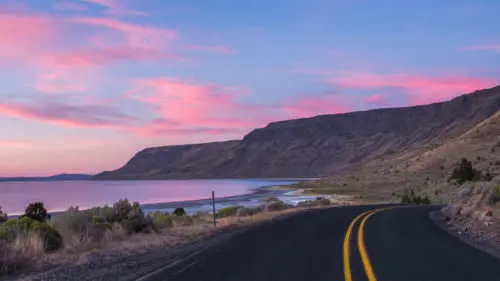
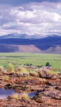
At the Narrows interpretive site, Mud Lake and Harney Lake lie to the west and Malheur Lake to the east. Creeks and rivers carry snowmelt off the high country into the three lakes and into the marshes and meadows around them. This is the Malheur National Wildlife Refuge: 187,757 acres by Travel Oregon’s count, 39 miles wide and 40 long by TripCheck’s, with 320 bird species on the Pacific Flyway. In spring the northern pintails and tundra swans arrive first. Sandhill cranes follow, then large concentrations of snow, Ross’ and white-fronted geese, and Travel Oregon says the snow geese can gather thickly enough to darken the sky. Later, broods of trumpeter swans appear on most refuge ponds, and migrant shorebirds work the mud flats and alkali playas. In fall the greater sandhill cranes stage, or gather, in the southern Blitzen Valley. Winter is the quiet season, with bald eagles and rough-legged hawks.
The Narrows-Princeton Road runs east to refuge headquarters. The visitor center staff there give tips on where to look, an observation deck faces Malheur Lake, and the George Benson Memorial Museum holds historic taxidermy mounts of the birds seen on the refuge. The headquarters stands within a settlement site the Paiute used seasonally for thousands of years. Fifty-eight species of mammals also use the refuge, among them fourteen kinds of bats, cougar and Rocky Mountain elk.
Frenchglen and the Steens
Farther south, Jackass Mountain rises to the west and the road runs beside ancient basalt flows. The Diamond Loop Tour Route turns east toward the lava formations of the Diamond Craters Outstanding Natural Area and the Peter French Round Barn. The barn stands on a low rise in the sagebrush about thirteen miles south of Malheur Lake. It is a covered corral roughly 100 feet across. Its low conical roof of red cedar shingles rests on 29 peeled juniper poles at the rim, a ring of 14 more inside, and a single 25-foot juniper center pole from which 15 diagonal braces radiate. Within, a stone wall about 9 feet high encloses the corral, broken by two gates and 14 wood-framed windows. Leland Roth, writing in the Oregon Encyclopedia, gives the wall as 64 feet across and a foot and a half thick; the Oregon History Project gives sixty feet and two feet. Oregon State Parks keeps it open as the Pete French Round Barn State Heritage Site.
The byway reaches the south end of the Blitzen Valley at Frenchglen, which has fuel and a small general store. The Frenchglen Hotel is an American Foursquare building that still takes lodgers and serves family-style meals, March through October by Travel Oregon’s account. It went up in the mid-1920s, in 1924 by Travel Oregon’s date, to house stockmen who came to buy cattle at the ranch, and the Civilian Conservation Corps remodeled it in 1938. By the 1990s, the Oregon Encyclopedia notes, it had become a base for hunters, sightseers, photographers, hikers, birders, cross-country runners and mountain bikers. East of town at the P Ranch stands the Long Barn, 150 by 50 feet. The Donner und Blitzen River passes close by, and anglers fish it for redband trout, a rainbow trout native to the high desert.
From near the hotel the Steens Mountain Loop Road heads east. It is 59 miles of unpaved road with steep grades and seasonal closures, and Harney County recommends high-clearance vehicles. The road climbs from Page Springs Campground into aspen and juniper. Near Fish Lake Campground is a grove of quaking aspen carved by Basque sheepherders in the early-to-mid 20th century, and it is illegal to touch or cut the trees. East of Fish Lake lies Whorehouse Meadows. The Oregon Encyclopedia says the name came from the buckaroos and sheepmen who spent the seasons on the mountain in the early 1900s, and from the commerce of a few prostitutes. Higher up is the overlook at Kiger Gorge, a broad U cut by glaciers. The Oregon Encyclopedia puts the summit at 9,733 feet, more than 5,000 feet above the Alvord Desert. From the rim, a trail of about 2.4 miles round trip drops into a glacial basin at Wildhorse Lake. The loop comes back down to Oregon 205 about nine miles south of Frenchglen.
The mountain is a fault block more than forty miles long. Basalt laid down in layers between fifteen and eight million years ago was stretched and compressed along north-south faults during the Pliocene, seven to four million years ago, and some of it sank to form the basins the byway crosses next. In June 1831 the Hudson’s Bay Company fur trader John Work recorded the mountain as “covered with snow,” and some early maps called it the Snow Mountains. The Army named it in 1860 for Major Enoch Steen, who skirmished with Northern Paiutes there during the Snake Wars. Maps of the 1870s spelled it Steins.
Catlow Rim to Fields
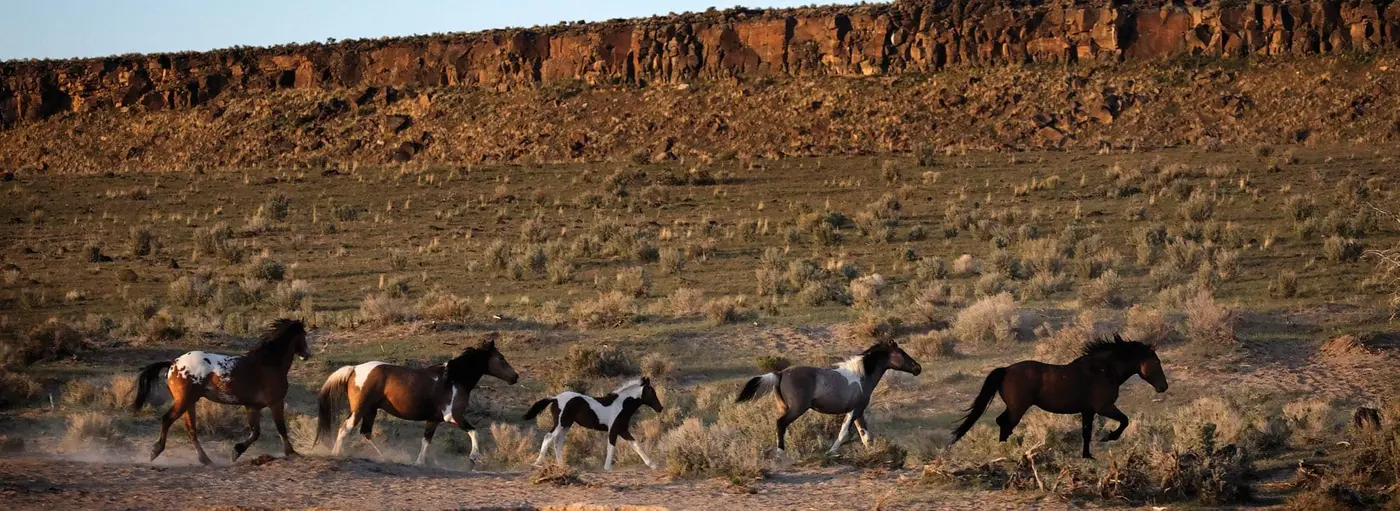
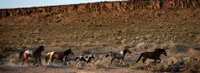
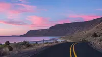
South of Frenchglen a primitive road leaves for the Hart Mountain National Antelope Refuge, 275,000 acres set aside in 1936 as spring, summer and fall range for pronghorn. Oregon 205 then runs along Catlow Rim and down the Catlow Valley past private ranches. Bighorn sheep and wild horses can often be seen from the road. The horses descend from domestic stock that got away from Native Americans, pioneers and twentieth-century ranchers, and the Bureau of Land Management manages them now.
The byway ends at Fields, a ranching town with gas, food and lodging. At the turn of the century, TripCheck says, borax gathered around Borax Lake brought in a significant share of its money. Fields is the staging point for the Trout Creek and Pueblo Mountains and for the Alvord Desert, where the privately owned Alvord Hot Springs is open to the public. The East Steens Tour Route runs north from here back to Burns.
Wada seeds and the P Ranch
When the first Euroamericans arrived, the Northern Paiute held this country. The Wadatika lived near Malheur Lake, and the smaller Tsisi-adi band lived at the cold eastern foot of the Steens and in the Alvord Basin. In 1872 the federal government confined them to the Malheur Reservation. In 1877 President Grant opened the north shore of Malheur Lake to white settlement, which made it nearly impossible for the Paiute to gather the wada seeds they lived on. After the Paiutes joined the Bannock Uprising of 1878, troops marched the survivors 350 miles through the snow to the Yakama Reservation, and in 1879 the Malheur Reservation was abolished.
The cattle had come earlier. TripCheck says word of the grass around present Frenchglen drew stockmen in the 1850s. The town’s name joins two men. Dr. Hugh Glenn ran a large wheat and cattle operation out of Sacramento, and John William “Peter” French came north in 1872 as his agent with 1,000 head. French later married into Glenn’s family. TripCheck says French soon fenced the whole Blitzen River Valley for a herd of more than 40,000. Oregon State Parks counts 70,000 acres and 45,000 cattle by the mid-1880s, and in an 1884 letter French asked for 7,000 head for a ranch of nearly 200,000 acres. He was the first rancher in the area to put up hay, and he ran thousands of sheep for wool.
French and his P Ranch cowhands built the round barn in 1883 or 1884. The cowhands were vaqueros, or Californios, who had come north from the central valley. The ranch foaled nearly three hundred horse and mule colts a year, and in winter the young stock were trained inside the barn for riding and freight hauling. State Parks says horses broken there pulled wagon trains of wool, hay and supplies to market in Oregon City. The juniper came from nearby. The pine lumber is believed to have traveled in French’s own wagons from A.H. Robie’s sawmill on Coffee Pot Creek near Fort Harney, more than thirty-six miles north, though it may have come from the Fort Bidwell mill in California. The ranch had three round barns, and this is the one that survives.
French came to control nearly all the water sources and stream banks in the Blitzen Valley while homesteaders tried to claim the same ground. State Parks records that some said he never legally acquired the land or water rights, and the disputes went to court. In 1897 he was shot over a fence. TripCheck names the homesteader Ed Oliver and says “allegedly.” Nancy Langston, in the Oregon Encyclopedia, writes that French was shot in the back. Travel Oregon says a jury of settlers quickly acquitted the killer. The barn passed to the French-Glenn Livestock Company on what was then the Barton Lake Ranch. The Jenkins family acquired it in the early 1920s and kept grain and equipment in it for decades, then gave the barn and surrounding land to the Oregon Historical Society in 1969. It was listed on the National Register of Historic Places in 1971, and Oregon Parks and Recreation took it over in 1995. The roof has been reshingled in 1918 and 1969, according to the Oregon History Project, and most recently in 2010, according to Roth.
Birds, a court and a byway
After French’s death, speculators cut up his holdings into small parcels, and promises to drain the wetlands for small farms came to nothing. In 1905 William Finley and Herman Bohlman campaigned to save Malheur Lake from market hunting. With the Audubon Society of Portland they persuaded President Theodore Roosevelt in 1908 to set aside the Malheur Lake Bird Reservation “as a preserve and breeding ground for native birds.” The reservation left out the rivers that fed the lakes. In drought years the lake shrank and homesteaders moved onto the dry bed, until the U.S. Supreme Court ruled in 1934 that the land belonged to the refuge. On September 25 of that year, the owners of the former French ranchlands accepted $675,000 for 65,000 acres of the Blitzen valley, water rights included.
Three Civilian Conservation Corps camps worked the refuge from 1935 to 1942, and more than a thousand young men restored wetlands there. John Scharff, a local rancher, managed the refuge from 1935 to 1971 and won over a suspicious valley largely by granting grazing leases. In 1967 he and E.R. Jackman published Steens Mountain in Oregon’s High Desert Country, with photographs by Charles Conkling. Reviewing it in the Eugene Register-Guard, W.L. Wassman wrote: “while you are up there [at the summit] and looking at the five states you may also see all the way to the state of your soul.”
On December 11, 2003, the Bend Bugle reported that the Oregon Transportation Commission had unanimously designated the High Desert Discovery Scenic Byway, along with the Diamond Loop, Steens Loop and East Steens tour routes, bringing the state to 14 scenic byways and nine tour routes. In January 2016 armed insurrectionists occupied the refuge, protesting federal control of Western lands. The occupation lasted forty-one days, cost the federal government more than $9 million, and kept the refuge visitor center closed to the public for more than sixteen months.
Notable Events
- 1831Hudson's Bay Company fur trader John Work recorded that the mountain was covered with snow, and because of this early description it appeared on some early maps as the Snow Mountains. oregonencyclopedia.org
- 1850sWord of lush grassland around present-day Frenchglen attracted stockmen who moved cattle into the region. tripcheck.com
- 1860The U.S. Army named the mountain in 1860 during the conflict known as the Snake Wars, when Major Enoch Steen skirmished with Northern Paiutes there during a patrol. oregonencyclopedia.org
- 1870s1870s maps misspelled the mountain's name as Steins; although the name likely was intended to include a possessive apostrophe, mapmakers did not include it. oregonencyclopedia.org
- 1872French came to Oregon from California in 1872 as an agent of Dr. Hugh Glenn, who had a large wheat and cattle operation based out of Sacramento. oregonhistoryproject.org
- 1880sBy the mid-1880s, Peter French's enterprise had grown to 70,000 acres and 45,000 head of cattle. stateparks.oregon.gov
- 1883The round barn was built by Peter French and his P Ranch cowhands in 1883 or 1884 to provide covered space for training and exercising horses during the winter. oregonencyclopedia.org
- 1897After French's death in 1897, ownership of P Ranch passed to the French-Glenn Livestock Company, on what was then called the Barton Lake Ranch. oregonencyclopedia.org
- 1897Peter French was fatally shot over a fence dispute; his killer was quickly acquitted by a jury of settlers. traveloregon.com
- 1908Oregon conservationists persuaded President Theodore Roosevelt in 1908 to establish Malheur Lake Bird Reservation on unclaimed government lands encompassed by Malheur, Mud, and Harney Lakes as a preserve and breeding ground for native birds. oregonencyclopedia.org
- 1918The barn's roof has been reshingled at least twice, once in 1918 and again in 1969. oregonhistoryproject.org
- 1920sIn the early 1920s, the barn was acquired by the Jenkins family, who used it for several decades for grain and equipment storage. oregonencyclopedia.org
- 1920sThe historic Frenchglen Hotel was built in the mid-1920s. tripcheck.com
- 1924The Frenchglen Hotel originally provided overnight lodging for stockmen visiting the ranch to buy cattle. traveloregon.com
- 1934In 1934 the U.S. Supreme Court ruled that the drying lakebed lands belonged to the wildlife refuge, though tensions over contested ownership simmered well into the twenty-first century. oregonencyclopedia.org
- 1935Three Civilian Conservation Corps camps operated on the Malheur Refuge from 1935 until 1942, and more than a thousand young men provided the labor for wetland restoration and habitat improvement along the byway's refuge section. oregonencyclopedia.org
- 1936275,000 acres of high-desert habitat were set aside for pronghorn antelope range. tripcheck.com
- 1938The Civilian Conservation Corps remodeled the Frenchglen Hotel in 1938. traveloregon.com
- 1967E.R. Jackman and John Scharff published a coffee-table book, Steens Mountain, in Oregon's High Desert Country, which reproduced evocative photographs by Charles Conkling, and interest in visiting the remote desert landscape grew. oregonencyclopedia.org
- 1969The Jenkins family stored grain and equipment in the barn for many years before donating the structure and surrounding lands to the Oregon Historical Society in 1969. oregonhistoryproject.org
- 1995The Oregon Parks and Recreation Department assumed ownership and management responsibilities of the site in 1995. oregonhistoryproject.org
- 2003With these new designations Oregon now has 14 scenic byways and nine tour routes. web.archive.org
- 2010The barn's cedar-shingle roof has been re-shingled three times, most recently in 2010. oregonencyclopedia.org
- 2016Armed insurrectionists occupied the refuge, decrying federal control over Western lands; the forty-one-day occupation cost the federal government over $9 million and shut the refuge visitor center to the public for more than sixteen months. oregonencyclopedia.org
- A grove of quaking aspen near Fish Lake Campground on the Steens Loop carries historic carvings, arborglyphs, left by Basque sheepherders. thisisharney.com
People
- Herman Bohlman, Oregon conservationist who with William Finley campaigned to save Malheur Lake, leading to the refuge the byway runs through (1905).
- John Scharff, Local rancher and manager of the Malheur Wildlife Refuge from 1935 to 1971 who turned local suspicion of the refuge into acceptance largely by granting refuge grazing leases (1935 to 1971).
- William Finley, Oregon conservationist whose 1905 campaign to save Malheur Lake, with Herman Bohlman and the Audubon Society of Portland, led to the refuge the byway crosses (1905).
- A.H. Robie, Operated the Coffee Pot Creek sawmill near Fort Harney whose lumber, hauled by French's own freight wagons, is believed to have built the barn.
- Peter French, Dr. Hugh Glenn's employee and eventual son-in-law, sent from California to expand their cattle operations (1897).
- Enoch Steen, Army major whose 1860 skirmish with Northern Paiutes during the Snake Wars gave Steens Mountain, the byway's eastern wall, its name (1860).
- John Work, Hudson's Bay Company fur trader whose 1831 note that the mountain was covered with snow produced its early map name, Snow Mountains (June 1831).
- Dr. Hugh Glenn, Successful rancher for whom Frenchglen is partly named.
- Ed Oliver, Homesteader who allegedly shot Peter French and was acquitted (1897).
- Hugh Glen, Wealthy California stock owner and Peter French's father-in-law (1872).
- John W. "Peter" French, California stockman who expanded a cattle herd in the Blitzen River Valley (1872).
Sources
- tripcheck.com/Pages/Scenic-Byways-High-Desert-Discovery
- traveloregon.com/things-to-do/trip-ideas/scenic-drives/high-desert-discovery
- web.archive.org/web/20140524071922/http://www.bendbugle.com/tag/top-stories/page/561
- oregonencyclopedia.org/articles/steens_mountain
- oregonencyclopedia.org/articles/malheur_national_wildlife_refuge
- thisisharney.com/from-steens-mountain-to-the-alvord-desert
- oregonencyclopedia.org/articles/peter_french_round_barn
- oregonhistoryproject.org/articles/historical-records/french-round-barn
- stateparks.oregon.gov/index.cfm?do=park.profile&parkId=209
- nsbfoundation.com/sb/high-desert-discovery-scenic-byway