Galice-Hellgate Back Country Byway
Galice, Oregon. Back country byway; Open year round.
Details
- Where
- Galice, OR. No street address stated. Directions
- Getting there
- From Grants Pass, Oregon take I-5 north to the Merlin exit. The byway begins as you exit the freeway and travel the Merlin-Galice Road west. Four miles into the route you will travel through the town of Merlin.
- Fees
- No fees.
- Access
- Allow 1-2 hours to visit the byway.
- Phone
- 541-618-2200
- Website
- blm.gov
- Managed by
- Medford District Office, Bureau of Land Management.
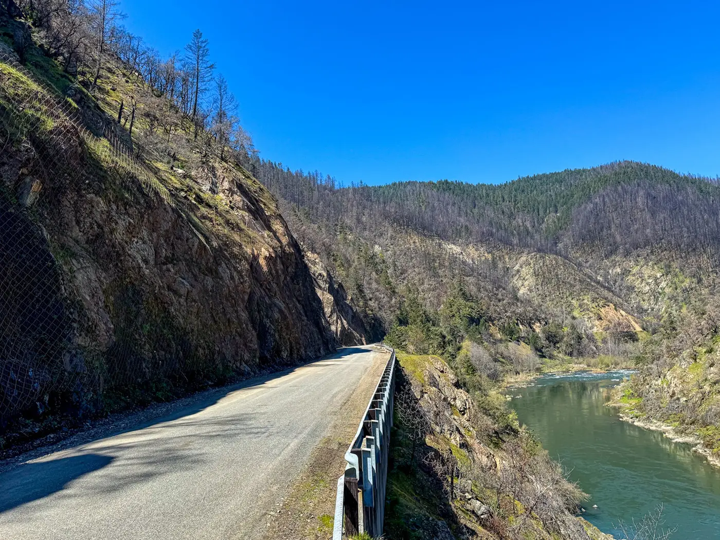
The byway begins at the Merlin exit off Interstate 5 north of Grants Pass. From the ramp the Merlin-Galice Road runs west and passes through the town of Merlin four miles in. From there it continues as a narrow, winding, paved road that a passenger car can travel. The Bureau of Land Management’s Medford District Office manages the route and gives its length as 40 miles one way, 80 round trip. The Federal Highway Administration’s byway listing gives 39 miles and allows one to two hours. Part of the road is a single lane with occasional turnouts, and the BLM asks for particular caution on the Galice Access Road. The road is open all year and charges no fee. The FHWA page calls Merlin the Gateway to the Wild and Scenic Rogue River and names it as the place to pick up supplies.
The overlook at Hellgate
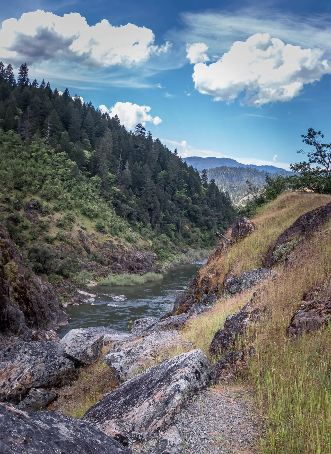
About ten miles west of Merlin, by the reckoning of Dr. Tom Atzet in a 2017 piece for the Southern Oregon Land Conservancy, the road reaches the Hellgate Canyon Viewpoint. It is a pullout with an informational sign above what Atzet calls the deepest gorge on the Rogue, more than 200 feet down. From the overlook he lists the canyon, its rock, a peek at the east end of Indian Mary Park, and the new bridge. The bridge is new because the old one was smashed in the Christmas flood of 1964. In that flood the river, measured above the Illinois River at Agness, reached nearly 300,000 cubic feet per second.
The canyon walls are serpentine and greenstone, rocks Atzet says are often associated with deep-seated faults. Across the canyon, metamorphosed marine sediments of the Galice Formation sandwich the serpentine. The iron- and magnesium-rich soils can be toxic, and he names the trees that commonly survive them: incense-cedar, Jeffrey pine, Port-Orford-cedar and Pacific madrone. Douglas-fir and ponderosa pine are less tolerant and keep to the Galice sediments. White and greenleaf manzanita grow mixed with pine mat manzanita, “not much taller than a shag rug.” Iris adds color in spring, and rock fern makes a sparse ground cover.
Chinook salmon and steelhead use the canyon to reach the upper Rogue, and local trout linger. Atzet writes that the Hog Creek boat landing, a quarter mile upstream, is usually busy, and that fishermen line the nearby banks. This reach lies in what the BLM calls the Hellgate Recreation Area, 27 miles of river from the mouth of the Applegate to Grave Creek. It has 11 boat ramps and Class I and II rapids, and private parties need no permit to boat it. Outfitters run guided float trips, fishing trips, jet boat trips, shuttles and equipment rentals. The Oregon Encyclopedia dates commercial jet boat excursions through the Hellgate section to the 1970s.
On the canyon’s name, Atzet notes that Zane Grey occasionally occupied a cabin on the mid Rogue in the twenties and thirties, “presumably navigating Hellgate for access.” He adds: “But getting past Rainie falls and Blossom bar is likely what gave Hellgate its name.” He also credits Meryl Streep and Kevin Bacon’s roles in The River Wild, about twenty years before he wrote, with making the canyon famous. The federal rivers site says the film shot some footage on the Rogue near Medford but staged its big rafting scenes on Montana’s Kootenai River.
Rand, Grave Creek and the climb into the Siskiyous
The Smullin Visitor Center stands 18 miles into the route at the Rand National Historic Site. It has restrooms and information about the area, and it issues the permits for the river’s wild section. Farther on, at Grave Creek, the byway meets the Rogue River National Recreation Trail, which the BLM gives as 40 miles long. The Takelma developed the trail, and miners and settlers improved it as they moved deeper into the canyon.
Grave Creek is also the put-in for the Wild Rogue, 32.4 miles of Class III water with a few Class IV rapids, running to Watson Creek. Boaters usually take three to four days to float it, and hikers take five. Foster Bar is the take-out. Private and commercial parties alike need a permit, and float permits are allocated competitively from May 15 to October 15. The federal rivers site says black bears, deer, otters, great blue herons and ospreys are commonly seen along the river looking for a meal of salmon.
The FHWA describes a portion of the route where the road climbs away from the river into the Siskiyou Mountains, with views of nearby peaks and stands of Douglas fir. Beyond the end of the byway the country is remote and has no services. The BLM advises a full tank of gas, a first aid kit, food and water for anyone going on, and warns that the roads past the byway are often closed in winter by snow.
Galice, a store and a deck
Services along the byway are in Galice. The Galice Resort calls the town the rafting hub of the Rogue, and its business is a store, restaurant, overnight lodging, whitewater rentals and shuttles. The resort’s page lists a season from May 18 through September 29, with live music on Friday, Saturday and Sunday evenings and food trucks on the same days. One reviewer quoted on the site wrote, “There are few places more peaceful than the deck at the Galice Resort Restaurant.”
The town is older than the deck. The resort’s history gives 1852 as Galice’s official founding, when it was called Galiceburg. That settlement stood a short distance up Galice Creek from Skull Bar, or Lower Town, at the creek’s mouth. The present community sits downstream from the creek, above the river. The name comes from Louis Galice, a French miner in the first group of gold prospectors. Rich placer finds brought large numbers of miners, and later women and children. By 1854 the Galice Mining District had formed, the third mining district in southern Oregon. One of the largest historic mines in southern Oregon, the Old Channel, is in the area. The federal rivers site says gold mining in the Rogue Canyon was extensive but its overall production low, and that pipe, flumes, trestles and stamp mills can still be found.
Until 1911 the road through Galice was narrow and full of chuckholes, dusty in summer and muddy in winter, with very few turnouts. Horses and wagons brought in all the supplies and crossed the river on the Massie Ferry, near the present Indian Mary Park. The first Hellgate Bridge was built for automobiles in 1916. Logging and a lumber mill were important in the 1950s and 1960s.
In 1979 two women, Annie and Arlene, sold the Galice property to another couple. Mary Lou and Gilbert “Gil” Thomason bought it from that couple in 1981, when the resort was a tiny store and restaurant combined. That first year the Thomasons held a barbecue in the street out front. “That first BBQ featured steaks, corn and watermelon—and it was a surprising success!” Mary Lou says. They also bought six rafts, and only one day that year were all six rented. “And we thought THAT was BIG business!” A friend told them, “You’ll starve out there…”
The next year they added a small deck so diners could see the river, and they kept building as the business grew. The cabins and the Cottage date from 1945 and were built with materials from an old local schoolhouse. Four still older cabins stood by the present boat shed until the 1964 flood washed them away. The bunkhouse went up in 1982 for storage and became lodging a couple of years later. The lodge followed in 1991. Annie and Arlene built the Riverview House after their sale and later sold it to Debbie Thomason. Gil Thomason died in March 2011. “Gil was a visionary,” Mary Lou says. The resort’s history page says she still runs the Galice Lodge and that Debbie owns and operates the corporation.
The river of rogues
People entered the Rogue drainage at least 10,000 years ago, according to historian Jeff LaLande in the Oregon Encyclopedia. In more recent centuries the Takelma lived from near the Table Rocks to well below Grants Pass. Runs of Chinook and coho salmon and steelhead were their most important source of protein, and they traveled in dugout canoes made of sugar pine. Early written accounts give “Trashit” as one Native name for the river. The first non-Native known to reach it was Hudson’s Bay Company trader Alexander Roderick McLeod, who came to the north bank of the lowermost Rogue on January 11, 1827. He wrote that his guides called it “Toototenez.” By the 1830s, after episodes of conflict with the Takelma, the company’s French Canadian trappers were calling it “Riviere des Coquins,” the river of rascals, or rogues, which gave the river its present name.
The 1850s brought Oregon’s first gold rush to this country. The federal rivers site says conflicts between settlers and Native Americans culminated in the 1855–56 Rogue River “Indian War,” after which Native people were relocated to reservations. In 1869 William Windsor built a small boat and made the first successful passage down the lower river from Grants Pass. LaLande says Windsor apparently had no other purpose than to be first. In the 1920s Zane Grey promoted the Rogue as a fly-fishing river, and President Herbert Hoover and Clark Gable fished it as well. Oregon banned commercial fishing on the Rogue in 1935.
On October 2, 1968, the Rogue became one of the original eight rivers designated under the Wild and Scenic Rivers Act. The designation covers 84 miles, from the mouth of the Applegate to the Lobster Creek Bridge, and the BLM’s Medford District administers the first 47. The same stretch is also an Oregon State Scenic Waterway. On March 12, 2019, Congress added 119 miles of tributaries to the Rogue Wild and Scenic River, among them Booze Creek, Rum Creek and Whisky Creek.
Notable Events
- 1854The Galice Mining District was formed, making it the 3rd mining district in southern Oregon. galice.com
- 1855Conflicts between white settlers and Native Americans culminated in the war, after which Native Americans were relocated to reservations. fws.gov
- 1916The first Hellgate Bridge was built for automobile travel. galice.com
- 1964Maximum discharge measured above the Illinois River at Agness reached nearly 300,000 cfs. oregonencyclopedia.org
- 1968The Rogue River was one of the original eight rivers designated by Congress under the Wild and Scenic Rivers Act, Public Law 90–542. blm.gov
- 2019Congress designated an additional 119 miles of numerous tributaries for management as part of the Rogue Wild and Scenic River under Public Law 116-9. blm.gov
People
- Louis Galice, French miner in the first group of gold prospectors; the town of Galice received its name from him.
- Zane Grey, Western writer who promoted the Rogue as an excellent fly-fishing river (1920s).