Flaming Gorge-Uintas Scenic Byway
Manila, Daggett County, Utah. National Scenic Byway.
Details

- Where
- Manila, Daggett County, UT. No street address stated. Directions
- Season
- Year-round; ice and snow may create hazards during winter.
- Getting there
- From Vernal, drive north on US-191; at US-191 and SR-44, either branch is part of the byway. SR-44 leads to Manila, while US-191 passes Dutch John and ends at the Utah-Wyoming border.
- Fees
- There are no fees along the byway proper.
- Access
- All roads are paved, in excellent condition, and appropriate for all vehicles; snow can be a problem in winter.
- Phone
- 800-477-5558
- Website
- recreation.gov
- Managed by
- Department of Transportation.
- Coordinates
- 40.455761, -109.528530.
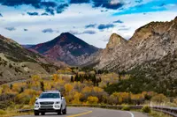
About three and a half miles north of the center of Vernal, on the right side of US 191, a small information board reads “Drive Through the Ages Geological Tour.” It holds a route description and a brochure for the signed formations ahead. Just beyond it, four blue-and-white geological signs come up one after another, the first of many, and later signs mark each place where the road passes from one formation into the next. The Drive Through the Ages was the route’s old name. It is now the Flaming Gorge-Uintas National Scenic Byway. It runs over the eastern flank of the Uinta Mountains, through the Ashley National Forest and Flaming Gorge National Recreation Area, and ends at Manila on Utah Highway 44.
The sources give different lengths. The Federal Highway Administration lists 82 miles and allows two hours, counting the backtrack on Highway 44. Visit Utah’s byway page gives 125 miles and “2+ hours.” Its driving guide, adapted from Scenic Driving Utah, counts at least 150 miles as a round trip from Vernal and at least five hours with stops. At Greendale Junction the road forks. The guide says the state-designated route takes the west branch, Highway 44, to Manila. Recreation.gov and the Forest Service count the east branch as well: US 191 over Flaming Gorge Dam, past Dutch John, to the Utah-Wyoming border. There are no fees on the byway itself. The roads are paved, and the main road is kept clear all year, though snow can be a problem in winter.
The byway’s theme is “Wildlife Through the Ages.” The Forest Service counts 14 interpretive sites along the road. Visit Utah counts 15 interpretive sites and nature trails, and Daggett County lists four nature trails. Visitor information is also available at the Northeastern Utah Visitor Center in Vernal, at the dam, and at the Forest Service office in Manila. The route also has a TravelStorys audio tour.
From Steinaker Reservoir to the county line
Steinaker Reservoir appears on the left. The country around it is sage-covered at first, then wooded toward the north end of the lake. There a sign marks the Jurassic Morrison formation, which the driving guide calls “the graveyard of the dinosaurs for which Vernal is famous.” The Forest Service says the drive begins among the Frontier, Morrison, and Chinle formations, whose rocks hold dinosaur bones and tracks, sharks’ teeth, fish scales, and seashells. It also describes rock art and trails left by Indians who used Brush Creek as a travel corridor to better hunting grounds. About four miles past the reservoir is Red Fleet State Park. A short paved road there leads to the start of a 2.5-mile hike to dinosaur tracks on the lake’s sandstone shore.
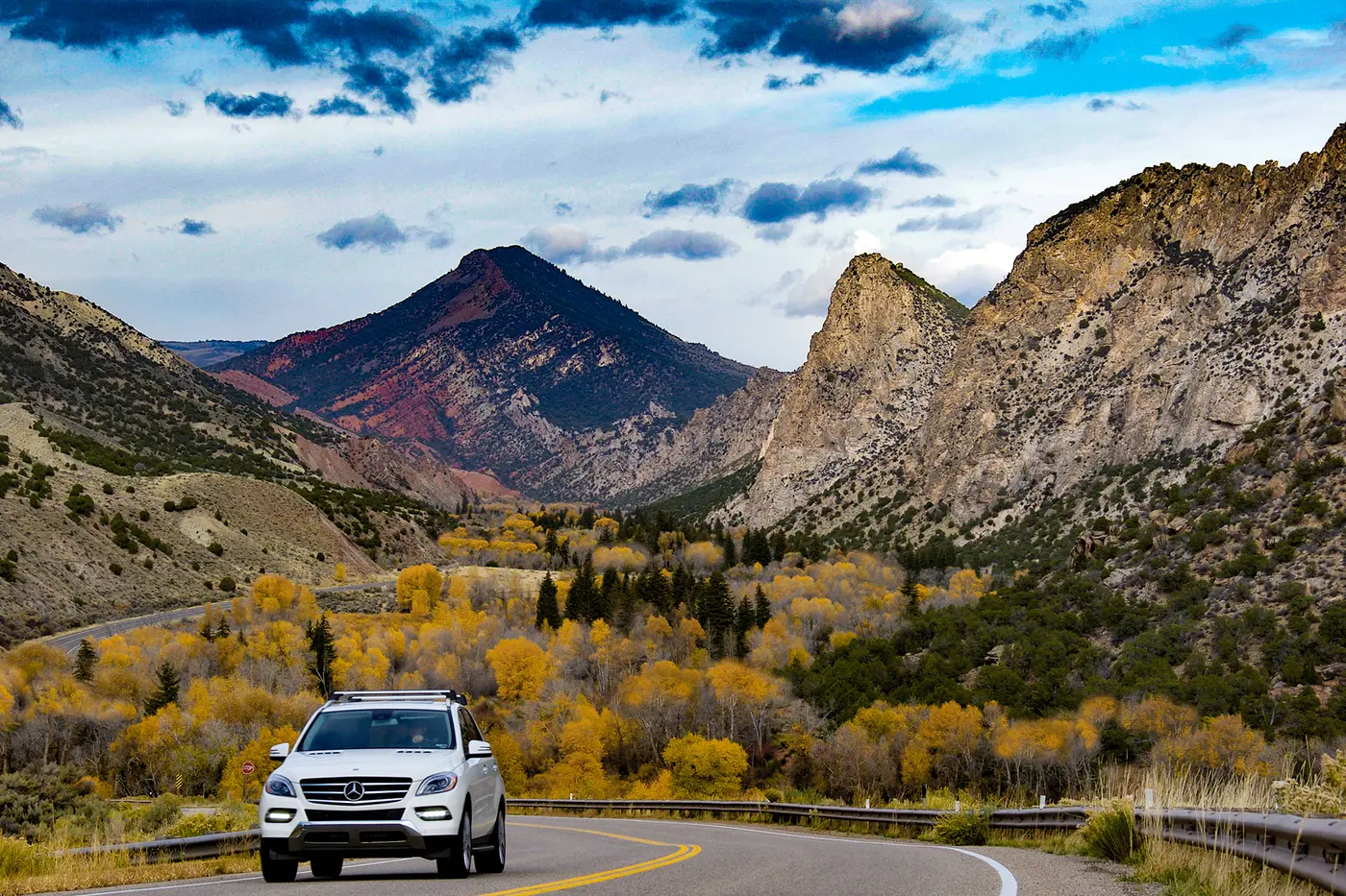
Fourteen miles north of Vernal, Forest Road 018 branches west as the Red Cloud/Dry Fork Scenic Backway. Around mile 17 the sagebrush flats give way to pinyon and juniper, and a few miles farther aspen lines the road. The Uintah-Daggett county line, at 8,428 feet, is the high point of the drive. In the Forest Service’s account, elk and deer here walk over the sands of ancient seas. Wintering herds shelter in the sagebrush and pinyon-juniper, and the higher forests hold moose, black bear, marmots, snowshoe hare, golden eagles, and goshawks.
The rock beneath tells a longer story. The Uintas formed about 70 million years ago, when a massive upheaval bent the rock layers into an elongated dome. Erosion has since removed the top, exposing the edges of the folded layers. Near the recreation area the road reaches what Daggett County calls the “one billion year old exposed core” of the range. Visit Utah says the exposed formations span 770 million years of geologic history. The road enters the recreation area about 33 miles north of Vernal, and Greendale Junction lies a mile and a half beyond.
Red Canyon, Sheep Creek, and the descent to Manila
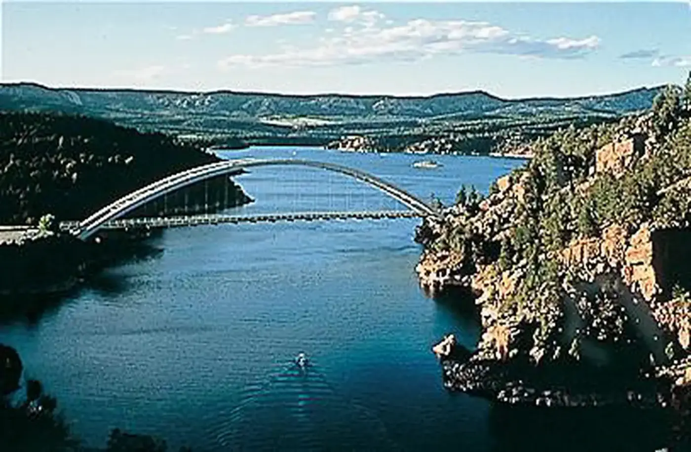
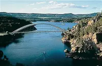
About three miles west of the junction on Highway 44, a side road turns off to Red Canyon. A mile up is Red Canyon Lodge, with a restaurant, cabins, groceries, gas, horseback rides, and a kids’ fishing pond. The road ends three miles in at Red Canyon Overlook. The overlook stands 1,700 feet above the reservoir on cliffs that drop almost vertically, and from there the water shows in deep blues and greens.
About twelve miles of forest driving farther, just past Deep Creek Campground, is the south end of the Sheep Creek loop. A turnout two miles beyond overlooks the start of the long descent to Manila. Daggett County gives the loop as thirteen miles along the Uinta Fault. The driving guide calls it a fifteen-mile side trip, with its north entrance just under six miles south of Manila.
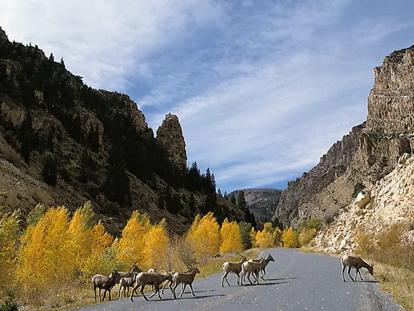
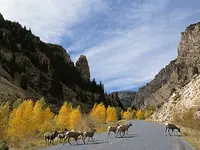
Two miles up Sheep Creek Road, on a hill, is the grave of Cleophas Dowd (1857–97). Dowd homesteaded here from 1885 until 1897, when his associate Charles Reaser killed him. Two of his children are buried beside him. Past Sheep Creek Ranch, where llamas may be grazing, the road enters the Sheep Creek Geological Area. The Uinta Crest Fault split the canyon and exposed 18 distinct layers of strata. Along the fault, spikes and wavy bands of rock jut from the canyon floor. The Forest Service compares the formations to city skyscrapers. Rocky Mountain bighorn sheep frequent the canyon, and the county reports recently released wild turkeys. According to the Forest Service, the cottonwoods and willows above the creek harbor more species of migrating songbirds than any other spot in Utah.
Just under mile ten, a rough road climbs to the Ute Tower Fire Lookout. The Civilian Conservation Corps built it, and it served from 1937 until 1968, when fire-spotting planes largely replaced towers. Newly refurbished, it is the last of its kind in Utah. A 17-mile spur winds through forest and meadow to Spirit Lake, and the backway closes in winter.
The Forest Service ends its account in the Mancos and Hilliard shales near Manila and Antelope Flat, “the remains of an ancient sea,” where antelope and jackrabbits now wander. Manila was settled in 1898, the year Admiral Dewey captured Manila in the Philippines, and took its name from that action. It incorporated in 1958, amid growing pains from the influx of workers on the Flaming Gorge project. Manila is the seat of Daggett County, which broke off from Uintah County in 1918. The county is named for Ellsworth Daggett, who helped develop irrigation in the area. It counted 935 people in the 2020 census and has no stoplights. In 1978 the old courthouse at Manila was moved brick by brick to make way for a new one.
Across the dam to Dutch John
On the east branch, half a mile north of the junction on US 191, a dirt road of a mile and a quarter leads to Swett Ranch. Oscar Swett homesteaded the land in 1909 and worked it for 58 years. He sold it in 1968, and the Forest Service bought it in 1972 to preserve as a traditional Utah family ranch.
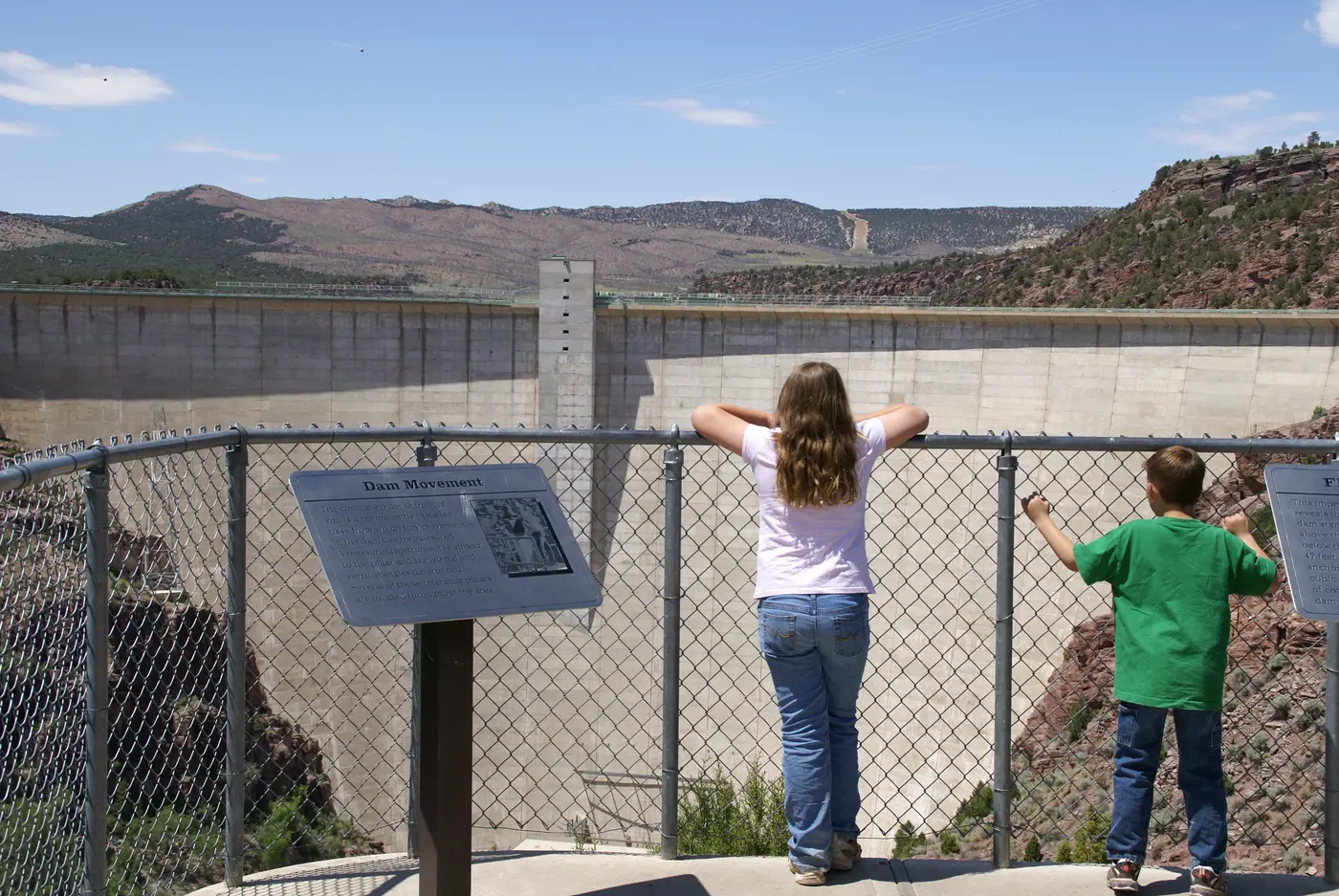
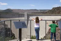
A little more than five miles on is the visitor center at Flaming Gorge Dam. The dam is a 502-foot thin-arch concrete structure on the Green River, about 32 miles below the Utah-Wyoming border, and its crest runs 1,285 feet. Daggett County describes a guided tour. The driving guide describes a self-guided tour that ends at an overlook of the bottom of the dam and the river beyond it. A dedication marker beside the road names Floyd E. Dominy, Commissioner of Reclamation, and Stewart L. Udall, Secretary of the Interior, in 1964. Below the dam, the Green is a blue-ribbon trout fishery. Above it the reservoir reaches as far as 91 miles. Its Utah end is canyon, bench, and forest, and its Wyoming end is low hills, shale badlands, and desert shrubs. A lake trout of 51.8 pounds, a record, was caught there in 1988.
Dutch John lies about two miles northeast of the dam. The Bureau of Reclamation says the Secretary of the Interior founded it in 1958 to house dam workers and named it for a pioneer settler. The driving guide gives 1957. Reclamation managed the town until 1998, and it incorporated in 2015. A marker there honors William H. Ashley, the namesake of the national forest. About twelve miles past the dam, a viewpoint beyond Antelope Flat looks back toward the gorge that gave everything here its name.
“A flaring, brilliant red gorge”
On May 24, 1869, Major John Wesley Powell and nine men set out from Green River, Wyoming, in small wooden boats. On May 27 they reached the Uintas. In the Bureau of Reclamation’s telling, the sun’s reflection off the red rock made the gorge look from a distance as if it were on fire. Powell wrote: “The river enters the range by a flaring, brilliant red gorge that may be seen from the north a score of miles away.” He went on: “This is the head of the first of the canyons we are about to explore... We name it Flaming Gorge.”
The sources explain the color differently. The Utah Geological Survey identifies the rocks as the vermilion Triassic Moenkopi and Chinle formations, overlain by buff-gray Nugget Sandstone. The driving guide credits red quartzites and red shale. Utah Place Names, as cited by the Salt Lake Tribune, puts the actual Flaming Gorge at the head of Horseshoe Canyon.
Powell found someone else’s mark already on the river. In April 1825, William Ashley and his trappers floated the Green from north of the Uintas, the first recorded float of the river. At the rapid later called Ashley Falls, Ashley painted his name on a rock above the water. Powell noted it in 1869 while lining his boats around the falls. The marker at Dutch John tells what followed. After a nearly disastrous boat trip, Ashley traded the Utes for horses, crossed the Uintas, and met Jedediah Smith and other trappers on Henry’s Fork. That summer some 1,000 mountain men and Indians traded and celebrated there for several days. The rendezvous became an annual event for the next 15 years.
The canyons under the reservoir
The dam grew out of the 1922 Colorado River Basin Compact, which divided the river’s water between upper and lower basins. On April 11, 1956, Congress passed the Colorado River Storage Project Act to pay for this dam and others. In 1957 and 1958, Green River, Wyoming, marked the start of construction with “Flaming Gorge Days.” Residents wore old-time clothes and the men grew beards, “the hirsute male custom of range and mining days,” as the paper Wyoming Trails put it. According to the Bureau of Reclamation’s history, construction temporarily tripled the population of Daggett County.
Work began in June 1958, and the last bucket of concrete was placed on November 15, 1962. The sources date the dam’s completion variously: 1962 in the Salt Lake Tribune, 1963 in the Utah History Encyclopedia, 1964 in WyoHistory.org. The reservoir began filling on December 10, 1962. President John F. Kennedy started the first generator on September 27, 1963.
On August 17, 1964, Lady Bird Johnson dedicated the dam and then ate buffalo barbecue in Green River. After Labor Day that year, a headline in the Green River Star read “26,000 Visitors in Flaming Gorge Area on Weekend.” Fewer than 4,000 people lived in Green River at the time. Congress created the national recreation area on October 1, 1968. In 1984, record floods on Colorado River tributaries were held in this reservoir and in Lake Powell instead of reaching the towns downstream. The road itself was designated in stages: segments as the Ashley National Forest Scenic Byway in 1988, the current route as a Utah State Scenic Byway in 1990, and a National Scenic Byway in 1998.
The water covered a stretch of the Green that few had seen. “Flaming Gorge was the place no one really knew,” the river runner and historian Roy Webb told the Tribune. “It was known only by the people who floated it, a few river runners and [Flaming Gorge] historian Bill Purdy.” Webb’s research describes big rapids and currant bushes along the banks. He reports that Purdy and a ranger once counted almost 1,000 elk at Hideout Flat in a single winter. “The only objections were from people getting displaced from the ranches along the river,” Webb said.
In the 1960s, University of Utah professor Jesse Jennings directed an archaeological and historical survey of the land to be flooded. Linwood, home to about 100 people and the Bucket of Blood Saloon, was the only town of any size lost to the reservoir, and most of it was bulldozed. Uncle Jack Robinson’s cabin, built by a fur trapper in the 1840s, was moved to an area near Green Lakes, making it one of Utah’s oldest surviving structures.
The Bureau of Reclamation hired Alonzo Jarvie, a local man, to work with his former neighbors. Houses had to be moved or destroyed, and owners were paid and offered help to relocate. One story from that time concerns Minnie Rasmussen, a longtime resident and the last rancher to leave Linwood. She invited Jarvie and the contractors to tea and told them she would consider their offers. That night she burned down her own house.
Notable Events
- 1776In September 1776 the friars Dominguez and Escalante and their companions crossed the Green River on their way to the Utah Valley, in the earliest written account of Utah's landscape. historytogo.utah.gov
- 1825William Ashley, heading down the Green River looking for beaver, stopped at the rapid later known as Ashley Falls and painted his name on a rock above it, which Powell noted in 1869. archive.sltrib.com
- 1825By the time Ashley floated the Green in 1825 the name Green River was already in common use; the river had been the Rio de San Buenaventura, then the Rio Verde, and for a time the Spanish River. historytogo.utah.gov
- 1825Ashley and his party set out to join Jedediah Smith and other mountain men trapping beaver along the Green River; about 1,000 mountain men and Indians traded and celebrated on Henry's Fork, beginning a rendezvous tradition that ran 15 years. hmdb.org
- 1840sUncle Jack Robinson's cabin, built by a fur trapper in the 1840s, was moved to an area near Green Lakes before the reservoir filled, making it one of Utah's oldest surviving structures. archive.sltrib.com
- 1869Explorer John Wesley Powell named the canyon Flaming Gorge after viewing the sun reflecting off the red rocks. usbr.gov
- 1898The town at the western end of the byway was settled the same year Admiral Dewey captured Manila in the Philippines, and was named Manila after that action. manilautah.com
- 1918The county the byway runs through broke off of Uintah County in 1918 and was named for Ellsworth Daggett. daggettcounty.gov
- 1922Construction of the dam the byway crosses was motivated in part by the 1922 Colorado River Basin Compact, an agreement among the states along the Colorado River. wyohistory.org
- 1956On April 11, 1956, Congress passed the Colorado River Storage Project Act to fund the dam and other projects. wyohistory.org
- 1957In 1957 and 1958, to commemorate the start of the dam's construction, residents of Green River, Wyoming, celebrated Flaming Gorge Days in old-time clothes with beards. wyohistory.org
- 1958Manila became an incorporated town in 1958; the town had suffered growing pains from the influx of workers associated with the Flaming Gorge project. manilautah.com
- 1958Construction of Flaming Gorge Dam, part of the Colorado River Storage Project, began in June 1958; the last bucket of concrete was placed on November 15, 1962. usbr.gov
- 1964The dam was dedicated on August 17, 1964, by former First Lady Claudia "Lady Bird" Johnson. usbr.gov
- 1964Locals looked forward to more tourism, which arrived as predicted; after Labor Day of the dedication year, headlines boasted 26,000 visitors in the Flaming Gorge area on one weekend, at a time when fewer than 4,000 people lived in the town of Green River. wyohistory.org
- 1968The Flaming Gorge National Recreation Area was established by Congress in October 1968. usbr.gov
- 1978The existing courthouse at Manila was moved brick by brick to make way for the newly dedicated Daggett County Courthouse. manilautah.com
- 1984In 1984 heavy rains brought floods to Colorado tributaries that broke records dating back to 1897, and water was trapped in Flaming Gorge Reservoir and Lake Powell instead of damaging communities downstream. wyohistory.org
- 1988Segments of the route were first designated as the Ashley National Forest Scenic Byway. travel.utah.gov
- 1998The byway was designated a National Scenic Byway by the U.S. Secretary of Transportation because of its natural intrinsic qualities. travel.utah.gov
- 2015Dutch John, the town beside the dam on the byway, was incorporated in 2015. daggettcounty.gov
People
- Bill Purdy, Flaming Gorge historian said to be among the few who knew the Green River canyons before the reservoir.
- Ellsworth Daggett, helped develop irrigation in the area; Daggett County, which the byway crosses, is named for him.
- William H. Ashley, early fur trader and trapper for whom the Ashley National Forest, which the byway crosses, was named.
- Floyd E. Dominy, Commissioner of the Bureau of Reclamation named on the Flaming Gorge Dam dedication marker beside the byway (1964).
- Stewart L. Udall, Secretary of the Interior named on the Flaming Gorge Dam dedication marker beside the byway (1964).
- Admiral Dewey, his 1898 capture of Manila in the Philippines gave the byway's endpoint town its name (1898).
- Claudia "Lady Bird" Johnson, former First Lady who dedicated Flaming Gorge Dam (1964).
- John Wesley Powell, explorer who led the 1869 expedition down the Green and Colorado rivers and named Flaming Gorge (1869).
- Alonzo Jarvie, area resident hired by the Bureau of Reclamation to work with his former neighbors whose property would be flooded.
- Jesse Jennings, University of Utah professor who directed the archaeological and historical survey of the land the reservoir would flood (1960s).
- Minnie Rasmussen, longtime resident said in one story to have been the last rancher to leave the flooded settlement of Linwood.
Sources
- visitutah.com/things-to-do/road-trips/scenic-byways
- visitutah.com/places-to-go/parks-outdoors/flaming-gorge/scenic-driving
- fs.usda.gov/r04/ashley/recreation/epic-adventures/scenic-byways-and-backways
- daggettcounty.gov/191/Scenic-Drives
- fhwaapps.fhwa.dot.gov/bywaysp/byway/2008
- recreation.gov/gateways/13646
- wyohistory.org/encyclopedia/flaming-gorge-dam-and-reservoir
- historytogo.utah.gov/post/green-river
- hmdb.org/m.asp?m=149084
- manilautah.com/tourism/history-of-manila
- archive.sltrib.com/article.php?id=53972285&itype=cmsid
- travel.utah.gov/wp-content/uploads/CMP_Update_FlamingGorge_Utah-1.pdf
- usbr.gov/uc/rm/crsp/fg
- geology.utah.gov/map-pub/survey-notes/powell-1869-river-journey