Feather River Scenic Byway (Highway 70)
Quincy, Butte, Plumas and Lassen Counties County, California. Scenic byway.
Details

- Where
- Quincy, Butte, Plumas and Lassen Counties County, CA. No street address stated. Directions
- Season
- Particularly stunning in the spring, when vibrant green surrounds nearly 100 waterfalls, and in the fall the steep mountainsides are ablaze with orange and red oak trees.
- Getting there
- From the west, it starts eight miles north of Oroville on Highway 70, winds through the Feather River Canyon, connects with Highway 89 on through Quincy to Blairsden/Graeagle, resumes as Highway 70 through Portola, drops down onto the Sierra Nevada eastern slope.
- Fees
- There are no fees to drive the byway itself.
- Access
- Site Open.
- Phone
- 530-534-6500
- Website
- fhwaapps.fhwa.dot.gov
- Managed by
- Feather River Ranger District.
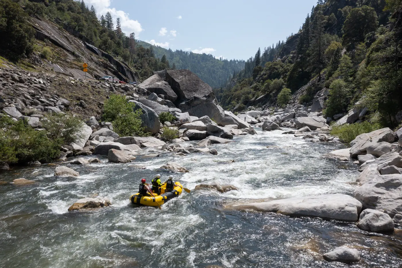
Eight miles north of Oroville, Highway 70 leaves the valley and enters the canyon of the North Fork of the Feather River. For about 60 miles the road keeps to the bottom of a gorge nearly a mile deep, cut through the Sierra crest from Bald Eagle Peak, at 7,183 feet, down to Tobin, at 1,992. The river is full of huge granite boulders. In spring, by the count of the Plumas County tourism association, nearly 100 waterfalls come down the walls. In fall the oaks on the steep mountainsides turn orange and red.
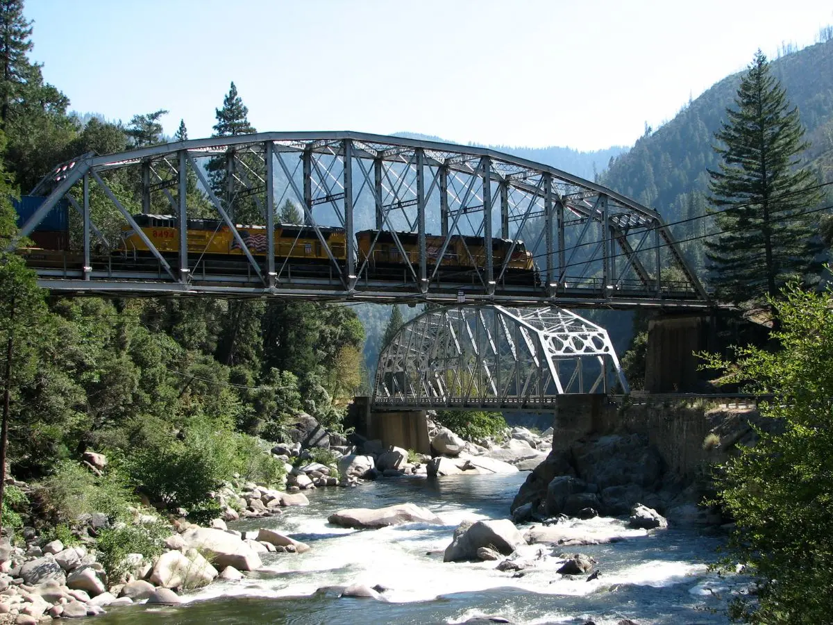
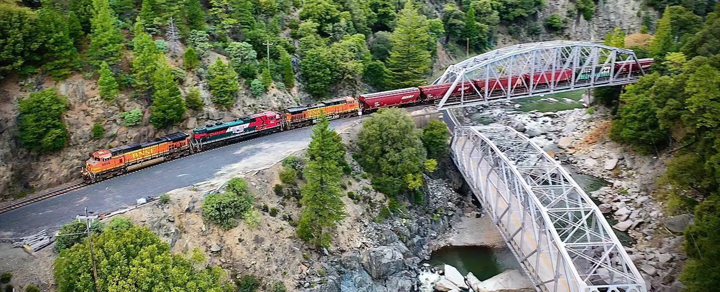
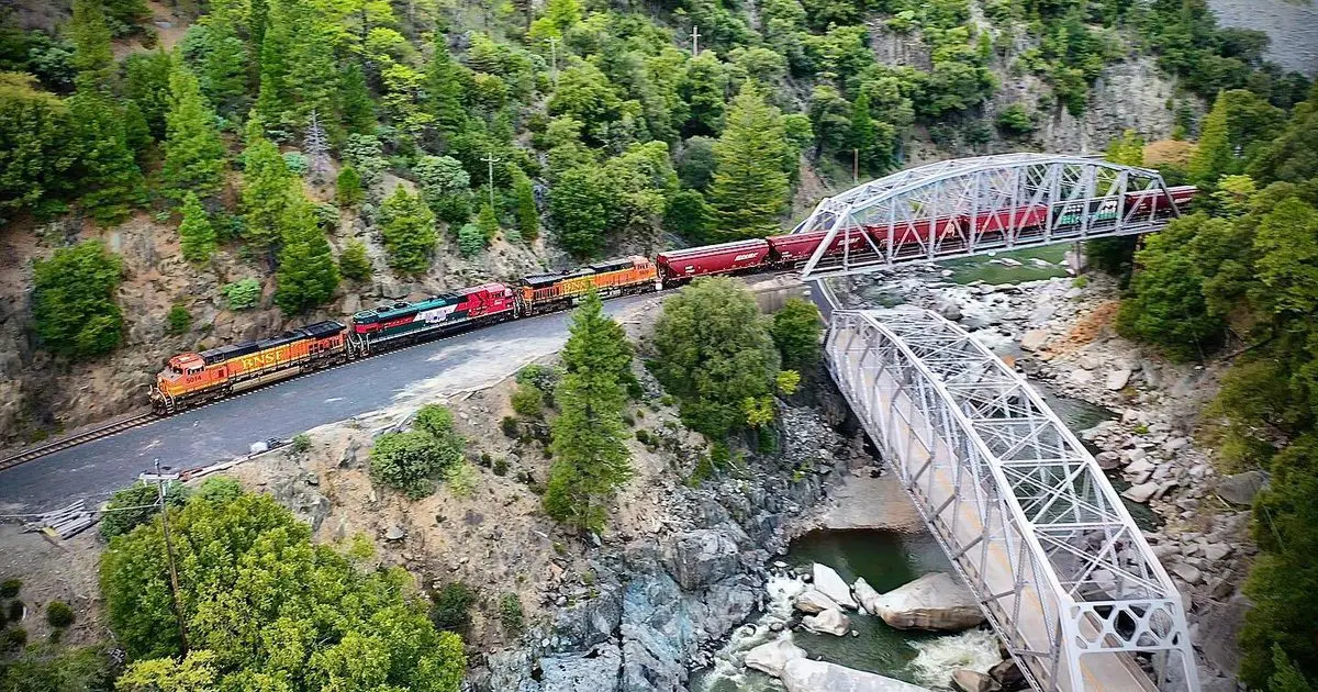
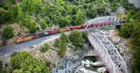
The road does not have the canyon to itself. Railroad tracks run beside it the whole way, carrying trains between Utah, the coast, and Oregon. Explore Butte County says a driver may meet an engine nose to nose and, with luck, get a blast of the horn. Seven hydroelectric powerhouses stand along the river, and together they are called the Stairway of Power.
The canyon is the first leg of the Feather River Scenic Byway, 130 miles of Highway 70 that follow the North and Middle forks across Butte, Plumas, and Lassen counties. Past the canyon the route joins Highway 89 through Quincy to Blairsden and Graeagle. It picks up Highway 70 again through Portola and crosses the Sierra at Beckwourth Pass. From there it drops down the eastern slope and through the Sierra Valley, the western edge of the Great Basin, to end at Hallelujah Junction. The Federal Highway Administration allows three hours for the drive; the tourism association says about three and a half, one way.
Plumas National Forest administers the route as a U.S. Forest Service Scenic Byway. The canyon road carries fast traffic and many trucks, and the association asks drivers who want to take their time to use the pull-outs. Cell reception is thin. Rockslides, floods, downed trees, and wildfire close the road from time to time.
Bridges over bridges, tunnels through granite
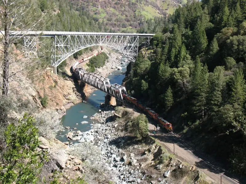
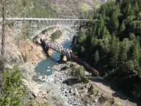
At Pulga the highway crosses the North Fork on a steel arch with a longest span of 350 feet. Its road bed sits 170 feet above a second bridge, the Western Pacific’s 435-foot through truss, built in 1909 in three spans on concrete piers. NoeHill Travels in California, which describes the pair, says the highway arch opened to traffic in 1932. About sixteen miles east, the steel bridges at Tobin repeat the arrangement, one crossing over the other, and draw both bridge photographers and railfans.
Farther on, the road passes through three tunnels blasted through solid granite: Arch Rock, Elephant Butte, and Grizzly Dome. Grizzly Dome is the longest, at 1,187 feet, and has viewing windows on its north side. NoeHill credits the tunnels to the Works Progress Administration, which Franklin Roosevelt established in 1935. According to NoeHill, some of the rock taken from inside them went into the stone guardrails along the drive. Rock House Dining & Espresso, on the byway, went up in 1937 from locally sourced rock, with stone walls 18 inches thick.
The canyon walls change color between Virgilia and Caribou, in a stretch called Serpentine Canyon. Nearby Red Hill is the most extensive ultramafic terrane in the Northern Sierra. It holds a great deal of serpentine rock and the highest concentration of sensitive rare plants in Plumas National Forest, and the California Native Plant Society has proposed it as a Special Interest Area.
Belden and Caribou Crossroads
Belden lies in the middle of the canyon, 28 miles west of Quincy by the tourism association’s figure and about 29 by the Plumas County Museum’s. The Pacific Crest Trail crosses the river here. The trail comes down from the Bucks Lake Wilderness, protected in 1984 and the only wilderness on Plumas National Forest, and climbs back out at Chips Creek. At Belden a traveler can get a burger, spend the night, and mail a postcard from the post office. The town sits on the south bank and is reached by the Belden Bridge, a steel Pratt span 104 feet long and one lane wide. A PG&E rest area across the river has historical displays. Above it a pipe runs down the hill to the Belden Powerhouse.
At Caribou Crossroads, the Caribou Cafe & Store serves food, and there is a campground and cabins. Caribou Road follows the west branch of the North Fork past the Gansner Bar, North Fork, and Queen Lily campgrounds, where the Forest Service lists canoeing, rafting, and berry picking in late summer. On select weekends from June to October, scheduled releases raise the river for whitewater boaters. Storrie, Tobin, Twain, and Paxton also offer lodging, camping, and stores.
Most canyon trails are steep. The Ben Lomond Trail climbs more than 4,000 feet in 4.8 miles from the river to the 6,453-foot summit of Ben Lomond. Paul’s Point, at 3,854 feet, makes a shorter climb. The south-facing Chambers Creek Trail works up the north wall. The north-facing Tobin Trail climbs the south wall and crosses creeks in steep drainages. Because the canyon lies lower than much of the county, these trails are walked in fall and early spring. Hikers should watch for falling trees, rockslides, ticks, and poison oak.
The 2021 Dixie Fire damaged every recreation facility in the North Fork Canyon. The tourism association calls the restoration of campgrounds, roads, and trails a top priority and asks visitors to check conditions before setting out.
Rich Bar, the Keddie Wye, and the pass
Twenty miles west of Quincy, a stone monument at a large turnout overlooks Rich Bar, which the museum calls one of California’s most famous gold rush camps. The Shirley Letters From the California Mines were written there in 1852 and 1853. The plaque was first set on a boulder in 1957 and later stolen. It turned up again in the 1980s, and the Clampers mounted it permanently in the early 1990s. Across the river and the tracks, a short trail leads to the Rich Bar Cemetery. A 1915 monument there remembers the camp’s pioneers and Nancy Ann Bailey, the first woman to die at Rich Bar.
Ten miles northwest of Quincy, at the Greenville “Y,” Indian and Spanish creeks meet and Highway 89 comes in from Indian Valley. Nearby the Keddie Wye, a railroad trestle built in the shape of a Y, stands high above Spanish Creek. A small parking area on the west side of the highway looks out on it. The Western Pacific held its Last Spike ceremony there on November 1, 1909. The tourism association says this made the Western Pacific the last transcontinental railroad built across the Sierra.
The line crosses at Beckwourth Pass on a one percent grade. NoeHill says that is half as steep as the Southern Pacific crossing at Donner Pass, which makes it the easiest railroad route over the range. Farther east the track makes a continuous one-mile loop at Williams Loop and crosses over itself to gain height, so a long train passes over its own cars. The Clio Trestle stands 172 feet high and 1,005 feet long. The Spring Garden tunnel runs 7,344 feet under Lee Summit. In Portola, the Western Pacific Railroad Museum runs caboose rides on weekends between Memorial Day and Labor Day and rents vintage diesel locomotives to visitors, who drive them with an instructor.
In Quincy the route passes the Plumas County Courthouse, completed in 1921 and still in use, with the county museum on Jackson Street behind it. At Beckwourth Pass, a mile east of Chilcoot on the Plumas–Lassen county line, the Native Daughters of the Golden West set a bronze plaque in 1937 honoring the pass’s discoverer and the pioneers of the Beckwourth Trail. The site is State Landmark No. 336. Three miles east of Portola, a log cabin museum carries a 1964 Clamper plaque stating that the cabin was the trading post of the mountain man James P. Beckwourth.
From footpaths to State Route 24
The Mountain Maidu have lived in Plumas County for more than 1,000 years. The river’s name comes from a Spanish explorer, though the sources disagree on the details. The Plumas County history on CAGenWeb says Luis Antonio Argüelo named it el Rio de las Plumas in 1821 for the multitude of waterfowl on its waters, and that the name was anglicized to Feather River about 1850. The Outdoor Writers Association of California gives the explorer as Captain Louis Arguello and the year as 1820, and says he was struck by the bright-feathered birds. When Plumas County was carved from Butte County in 1854, it took the river’s name.
The gold rush of 1850 followed Thomas Stoddard’s story of a lake with gold nuggets gleaming in the moss at the water’s edge. Neither he nor the thousands who went looking ever found it again. Throughout the 1850s, miners, expressmen, and pack trains wore Maidu footpaths into single-lane roads. As early as October 1850, workable roads reached from Marysville as far as the North Fork. In 1850 James P. Beckwourth found the 5,212-foot pass that bears his name, the lowest over the Sierra Nevada. Between 1851 and 1854, some 1,200 emigrants used his trail, driving 12,000 cattle, 700 sheep, and 500 horses.
Winter shut the high roads for three to five months a year. In 1858 Fenton “Buck” Whiting began carrying mail by dog sled when the Oroville–Quincy stage stopped for the season. By 1865 he had switched to horses fitted with iron snowshoes with rubber bottoms. The Western Pacific took over the mail in 1910.
Belden itself grew out of the railroad’s construction between 1905 and 1909. Before that, the north bank was Brown’s Bar, home to gold miners, a few struggling farmers, and a small Maidu village. The town took its name from Susan Belden, who was Maidu, and Robert Belden, pioneer settlers who raised their family on the river. A hotel, a store, a saloon, and cabins soon went up for train travelers, hunters, and fishermen. Once the railroad was finished, timber replaced gold as the county’s principal industry.
Power companies came next. In 1911 the Oro Electric Company began surveying a hydroelectric project at the mouth of Yellow Creek. In July 1912 a Quincy paper reported 200 men grading the road bed and setting piers for a bridge at Belden. By February 1913 the steel skeleton was rising. A few weeks later the rail gang sat idle, waiting on an air compressor for the riveting. By April some 300 men were at work in and around Belden, and the surveyor A.W. Keddie had finished his surveys for the powerhouse. The dam in Humbug Valley, the company said, would be built “in due time.” That August the Great Western Power Company, predecessor of Pacific Gas & Electric, bought the utility side of Oro Electric, and the Humbug Valley project ended. The bridge stayed. Photographs from 1915 show sheep crossing it.
In the 1930s the bridge’s place on the rail line made it a handy delivery point for supplies to the highway builders. The road opened to cars on August 14, 1937, as State Route 24. It was later renumbered 40A and then 70. The 70-mile stretch first cost 8 million dollars. The Belden Bridge was converted to a single-lane highway bridge, and in 1985 a Caltrans report found it historically significant as a key link in an important highway. Repairs after the February 1986 flood cost more than 10 million dollars.
In October 1987, Quincy marked the highway’s fiftieth year at the courthouse, with Superior Court Judge Stanley C. Young as chairman. The date is October 2 on the marker’s inscription as recorded by the Historical Marker Database and October 3 in NoeHill’s transcription. The Las Plumas del Oro Chapter of E Clampus Vitus dedicated their stone monument and bronze plaque on September 9, 1995, on PG&E land at the Belden rest stop, just west of the Yellow Creek bridge and the Belden Power Plant.
Notable Events
- 1850As early as October 1850, feasible roads were opened from Marysville to as high as the North Fork of the Feather River, after pack trains wore Native American footpaths into roadways. cagenweb.org
- 1905The town grew out of railroad construction work; before it, the north side of the river was the mining camp of Brown's Bar. plumascounty.us
- 1909The Western Pacific Railroad's completion gave the Plumas County timber industry a major boost, and county timber replaced gold as the principal industry. cagenweb.org
- 1909The Keddie Wye, standing high above Spanish Creek, was the scene of the Western Pacific's Last Spike ceremony on November 1, 1909; the page says the last spike driven at Keddie made it the last transcontinental railroad built across the Sierra. plumascounty.org
- 1913The Pratt-style Belden Bridge was built by the American Bridge Company for the Oro Light and Power Company as a Western Pacific Railroad spur carrying materials for the Yellow Creek Powerhouse. plumascounty.us
- 1932The steel arch Pulga highway bridge, with a 350-foot longest span and road bed 170 feet above the railroad bridge, opened to traffic when State Route 70 was built. noehill.com
- 1935Three tunnels — Arch Rock, Elephant Butte and Grizzly Dome, longest at 1,187 feet with viewing windows on the north side — were blasted through solid granite as a WPA project; rock removed was used in stone guardrails along the drive. noehill.com
- 1937The highway opened to auto traffic on August 14, 1937 as State Route 24; the initial cost of the 70-mile stretch was 8 million dollars. hmdb.org
- 1937When the Feather River Canyon Highway from Oroville to Quincy was finished, the railroad bridge was converted into a single-lane highway bridge linking Belden to the route now numbered 70. plumascounty.us
- 1937The Native Daughters of the Golden West set a bronze plaque at the pass on the state highway honoring the discoverer and the pioneers who passed along the Beckwourth Trail. plumasmuseum.org
- 1937Rock House Dining & Espresso, an iconic structure on the byway, was built from locally sourced rock with 18-inch thick stone walls. web.archive.org
- 1985A state bridge report found the bridge significant under Criterion A, as a key link in an important highway, and Criterion C, as a distinctive example of a type, method and period of construction. plumascounty.us
- 1986The cost of repair from the February 1986 flood was over 10 million dollars. hmdb.org
- 1987On October 2, 1987 a celebration was held at the Plumas County Courthouse in Quincy celebrating the 50th anniversary of the opening of the Feather River Highway, chaired by Superior Court Judge Stanley C. Young. hmdb.org
- 1995A stone monument and bronze plaque recognizing the Feather River Highway was placed by the Clampers at the Belden Rest Stop, recording the 50th anniversary of the highway's completion, which cost $8,000,000 to build. plumasmuseum.org
- 2021Large fires of the 21st century altered the canyon; the 2021 Dixie Fire impacted all recreation facilities within the North Fork Canyon. plumascounty.org
People
- Luis Antonio Argüelo, Spanish explorer who named the Feather River el Rio de las Plumas for the multitude of waterfowl seen upon its waters (1821).
- Stanley C. Young, Plumas County Superior Court Judge, chairman of the anniversary celebration (1987).
- A.W. Keddie, civil and mining engineer and surveyor who completed surveys at Belden for the Oro Electric Company power project (1913).
- Robert Belden, pioneer settler on the North Fork Feather River, for whom the canyon town and its highway bridge are named.
- Susan Belden, Maidu Indian pioneer settler of the Belden family on the North Fork Feather River, for whom the canyon town is named.
- James P. Beckwourth, mountain man for whom Beckwourth Pass and the Beckwourth Trail on the byway route are named; a Clamper plaque states that the log cabin museum east of Portola was his trading post.
Sources
- plumascounty.org/blog/explore/scenic-byways
- sierranevadageotourism.org/entries/feather-river-scenic-byway-feather-river-canyon/85599630-230e-4b87-b012-794e43d25f63
- fhwaapps.fhwa.dot.gov/bywaysp/byway/2196
- plumascounty.org/get-outside/places-to-visit/feather-river-canyon
- exploreplumascounty.com/recreation/scenic-byway
- plumascounty.us/documentcenter/view/10947
- plumasmuseum.org/pdf/nletter05.08.pdf
- noehill.com/plumas/poi_feather_river_highway.asp
- hmdb.org/m.asp?m=66155
- noehill.com/butte/poi_pulga_bridges.asp
- noehill.com/plumas/poi_wpa_tunnels.asp
- web.archive.org/web/20260412231406/https://www.explorebuttecounty.com/activities/your-road-trip-guide-to-the-feather-river-canyon
- cagenweb.org/plumas/history.htm
- owac.org/discovering-las-plumas
- plumascounty.org/blog/explore/trains-railroads-railfanning