
Energy Loop Scenic Byway
Fairview, Utah, Carbon, Emery, Sanpete County, Utah. National Scenic Byway; May.
Details

- Where
- Fairview, Utah, Carbon, Emery, Sanpete County, UT. No street address stated. Directions
- Getting there
- From Fairview, take State Highway 31 east to its junction with State Highway 264, at the top of Fairview Canyon. Here, the byway forks.
- Fees
- There is no charge to drive the byway.
- Access
- For directions to this site, please contact the Price Ranger District: 435-636-3500.
- Phone
- 435-636-3500
- Website
- fhwaapps.fhwa.dot.gov
- Managed by
- Manti-La Sal National Forest.
- Established
- 1990.
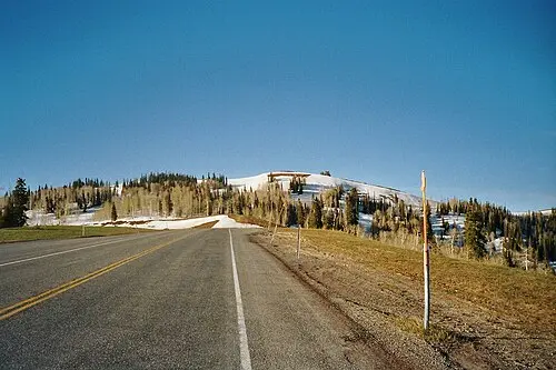
The byway begins at a stoplight-town intersection in Fairview, where US-89 meets State Route 31 in Sanpete County. Within about two miles the road leaves town, bends northeast along Cottonwood Creek, and enters Fairview Canyon. For another six or seven miles it climbs through the canyon, crosses into the Manti-La Sal National Forest, and tops out at about 8,800 feet. There, at the top of Fairview Canyon, the route splits in two. A National Scenic Byway Foundation itinerary suggests starting with coffee in Fairview and a stop at the Fairview Museum of History.
The official name is The Energy Loop: Huntington and Eccles Canyons National Scenic Byway. Visit Utah gives its numbers as State Routes 96, 264 and 31 and U.S. 6. The Federal Highway Administration lists no charge to drive it.
The sources do not agree on the length. Wikipedia gives about 83 miles. The Federal Highway Administration gives 85.92 miles, and the National Scenic Byway Foundation gives 86. A 2011 corridor management plan counts 101 miles. Visit Utah gives 138 miles and two and a half to four hours of driving; the federal listing allows an hour and a half to drive, or a day to visit. The Forest Service lists the season of use as May and notes that weather and snowmelt govern opening and closing. The 2011 plan states that the Utah Department of Transportation clears snow in winter.
Up Fairview Canyon to the fork
Visit Utah describes 360-degree views from the plateau, with Mount Nebo to the north and the San Rafael Swell to the east. It also notes that in fall, yellow aspen stands alternate with deep green conifers along the road. The 2011 plan lists aspen, spruce-fir, mountain brush, pinyon-juniper and sagebrush, with cottonwoods, willows and wetland sedges along the streams. Moose, elk and mule deer are most often seen early in the morning, in the evening, and during migration. The plan adds black bear, mountain lion, blue grouse, and golden and bald eagles.
Skyline Drive leaves State Route 31 near the summit and runs along the backbone of the Wasatch Plateau. It follows the line between the Great Basin and the Colorado Plateau. The northern part of Skyline Drive suits passenger cars. The southern part requires high-clearance four-wheel drive. The 2011 plan describes a 16-mile stretch of Skyline Drive linking Eccles and Huntington canyons with “top of the world” views. Visit Utah also names the Arapeen OHV trail along the route. The Carbon County tourism page notes that the loop also works as a bicycle tour.
Huntington Canyon and the mammoth of 8-8-88
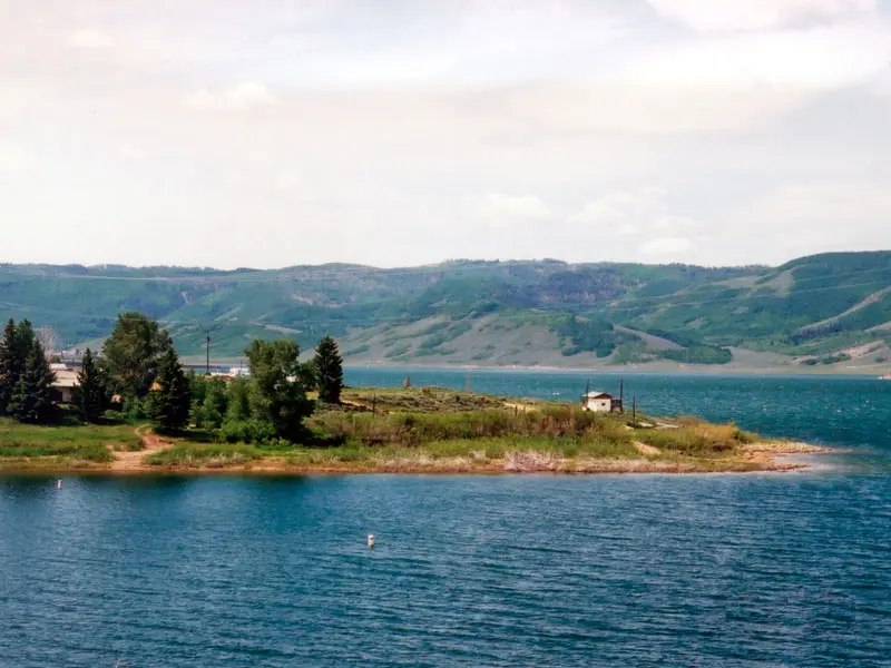
The south branch stays on State Route 31. It climbs above 9,600 feet, according to Wikipedia, and then drops east-southeast past Huntington Reservoir and Cleveland Reservoir. The Foundation itinerary puts Fairview Lakes Overlook 13 miles out of Fairview and Huntington Reservoir 5 miles farther. Anglers fish the reservoir for tiger trout.
On August 8, 1988, dam construction at Huntington Reservoir uncovered a Columbian mammoth. The Foundation says the skeleton was 90 percent complete and that the surrounding mud had “acted as a refrigerator.” The Foundation dates the animal at 10,000 years. The Forest Service and Carbon County give nearly 9,500 years. Carbon County says the bones turned up during a rebuild of the dam and that the skeleton is now on display at the USU Eastern Prehistoric Museum in Price. The 2011 plan places replicas in museums in Price, Salt Lake City and Fairview. Near the reservoir, the Mammoth Discovery Wayside Shop has exhibits on the area’s archaeology.
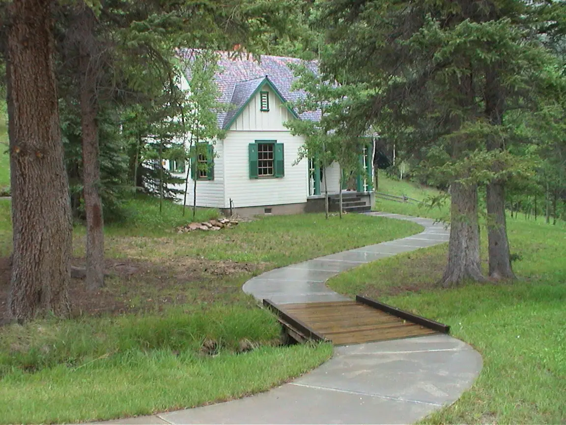
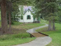
From Electric Lake the road turns southeast and follows Huntington Creek down Huntington Canyon. The Stuart Guard Station stands 11 miles beyond the reservoir. The Civilian Conservation Corps built it in the early 1930s, and the Forest Service used it regularly for several decades afterward. At a 2003 ceremony there, Forest Service recreation director Bill Broadbear described the ranger’s life the station represents. Each day the ranger went out on horseback or on foot to patrol the forest, oversee grazing and timber sales, and watch for fires. The same year, the byway committee received $25,000 to help the forest set up a visitor center in the station, the only one on the byway. The Forest Service page, last updated February 18, 2025, lists the site as day use only, with a vault toilet and no potable water, and states that it is not currently open.
Six miles below the guard station is the Crandall Canyon Mine Disaster Memorial. In 2007, a collapse at the Crandall Canyon Mine, reached by a turnoff from the byway, trapped six miners. When the rescue tunnel also collapsed, three rescue workers were killed and six more were injured.
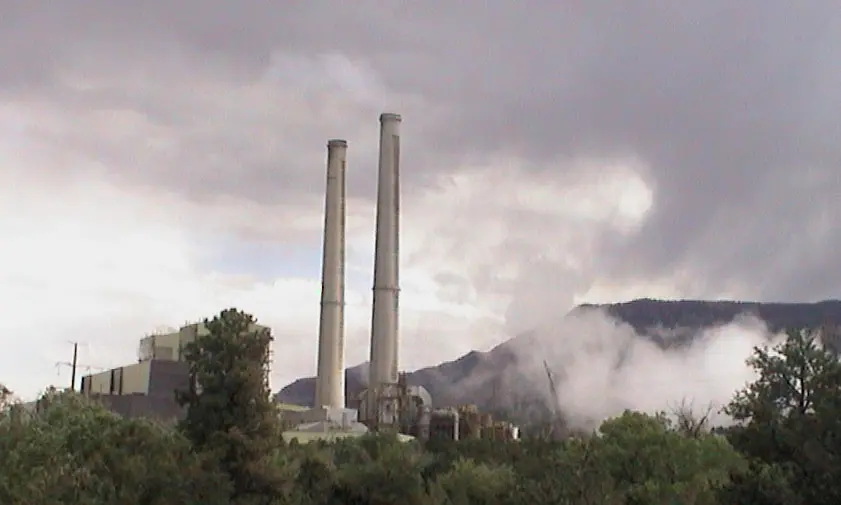
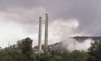
Lower in the canyon the road passes the energy works that gave the byway its name. In 2003, Debra Dull, speaking for Utah Power, PacifiCorp and Energy West Mining, described the Huntington Power Plant and the Deer Creek Coal Mine, which supplies the plant. She said the plant draws its water from the Huntington River, which runs beside part of the byway. The branch ends at State Route 10 in the town of Huntington, a mile southwest of Huntington State Park. The Foundation itinerary puts the park 18 miles below the Crandall Canyon memorial and lists fishing, waterskiing and catching crawdads there.
A Daughters of Utah Pioneers marker in Huntington records how the town began. In 1875, Leander Lemmon and James McHadden came looking for horse range and found plenty of feed at the canyon mouth. In autumn 1876, Lemmon built the first log cabin on Huntington Creek. The marker says the town takes its name from the creek. A write-up for Utah Historical Markers adds that the region had “likely been named” by the brothers Dimick, Oliver and William Huntington, who explored it in the 1850s. By 1880 the settlement had 126 people.
Eccles Canyon and Scofield
The north branch takes State Route 264 east to the north end of Electric Lake. It then runs about three miles up Upper Huntington Canyon and climbs over into Eccles Canyon, following Eccles Creek down for about six miles. The road continues north through Scofield, where a spur leads to Clear Creek, and past Scofield Reservoir and its state park. Scofield State Park is open in summer and winter, and its campgrounds include two reservable teepees. Beyond the reservoir, State Route 96 turns east and ends at U.S. 6 near Colton. Carbon County names Skyline Mine as one of the industrial operations still working in the corridor.
The coal along this branch drew a large workforce. In the early 1880s the Denver and Rio Grande Western Railroad, surveying a route from Denver to Salt Lake City, found vast coal fields in Carbon County. The 2011 plan says that people from more than 30 countries came to mine and haul that coal, among them Greeks, Italians, Mexicans, Poles, Chinese, Danes, Britons and Finns.
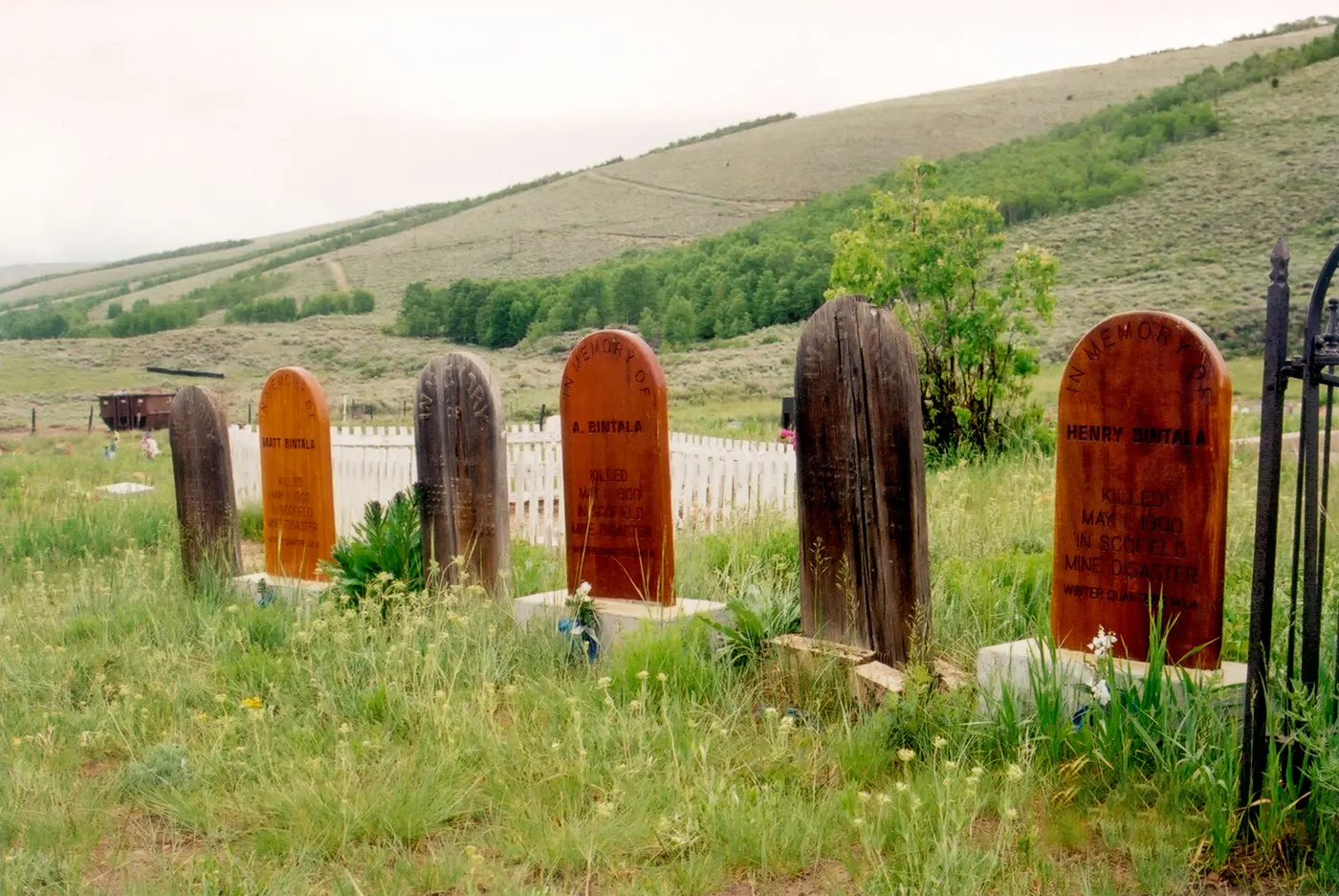
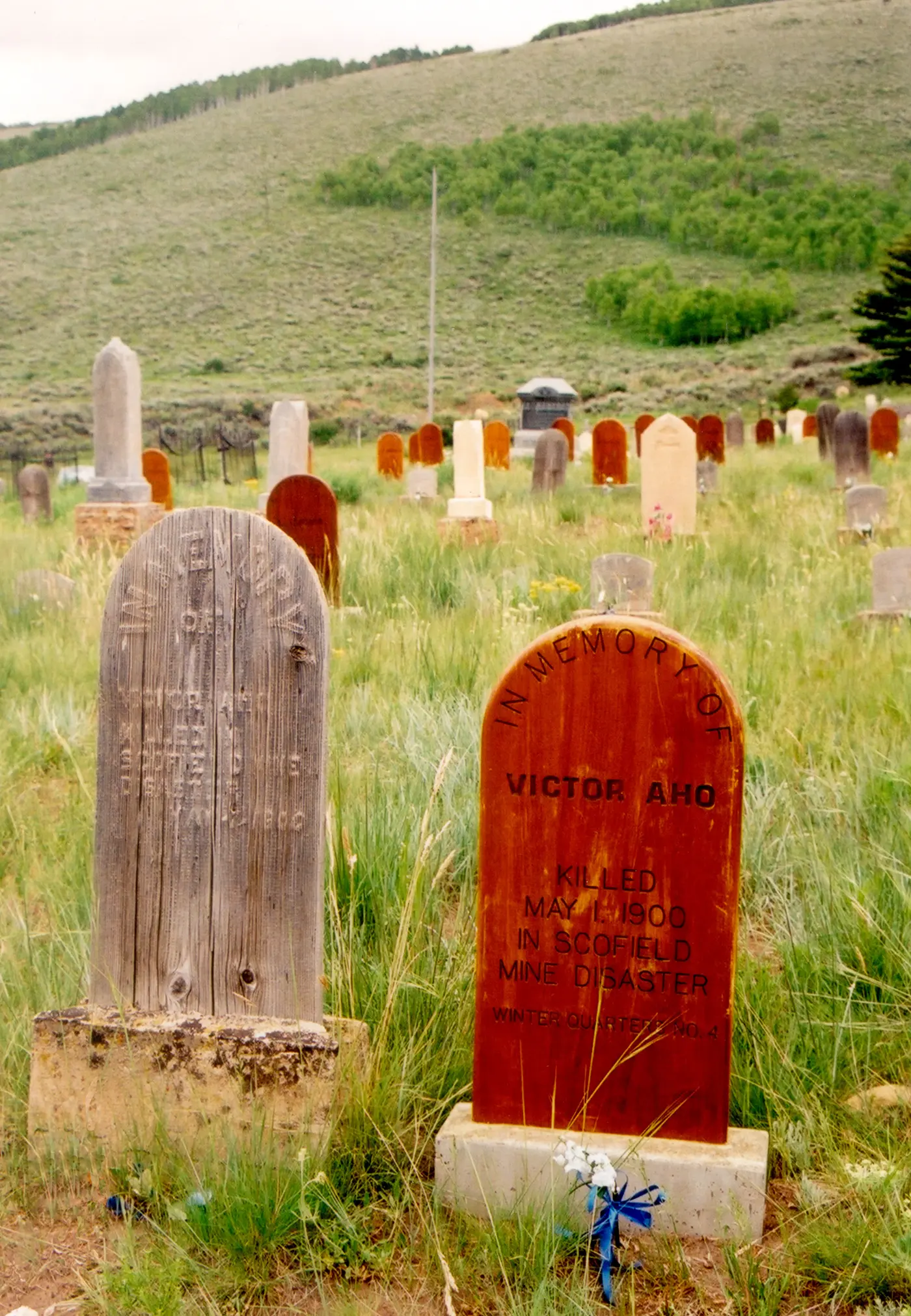
On the morning of May 1, 1900, several hundred Pleasant Valley Coal Company miners left their homes in Scofield for work. Some planned to attend an evening celebration at Odd Fellows Hall for Dewey Day. At 10:28 a.m. the Winter Quarters No. 4 mine exploded. A Utah history account says many in town at first took the noise for fireworks set off early. Miner John Wilson had been standing at the mine opening and was thrown 820 feet against a tree. Clearing the entrance took nearly twenty minutes. Rescuers found men still alive inside, suffocating in the gases, and miners in the connected No. 1 shaft were dying too. Two hundred men were killed, the worst mine disaster in America to that time. Bodies were washed and dressed at the company boarding house and laid out at the schoolhouse, where mothers and wives waited to claim them. On May 5, Scofield held two funerals: a Lutheran service for 61 Finns, and a Latter-day Saint service. The account notes that marks of the blast can still be found at the opening of the old No. 4 mine.
A loop that is not a loop
Both canyons run through ground set aside early in the last century. President Theodore Roosevelt created the Manti Forest Reserve in 1903, and it became a national forest in 1908.
The accounts of the road’s designation do not agree. A 2003 Sun Advocate report says the Huntington and Eccles Highway received Utah’s first scenic byway designation in 1987. Wikipedia gives 1990 for state designation and February 6, 1991, for designation as the Huntington Canyon and Eccles Canyon National Forest Scenic Byways. The 2011 plan dates the National Forest and State designations to 1992. All the sources agree on national designation: June 15, 2000.
The Energy Loop name came out of a 1999 effort by Sanpete, Carbon and Emery counties to bring tourists to towns at both ends of the road. The Deseret News reported that the byway was being marketed under that name because of the power generation and coal mining along it. Consultant Scott Kieselbach, of the Colorado firm CommunityFirst! Partners, observed that the loop “is not really a loop.” Public meetings were held at the Huntington Town Hall and at Snow College to review a draft corridor management plan and a national application. “The consultant team drove the byway to develop those themes,” Kieselbach said. The themes he described included early people and creatures, Latter-day Saint settlers, miners and outlaws. Seventeen markers already stood along the road by then, one of them explaining the Huntington Mammoth.
In mid-October 2003, officials from the three counties gathered at the Stuart Guard Station to unveil three new double-sided entrance signs. Steve Tanner, a local poet and artist, read a poem written for the occasion. Debra Dull said: “The company was very pleased when the byway was named the Energy Loop since there is such a rich and colorful history concerning energy in this area.” Kathy Hanna Smith, Carbon County’s tourism chief, opened the ceremony: “Roads no longer merely lead to places, they are places and as they say in Utah, this is the place.”
In 2017 the byway committee replaced the original signs, then about 20 years old, which it judged dilapidated. It installed 30 interpretive signs at 16 wayside stops. Shari Yagodnik and Rebeca Field of Kimley Horn designed the panels, and Post Modern fabricated them. The panels stand on pedestals made from logs cut on the Manti-La Sal National Forest and on Skyline Mine property.
Notable Events
- 1880sThe Denver and Rio Grande Western Railroad, looking for a route from Denver to Salt Lake City, discovered vast coal fields in Carbon County. ilovehistory.utah.gov
- 1900The explosion killed 200 miners and was the worst mine disaster in America to that time. historytogo.utah.gov
- 1903President Theodore Roosevelt created the Manti Forest Reserve. visitemerycounty.com
- 1908The reserve created in 1903 became the National Forest the Energy Loop winds through. visitemerycounty.com
- 1930sThe historic Stuart Guard Station along the byway was originally built by the Civilian Conservation Corps and was afterward in regular use by the U.S. Forest Service for several decades. fs.usda.gov
- 1987The Huntington and Eccles Highway was given the first Scenic Byway designation in Utah. etvnews.com
- 1988Dam construction unearthed the 90 percent complete skeleton; mud around the 10,000-year-old animal had preserved it. nsbfoundation.com
- 1992The Huntington Canyon and Eccles Canyon sections of the Energy Loop have been designated National Forest and State Scenic Byways since 1992. travel.utah.gov
- 2000The Energy Loop: Huntington/Eccles Canyons Scenic Byway was designated on 6/15/2000. scenic.org
- 2003The Byway Committee received $25,000 to help the Manti-La Sal National Forest create a visitor center facility at the historic Stuart Guard station in Huntington Canyon, the only visitor center along the byway. travel.utah.gov
- 2007Six miners were trapped when a mine shaft collapsed at the Crandall Canyon Mine, reached by a turnoff on the byway; three rescue workers were killed and another six injured when the rescue tunnel also collapsed. visitutah.com
- 2017The byway committee installed 30 interpretive signs at 16 wayside stops, replacing dilapidated original signs. heraldextra.com
People
- Scott Kieselbach, consultant from CommunityFirst! Partners, a Colorado community development and consulting firm, hired for the byway's corridor management plan and its National Scenic Byway application.
- Bill Broadbear, recreational director for the forest service along the byway; gave an overview of the Stuart Guard Station.
- Dave Gerrard, owner of Sign Edge, which made the byway's new signs.
- Debra Dull, represented the energy-company sponsors Utah Power, Pacific Corp. and Energy West Mining, which welcomed the byway's Energy Loop name.
- Joan Taylor, coordinator of this scenic byway.
- Kathy Hanna Smith, Carbon county tourism chief who framed the byway's intrinsic qualities and its story for visitors.
- Margaret Godfrey, with the Utah State Travel council, guided the byway committee through the grant process each year.
- Rebeca Field, with Shari Yagodnik of Kimley Horn, designed the byway's interpretive panels.
- Rosann Fillmore, Byway Coordinator of the Energy Loop: Huntington and Eccles Canyons National Scenic Byway.
- Shari Yagodnik, with Rebeca Field of Kimley Horn, designed the byway's interpretive panels.
Sources
- fhwaapps.fhwa.dot.gov/bywaysp/byway/13831
- recreation.gov/gateways/13643
- visitutah.com/things-to-do/road-trips/scenic-byways
- fs.usda.gov/r04/manti-lasal/recreation/energy-loop-huntington-eccles-canyons-nsb
- deseret.com/1999/9/20/19466669/energy-loop-a-tourist-magnet
- heraldextra.com/special-section/2018/may/16/energy-loop-passport-tour-provides-exploration
- etvnews.com/articles/sunadvocate/tourist-officials-celebrate-new-signage-on-energy-loop-3
- fs.usda.gov/r04/manti-lasal/recreation/stuart-guard-station-scenic-byway-site
- travel.utah.gov/wp-content/uploads/EnergyLoopBywayUpdate2011.pdf
- scenic.org/all-national-scenic-byways-and-all-american-roads