Eagle Rock Agate Site
Prineville, Crook County, Oregon. Rockhound collection site; Best time to visit: May to October.
Details

- Where
- Prineville, Crook County, OR. No street address stated. Directions
- Getting there
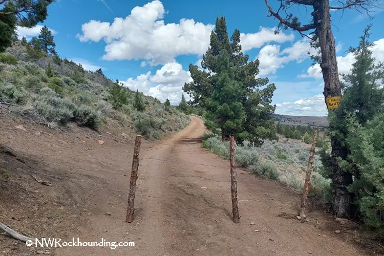
- From Prineville, follow Paulina Highway (Highway 380) toward Post for about 15 miles; turn right onto a gravel road between mileposts 14 and 15; after the cattle guard, bear left and continue uphill for 0.9 miles to the first fork; bear right, open and close the gate, and continue 0.4 miles to the second fork and trail on the left.
- Fees
- None.
- Access
- The gravel roads can be rough, and a high-clearance 4WD vehicle is recommended, especially after rain. There are no restrooms, water, or stores nearby. Bring all necessary supplies, including plenty of water, snacks, sunscreen, and a first-aid kit. Watch for rattlesnakes. Limited cell service.
- Website
- fs.usda.gov
- Managed by
- Bureau of Land Management.
- Coordinates
- 44.185, -120.67.
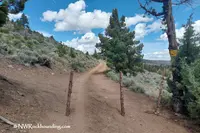
About fifteen miles out of Prineville on the Paulina Highway, Highway 380, a pale ash-flow tuff formation stands above the road in the shape of an eagle perched over the country. Oregon Discovery calls it the landmark for the turn: a gravel road between mileposts 14 and 15. Past the cattle guard the road bears left and climbs 0.9 mile to a first fork. It then bears right through a gate, which visitors open and close behind them, and runs 0.4 mile more to a second fork, where a trail leaves on the left. A high-clearance four-wheel-drive vehicle is recommended, especially after rain. There are no restrooms, water, or stores, cell service is limited, and rattlesnakes are about.
The ground lies within the boundary of the Ochoco National Forest and is managed by the Bureau of Land Management. About 150 acres of it, at an elevation of some 4,500 feet, have been set aside for recreational rockhounding. There is no fee, and the season runs May to October.
The climb from the second fork
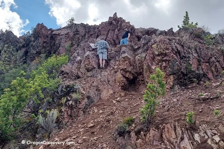
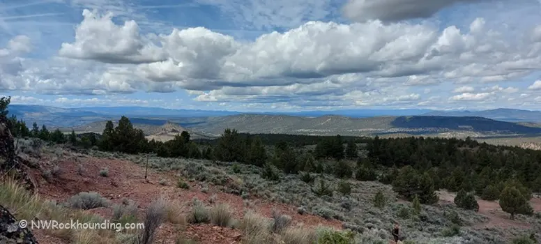
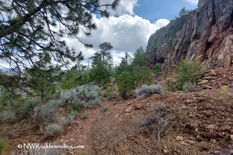
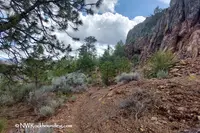
The hike can start at either fork. From the gate at the first fork, a 0.4-mile stretch of trail is easy and looks out over the Central Oregon landscape. Drivers can instead go on to the second fork and park on the hillside, where motorized travel ends. From there the trail climbs 0.6 mile to a fork on the hilltop, and a left turn leads 0.1 mile to the collecting area. Oregon Discovery puts the trail at 0.7 mile one way with a 500-foot gain. It is well maintained but steep, slippery, and rocky, and wet ground or hot weather makes it harder. Private property borders the area. At the top the trail reaches juniper-dotted hills, basalt cliffs, and long views.
Plume agate in the cliff face
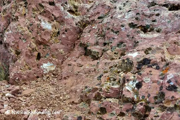
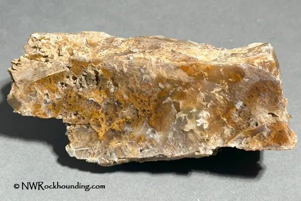
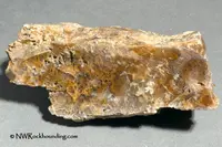
Plume agate is the reason most people make the climb. It comes in black and brown, with feather-like patterns, and Northwest Rockhounding calls the Eagle Rock material “distinctive and highly prized.” The same site says it has become scarce but can still be found with some effort. A brochure from the Travel Information Division of the Oregon State Highway Department listed the Eagle Rock area for “outstanding red and black plume agate.” Moss agate also turns up here, with plant-like inclusions in green, red, and brown, along with botryoidal agate in rounded, bubbly forms that can resemble clusters of grapes. Jasper in red, yellow, orange, and brown lies scattered across the surface.
The two guide sites disagree about how to look for it. Northwest Rockhounding says surface collecting is often the easiest way to search. Oregon Discovery says surface collecting yields limited quality material and that the best specimens are embedded in the cliff face, where removing them can be very difficult. It advises gloves and safety glasses for anyone breaking stone from the cliff, and a move to safer ground where sections are unstable. Both sites agree that rain helps. After winter rains, seasonal streams often expose fresh deposits. Collectors carry rock hammers, picks, and chisels. The Forest Service notes that agate often has to be cut or polished before its quality shows, and adds, “Many rockhounds consider this part of the fun.” Collection sites are for personal use only, and commercial resale is not allowed.
A welded tuff of the John Day Formation
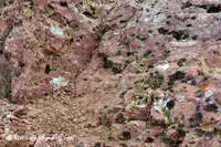
The rock of the eagle itself was mapped by Jason D. McClaughry and Mark L. Ferns of the Oregon Department of Geology and Mineral Industries, who did their field work in 2006. Their 2007 map of the Eagle Rock quadrangle describes the welded tuff of Eagle Rock as yellow-white to gray and densely welded, weathering to red-orange and yellow. East of the rock it has distinct columnar jointing. Inside, stretched pumice reaches 0.04 meter long. The lower part of the flow holds open lithophysal cavities, and east of Eagle Rock its fractures are filled with silicified breccia. The tuff is 10 to 50 meters thick and apparently thickens to the west. Above it lies the welded tuff of Antelope Creek, dark purple, pink, and gray, about 30 meters thick.
Robinson and others reported a potassium-argon age of 32.1 ± 0.7 million years, in 1990, for the lower ash-flow tuff of the John Day Formation’s southern facies near Prineville Reservoir. McClaughry and Ferns infer that the dated sample came from Eagle Rock at the mouth of O’Neil Creek. The Forest Service dates the John Day volcanoes from about 33 million years ago. During that volcanic activity, the agency says, superheated groundwater circulated through the rocks and filled cracks and voids with quartz, calcite, cinnabar, and other minerals. Carrie Gordon, a geologist with the Ochoco National Forest, told The Bulletin in 2008 that silica-rich groundwater filled the cracks with quartz, agate, and jasper.
Maps from the 1960s on
The highway department brochure placed Eagle Rock 15 miles southeast of Prineville, with the Maury Mountain area beyond it, and sent collectors to the Prineville Chamber of Commerce for directions. According to The Bulletin, the county’s rockhounding areas were first mapped in the 1960s, when local chambers of commerce maintained a few of the sites. About 2004, the Forest Service, the BLM, and the Prineville-Crook County Chamber of Commerce updated the map. The new edition added GPS coordinates, a briefing on geologic history, and a “rockhound’s code of ethics.” Eagle Rock appears on that Central Oregon Rockhounding Map, which is sold at the chamber’s visitor center and at Wagner’s Market.
In 2008 the chamber was handing out hundreds of maps a year. Its executive director, Brandi Hereford, described the visitors who came for them: “They’re very specific: ‘I’m here to rockhound, where’s the map?’” Gordon explained the rules on the public sites: shovels are allowed, but no mechanized digging and no blasting. “What we’re talking about is personal collecting,” she said. “We’re talking about recreation, going out with the family for personal collection.” She added that equipment was often unnecessary: “I’ve actually found some of my best pieces just walking around in the spring on the slopes in the forest and on BLM land.”
Notable Events
- 1960sRockhounding areas were first mapped in the 1960s, when a few of the sites were maintained by local chambers of commerce. bendbulletin.com
People
- Carrie Gordon, Ochoco National Forest geologist who explains how the area's agate and jasper formed and what personal collecting means at the public sites.
Sources
- bendbulletin.com/2008-06-02/for-rock-enthusiasts-were-a-bit-of-a-mecca
- exploreprineville.com/rockhounding-in-prineville-oregon
- pubs.oregon.gov/dogami/og/OGv69n01-CrookedRivercaldera.pdf
- d3itl75cn7661p.cloudfront.net/dogami/ofr/O-07-10.pdf
- oregon.gov/dogami/milo/archive/HistoricalSociety/Josephine/OregonMineralsFossilsRock.pdf
- fs.usda.gov/r06/ochoco/natural-resources/rocks-minerals