.jpg)
Diamond Loop Back Country Byway
Diamond, Harney County, Oregon. Tour Route; Spring through Fall.
Details
- Where
- Diamond, Harney County, OR. No street address stated. Directions
- Getting there
- You'll begin on the Diamond Loop Tour Route by heading east on South Diamond Lane, through the southern section of the Malheur National Wildlife Refuge.
- Fees
- No Fees.
- Access
- At Diamond Craters there are no restroom facilities or other amenities; bring water and shelter, pack out waste, and keep vehicles on hard-packed roads and obvious parking areas.
- Phone
- 541-573-4400
- Managed by
- Burns District Office.
The Diamond Loop leaves State Highway 205 and runs east on South Diamond Lane through the southern marshes of the Malheur National Wildlife Refuge. The refuge is a stopping point on the Pacific Flyway, and waterfowl, shorebirds, hawks and eagles use it. Mule deer and pronghorn live here too. The Bureau of Land Management’s 1995 brochure for the byway counts about 220 bird species on and near the refuge over the year. It asks drivers who stop to pull fully onto a shoulder or turnout and to watch for others who have done the same, especially during the spring waterfowl migration.
The BLM’s Burns District Office manages the route. Its brochure, Travel Oregon, and the state’s TripCheck service give the length as 69 miles; the federal America’s Byways listing gives 64. The road runs through the ranch valleys between the Steens and Riddle mountains, past sage hills, red rimrock canyons, and grassy marsh. The listings allow three to five hours and recommend spring through fall. There is no fee. The 1995 brochure names three places to begin: near Princeton on State Highway 78, at the junction of Highway 205 and Diamond Lane, and at Frenchglen on 205. It warns that road conditions change without notice, that the grade between Diamond and Happy Valleys needs care, and that cattle herds use the road in spring and fall. The meadows along the way are private, and the brochure asks travelers to get a landowner’s permission before walking into them.
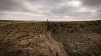
Lava beds north of Diamond Swamp
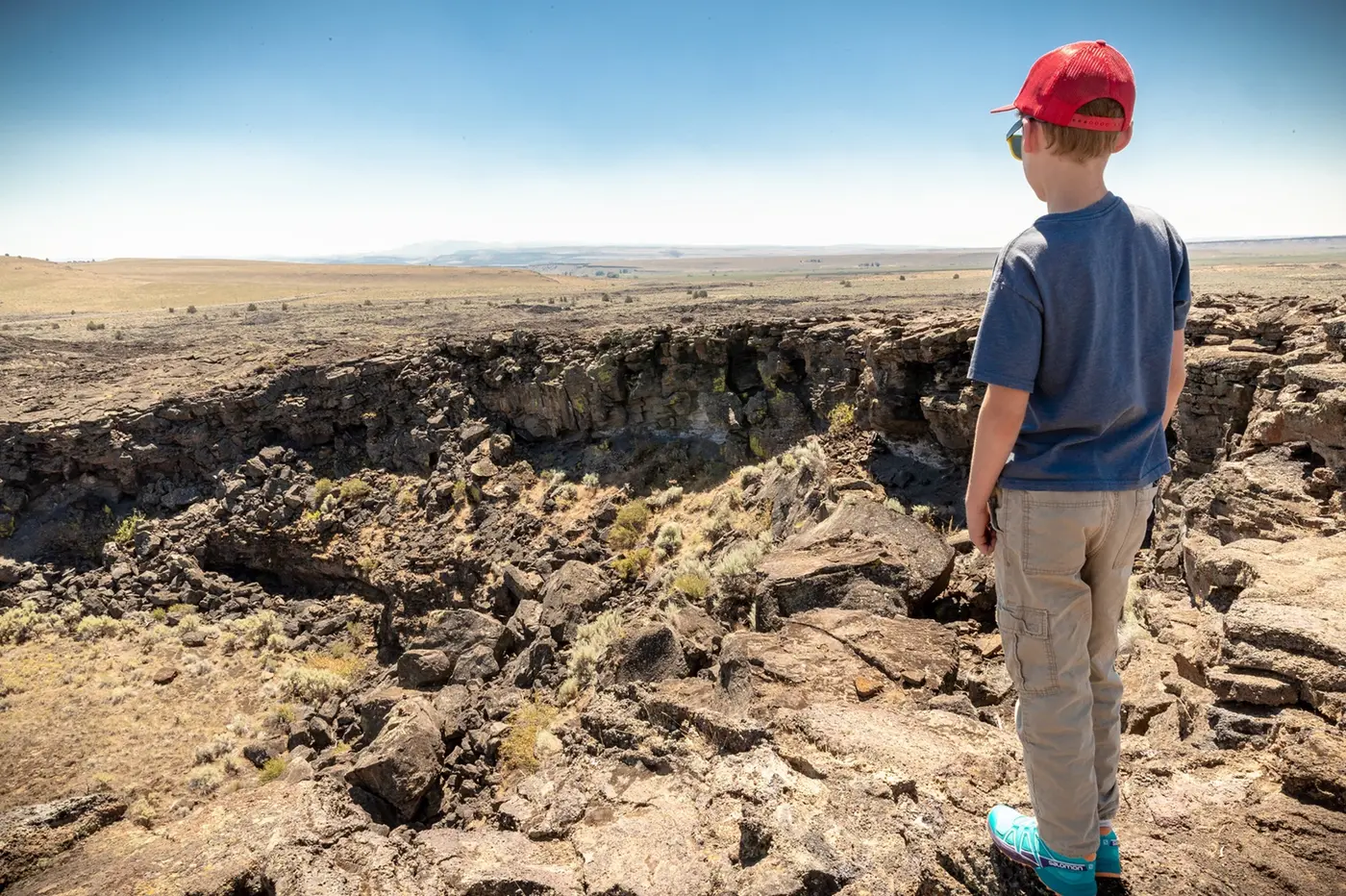
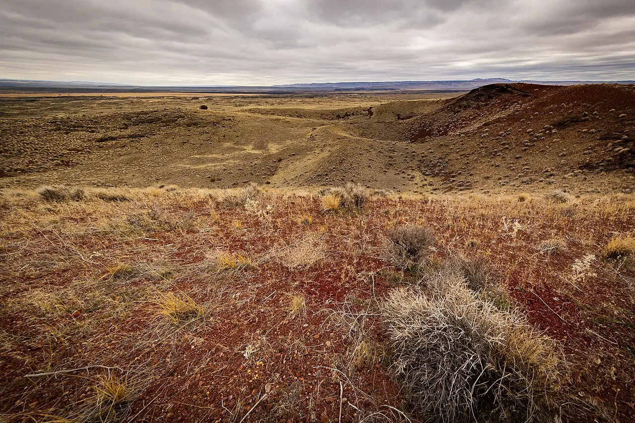
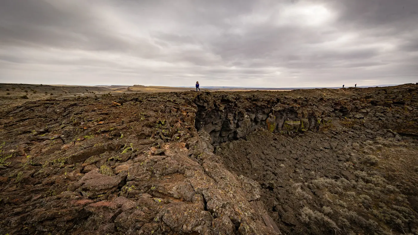
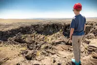
Travel Oregon describes the turn north onto Lava Beds Road as the point where the lowlands of Diamond Swamp give way to blackish, barren rock. This is the Diamond Craters Outstanding Natural Area, 17,000 acres that the BLM says hold some of the most varied basaltic volcanic features in the nation in a small, reachable area. The BLM describes the field as “a thin, rocky pancake with a few bumps.” A visitor can identify craters and vents, cinder cones, spatter cones, lava tubes, driblet spires, a graben, and a water-filled maar. A self-guided tour points out Lava Pit Crater and Graben Dome. The 1995 brochure includes a photograph of Little Red Cone. The area has no restrooms or other facilities. The BLM asks visitors to bring water and shelter, pack out what they bring, keep vehicles on hard-packed roads and obvious parking areas, and leave rocks, plants and animals in place.
The Geological Survey explains how the field formed. Lava flowed first from a central fissure or vent. Magma then pushed into the shallow ground beneath and arched the lava field up as much as 500 feet into six elongate domes. Graben Dome, the largest, is nearly 2 miles long and 1 mile wide, and takes its name from a 130-foot-deep crack along its crest. Where rising magma met shallow groundwater, it set off hydrothermal explosions that scattered shattered rock across the field, in places up to 65 feet deep near the central crater complex. One of the smaller explosion craters holds a shallow pond. In the 1970s researchers cored it and drew out 50 feet of sediment reaching back nearly 6,000 years, a record of the region’s plants and of the rise and fall of its water table.
The sources disagree on the field’s age. The BLM says it formed sometime in the past 25,000 years. The 1995 brochure adds that some eruptions came as late as 17,000 years ago. Travel Oregon says the fields formed 25,000 years ago. The Geological Survey dates the lava flows and associated ash to between about 7,790 and 7,320 years ago. The craters take their name, by the brochure’s account, from the same diamond brand that named the town 8 miles off.
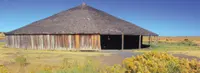
Peter French’s round corral
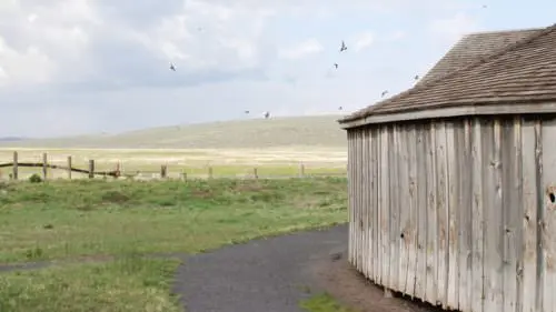
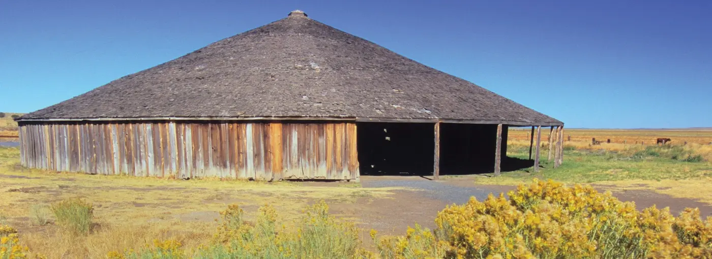
About 3 miles beyond the craters, the route meets Happy Valley Road and the Pete French Round Barn, now a State Heritage Site of the Oregon Parks and Recreation Department. A visitor center and the Jenkins Ranch family museum stand at the entrance. The building is 100 feet across. Inside, a round stone corral 60 feet in diameter and two feet thick is ringed by a paddock 20 feet wide. The Oregon History Project describes the building as an enclosed corral. Its umbrella-shaped roof rests on a center post and a ring of interior posts, all of juniper. The two entrances and fourteen windows are framed in sawn ponderosa pine, and the roof is covered in western red cedar shingles. It was reshingled at least twice, in 1918 and again in 1969.
The sources disagree on when it was built and why. The 1995 brochure and TripCheck say the late 1870s or early 1880s, and America’s Byways says late 1870. The Oregon History Project says the early 1880s, and Travel Oregon says the 1880s. The brochure says the barn was used to break horses through long eastern Oregon winters. Travel Oregon says it was designed for training draft horses. Oregon State Parks says it trained wild horses to pull long wagon trains of wool, hay and supplies to market at Oregon City. State Parks also notes that round barns were popular in the Midwest between 1880 and 1920, where they were promoted as efficient for progressive farming.
Peter French came to Oregon from California in 1872 as the agent of Dr. Hugh Glenn, who ran a large wheat and cattle operation out of Sacramento. Accounts of the size of his holdings vary:
- Oregon State Parks: 70,000 acres and 45,000 head of cattle by the mid-1880s.
- Oregon History Project: well over 100,000 acres and tens of thousands of cattle and horses, the largest cattle empire in Oregon at the time. Its archive also holds an 1884 letter in which French asked for 7,000 head for a ranch of nearly 200,000 acres.
- Travel Oregon: a 100,000-acre French-Glenn empire.
- 1995 brochure: French bought a 185,000-acre landholding.
State Parks writes that although he was called the “Cattle King,” French was the first rancher in the area to put up hay, and he raised thousands of sheep for wool. Some claimed he had not legally acquired his land or water rights, and the disputes went to court. One of them, State Parks says, led to his murder in 1897 by a disgruntled settler.
The French-Glenn Livestock Company built three round barns, and only this one remains. It stood on the company’s Barton Lake Ranch, which the Jenkins family acquired in the early 1920s. The Jenkinses stored grain and equipment in it for many years. In 1969 they gave the structure and the surrounding land to the Oregon Historical Society. The site was listed on the National Register of Historic Places in 1971. In the mid-1990s the Society and the parks department rehabilitated it together, and in 1995 the department took ownership.
Diamond, named for a brand
From the barn, Happy Valley Road climbs the grade and drops south to Diamond. The town lies along Swamp Creek at the head of Diamond Valley, northwest of Steens Mountain and about 55 miles southeast of Burns. Swamp Creek runs a short way down the valley into Diamond Swamp. TripCheck lists the renovated Hotel Diamond, a store, and a few houses. A K-8 school still operates, and older students attend the boarding high school at Crane. In 1995 the store sold unleaded gasoline, diesel, groceries and snacks. That year’s brochure also noted a row of 100-year-old poplars shading the McWilliams home. It noted, too, a stone building put up by Charlie Hawkins that had served as store, post office, meeting place and dance hall.
The country around Diamond was settled in 1874–75. Mace McCoy, a pioneer settler, ran the Diamond Ranch with a diamond-shaped branding iron. According to Crook County historian Steve Lent, Minerva J. “Dolly” Kiger applied the ranch’s name to the community in 1874. A post office opened on October 4, 1887, with John L. Ingram as postmaster, and closed on April 13, 1962. The 1995 brochure puts the town’s peak population at about 50.
Marion Horton built Hotel Diamond just before 1900 and built his own house beside it. The Hortons ran the hotel for a time and then sold it to Sid Comegys, who added a saloon that proved popular. Later owners closed the saloon, Lent writes, “much to the dismay of enthusiastic patrons.” The hotel served its meals family style.
East of Diamond, an eleven-mile dirt road runs to the BLM’s Kiger Mustangs Viewing Area. TripCheck recommends it for high-clearance four-wheel-drive vehicles in dry weather only. The brochure says the Kigers are thought to be one of the purest herds of Spanish mustangs left in the wild, possibly descended from Spanish Barb horses brought to North America in the late 16th century. It describes dun and buckskin coats, zebra stripes on the knees and hocks, hooked ear tips, and fine muzzles.
Somerange, Frenchglen, and a 1991 nomination
The loop’s southern starting point, Frenchglen, began as a stopping place for travelers. A post office opened there in 1923 under the name Somerange. In the mid-1920s, the brochure says, the Eastern Oregon Livestock Company urged that a townsite be laid out in the upper Blitzen Valley, because more and more travelers were arriving at its P Ranch headquarters asking for help and a bed. In 1930 the post office was renamed Frenchglen, for Peter French and his father-in-law, Dr. Hugh James Glenn, whom the brochure calls “the California wheat king.” The town keeps a post office, a school and several homes. Its hotel is on the National Register of Historic Places and still takes travelers.
The refuge between the two towns was dedicated by President Theodore Roosevelt in 1908. The upper Blitzen Valley, including the P Ranch, was added in 1935.
The byway itself dates from October 1991. That month the BLM’s Burns District Planning Update reported that the district had nominated a second Back Country Byway, to be called the Diamond Loop. The first was the Steens Loop Road. The new byway would run from Frenchglen to Diamond and take in the Malheur refuge, to bring visitors to the country around the Steens. The same report described the Steens as “not a range of mountains but rather one 30-mile long mountain.” It also said a dedication for the Steens Loop, Diamond Loop and Hart Mountain byways was planned for that fall. By 1995 the district had printed the brochure. One of its photographs, of the Narrows, by Marcus Haines, carries the caption “Note: Watermelon on front fender.”
Notable Events
- 1870sThe Round Barn in Happy Valley was built to break horses during long, hard winters in eastern Oregon. npshistory.com
- 1872Peter French came to Oregon from California in 1872 as an agent of Dr. Hugh Glenn, whose large wheat and cattle operation was based out of Sacramento. oregonhistoryproject.org
- 1874The region in the vicinity of Diamond, Oregon was settled. crookcountyhistorycenter.org
- 1874Minerva J. (Dolly) Kiger is credited with applying the ranch's name to the community. crookcountyhistorycenter.org
- 1880sPeter French arrived in 1872 and began amassing land and cattle; by the mid-1880s his enterprise had grown to 70,000 acres and 45,000 head of cattle. stateparks.oregon.gov
- 1887A post office was established at Diamond with John L. Ingram as first postmaster. crookcountyhistorycenter.org
- 1897After twenty-five years building the largest cattle empire in Oregon at the time, Peter French was murdered by a disgruntled settler in 1897. oregonhistoryproject.org
- 1900Marion Horton built Hotel Diamond to serve travelers and local ranching needs and erected his home beside the inn. crookcountyhistorycenter.org
- 1908The wildlife refuge was dedicated by President Theodore Roosevelt in 1908. npshistory.com
- 1923A post office was established in the community, then called Somerange, in 1923. npshistory.com
- 1930In 1930 the post office was renamed Frenchglen, honoring cattle baron Peter French and his father-in-law Dr. Hugh James Glenn. npshistory.com
- 1935The upper Blitzen Valley section, including the P Ranch, was added to the refuge in 1935. npshistory.com
- 1962The post office was discontinued after operating for several years. crookcountyhistorycenter.org
- 1969The Jenkins family, who acquired the French-Glenn Livestock Company's Barton Lake Ranch in the early 1920s, donated the Round Barn structure and surrounding lands to the Oregon Historical Society in 1969. oregonhistoryproject.org
- 1970sCoring a shallow pond in an explosion crater yielded sedimentary beds dating back nearly 6,000 years, recording regional paleobotany and water-table changes. usgs.gov
- 1971The Pete French Round Barn site was listed on the National Register of Historic Places in 1971. oregonhistoryproject.org
- 1991The district reported nomination of Diamond Loop as a second Back Country Byway, with a route proposed from Frenchglen to Diamond including Malheur Wildlife Refuge. archive.org
- 1995After the Oregon Historical Society rehabilitated the site with the Oregon Parks and Recreation Department in the mid-1990s, the department assumed ownership and management responsibilities of the Round Barn site in 1995. oregonhistoryproject.org
People
- John L. Ingram, Diamond's first postmaster (1887).
- Mace McCoy, Rancher whose diamond brand named the town of Diamond.
- Marion Horton, Constructed Hotel Diamond for travelers and local ranching needs (just before 1900).
- Sid Comegys, Bought Hotel Diamond from the Hortons and added a saloon.
- Charlie Hawkins, Built the stone building in Diamond that served as store, post office, meeting place and dance hall.
- Dr. Hugh James Glenn, Peter French's father-in-law, the California wheat king, honored in the name Frenchglen.
- Peter French, Designed and built the Round Barn; manager of the Frenchglen Livestock Company; cattle baron honored in the name Frenchglen.
Sources
- traveloregon.com/things-to-do/trip-ideas/scenic-drives/diamond-loop-tour-route
- blm.gov/programs/recreation/recreation-activities/byways
- npshistory.com/brochures/blm/or/diamond-loop-nbcb-1995.pdf
- blm.gov/visit/diamond-craters-outstanding-natural-area
- crookcountyhistorycenter.org/2024/05/ranching-outpost-on-the-malheur-wildlife-refuge
- usgs.gov/volcanoes/diamond-craters-volcanic-field
- archive.org/stream/burnsdistrictpla19unit/burnsdistrictpla19unit_djvu.txt
- stateparks.oregon.gov/index.cfm?do=park.profile&parkId=209
- oregonhistoryproject.org/articles/historical-records/french-round-barn
- fhwaapps.fhwa.dot.gov/bywaysp/byway/68915
- tripcheck.com/Pages/Scenic-Byways-Diamond-Loop