

Death Valley Scenic Byway
Furnace Creek, Inyo County, California. National Park; open year-round.
Details

- Where
- Furnace Creek, Inyo County, CA. No street address stated. Directions
- When
- open year-round, 24 hours a day.
- Getting there
- East Side: CA 190 from Death Valley Junction, CA.
- Fees
- Private Vehicle Year-round $30.00.
- Access
- Saline Valley Lower Springs closed after 9/15 wildfire with safety hazards including potential hazardous chemicals; camping between Lower and Palm Springs remains open.
- Phone
- (760) 786-3200
- Website
- nps.gov
- Managed by
- National Park Service.
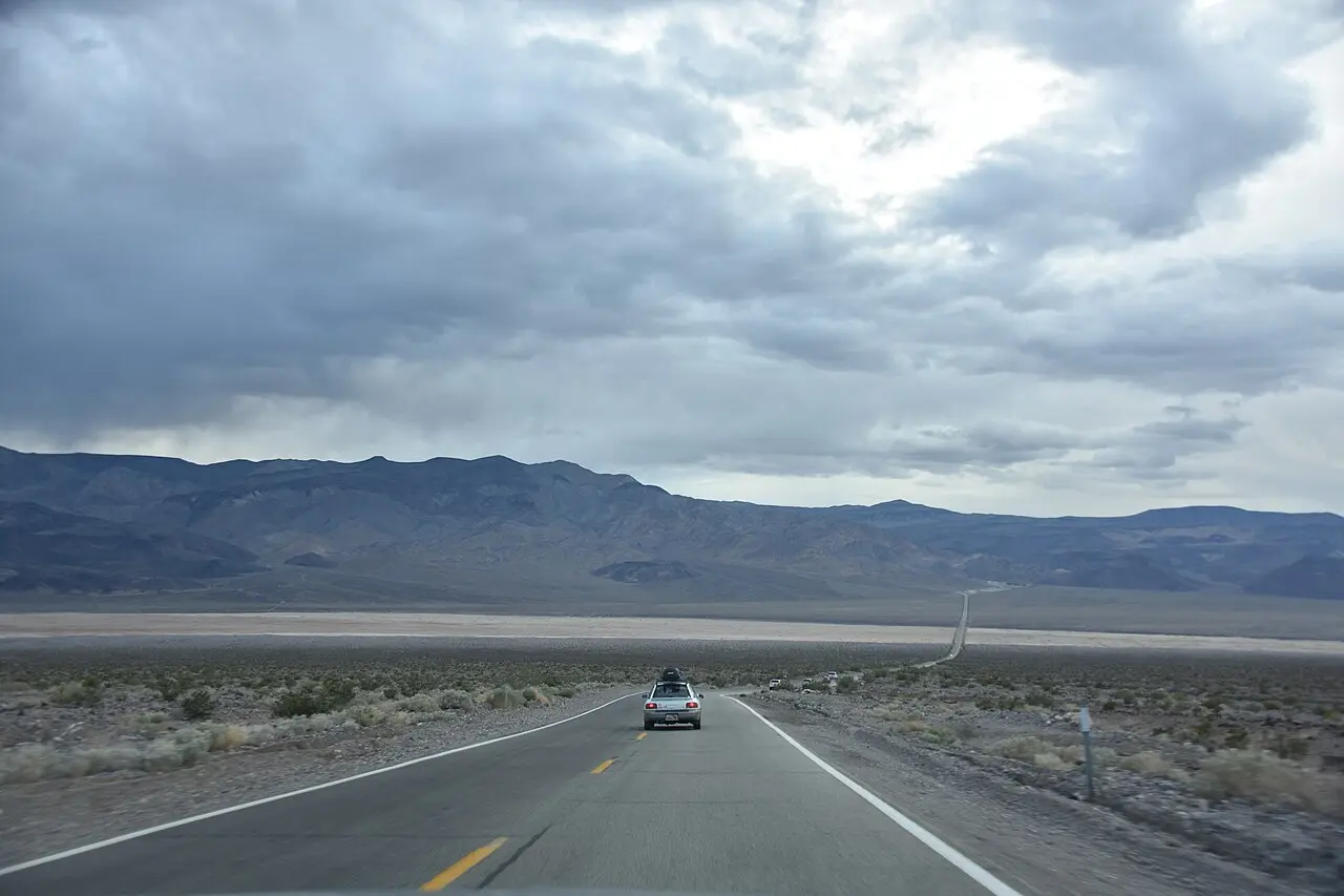
Highway 190 enters Death Valley National Park from the east by way of Death Valley Junction. The first fee machine on the road, at the Ryan Kiosk, takes a credit card; the park does not accept cash. From there the Death Valley Scenic Byway runs 81.5 miles through sculpted hills and shifting sand dunes, and it drops below sea level. The Federal Highway Administration allows two hours to drive it and four to see it. The road was designated a National Scenic Byway in 1998, and the park manages it.
Highway 190 from Zabriskie Point to Towne Pass
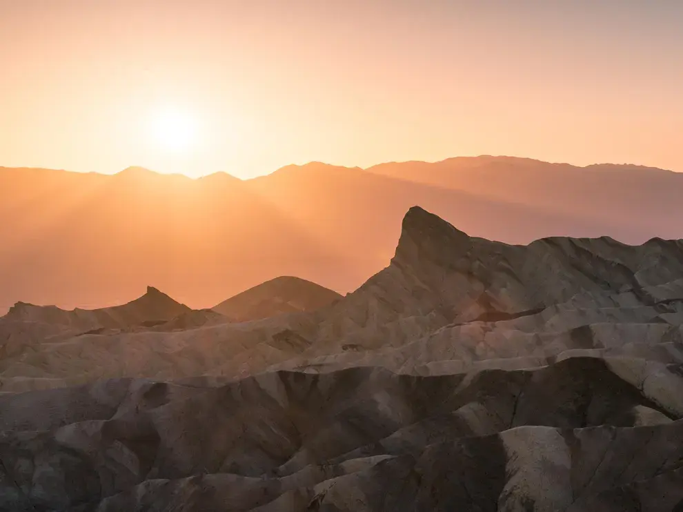
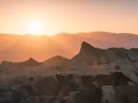
Zabriskie Point is a common place to watch sunrise over the badlands, and Artists Palette and Aguereberry Point are good at sunset. At Furnace Creek, the visitor center is open every day of the year, holidays included. Statues of life-sized desert bighorn sheep stand at the entrance to the exhibit hall. A 20-minute park film runs in the theater, and the Death Valley Natural History Association keeps a bookstore inside. Public Wi-Fi works there around the clock. Along most park roads there is no cell service. Badwater Basin lies 18 miles south on the Badwater Road. At 282 feet below sea level it is the lowest point in North America. Dantes View stands a mile above those same salt flats.
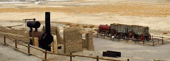
The Harmony Borax Works is on the highway 1.4 miles north of Furnace Creek. An original 20-mule team wagon stands there among adobe ruins. In the creek country nearby, the Salt Creek pupfish survives from a time when a gigantic lake filled Death Valley. It tolerates water saltier than the ocean and spawns in the cooler winter months. As summer comes on and the creek dries, it retreats upstream to the spring-fed source. Visitors can see the fish in springtime.
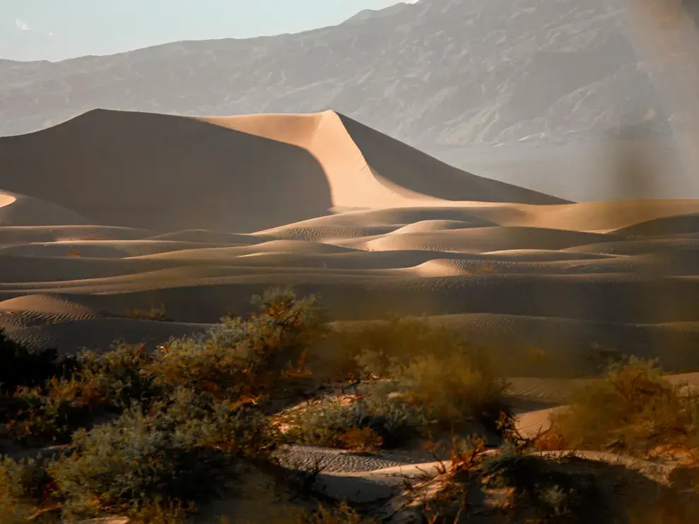
The Mesquite Flat Sand Dunes sit directly off Highway 190, with a parking lot on the south side of the dune field. At sunrise and sunset the ripples and edges of the sand stand out in long shadows. The dunes have appeared in films from The Three Godfathers to Star Wars: Episode IV – A New Hope. Beyond them is Stovepipe Wells, with a ranger station whose hours vary, 87-octane gasoline at the resort, and four electric-vehicle chargers beside the General Store. West of there the highway climbs over the Panamint Range by Towne Pass. The Darwin Falls road is washed out in many places, and the park expects it to stay closed until about the summer of 2027. Hikers park on the shoulder of CA-190 and walk in. Emigrant Campground is closed indefinitely for water system repairs.
The park’s roads were mostly built in the 1930s. They are narrow and serpentine, and the park ranks the single-car rollover as a greater danger than the heat. Snakes warm themselves on the blacktop in the mornings and evenings. The park asks drivers to slow down at night and to leave any snake to move off the road on its own. On the valley floor there are no cacti, because the heat, the dryness, and the salt in the soil keep them out. They begin at about 400 feet above sea level and grow up to the summits. Weathered wooden mining claim posts stand along many hiking routes. Birds perch on them now, and the park asks visitors to leave them in place.
The park describes the seasons this way. Autumn arrives in late October with warm days and clear skies. Winter brings snow to the high peaks. Spring is the busiest season. By May the valley can be scorching. The 2027 Death Valley Dark Sky Festival is set for February 5–7, with telescope viewings, talks, and scientists working alongside park rangers.
Christmas Eve at Travertine Springs
The highway’s eastern approach is older than any pavement. In October 1849 a wagon train called the San Joaquin Company left Salt Lake City, too late in the year to cross the Sierra Nevada. Its guide, Captain Jefferson Hunt, would go only as fast as the slowest wagon. A young man rode into camp with a hand-sketched map of a “short cut” to Walker Pass. More than 20 wagons kept to it after the rest turned back. According to the Park Service, these parties entered Death Valley by way of present-day Death Valley Junction, along the route Highway 190 now follows. On Christmas Eve of 1849 some of them reached Travertine Springs, the source of Furnace Creek.
From there they split. The Jayhawkers went north toward the Mesquite Flat Sand Dunes. They slaughtered several oxen, burned the wood of their wagons to cook the meat and make jerky, and walked out over Towne Pass. The Bennett-Arcan party failed to cross the Panamints by Warm Springs Canyon. They sent two young men, William Lewis Manly and John Rogers, over the mountains for supplies. The two walked more than 300 miles to Mission San Fernando and came back nearly a month later with three horses and a one-eyed mule. They had ridden one horse to death and abandoned the other two. Two families with children had waited for them. The Park Service records that only one man died during the wait, but over its four months the short cut cost the lives of many men. As the survivors climbed out over the Panamints, one of them is said to have looked back and said, “Goodbye, Death Valley.”
Cottonball and twenty mules
In 1881 Aaron Winters discovered borax on the marsh near Furnace Creek, which was then called Greenland. He sold his holdings to W. T. Coleman of San Francisco. The California landmark marker says Coleman built the Harmony Borax Works in 1882. The Park Service says the plant began processing ore in late 1883 or early 1884. Chinese workmen gathered the ore, which was called cottonball. At full operation the plant employed 40 men and produced three tons of borax a day. In summer the processing water would not cool enough for the borax to crystallize, so Coleman moved the work force to the Amargosa Borax Plant near present-day Tecopa. His superintendent, J. W. S. Perry, designed the wagons and laid out the route. Twenty-mule teams hauled the double wagons 165 miles to the railroad at Mojave until 1889.
The plant had already shut down in 1888, after five years of production, when Coleman’s financial empire collapsed. Francis Marion Smith acquired it and never resumed boiling ore there. The works became part of the reserves of the Pacific Coast Borax Company. Not far away, on July 10, 1913, a thermometer at Furnace Creek Ranch recorded 134°F (57°C), the world’s highest air temperature on record. California registered the borax works as a Historical Landmark in 1962. It was placed on the National Register of Historic Places on December 31, 1974.
Eichbaum’s road over Towne Pass
In 1925, Death Valley had no automobile road fit for tourists. H. W. Eichbaum knew the country well. He had come west in 1905 with an engineering degree and built Rhyolite’s first electricity plant in 1906. Later he ran sightseeing tours on Catalina Island in Moreland Roadrunners, open-topped buses that seated 20. He wanted to build a hotel at Stovepipe Wells and a toll road to reach it. “You can see lots of things in Death Valley, and you see something different every day,” he once said.
The Inyo County Board of Supervisors put him off twice. On August 3, 1925, it voted three to two against him. Officials of the Pacific Coast Borax Company opposed the plan, and the mine owner John Salsbury called it “confiscation.” The company’s chief field engineer, C. M. Rasor, then offered terms. The road had to end at Stovepipe Wells, and Eichbaum had to drop a second route north through Furnace Creek, the heart of the company’s borax ground. Eichbaum agreed. On October 5, 1925, he returned with a petition signed by 384 people and a letter from the Automobile Club of Southern California. The board voted unanimously for Resolution No. 25-16. Official documents called the road the Death Valley Toll Road.
A crew of six to eight men, among them a team driver, a grader, rock throwers, and a cook, worked east from Darwin Wash. They lived in tents and moved them as the work went forward. A Caterpillar tractor pulled a seven-foot grader. To save money Eichbaum used no dynamite, so the road went around rock outcrops it could not move. In Darwin Canyon it likely followed an earlier Native American trail. Towne Pass had been too steep to draw much traffic until then. Supervisor Amos P. Hancock inspected the finished road, and the county issued its Certificate of Completion on May 4, 1926. The road ran about 35.5 miles and was not surfaced.
The Stovepipe Wells resort opened in November 1926, the first tourist lodging in the valley. It took its name from the old spring nearby. According to the park’s Historic Resource Study, blowing sand often hid the spring until someone pushed a length of stovepipe into it so it could be found from any direction. In February 1927 the Pacific Coast Borax Company opened the Furnace Creek Inn. Park Service director Stephen T. Mather consulted with the railroad men who planned it.
From toll road to state highway
Eichbaum died in Los Angeles on February 16, 1932. Death Valley National Monument was established in 1933. Its first administrator, John R. White, who was also superintendent of Sequoia National Park, urged that the toll road be sold to the state or to Inyo County. On July 17, 1933, District 9 Engineer J. W. Vickrey met Eichbaum’s widow, Helene, at the Dow Hotel in Lone Pine, and she negotiated the road’s sale to the state. The next year a state engineer named Lowden reported the road in “very poor” condition, with washouts, and in need of “intensive maintenance work.” Federal guardianship brought better roads, and visitation rose from a few thousand in 1933 to almost 50,000 in 1936.
The monument was enlarged in 1937. The California Desert Protection Act of October 31, 1994, abolished it and made its lands Death Valley National Park. The state paved, widened, and improved several sections of Eichbaum’s road into State Route 190. Other sections were bypassed. In Darwin Canyon the old grade is now a four-wheel-drive road, and near Towne Pass abandoned segments lie off to the side of the highway.
Notable Events
- 1849The stranded emigrant parties entered the valley by way of present-day Death Valley Junction and along the same route followed by Highway 190; on Christmas Eve of 1849 some of them reached Travertine Springs, the source of Furnace Creek. nps.gov
- 1880sAn original 20-mule team wagon and the adobe ruins mark the 1880s Harmony Borax Works along the byway. nsbfoundation.com
- 1881Borax was found near Furnace Creek Ranch, then called Greenland, in 1881. nps.gov
- 1888The Harmony plant went out of operation in 1888, after only five years of production, when Coleman's financial empire collapsed. nps.gov
- 1889From this point 20-mule teams transported the processed borax 165 miles to the railroad until 1889; the ore, called 'cottonball', was gathered by Chinese workmen. ohp.parks.ca.gov
- 1913The world record highest air temperature of 134F (57C) was recorded on July 10, 1913 at Furnace Creek Ranch. nps.gov
- 1925The Board voted unanimously in favor of Eichbaum's application; the act was codified as Inyo County Resolution No. 25-16, authorizing him to construct the toll road in Death Valley. dot.ca.gov
- 1926Following an inspection by Inyo County Supervisor and ex-officio road overseer Amos P. Hancock, the county issued the Certificate of Completion on May 4, 1926; the road was about 35.5 miles long and not surfaced with gravel or any other material. dot.ca.gov
- 1926H.W. Eichbaum built the Stovepipe Wells resort in the upper part of the valley, the first tourist accommodations in the area; it first opened its doors in November 1926. npshistory.com
- 1927The Pacific Coast Borax Company opened the Furnace Creek Inn in February 1927, offering a whole new segment of the valley to public view. npshistory.com
- 1932Eichbaum died in Los Angeles on February 16, 1932 and did not live to see the final chapter of his toll road written. dot.ca.gov
- 1933By early 1933 the State Division of Highways was actively pursuing acquisition; District 9 Engineer J.W. Vickrey met Helene Eichbaum on July 17, 1933 at the Dow Hotel in Lone Pine. dot.ca.gov
- 1933Death Valley National Monument was established in 1933 and enlarged in 1937, per Congress's findings in the desert protection act. nps.gov
- 1933Increased travel was insured when the area was turned over to the federal government as a national monument in 1933, for federal guardianship meant a corresponding improvement in its roads and facilities. npshistory.com
- 1934Engineer Lowden reported that the toll road's condition was "very poor" with washouts and in need of "intensive maintenance work", and that it appeared the road was no longer being maintained by Mrs. Eichbaum. dot.ca.gov
- 1936Rapid development after the monument's creation raised visitation from only a few thousand in 1933 to almost 50,000 in 1936. npshistory.com
- 1962The state registered Old Harmony Borax Works as a Historical Landmark on 8/16/1962, at Furnace Creek in Inyo County, on State Hwy 190 (P.M. 109.1), 1.4 mi N of Furnace Creek. ohp.parks.ca.gov
- 1974On December 31, 1974 the site was placed on the National Register of Historic Places. nps.gov
- 1994The California Desert Protection Act of October 31, 1994 abolishes the monument and incorporates its lands into a new Death Valley National Park. nps.gov
- 1998The byway's designation info records National Scenic Byway status in 1998. nsbfoundation.com
People
- Amos P. Hancock, Inyo County Supervisor and ex-officio road overseer who voted for Eichbaum's application and inspected the completed road for its Certificate of Completion (1926).
- Burkett E. Sherwin, Inyo County Surveyor hired by Eichbaum to survey the toll road route.
- H.W. Eichbaum, built the Eichbaum Toll Road, sections of which became the current state highway, and the Stovepipe Wells resort it served; lauded for pioneering the tourist business into Death Valley (road built 1925-26).
- Helene Eichbaum, widow who administered the Eichbaum estate and negotiated the sale of the toll road to the state.
- John R. White, Superintendent of Sequoia National Park and first administrator of Death Valley National Monument; urged the sale of the toll road to the state or Inyo County (1933).
- Francis Marion Smith, acquired the Harmony works after Coleman's empire collapsed; the site became part of the borax reserves of the Pacific Coast Borax Company and its successors.
- William T. Coleman, built the Harmony plant and began processing ore; moved his work force to the Amargosa Borax Plant near present-day Tecopa in summer (late 1883 or early 1884).
- Captain Jefferson Hunt, guide of the wagon train, going only as fast as the slowest wagon.
- John Rogers, one of two young men sent over the mountain to get supplies who rescued the Bennett-Arcan party.
- William Lewis Manly, one of two young men sent over the mountain to get supplies who rescued the Bennett-Arcan party.
- Harry Gower, engineer for the borax company for almost fifty years, quoted on the hardships of its Death Valley hotel venture (almost fifty years).
- Stephen T. Mather, Director of the National Park Service and an active consultant with the railroad men and others planning the Furnace Creek Inn operation.
- Aaron Winters, discovered borax on the marsh at Furnace Creek and sold his holdings to W. T. Coleman (1881).
- J. W. S. Perry, superintendent for W. T. Coleman, commissioned to design wagons and locate a suitable route to Mojave (1882).