
D. L. Bliss State Park (Lester Beach)
South Lake Tahoe, El Dorado County, California. State Park.
Details

- Where
- Lester Beach Road, South Lake Tahoe, CA 96150. Directions
- When
- Day Use Hours: Sunrise to Sunset.
- Season
- Off-season Day Use (closed to vehicles) will begin October 1st 2026.
- Getting there
- The park is located 17 miles south of Tahoe City on Highway 89, a couple of miles north of Emerald Bay.
- Fees
- Vehicle Day Use: $10.00.
- Access
- When the parking lots have filled for Day Users, visitors will have to park at the visitor center at the top of Bliss hill. The Visitor Center parking lot is near highway 89 and the visitor center is open on weekends. It is approximately 1 mile to hike from the Vistor Center to the closest Rubicon Trailhead, and a steep mountainous 2 mile hike to the beaches.
- Walk-in or reserve
- Camping at DL Bliss is on a first come/first serve basis through the night of September 30th when camping will close for the 2026 season.
- Phone
- (530) 525-7277
- Website
- parks.ca.gov
- Managed by
- California State Parks.
- Established
- 1929.
Since October 1, 2026, the park gate has been closed to cars for the off-season. Walkers park in the visitor center lot near Highway 89, at the top of Bliss hill, and go in on foot between sunrise and sunset. It is about a mile to the nearest Rubicon trailhead and a steep two miles to the beaches. The visitor center is shut, and the park has no water or restrooms until spring. The nearest restrooms are at the Sugar Pine Day Use Area, seven miles north, and the nearest food is in South Lake Tahoe, ten miles south. Heavy Sierra snow can close Highway 89 for a time in winter.
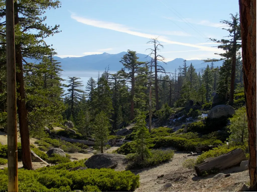
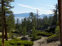
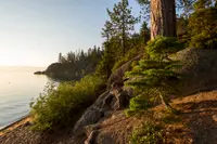
The park lies 17 miles south of Tahoe City on Highway 89, a couple of miles north of Emerald Bay. Sugar pines grow here on thin granitic soil, with ponderosa and Jeffrey pines, incense cedar, and Sierra juniper. The state’s brochure points visitors to the vanilla scent of Jeffrey pine bark and to bats working the beach at twilight. The ground falls steeply to the water, and nearly every road and camp in the park sits somewhere on that slope.
Lester Beach and Calawee Cove
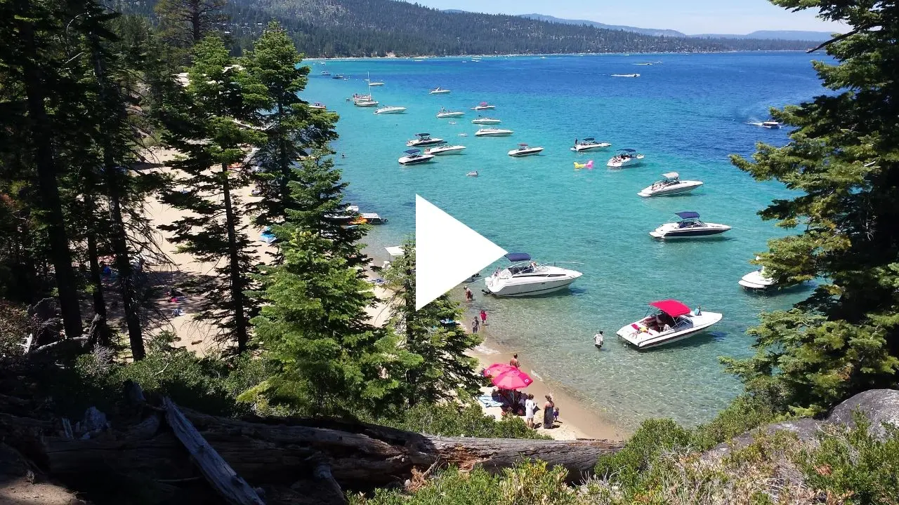
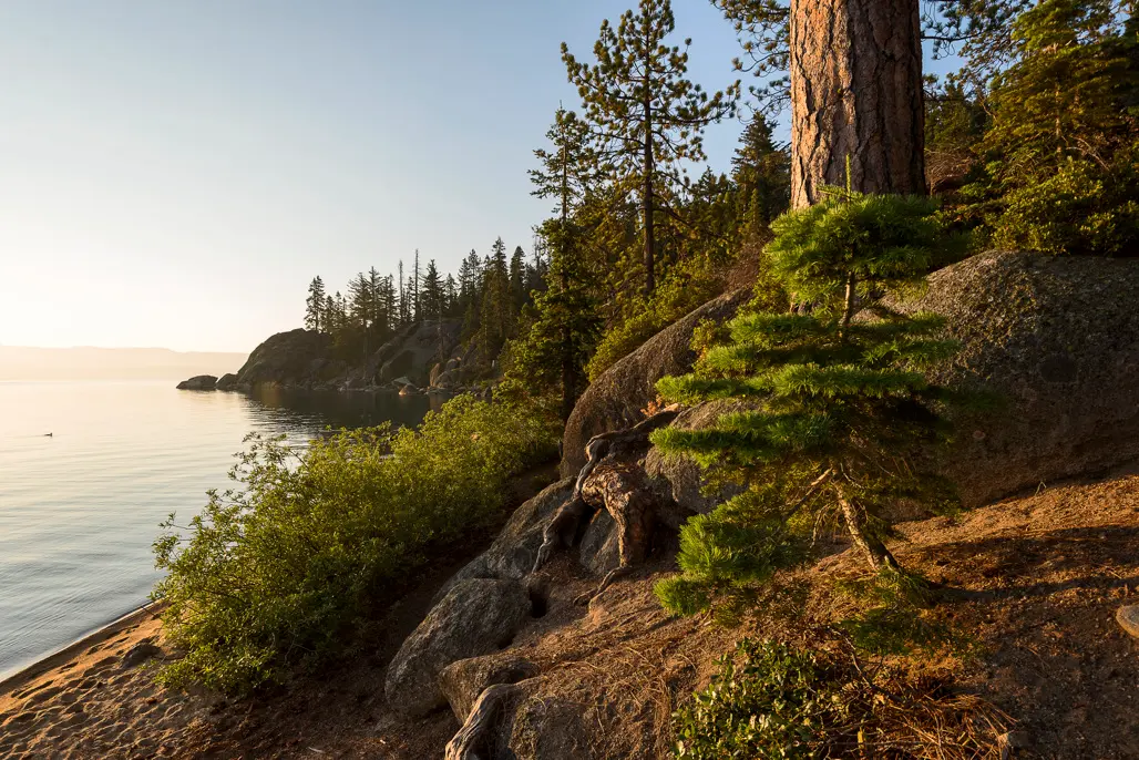
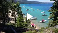
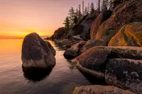
At the bottom of the hill are two sand beaches. Lester Beach has accessible parking and is a common put-in for kayaks, paddleboards, and canoes. Boats come in on car roofs, because trailers are not allowed in the day-use lots and the park has no launch for motorized craft. Calawee Cove lies at the north end. Kaytlen Jackson, spokesperson for the Sierra District of California State Parks, lived in the park for about four years as a park aide. “You can go for a long swim because it stays shallow quite a ways,” she said. “Especially here at Calawee Cove, it’s a little bit more protected, so we don’t have the massive waves the parts of the lake get.”
Just around the corner from the cove the bottom falls away. Jackson described “a massive drop off, like you’re cruising at this turquoise light water, and then all of a sudden it’s black, blue, deep water, right on the other side of that wall.” Scuba diving is allowed in the underwater preserve, which takes in Rubicon, Emerald, and Eagle Points. The preserve opened in September 1994 as California’s first shipwreck preserve. The sources disagree on how far down a person can see. The park’s web page and its 2026 information sheet say over 100 feet from promontories such as Rubicon Point. The older park brochure says about 70 feet. The rules forbid jumping or diving into the water from shore, rocks, or piers.
The Rubicon Trail starts at Calawee Cove and follows the shore south past Vikingsholm to Eagle Point Campground in Emerald Bay State Park. The park’s web page gives its length as 7.4 miles, the information sheet as 5 miles one way, and KQED as around 8 miles. Vicki Adams grew up at Tahoe and told KQED she had hiked the trail every year for 40 or 50 years, except during the recent closure. Lake Tahoe historian Mark McLaughlin advised hikers to watch for bald eagles and osprey taking fish out of the lake. Paddlers below the cliffs to the south can see hikers on the trail 150 feet above them.
In summer, parking near the beaches fills early. “On the weekends, sometimes we’re closed for day parking by 9 a.m.,” Jackson said.
The camps on Bliss hill
The campground holds 165 sites in five clusters: Upper and Lower Pines, East and West Ridge, and Beach Camp. The Pines sites sit highest and farthest from the lake, and many are cut into the steep slope with views down to the water. Jackson singled out site 162 for its alpenglow at sunrise and sunset. Beach Camp is a short walk uphill from Lester Beach. The campground was built in 1934, and its parking pads are still small. Each site has a table and a metal bear-resistant food locker, and camping closed for the 2026 season after the night of September 30.
Over Memorial Day weekend 2026, KQED reporter Sarah Wright camped at site 151 and heard a ukulele nearby. It was Charlie Gawley of Fairfield, playing while his wife, Kathy, walked their two-year-old Labrador, Kona. The couple had camped at Bliss regularly before the park closed. “Every year during the renovation [Kathy] kept checking to see if it was going to be open,” he said. What brings them back is the quiet. “It’s not a party place,” Kathy said. They told Wright they had seen a bear on every visit. A few minutes later, while she was paddling at sunset, car alarms and air horns went off in the camp as campers drove off a large black bear. “They are looking for the most amount of calories for the least amount of work — and we can’t fault them for that,” Jackson said.
Balancing Rock and the Washoe winter house
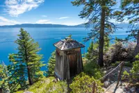
A half-mile self-guided nature trail in the northwest part of the park leads to Balancing Rock. At the trailhead stands a Galis Dungal, a winter home of the Washoe people. Jackson said a tribal member built it of incense cedar bark, which resists pests and fire. The Washoe were the first people of the Tahoe basin. They called the lake da-ow-aga and held it to be the center of the Washoe world. They fished and gathered here and went down to the Nevada and California valleys for the winter. The name Tahoe comes from a Washoe word interpreted to mean “edge of the lake.” Between 1848 and 1862, during the gold and silver rushes, the Washoe lost an estimated 10,000 square miles of lakeside and surrounding land. The Washoe Tribe of California and Nevada now runs the Meeks Bay resort and campground north of the park.
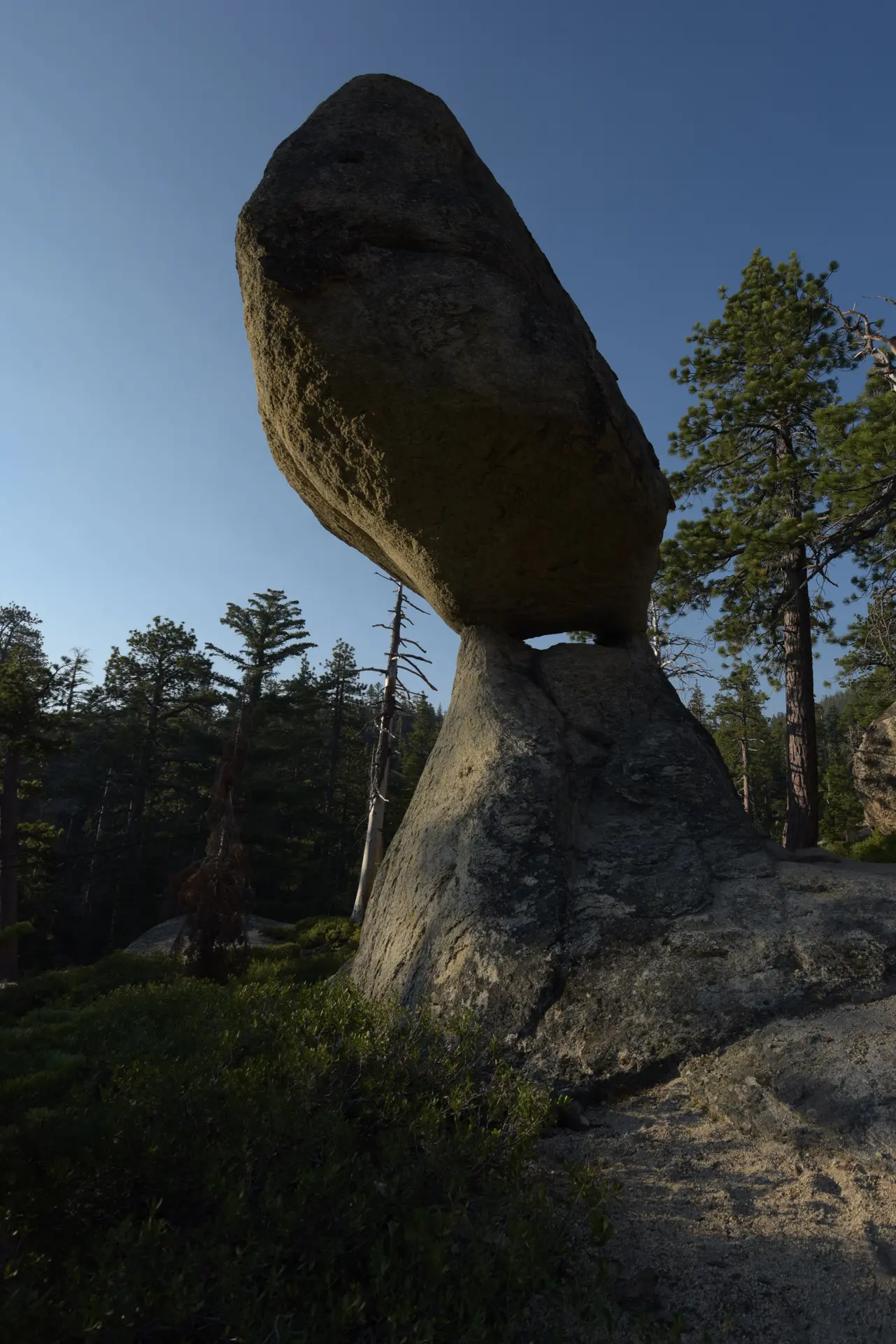
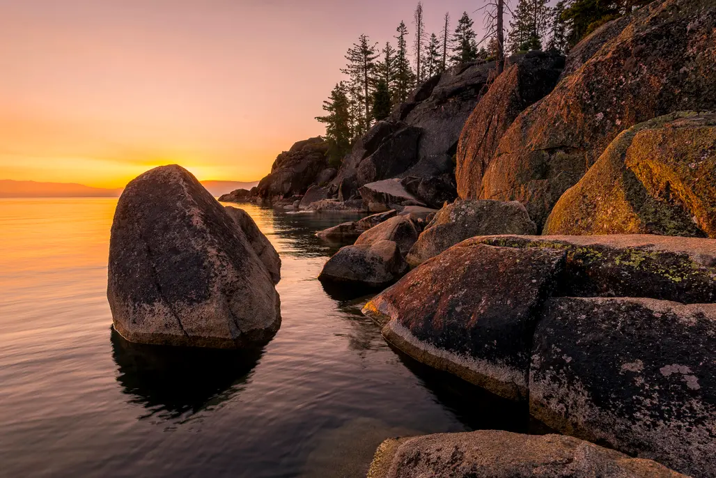
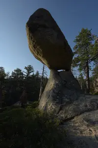
The rock itself is an upper block of about 130 tons resting on a slender stone base. The granite weathered faster along a joint plane, a long horizontal crack that shows plainly at the rock’s “waist.” Visitors in the late 1800s and early 1900s had their photographs taken beside it. The park says it will fall once enough stone erodes to break the balance between the two pedestals. Granite boulders of the same kind lie all through the park. “There’s a lot of really tough bouldering in this park,” Jackson said.
A light on Rubicon Point
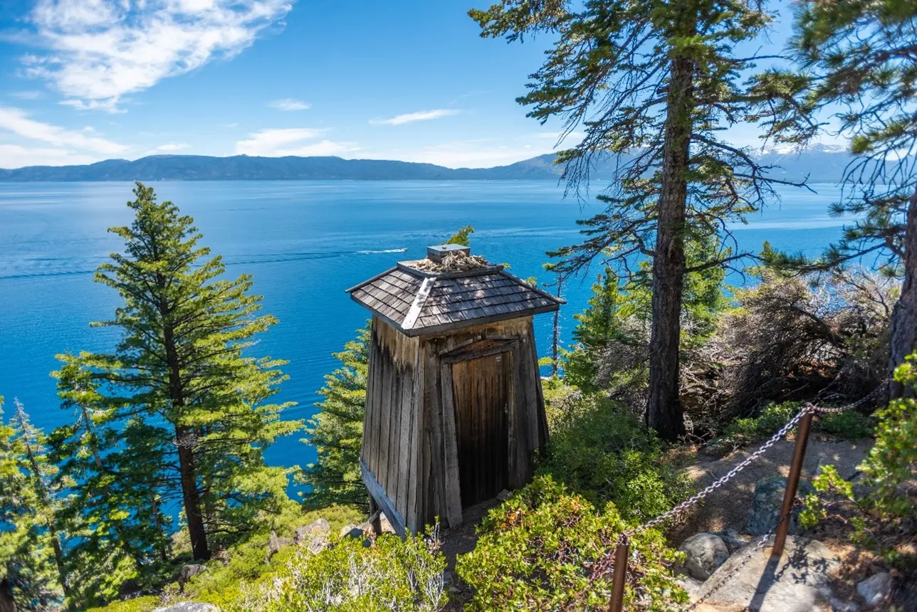
The Lake Tahoe Protective Association asked for navigation aids on the lake for three years before Congress authorized them on August 28, 1916. Congress provided no money at the time. Steamers and launches were then carrying many passengers on the lake, which had a seventy-mile mail route. An acetylene light was set on Rubicon Point at a cost of $1,352. It was a 200-millimeter AGA lantern and flasher on a small lantern house. The Lighthouse Service Bulletin of October 1, 1919, reported it established, so it was likely lit that September. Its focal plane stood 200 feet above the lake, and it showed a white flash every five seconds. KQED counts it among the highest-elevation lighthouses in the country. In 1921 the light was discontinued and moved four and a half miles north to Sugar Pine Point.
The point had seen trouble before the light. Captain Dick Barter, known as “the Hermit of Emerald Bay,” lived on Fannette Island from 1863 to 1873. In 1873 his boat was found wrecked at Rubicon Point above deep water, and his body was never recovered.
The empty lantern house was stabilized in 2001, after the nonprofit Tahoe Heritage Foundation helped raise about $25,000. Wood-penetrating epoxy was injected into its beams. An independent mill supplied sugar pine to match the original lumber. For about five years afterward, a battery light was shown on special occasions. After vandals struck again, work began in 2015 on a new rehabilitation. A $48,000 Tahoe Fund grant in 2017, tied to rerouting a steep stretch of the Rubicon Trail, paid for timber cross braces inside and an iron frame in the doorway. The Lighthouse Trail runs 0.9 miles one way and makes a loop with part of the Rubicon Trail.
Duane Bliss and the four-inch pipe
The park takes its name from Duane Leroy Bliss. According to McLaughlin, he was born in Savoy, Massachusetts, in 1833 and finished school by age 13. Rich Adams, acting Sierra District superintendent, describes him as a 49er who came to California in 1849 at 16 and went from prospecting to banking in Virginia City. In 1868 the Bank of California made him right-of-way agent for the new Virginia & Truckee Railroad. In 1873 he became president and general manager of the Carson and Tahoe Lumber and Fluming Company. McLaughlin writes that Bliss ordered his loggers to spare trees under 15 inches in diameter so the forest would regrow. Around the turn of the century he launched a passenger steamship, built a hotel for wealthy tourists, and laid a narrow-gauge railroad from Tahoe City to Truckee. “It was the Bliss family that wanted this to be a state park after Duane passed away,” Adams said. The state began negotiating in 1928, and in 1929 the family gave 744 acres to the California State Park System.
The Civilian Conservation Corps built the park between 1933 and 1942. Lester Beach Road served as their service road while crews cut roads through the park with a 1932 Caterpillar bulldozer. The water system dates from that period. It was a four-inch line that received only repairs from 1934 onward.
In May 2023 the park closed so crews could dig up and replace every pipe in it. Snow limited the work to summers. The project was planned to take one year, but laying pipe through Sierra granite slowed it. “Every summer we built upon what had been done the previous year until the project was completed in the fall of 2025,” Jackson said. The crews laid an eight-inch main along 2.9 miles of park road and added 22 high-flow, freeze-proof hydrants that work year-round. The roads were repaved, the visitor center was renovated, and new interpretive signs went up. The entrance station was moved off Highway 89 and farther into the park to ease traffic. The cost rose from $5 million to just over $6 million, with about $1.1 million from the Tahoe Regional Planning Agency and the U.S. Fish and Wildlife Service. The park’s game cameras recorded bobcats, pine martens, snowshoe hares, coyotes, osprey, and bald eagles during the empty years. “It kind of gave the park a rest from heavy visitorship,” Jackson said.
D.L. Bliss reopened on May 21, 2026. The ribbon was cut in spring rain on Thursday, May 28. Adams began working at the park in 1995. “I lived here in this park in ‘95 and ‘96 in the Bliss Dorm and it still is home,” he said. At the ceremony, a length of the original 1930s four-inch pipe was laid beside a length of the new eight-inch line.
Notable Events
- 1848Between 1848 and 1862, the Washoe people's estimated 10,000 square miles of lakeside and surrounding land were taken during the gold and silver rushes. parks.ca.gov
- 1900sRubicon Point Lighthouse was built in the early 1900s and is among the highest-elevation lighthouses in the country. kqed.org
- 1919The light was likely placed in operation in September 1919, as the Lighthouse Service Bulletin of October 1, 1919 noted that an acetylene light had been established at Rubicon Point. lighthousefriends.com
- 1921In 1921, the light on Rubicon Point was discontinued and moved four-and-a-half miles north to Sugar Pine Point. lighthousefriends.com
- 1928The state started negotiating the purchase of D. L. Bliss State Park in 1928. tahoefund.org
- 1933The park's infrastructure was built by the Civilian Conservation Corps; Lester Beach Road served as a service road while the CCC built roads throughout the park using a 1932 Caterpillar bulldozer. tahoedailytribune.com
- 1934The campground was built in 1934 and the parking pads are small. parks.ca.gov
- 2001Renovation and stabilization of Rubicon Point Lighthouse was completed in 2001, after the nonprofit Tahoe Heritage Foundation helped raise around $25,000 for the project. lighthousefriends.com
- 2023D.L. Bliss closed so workers could dig up and replace water pipes throughout the park. kqed.org
- 2025Work built on each previous summer until the project was completed in the fall of 2025, Jackson said. kqed.org
- The foundation announced completed water infrastructure improvements and a May 21st park reopening. sierrastateparks.org
People
- Kaytlen Jackson, Sierra District California State Parks spokesperson; lived in the park for around four years as a park aide.
- Duane Leroy Bliss, namesake; 19th century banker, railroad operator and timber baron (born 1833).
Sources
- parks.ca.gov/?page_id=505
- parks.ca.gov/pages/505/files/DLBliss_Infosheet_8.5x11_052126_FINAL.pdf
- kqed.org/news/12088718/this-iconic-tahoe-campground-just-reopened-heres-how-to-make-the-most-of-it
- tahoefund.org/about-tahoe/tahoes-environmental-history
- sierrastateparks.org/our-parks
- parks.ca.gov/pages/505/files/DLBlissEmeraldBayFinalWeb122917.pdf
- tahoedailytribune.com/entertainment/rubicon-trail-at-lake-tahoes-d-l-bliss-state-park-provides-history-with-its-views
- lighthousefriends.com/light.asp?ID=1772
- tahoedailytribune.com/news/d-l-bliss-state-park-celebrates-grand-reopening-with-ribbon-cutting-ceremony-after-three-year-closure