.jpg)
Chimney Peak Back Country Byway
Lake Isabella, Kern County, California. BLM Byway.
Details

- Where
- Lake Isabella, Kern County, CA. No street address stated. Directions
- Getting there
- Follow highway CA-178 approximately 30 miles east of the town of Lake Isabella and turn north onto Canebreak Road.
- Fees
- No Fees.
- Access
- 7/17/2024- Chimney Peak, Long Valley campgrounds and portion of the Pacific Crest Trail are closed due to wildland fire danger.
- Phone
- (661) 391-6000
- Website
- blm.gov
- Managed by
- Bakersfield Field Office.
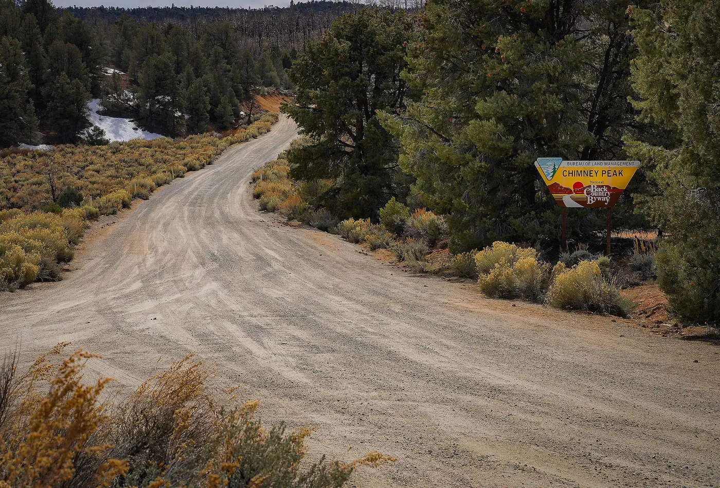
About 30 miles east of the town of Lake Isabella, State Highway 178 passes the Canebrake Flat area, and a graded dirt road leaves it to the north. This is Canebrake Road, also called the Chimney Peak Back Country Byway. The Tulare County Treasures Project calls it rugged and recommends a high-clearance, four-wheel-drive vehicle. The Bureau of Land Management’s Bakersfield Field Office manages the road and charges no fee. The Federal Highway Administration’s byway listing advises allowing one to two hours for the drive, depending on weather. The sources disagree on the road’s length. The Federal Highway Administration gives 39 miles, and the National Scenic Byway Foundation gives 18.1.
Up Canebrake Road between three wildernesses
Heading north, a driver has the Domelands Wilderness on the left and the Owens Peak Wilderness on the right. About 9 miles up from the highway the road meets Long Valley/Chimney Basin Road at a prominent junction. Beyond it, the Chimney Peak Wilderness lies to the left for those who stay on Canebrake Road and to the right for those who take the Long Valley fork. The BLM names its best on-trail entry as a small Pacific Crest National Scenic Trail trailhead about 1.6 miles north of the junction. Motor vehicles stop at the wilderness line, and the byway runs along that boundary. By the Federal Highway Administration’s count, it passes more than 50,000 acres of designated wilderness.
The road serves the Chimney Peak Recreation Area, about 105,000 acres reaching from north of Highway 178 to the edge of the field office near Kennedy Meadows. Chimney Creek and Long Valley campgrounds are reached from it, and Walker Pass Campground lies within the same recreation area. The BLM lists hiking, backpacking, horseback riding, hunting, wildlife viewing, and camping. The highway administration adds mountain biking.
Pinyon, Joshua tree, and trout water
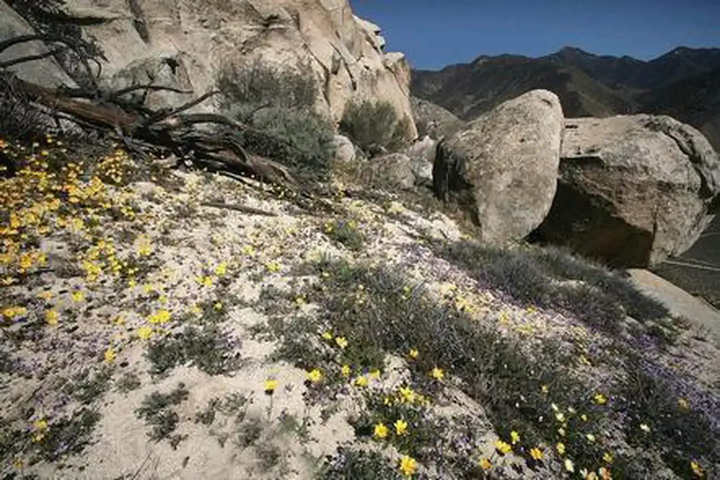
Here the Sierra Nevada gives way to the Mojave Desert. The woodland along the road is predominately pinyon-juniper. The BLM describes the Chimney Peak Wilderness as rocky mountainous terrain dominated by pinyon pine, with areas of sagebrush, scattered springs and streams with their riparian growth, and seasonal wildflower displays. The Tulare County Treasures Project adds Joshua trees and creosote bushes on the valley floors, foothills, and alluvial fans. It gives the wilderness 13,140 acres between 5,246 and 7,951 feet; the 1994 law that designated it set the acreage at 13,700. By that project’s account, most of the wilderness lies in the southeast corner of Tulare County, north of the Kern County highway where the road begins.
According to Wilderness Connect, Chimney Peak rises in the northeast corner to 7,994 feet. Chimney Creek runs briskly across the eastern boundary and holds trout. Mule deer, mountain lion, black bear, and bobcat range the country. About 8 miles of the Pacific Crest Trail cross the wilderness on the way north to the Domelands.
Fire on the ridges, 2000 to 2024
West of the road, the Dome Land Wilderness is a country of granite domes, mostly pinyon and sage. Much of it burned in the Manter Fire of 2000.
At about 3:30 in the afternoon of June 1, 2016, the BLM received a report of fire near Chimney Peak campground. When firefighters arrived it covered about 30 acres and was growing rapidly in difficult terrain. Firefighters and local and county law enforcement evacuated private residences and the campgrounds. The BLM’s update the next day put the Chimney Fire at an estimated 1,000 acres, burning mostly in the Chimney Peak and Owens Peak wilderness areas. The fire was 10 percent contained, with 390 people assigned: 13 hand crews, 18 engines, 7 helicopters, and 9 air tankers. Chimney Peak/Canebrake Road was closed to all traffic. The Pacific Crest Trail was shut between Highway 178 and Kennedy Meadows, though the fire had not crossed it. No structures had been lost, and the cause was under investigation. The second incident priority was “To protect wilderness character in the Chimney and Owens Peak Wilderness Areas.”
A BLM notice dated July 17, 2024, closed the Chimney Peak and Long Valley campgrounds and a portion of the Pacific Crest Trail because of wildland fire danger.
A low-standard road and a desert law
The road’s designation dates from 1989. That year the BLM began a byway program in response to the report of the President’s Commission on Americans Outdoors. The agency’s 1993 handbook gives the program’s primary focus as “back country byways,” “a system of low standard roads and trails that pass through areas of public lands that have high scenic or public interest value.” The Intermodal Surface Transportation Efficiency Act of 1991 created a national scenic byway program and recognized the BLM’s back country byways as part of the national system. The BLM State Director approves each designation.
On October 31, 1994, the California Desert Protection Act designated the Chimney Peak Wilderness. The same act established Death Valley and Joshua Tree national parks and the Mojave National Preserve.
Walker’s pass and the cane gatherers
East of the turnoff, Highway 178 crosses Walker’s Pass. A state landmark stands at its summit, 8.4 miles northwest of Freeman Junction. Joseph R. Walker, whom the marker calls an American trailblazer, left the San Joaquin Valley through the pass in 1834. Topographer Edward M. Kern crossed the area with the Frémont expedition of 1845, and the Kern River was named for him. Kern County was organized in 1866. After 1860 the pass carried mining freight to Owens Valley.
The California Department of Fish and Wildlife records that Native Americans first inhabited the South Fork Valley, below the byway, about 1000 B.C. They wintered there after summering in the high Sierra. The first European presence in the valley was the United States Army in 1834, and settlers soon followed. In 1853 Lt. R.S. Williamson found Native Americans gathering cane along a creek, from which they processed a sweet sugary substance. He named it Canebrake Creek, and the road north from the highway carries the same name.
Notable Events
- 1834Joseph R. Walker, American trailblazer, left the San Joaquin Valley through Walker Pass in 1834, the pass named for him on the highway that gives access to this byway. ohp.parks.ca.gov
- 1834The first European presence in the valley the byway road climbs out of was the United States army in 1834, and settlers soon followed. wildlife.ca.gov
- 1853Canebrake Creek was named in 1853 when Lt. R.S. Williamson found Native Americans collecting cane there. wildlife.ca.gov
- 1860After 1860 the Walker Pass country became a mining freight route to Owens Valley. ohp.parks.ca.gov
- 1872Before acquisition by the state, the Canebrake property was one of the first ranches in the valley, established around 1872, and its ranching history greatly altered the river system and riparian habitat. wildlife.ca.gov
- 1989The Bureau of Land Management started a byway program in 1989, in response to recommendations in the report from the President's Commission on America's Outdoors, focused on designating back country byways. blm.gov
- 1991Section 1047 of the Intermodal Surface Transportation Efficiency Act of 1991 created a national scenic byway program under the Secretary of Transportation, and the act recognized the BLM back country byway program as a component of the national byway system. blm.gov
- 1994The U.S. Congress established the Chimney Peak Wilderness, whose boundary the byway runs along, through the 1994 California Desert Protection Act. tularecountytreasures.org
- 2000Much of the Domeland Wilderness at the north end of the Chimney Peak Recreation Area, a country of granite domes, was burned in the Manter Fire of 2000. sierranevadageotourism.org
- 2016The Chimney Fire was reported in the area of Chimney Peak campground and burned primarily in the Chimney Peak and Owens Peak wilderness areas. blm.gov
People
- Edward M. Kern, topographer for the Frémont expedition, for whom the Kern River was named and thus the county this byway lies in (1845).
- Joseph R. Walker, American trailblazer who discovered the pass on the state highway that the byway turns off from (1834).
- Lt. R.S. Williamson, lieutenant whose 1853 party gave Canebrake Creek its name, the creek behind the byway's other name, Canebrake Road (1853).
Sources
- fhwaapps.fhwa.dot.gov/bywaysp/byway/68952
- blm.gov/visit/chimney-peak-recreation-area
- nsbfoundation.com/sb/chimney-peak-back-country-byway
- blm.gov/visit/chimney-peak-recreation-area
- blm.gov/visit/chimney-peak-wilderness
- wilderness.net/visit-wilderness?ID=117
- blm.gov/press-release/chimney-fire-update
- sierranevadageotourism.org/entries/kern-plateau-sequoia-national-forest/0c11b89c-bc7d-4af9-964c-27fb84ff9124