Charleston to Bandon Tour Route
Charleston, Coos County, Oregon. Scenic Drive; Spring through fall.
Details
- Where
- Charleston, Coos County, OR. No street address stated. Directions
- When
- Driving time: 2-3 hours.
- Getting there
- Beginning in Charleston, a 40.5-mile route with optional spurs from Charleston's Marina that ends in Bandon.
- Fees
- None.
- Phone
- 1-800-547-7842
- Website
- traveloregon.com
- Managed by
- Travel Oregon.
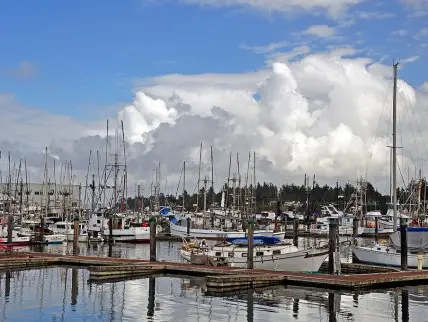
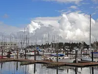
The route begins among boats. Charleston sits at the entrance to Coos Bay, a deep-water port where, in Travel Oregon’s description, fishing fleets and freighters find refuge from the open ocean. Fishing charters and whale-watching excursions leave from the Charleston marina. Betty Kay Charters, run by Bill and Margery Whitmer, is one of the outfits taking passengers out for ocean fishing.
From the marina the Charleston to Bandon Tour Route runs west to the end of the Cape Arago Highway, doubles back, and goes south over Seven Devils Road to the Coquille River and the beach at Bandon. Its length depends on who measures it. Travel Oregon and the state’s TripCheck service give 41 miles and two to three hours of driving. The Bay Area Chamber of Commerce gives 40.5 miles, with optional spurs. The federal byways listing calls it the Charleston-Bandon Loop Tour Route and gives 69 miles and three to five hours, and a byways data page lists it as an Oregon State Scenic Backway. Travel Oregon names spring through fall as the season to drive it, and TripCheck adds winter for whale watching. Along the way the chamber counts six state parks, two national wildlife refuges, and the nation’s first National Estuarine Research Reserve. A driver also passes the three lead natural resource industries of Coos County: commercial fishing, timber and cranberries.
The highway west to Cape Arago
West of town the highway passes the Oregon Institute of Marine Biology, a teaching and research extension of the University of Oregon. Beyond it are Coos Head at the mouth of the bay and Bastendorff Beach County Park, a surfing beach. According to a 2021 field-trip account by the Geological Society of the Oregon Country, this part of the Coos peninsula changed more than any other over the 20th century. The cause was the jetty enclosing the Coos Bay shipping channel, begun in 1926. What were once shoreline cliffs are now a vegetated bluff at least a quarter mile inland. The Army Corps of Engineers brought boulders for the jetty by rail through a tunnel in the Coos Head headland. The original jetty stone is black basalt of the Siletz River Volcanics, and the newer stone is blueschist from the Klamath Mountains.
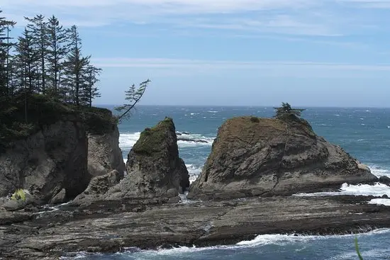
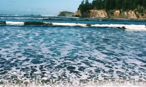
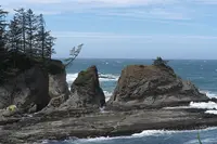
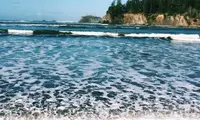
Sunset Bay State Park wraps around a shallow cove. Travel Oregon calls it warm enough for swimming, and the county guides say sandstone cliffs shield it from the strongest winds and waves. A cliffside trail gives views of sea stacks and the Cape Arago Lighthouse. The cliffs are Coaledo Formation, sandstone and mudstone laid down between 45 and 39 million years ago and folded by compression from the Cascadia subduction zone. Each cove on the headland sits on a strike-slip fault running roughly east to west. The layers grow younger northward, so a driver heading south toward Cape Arago travels deeper into time. On Labor Day weekend 2020, the geological society reported, ancient tree stumps showed in the bay.
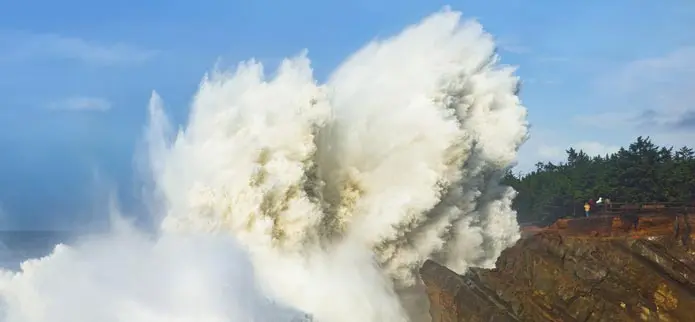
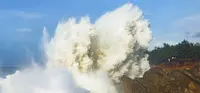
Shore Acres State Park lies a mile on by the reckoning of Travel Oregon and the state parks, and three miles on by the county guides. It occupies the bluff where Louis Jerome Simpson’s estate stood. The formal garden, inspired by the original, holds a Japanese-style garden with a lily pond and two rose gardens. The state says something is in bloom almost every day of the year. Bulbs come up in late February, rhododendrons and azaleas follow, roses bloom through summer, and dahlias run from August to mid-October. A fully enclosed observation building now stands on the mansion site, with interpretive panels on the estate. One trail drops to a cove at Simpson Beach, and another follows the cliff edge. The state names December through February for storm waves and December through June for migrating whales. The Friends of Shore Acres keep an information and gift center at the garden entrance. From November 26 to December 31, 2026, the formal garden holds the Holiday Lights show, thousands of lights and displays lit from 4:30 to 9 p.m.
The highway ends at Cape Arago State Park, 200 feet above the Pacific. From the overlook a visitor looks down on barking sea lions and bobbing seals at Simpson Reef and Shell Island, both part of the Oregon Islands National Wildlife Refuge. The south cove trail leads to a sandy beach and tidepools. The north cove trail, used for fishing and beachcombing, closes March 1 through June 30 to protect seal pups. The park has picnic tables, a gazebo shelter, and a monument to Sir Francis Drake, placed in 1977.
Seven Devils Road to the Coquille
To continue, a driver retraces about six miles toward Charleston. Travel Oregon suggests a turn onto Boat Basin Road first, for the sea creatures and coastal-ecosystem exhibits at the Charleston Marine Life Center. Seven Devils Road then leads south. About five miles south of Charleston is the South Slough National Estuarine Research Reserve, which the chamber calls the first estuarine reserve in the nation. It covers 4,700 acres of freshwater streams, upland forest, salt marsh, mudflat and open channel, with an interpretive center, boardwalk trails, and quiet water for kayaks. Its tidal flats are a nursery for shellfish, salmon and seabirds, and the guides list bald eagles, great blue herons, elk and Dungeness crab.
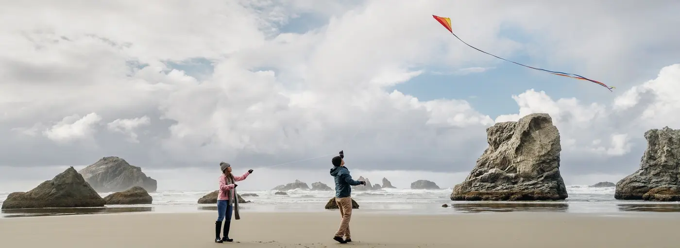
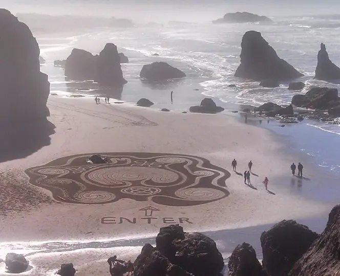
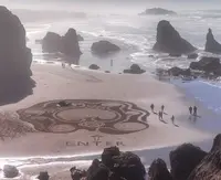
Farther south come the low-lying cranberry bogs, and the county guides call Bandon the unofficial cranberry capital of the Pacific Northwest. A side road leads to Bandon Dunes Golf Course. An 1896 lighthouse marks the mouth of the Coquille River, which runs between Bullards Beach State Park and Bandon Marsh National Wildlife Refuge. TripCheck describes the refuge as part of the Oregon coast’s largest waterfowl wintering grounds. The route skirts Old Town Bandon and ends at the beach, among sea stacks and surf.
The road is named for its ravines. George Davidson described the coast south of Cape Arago in the 1889 Coast Pilot of California, Oregon and Washington. He wrote of hills under dense forest and underbrush, “cut by deep ravines running at right angles to the shore-line.” He added: “From the number of these ravines, the coast is locally known as ‘the Seven Devils.’” Oregon Geographic Names, drawing on R.R. Monbeck, says it seems apparent the name was first applied because of the difficulty of cutting the coast trail across them. Alice Maloney, a scholar of Jedediah Smith, suggested the name probably came from Hudson’s Bay Company explorers. Nathan Douthit wrote that pioneer narratives make it seem likely early settlers gave it.
The earliest known mention of the ravines is in the journal Harrison G. Rogers kept on the Ashly-Smith Exploration. On July 4, 1828, he wrote: “The travelling pretty bad, as we were obliged to cross the low hills, as they came in close to the beach, and the beach being so bad that we could not get along, thicketty and timbered, and some very bad ravines to cross.” In 1914, as Dow Beckham tells it in Bandon-By-The-Sea, two men challenged each other to race the route, one in a Ford and one in a Hupmobile. The Hupmobile took six hours and 25 minutes. The Ford beat it by two hours and 34 minutes.
Three lighthouses on Chiefs Island
Long before the light, Gregory Point was the site of a Coos village called Baldiyaka. Its people gathered shellfish and fish at low tide along the rocks, and limited excavations have established that their shell middens formed over the last 2,100 years. The Coos named the island off the point Chiefs Island; their homelands include the headland across from it. Later arrivals called it Lighthouse Island. The point lies about two and a half miles north of the cape itself.
In July 1864 Congress approved $15,000 for a light to guide ships over the Coos Bay bar. The first tower stood at the island’s tip: octagonal, 25 feet high, on stilts, and sheathed in sheet iron. A wooden walkway 1,300 feet long joined it to the keeper’s dwelling. Leonard Hall, the first head keeper, lit it on November 1, 1866, making it the second lighthouse in Oregon. In 1878 the Lighthouse Board built Oregon’s first life-saving station on the island.
Reaching the island was the hazard. Restore Oregon dates the first low bridge to 1875 and the Oregon Encyclopedia to 1876. A November gale in 1877 destroyed it, and its successors washed out in turn. In 1891 the government strung a 400-foot cable tramway, worked by a hand winch on the mainland. In July 1898 the cable snapped with assistant keeper Thomas Wyman, his daughter and two others aboard. Wyman landed on the rocks, and one of his shattered legs had to be amputated. The others suffered no permanent injury. A high bridge was finished a few weeks later.
The island was also wearing away under the buildings. A fog signal and new keepers’ quarters were completed in May 1896, but ten years later erosion threatened both the tower and the fog signal. A wooden lighthouse with an octagonal tower replaced them. The National Register nomination says it was erected in 1908, and the Encyclopedia says it began operating July 1, 1909. Its fourth-order Fresnel lens was made in Paris by Barbier, Benard and Turenne. The third lighthouse, of concrete with a two-story octagonal tower, was built by local contractor R.J. Hillstrom. The Encyclopedia and the Register give 1934 as its date, and Restore Oregon gives 1935. It is the one standing now.
In 1938 a trestle footbridge 389 feet long and 8 feet wide replaced the high bridge. The first tower was demolished about 1936. The keepers’ quarters burned in the spring of 1957, after new crew quarters went up on the mainland. The old wooden lighthouse had served last keeper Arthur Shaeffer as his office. The Register dates its razing to 1960, and the Encyclopedia to the early 1960s.
The Coast Guard automated the light in 1966. In 1993 the station entered the National Register, and the Fresnel lens went on display at the Coast Guard Air Station in North Bend. The light was turned off on January 1, 2006, after 140 years. The Confederated Tribes of the Coos, Lower Umpqua, and Siuslaw Indians had held an easement on the mainland since 1975. A bill sponsored by Representative Peter DeFazio transferred the lighthouse to them. On August 3, 2013, the Coast Guard turned over the lighthouse, Chiefs Island and twenty-four acres of surrounding land. That year the footbridge was cut into 54-foot sections and removed, and the lighthouse is not open to the public. Restore Oregon reported in 2014 that only thin remnants of the middens at Baldiyaka remain.
Cape Gregory and the Simpson estate
James Cook sighted the headland on March 12, 1778, the saint’s day, and named it Cape Gregory. The US Coast Survey of 1850 renamed it for Dominique F. J. Arago, the French physicist and geographer. The state park page says Europeans first sighted the cape on one of Drake’s expeditions in the late 1500s. A theory posed in the 1970s holds that Drake anchored in the south cove in June 1579. Its followers believe he mistook the dunes between the Coos and Siuslaw Rivers for low, snow-covered hills and sailed on down the coast to California.
The gardens on the bluff began with a lumber family. Asa Mead Simpson, a shipping and timber magnate, arrived on Coos Bay in 1855 and founded North Bend. In 1906-07 his son Louis Jerome Simpson, lumberman and shipbuilder, built a summer home on the promontory for his wife, Cassandra Stearns. “Shoreacres” grew to include a mansion with an ocean view, an indoor swimming pool, a large ballroom, a modern farm and a dairy herd. Its gardens held trees, shrubs and flowering plants brought from around the world aboard Simpson’s ships. Cassandra died in April 1921, and the mansion burned that July. Simpson married Lela Gardner and built a larger house, completed in 1928, just before the stock market crash. The losses left house and grounds in disrepair and the estate, eventually, in bankruptcy.
In 1932 L. J. and Lela Simpson, Coos County and the Cape Arago Park Commission gave the land at the cape to the state. It lay undeveloped until 1934. That year Civilian Conservation Corps enrollees began two years of work there. They built roads, trails and fire breaks, cleared a picnic area, set up tables and stoves, laid a water system and put up a park foreman’s cottage. The state says few of those works remain, while the Living New Deal finds the park’s layout substantially the same. The state bought the first Shore Acres holding from Simpson in 1942 and acquired more land from other owners between 1956 and 1980. The garden lay in disarray for decades before it was restored, in the state’s words, “to perhaps an even grander scale than that achieved by the Simpsons.”
Notable Events
- 1778The cape was originally named Cape Gregory by James Cook, honoring the saint on the day of sighting. stateparks.oregon.gov
- 1828The Harrison G. Rogers journal of the Ashly-Smith Exploration gives the earliest known mention of the ravines. theworldlink.com
- 1850Since the US Coast Survey of 1850 the headland has been called Cape Arago for Dominique F. J. Arago, French physicist and geographer. stateparks.oregon.gov
- 1866The first Cape Arago Lighthouse was completed, the second lighthouse in Oregon. oregonencyclopedia.org
- 1875A low water bridge erected in 1875 was destroyed in 1877, replaced by 1883, and destroyed again in 1886. restoreoregon.org
- 1898The high bridge was erected in 1898 after the aerial tramway cable broke, dumping the keeper and other occupants onto the rocks in the beach cove; the accident resulted in the eventual amputation of the keeper's leg. npgallery.nps.gov
- 1906Lumberman and shipbuilder Louis Jerome Simpson built an oceanfront summer home for his wife Cassandra Stearns on the bluff the route now passes. stateparks.oregon.gov
- 1908A one-story wood frame lighthouse was erected in 1908 to replace the tower built in 1866. npgallery.nps.gov
- 1914Two men raced a Ford and a Hupmobile on the route; the Ford beat the Hupmobile's time of six hours and 25 minutes by two hours and 34 minutes. theworldlink.com
- 1921Cassandra Simpson died in April 1921 and the Shore Acres mansion burned that July. stateparks.oregon.gov
- 1932The park was given to the state in 1932 by L. J. and Lela Simpson, Coos County and the Cape Arago Park Commission. stateparks.oregon.gov
- 1934CCC enrollees began improvements in 1934 and over a two-year period built roads, trails and fire breaks, cleared a picnic area, set up tables and stoves, constructed a water system and erected a park foreman's cottage. livingnewdeal.org
- 1934Cape Arago's third lighthouse, of concrete with a two-story octagonal tower, was built under a contract awarded to local resident R.J. Hillstrom. oregonencyclopedia.org
- 1936The station's first lighthouse, abandoned in 1903, stood in disrepair until the 1930s and was demolished about 1936. npgallery.nps.gov
- 1938The high water bridge of 1898 was replaced by a similar trestle-type footbridge in 1938, measuring 389 feet long and 8 feet wide and identified as a contributing structure in the National Register nomination. restoreoregon.org
- 1942Oregon State purchased the initial Shore Acres holding from Simpson. stateparks.oregon.gov
- 1957The Keeper's Quarters No. 2 was burned in the spring of 1957 after new crew quarters were built on the mainland. npgallery.nps.gov
- 1960The second lighthouse, last used as the keeper's office, was razed in 1960. npgallery.nps.gov
- 1977A monument to Drake was placed in the park in 1977. stateparks.oregon.gov
- 2013The Coast Guard turned the Cape Arago Lighthouse, Chiefs Island, and twenty-four surrounding acres over to the Confederated Tribes of the Coos, Lower Umpqua, and Siuslaw Indians on August 3, 2013. oregonencyclopedia.org
- 2013The footbridge was cut into 54-foot-long sections and removed, the decision taken as part of the transfer of Chief's Island and the lighthouse from the U.S. Coast Guard to the Bureau of Indian Affairs. restoreoregon.org
People
- Arthur Shaeffer, the station's last keeper, who used the second lighthouse as an office.
- R.J. Hillstrom, local contractor who built Cape Arago's third lighthouse (1934).
- Thomas Wyman, assistant keeper at the Cape Arago Lighthouse, injured when the island tramway cable snapped (1898).
- Dominique F. J. Arago, French physicist and geographer for whom Cape Arago has been named since the US Coast Survey of 1850.
- James Cook, the English navigator who originally named the headland Cape Gregory (1778).
- L. J. and Lela Simpson, with Coos County and the Cape Arago Park Commission, gave the park land to the state (1932).
- Sir Francis Drake, the English privateer and explorer a theory posed in the 1970s says anchored in the south cove of Cape Arago (June 1579).
- Cassandra Stearns, wife of Louis Jerome Simpson, for whom the Shore Acres summer home was built (1906-07).
- Louis Jerome Simpson, lumberman and shipbuilder who built the Shore Acres estate (1906-07).
- Harrison G. Rogers, his journal of the Ashly-Smith Exploration gives the earliest known mention of the Seven Devils ravines (1828).
Sources
- traveloregon.com/things-to-do/trip-ideas/scenic-drives/charleston-to-bandon-tour-route
- fhwaapps.fhwa.dot.gov/bywaysp/byway/16493
- oregonsadventurecoast.com/tripideas/charleston-to-bandon-tour-route
- bandon.com/charleston-to-bandon
- tripcheck.com/Pages/Scenic-Byways-Charleston-Bandon
- coosbaynorthbendcharlestonchamber.com/conventions-tours
- stateparks.oregon.gov/index.cfm?do=park.profile&parkId=66
- npgallery.nps.gov/GetAsset/945b30f7-b15e-4745-994d-43d25be5a313
- restoreoregon.org/2014/04/17/cape-arago
- livingnewdeal.org/sites/cape-arago-state-park-coos-bay-or
- stateparks.oregon.gov/index.cfm?do=park.profile&parkId=68
- oregonencyclopedia.org/articles/cape-arago-lighthouse
- gsoc.org/coaledo-field-trip-days
- theworldlink.com/news/local/q-how-did-seven-devils-road-get-its-name/article_790317c7-3b4b-526a-b562-2660df9722bd.html