Chain of Craters Back Country Byway
Grants, Cibola County, New Mexico. 33-mile backcountry byway; Open year-round.
Details

- Where
- Grants, Cibola County, NM. No street address stated. Directions
- Getting there
- The Chain of Craters Back Country Byway is located in Cibola County, near Grants, NM. From Interstate I-40, access may be gained from NM 117 or NM 53. To join the byway from the south entrance, turn south onto NM 117 from I-40, approximately 5 miles east of Grants. County Road 42 begins approximately 35 miles from the NM 117 turnoff.
- Fees
- None.
- Access
- A high-clearance vehicle, such as a truck or a 4-wheel drive vehicle is recommended as this road is rugged in several areas, features blind curves and hills, and can be difficult to navigate when wet. Service is also scarce.
- Phone
- 505-761-8700
- Website
- blm.gov
- Managed by
- Bureau of Land Management.
- Coordinates
- 35.00109600000000, -108.08333000000000.
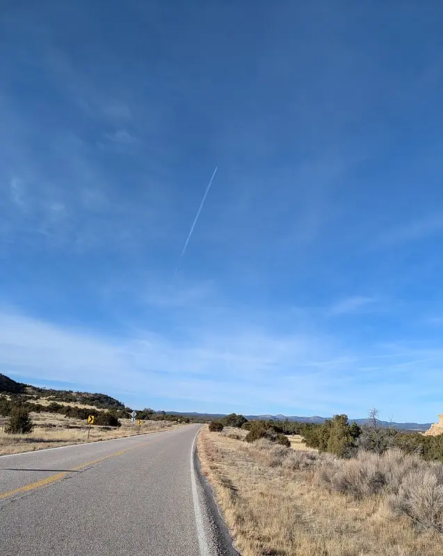
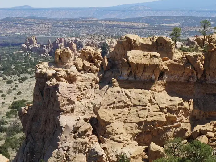
County Road 42 leaves the south side of NM 53 about a mile past the turnoff for the Bandera Crater ice caves. It runs 33 miles of dirt and gravel to NM 117, almost all of it across public land. For most of that distance it forms the western boundary of the West Malpais Wilderness, and along it stands the line of extinct volcanoes that gives the Chain of Craters Back Country Byway its name. The Federal Highway Administration’s byway listing tells drivers to allow 90 minutes and notes sandstone bluffs to the east. The lower ground is piñon and juniper woodland, and it gives way to ponderosa pine as the road climbs. Pronghorn, elk, rock squirrels, and hawks, red-tailed among them, are listed as wildlife along the way.
Dirt, grader, and weather
The Bureau of Land Management, whose Rio Puerco Field Office manages the route, calls it an annually maintained dirt road that the county grades routinely. The agency says its grades, curves, and surface can be handled “without undue difficulty” in a two-wheel-drive vehicle with high clearance. In the same listing it recommends a truck or four-wheel drive, warns of blind curves and hills, and says the road is likely to be impassable in rain and snow seasons. The National Park Service, which runs the adjoining monument, describes the road as lightly maintained and recommends four-wheel drive and high clearance. Its advice is plain: despite how the road looks on a map, it is “NOT A SHORTCUT” from one side of El Malpais to the other, and it is always faster to go back to I-40. Rangers ask drivers to check road conditions and weather before leaving the pavement.
The byway has no fees, no potable water, no restrooms, and little cell service. The nearest food, gas, and water are in Grants, about 27 miles away. It is open year-round. Dispersed camping is allowed if the vehicle stays beside the road and the camper carries gear in to the site. Gathering firewood is prohibited, and so is bringing wood in from outside the wilderness.
The sources disagree about which federal unit the road crosses. The highway administration’s page says the byway passes in its entirety through El Malpais National Monument. The Park Service says it runs along the monument’s western boundary inside the El Malpais National Conservation Area. A Bureau of Land Management page gives the most exact account: from the NM 53 end, County Road 42 crosses about 3 miles of the monument before it enters the conservation area.
A seam of cones
The Chain of Craters is a line of more than 25 cinder cones, formed, in the Bureau of Land Management’s words, when magma found “a weak spot in the Earth’s crust.” The cones belong to the Zuni-Bandera volcanic field, which the Park Service dates to about 700,000 years ago. The field has had three periods of activity. The Chain of Craters came in the second, about 150,000 years ago, and most of it lies west of the monument boundary. Cerro Bandera is the northernmost cone of the chain. Because of its age, its crater is less distinct than those of the younger cones nearby.
Each vent in a field like this erupts only once. The Park Service calls the Chain of Craters a good example of a field of these single-eruption cinder cones. After the chain came the El Malpais phase, from 60,000 to 3,900 years ago, which laid down the black lava east of the road. Its last flow, the McCartys, is dated at about 3,900 years by the Park Service and at only 3,000 years by the New Mexico Bureau of Geology. Neil C. Mangum’s 1990 history for the Park Service records an older view drawn from archaeological evidence: an eruption perhaps as recent as 500 years ago. Mangum also writes that Acoma traditional stories tell of lava covering the cultivated fields of their ancestors.
Cairns off the county road
Several foot routes start from County Road 42. The Continental Divide National Scenic Trail crosses it at two trailheads, about 5 miles in from NM 53 and about 9 miles in from NM 117. Between them the trail runs roughly 20 miles among the cones, through piñon, juniper, and ponderosa pine, and it is marked by rock cairns. There is no reliable water anywhere along it.
From the NM 117 end, a fork 2.1 miles in leads about 5 miles north to the trailhead for Hole-in-the-Wall. It is a 6,700-acre kīpuka, an island of ponderosa pine and open rangeland surrounded by lava, and reaching it takes several miles of walking across plains and lava. The Park Service sends visitors to its Big Tubes area by way of County Road 42 and NPS 300. A 2008 Bureau of Land Management page called the lava tube system there one of the longest in North America, with a cairn route to Four Windows and Big Skylight caves.
The way around the lava
People have lived with this landscape for more than 10,000 years. Acoma and Zuni people cut a footpath straight through the malpais between their two pueblos, which Mangum calls one of the oldest highways in the region. The Spanish could not follow it. Mangum writes that their horses could not cross “the razor-like lava without lacerating hooves and fetlocks.” They went around it instead, either north through the Rio San Jose corridor or south and west, “traversing the chain of extinct volcanoes on the west side of the lava flows.” That is the ground the county road follows now. Mangum says the conquistadors named the country El Malpais, “the bad country.” The Bureau of Land Management translates it as “the badlands” and gives the pronunciation as Mal (rhyming with wall), pie, ees.
The Park Service says national monument status for the area was first proposed in the 1930s. On December 31, 1987, Public Law 100-225 established both El Malpais National Monument and El Malpais National Conservation Area. The conservation area covers about 262,690 acres on a federal map dated May 1987. The same act authorized the Masau Trail, a vehicular tour route along existing public roads. The Ramah Navajo and the Puebloan peoples of Acoma, Laguna, and Zuni still use El Malpais as their ancestors did, gathering plant materials, paying respect, and renewing their ties to the land.
Notable Events
- 1987Public Law 100-225 established the El Malpais National Monument and the El Malpais National Conservation Area in New Mexico and authorized the Masau Trail, a vehicular tour route along existing public roads. nps.gov
- 1987The conservation area the byway runs through was set at approximately 262,690 acres of federally owned land on the map numbered NM-ELMA-80,001-B and dated May 1987. nps.gov
- The second period of volcanism in the Zuni-Bandera field produced the series of cinder cones known as the Chain of Craters. nps.gov
- The McCartys flow erupted 3,900 years ago; it is the youngest lava flow in the state of New Mexico and the most recent eruption in the Zuni-Bandera field. nps.gov
Sources
- blm.gov/visit/chain-craters-backcountry-byway
- blm.gov/visit/el-malpais-nca
- recreation.gov/gateways/15137
- nps.gov/elma/learn/historyculture/upload/ELMA_hist.pdf
- nps.gov/articles/000/volcanic-resources-summary-elma.htm
- nps.gov/elma/learn/management/upload/Public-Law-100-225.pdf
- geoinfo.nmt.edu/tour/federal/monuments/el_malpais/zuni-bandera/background.html
- nps.gov/elma/planyourvisit/gettingaround.htm
- nps.gov/articles/nps-geodiversity-atlas-el-malpais-national-monument-new-mexico.htm
- fhwaapps.fhwa.dot.gov/bywaysp/byway/68990
- blm.gov/visit/chain-of-craters-wsa
- web.archive.org/web/20081014200005/http://www.blm.gov/nm/st/en/prog/recreation/rio_puerco/el_malpais.html