
Carson Pass Highway (Route 88)
Woodfords, California. All-season roadway.
Details
- Where
- Woodfords, CA. No street address stated. Directions
- Season
- Whatever the season, the Carson Pass Highway is open for fun.
- Getting there
- An all-season roadway, Highway 88, the Carson Pass Highway, enters the Eldorado National Forest 64 miles east of Stockton near the Dew Drop Fire Station at the 4300 foot elevation and continues through the forest for 38 miles until in reaches Carson Pass at the 8573 foot elevation.
- Fees
- Sno-Park permit $40.00 per season or $15.00 a day.
- Access
- The Carson Pass Information Station is closed for the season and will reopen May 27, 2027, weather permitting.
- Walk-in or reserve
- Sno-Park Permit required to park at the Carson Pass and Meiss Meadow Trailheads from November 1, 2026 until May 30, 2027; buy it before parking, not sold at the Sno-Park.
- Phone
- (530) 622-5061
- Managed by
- Eldorado National Forest.
Highway 88 enters the Eldorado National Forest 64 miles east of Stockton, near the Dew Drop Fire Station at 4,300 feet, and climbs through it for 38 miles to Carson Pass at 8,573 feet. Over that rise the forest changes from foothill woodland, chaparral and mixed conifer to the true fir and subalpine stands of the crest. Much of the road runs along the northern ridge above the Mokelumne River canyon. It then follows the Carson River Route of the Emigrant Trail, and from the summit it descends past Woodfords toward the Carson Valley in Nevada. The Federal Highway Administration counts 58 miles of designated byway between the Sacramento and Carson valleys and allows about an hour and a half to drive it. Frank Tortorich, author of a driving guide to the route called Gold Rush Trail, counts more than 35 miles of it above 7,000 feet. By his figures U.S. 50 has about six such miles and Interstate 80 about four.
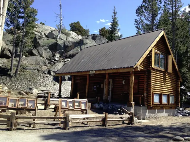
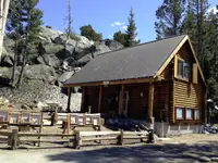
At the summit is the Carson Pass Information Station, staffed by docents of the Eldorado National Forest Interpretive Association. In summer they issue wilderness and campfire permits, sell maps, books and wildflower guides, lend dog leashes free, and lead interpretive hikes. The station is open daily from Memorial Day to Labor Day. At the end of September 2026 it had closed for the season, to reopen May 27, 2027, weather permitting. The Pacific Crest Trail runs past the door, and many of the hikers walking it from Mexico to Canada have come from other countries. A five-dollar user fee is collected at the parking lots. Within a few hundred feet stand markers to Kit Carson, to Snowshoe Thompson, to the pioneer Odd Fellows, and to the emigrants’ ascent of the pass. One of them states: “Today, Carson Pass carries hundreds of cars on a daily trek over the mountain.”
Frog Lake, Meiss country, and the Sno-Parks
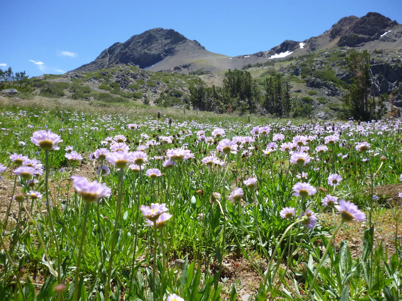
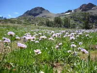
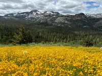
A trail leaves the lot beside the station and runs a mile through old forest to Frog Lake. From there it continues toward Winnemucca Lake, Round Top and Elephants Back. This is the Carson Pass Special Management Area of the Mokelumne Wilderness. It is set apart for its Round Top Geologic Area, with extinct volcanoes and glacier-cut ground along about ten miles of trail, and for its Round Top Botanical Area. Depending on the previous winter’s snowpack, wildflowers in the botanical area peak between mid-July and the first week or two of August. On the trail to Winnemucca Lake, ENFIA reports, blooming starts in early July.
A few hundred yards west is the Meiss trailhead. From there the Pacific Crest Trail climbs 1.2 miles to a ridge and runs north into the Meiss country, with views over Meiss Meadow toward Lake Tahoe. The name is pronounced “Mice,” Tortorich writes, for Louis Meiss, who settled the meadow in 1858. Meiss ran cattle out of Ione, and like many valley ranchers he pastured them in the high country in summer. Most drove their herds up the highway each spring and back down each fall until the mid-1970s.
From November 1 to May 30 the lots at the Meiss trailhead and the station become Sno-Parks, as do lots at Iron Mountain and Hope Valley. Parking requires a state permit, $15 a day or $40 a season, bought in advance; none are sold at the lots. The trail to Frog Lake carries no blue diamonds in winter, and skiers find their own way. Snowmobiles are not allowed at the pass or in the Meiss country. Riders use the trails at Iron Mountain, at the junction with Mormon-Emigrant Trail Road, and in Hope Valley east of the summit. Silver, Caples, Red and Woods lakes are fished through the ice for Mackinaw, brown, brook and rainbow trout, and ENFIA reports Mackinaw in excess of twenty pounds. Kirkwood, which operates under a Forest Service permit, runs 15 lifts on 2,000 skiable acres known for steep chutes and cornices. Its cross-country center, a quarter mile east of the turnoff at 7,800 feet, grooms 80 kilometers of trail past lava cliffs and down to beaver dams on Caples Creek.
Way stations from Volcano to Kirkwood Meadow
Tortorich begins his eastbound tour at Volcano, the Amador County gold camp that by his account may have held 20,000 to 40,000 people at its peak. East of town a string of trading posts and hotels once served the Amador-Carson Valley Wagon Road. The first was Foster’s Hotel at Lockwood Junction. After it came Ballard’s at Antelope Springs, now Dewdrop; Charlie Sedham’s, now Cook’s Station; and Smith’s Hotel, now Ham’s Station. Osborn’s stood at Prospect Rock and Patterson’s at Mud Springs. Avery’s Lumberyard is now a Forest Service fire station. James Goldsworthy kept a hotel at Lower Corral Flat, and Gilbert’s stood at Upper Corral Flat, where the Mormon Emigrant Trail now meets the highway. Beyond were Washington Porter’s at Tragedy Spring meadow, Plasse’s Resort and Wade’s Lake House. Then travelers crossed what Tortorich calls “the treacherous Carson Spur” to the Kirkwood Inn.
The Comstock Lode, struck in 1859, created the need for a commercial wagon road to carry men and supplies from Sacramento to Virginia City. Construction ran from 1859 to 1864. In 1862 Amador County residents approved $25,000 in bonds, and the road was required to be 16 feet wide so wagons could pass going opposite ways. Its grade reached 18 percent between Antelope Spring and Caples Lake. At the toll stations on the Antelope-Pine Grove turnpike, travelers paid 50 cents a person and ten cents an animal.
The stations changed names as they changed hands. Ham’s Station may have begun as Clairborne Foster’s trading post in 1852, then became Smith’s, and has carried the Ham brothers’ name since about 1881, if not several years before. Cook’s Station was first Hipkin’s, then Wiley’s. It took its present name in 1905 from Lewis H. Cook, who also ran the St. George Hotel in Volcano.
At Antelope Springs in 1932 the Jackson Lions Club cleared a strip 100 feet wide and 1,200 feet long for a double wooden toboggan run. It put up a 16-by-40-foot clubhouse with a refreshment stand and graded parking off the highway. Two feet of snow fell by mid-December, but most of it melted before the grand opening, scheduled for January 1, 1933. A few days later more than four feet fell and closed the highway, and the opening was put off to January 29. By the first week of February the two-lane road was clear and 150 automobiles came up for the snow. The site later took the name Dewdrop from a nearby restaurant, the Dewdrop Inn. It operated at least into the early 1940s, and Tortorich suggests it may have ended when Merv Amick opened Peddler Hill Ski Resort at 7,000 feet.
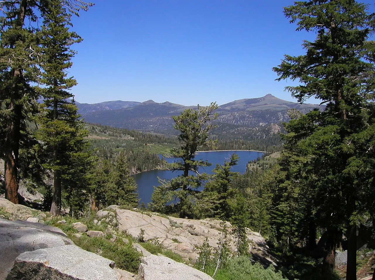
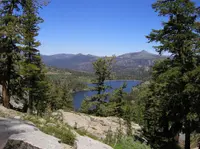
Zach Kirkwood may have run cattle in the meadow as early as 1858, and in 1864 he opened his inn on the new wagon road. About 1904, guests there heard of a woman looking for the daughter she had buried in a meadow in 1850. From that, Tortorich writes, “began the legend and confusion over the Maiden’s grave.” In 1993 Martha Freeman of the Los Angeles Times described the Kirkwood Inn as “a locals’ joint, bar and restaurant in one dimly lit room.” Large dogs lay on the porch, and she ordered a $4.50 bowl of chili that held carrots and celery along with the meat and beans. That week she was staying at the Kit Carson Lodge on Silver Lake, below Thunder Mountain. On the lodge desk she found The History of Amador County and its 1881 verdict: “Silver Lake is one of the most beautiful sheets of water in the world, and a sojourn on its banks in the summer is one of the most pleasantest enjoyments possible.” The Washoe, she noted, lived most of the year in the Great Basin and camped near Silver Lake in summer.
Past the Carson Spur lies Caples Lake, once called Twin Lakes. Dr. James and Mary Jane Caples used it as a summer home and sometimes a trading post from the mid-1850s, Tortorich writes, for perhaps 30 years. A state landmark registered in 1958 describes how the Old Emigrant Road of 1848 swung across the meadow the lake now covers and climbed a ridge to a gap at 9,460 feet. That rough, circuitous section became obsolete in 1863, when a better route was blasted out of the cliff face at Carson Spur. The Historical Marker Database lists the marker as confirmed missing.
Traders, a winter crossing, and a carved tree
The sources give different ages for the trade route over the pass. ENFIA says over 2,000 years, on the traditional lands of the Washoe and Northern Sierra Miwok, and cites abalone shells, salts and obsidian as evidence of trade. The summit marker says 5,000 to 10,000 years. Tortorich says over 10,000, with the Washoe trading obsidian and pine nuts and the Miwok trading sea shells and acorns.
In January 1844 John C. Frémont, traveling south along the eastern edge of the Sierra Nevada, found his expedition short of supplies and decided to cross the mountains to Sutter’s Fort. ENFIA writes that he ignored the warnings of local Washoe. The summit marker says an American Indian directed the party to cross at this place. With Kit Carson and the cartographer Charles Pruess, the party struggled through heavy snow and crossed what is now Carson Pass, west of Red Lake, on February 21, 1844. ENFIA counts them the first white men to cross the Sierra Nevada in winter. All reached Sutter’s Fort on March 6, and the maps they made later guided emigrants. The marker adds that the pass lay under 20 to 30 feet of snow. It also says payroll records show Carson was hired as hunter and Indian fighter, with Thomas Fitzpatrick as the official guide. Bob Graham of Sacramento, in a commentary on the marker’s database entry, traces the final assault to February 20, up the flanks of Red Lake Peak to the 9,000-foot level. By his reading Frémont crossed south to north, not east to west as the later wagons did.
Frémont named the river flowing east through Hope Valley for Carson. The pass took Carson’s name later, probably because a tree there bore the carving “Kit Carson 1844.” The state landmark at the summit, registered July 12, 1939, says Carson cut his name there in 1844 while guiding Frémont. It also says the inscription was cut from the tree in 1888 and is now at Sutter’s Fort in Sacramento. The marker beside the road doubts the 1844 date, since no starving man would dig through 20 or 30 feet of snow to carve a name. In the summer of 1853, it notes, Carson came over this pass with a group of men and 6,500 head of sheep to sell in the gold fields. “Could it have been then,” the marker asks, “that Carson took the time to carve his name on the tree but dated it back to 1844 when he was first here?”
Forty-five men and Melissa Coray
The wagon road was opened in 1848 by former members of the Mormon Battalion returning to Salt Lake from the war with Mexico. Many had been working at John Sutter’s sawmill in Coloma when gold was discovered. The company of 45 men and one woman, Melissa Coray, wanted a trail over the Sierra that avoided the more than two dozen river crossings of the Truckee route. In June 1848 they gathered at Pleasant Valley, east of Placerville, and went east to what is now called Tragedy Springs. They crossed West Pass, now part of the Kirkwood ski area, and came down to Twin Lakes. On July 28 they reached Carson Pass and followed the line of present Highway 88 to the Carson River. From there they joined the Truckee route and reached Salt Lake City on September 29, 1848.
ENFIA writes that more than 40,000 gold seekers and settlers crossed by this route in a single year, until more direct roads drew traffic away in the early 1850s. Beginning in 1856 Snowshoe Thompson carried winter mail for 20 years, mostly by the line of U.S. 50 to Genoa, but at times over Carson Pass. After the emigrant years the route was the Amador-Carson Valley Wagon Road. In 1909 it became Legislature Route Number 34, and it was officially listed under that number in 1915. In 1911 it was designated the Alpine Highway from Route 49 to Route 89 in Hope Valley, also called the Kit Carson Pass Highway, a name it kept for 45 years. In 1956, the year President Eisenhower signed the Federal Aid Highway Act, Route 34 became California State Route 88.
East of the summit, near Alpine Village, Trails West erected a marker in 2003 at the corner of the highway and Emigrant Trail. It quotes Giles S. Isham, writing on August 5, 1850: “Thence over a high sloping stony hill (sloping to the river) and down a steep hill to a canon or pass creek, where comes the first tug of war! Through the first range of the Sierra Nevada mountains.”
Notable Events
- 1844The party crossed what is now Carson Pass west of Red Lake. enfia.org
- 1844John C. Fremont led men over the mountains as they struggled to reach Sutter’s Fort. hmdb.org
- 1848Former members of the Mormon Battalion returning to Salt Lake from the War with Mexico opened the wagon route. enfia.org
- 1848The road crossed the meadow now covered by Caples Lake and climbed the ridge to the gap at the valley head. ohp.parks.ca.gov
- 1850sThe route became one of the most popular routes to the goldfields, with over 40,000 gold seekers and settlers crossing in a single year, but by the early 1850's other, more direct roads were established. enfia.org
- 1853Kit Carson and a group of men brought sheep over the pass to sell in the gold fields. hmdb.org
- 1862The route was first designated and used in 1862 as the Amador-Carson Valley Wagon Road; before that it was the Carson River Route of the Emigrant Trail. ledger.news
- 1863A better route was blasted out of the cliff face at Carson Spur, making the rough circuitous section obsolete. ohp.parks.ca.gov
- 1888The original inscription Kit Carson cut into the Kit Carson Tree was cut from the tree in 1888 and is now in Sutter's Fort, Sacramento. ohp.parks.ca.gov
- 1909LRN (Legislature Route Number) 34 was the first name given to this route and is the predecessor of CSR 88. ledger.news
- 1911The route was designated the "Alpine Highway" from CSR 49 to CSR 89 in Hope Valley and was also referred to as the "Kit Carson Pass Highway," a name it held for the next 45 years. ledger.news
- 1915The route was officially listed as LRN 34. ledger.news
- 1939Registration date of the Kit Carson Marker historical landmark, located in Alpine County on State Hwy 88 west of Woodfords. ohp.parks.ca.gov
- 1956With the Federal Aid Highway Act of 1956 signed by President Dwight D. Eisenhower, LRN 34 became California State Route 88. ledger.news
- 1958Registration date of the Old Emigrant Road landmark. ohp.parks.ca.gov
- 1962The Carson Road, also called the Volcano Road in 1852, was designated a toll road, 16 feet wide with a maximum grade of 18% from Antelope Spring to Caples Lake. ledger.news
- 2003Trails West, Inc. erected the Carson Trail–To West Carson Canyon marker. hmdb.org
- They reached Carson Pass and followed the route of present day Highway 88 to the Carson River. enfia.org
People
- Charles Pruess, Fremont’s cartographer on the winter crossing.
- John C. Fremont, Charged with mapping, recording flora and fauna and elevations, and evaluating land quality on the expedition.
- John Sutter, Many of the wagon-route pioneers had worked at his sawmill in Coloma when gold was discovered.
- Kit Carson, Scout who guided John C. Fremont's expedition into California in 1844; Carson Pass, which the highway crosses, was named for him (1844).
- Melissa Coray, The one woman in the party seeking a new trail over the Sierra to avoid the Truckee River crossings.
- Giles S. Isham, Emigrant whose account of the difficult canyon crossing is quoted on the marker (Aug 5, 1850).
- Thomas Fitzpatrick, Official guide for the expedition; the marker says payroll records show Carson was hired as hunter and Indian Fighter.
- Snowshoe Thompson, Winter mail carrier who at times came over Carson Pass on his deliveries (20 years of winter mail deliveries).
Sources
- fhwaapps.fhwa.dot.gov/bywaysp/byway/2291
- fs.usda.gov/r05/eldorado/recreation/highway-88-corridor-area
- commons.wikimedia.org/wiki/Category:Carson_Pass
- enfia.org/discover/carson-pass
- nsbfoundation.com/sb/carson-pass-scenic-byway-route-88
- fs.usda.gov/r05/eldorado
- enfia.org/discover/carson-pass/history-of-hwy88-carson-pass
- ledger.news/roots/historic-california-state-route-88-also-known-as-the-carson-pass-highway/article_90075e16-cec5-11ef-a575-f70aaab29ed8.html
- ohp.parks.ca.gov/ListedResources/Detail/315
- latimes.com/archives/la-xpm-1993-08-15-tr-24022-story.html