Buckhorn Back Country Byway
Gerlach, Lassen County, California. BLM Byway.
Details
- Where
- Gerlach, Lassen County, CA. No street address stated. Directions
- Getting there
- The byway begins on State Route 447 at Duck Flat about 40 miles northwest of Gerlach and ends at Ravendale on U.S. 395 between Susanville and Alturas, California.
- Fees
- None.
- Access
- Single-lane gravel road.
- Phone
- (530) 279-6101
- Managed by
- Bureau of Land Management Eagle Lake Field Office.
At the edge of Duck Flat, about 40 miles northwest of Gerlach, Nevada, the Buckhorn Back Country Byway leaves State Route 447 as a single-lane gravel road and climbs. On top is a high plateau of sagebrush-covered rolling hills and intermittent lakes, with the peaks of the South Warner Mountains in view to the north. The road runs 31 miles across the topmost corners of Nevada and California and ends at Ravendale, on U.S. 395 between Susanville and Alturas. The Federal Highway Administration’s America’s Byways listing allows two hours for the drive, more with stops. It advises a tuned-up four-wheel-drive vehicle, extra water, and a spare tire. There is no fee.
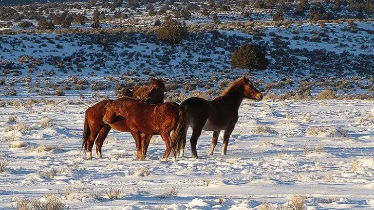
Partway along, the route crosses the Twin Peaks Wild Horse and Burro Management Area, where the animals may be seen among juniper and sagebrush. Pronghorn antelope may also be seen sprinting across the same country at speeds of up to sixty miles per hour. During the wet months, flocks of migratory birds stop at several wet-weather lakes just off the road, and the listing names rare waterfowl among them. The Pine Dunes Research Natural Area is also just off the byway. There a stand of ponderosa pine grows in hot sand, on protected acres where the trees stand out against the dunes around them.
The byway is a Bureau of Land Management road, kept by the Eagle Lake Field Office in Susanville. In the summer of 2026, BLM lands in Lassen County, California, and Washoe County, Nevada, were closed for emergency suppression of the Biscar Fire. East of U.S. 395, the closed area ran north from Smoke Creek Road to Sand Pass Road, then to Stone Corral Road, then to the Buckhorn Backcountry Byway. Emily Ryan, the field office manager, signed the order lifting the closure, and the lands reopened for public use on July 27, 2026.