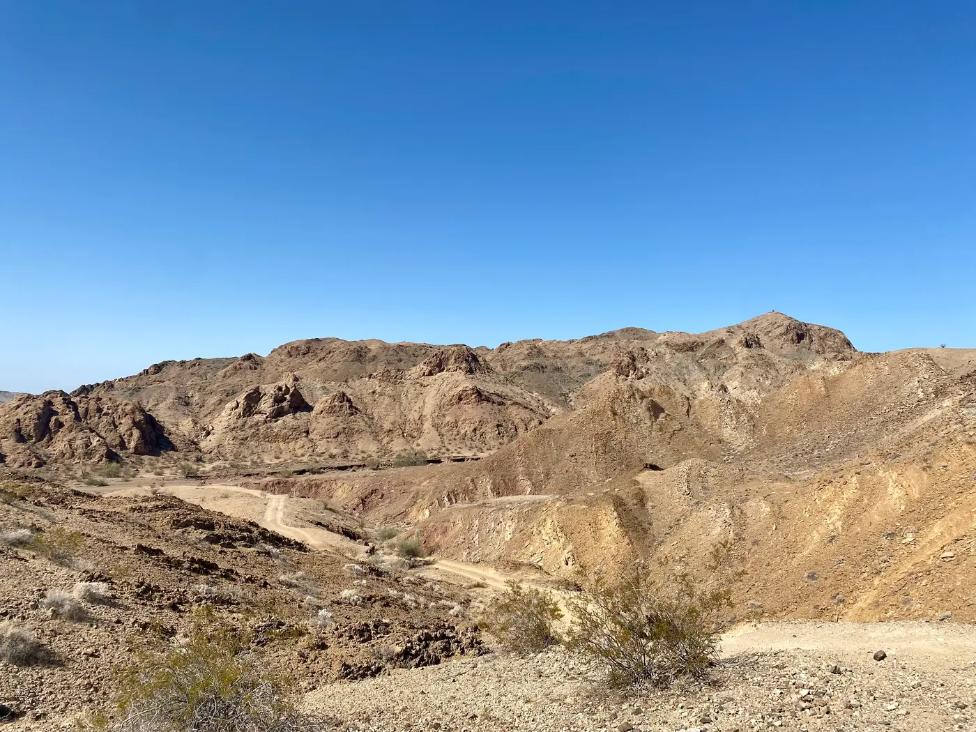
Bradshaw Trail Back Country Byway
Blythe, Riverside County, California. Back Country Byway.
Details

- Where
- Blythe, Riverside County, CA. No street address stated. Directions
- Getting there
- From Blythe, take Interstate 10 west for about 17 miles to the Wiley's Well exit. Go south (left) on Wiley's Well Road for about 9 miles to its intersection with the Bradshaw Trail, just past Wiley's Well Campground. Turn right and proceed west towards Indio.
- Fees
- None.
- Access
- Notice: Flash floods have affected routes in the area of the Bradshaw Trail. Exercise increased caution when visiting the area, check the weather before your trip, and be prepared.
- Phone
- 760-833-7100
- Website
- blm.gov
- Managed by
- BLM's Palm Springs-South Coast Field Office.
- Established
- Blazed by William Bradshaw in 1862 as an overland stage route.
About 17 miles west of Blythe on Interstate 10 is the Wiley’s Well exit. From there Wiley’s Well Road runs south for about 9 miles. Just past Wiley’s Well Campground a dirt road turns off to the west, toward Indio. This is the Bradshaw Trail. The Bureau of Land Management gives its length as 70 miles. The Federal Highway Administration’s byway listing gives 65. The Riverside County Transportation Department grades it from time to time, but stretches of soft sand remain, and the BLM recommends four-wheel drive. The agency classes the byway as a Type 3 route.
Most of the road crosses public land. From it a driver can see the Chuckwalla Bench and the Orocopia, Chuckwalla and Mule Mountains, and the federal listing adds the Palo Verde Valley. The BLM describes the bench as a desert woodland used for millennia by the ancestors of many Native American Tribes. That woodland, with more than 50 miles of the byway, is now part of the Chuckwalla National Monument. Linda Castro, assistant policy director for Cal Wild, has written about the place-names along the route: “Some historians believe that the name ‘Chuckwalla’ came from the Cahuilla word (‘chu qual’) for the lizard we now call Chuckwalla.”
There is no fee. Visitors camp, hunt, hike, ride horseback, drive off-highway vehicles and watch for wildlife. Stays are limited to 14 days. The federal listing says the time to allow varies with weather and vehicle. The BLM has posted notice that flash floods have affected routes in the area of the trail, and it advises visitors to check the weather before setting out. The byway is administered by the BLM’s Palm Springs-South Coast Field Office.
Two canals at the west end
At the western end the road meets the Coachella Canal, which is two canals. Tim Augustine describes them in an access supplement for the Mojave Desert Heritage and Cultural Association. The new canal is lined with concrete and carries water. The old canal lies just north of it and is a deep, dry, sandy ditch. Three roads run alongside the two canals. The two roads beside the new canal are closed to the public, and the Coachella Valley Water District has put up gates and fencing along part of the southern one. The legal route runs on the north side of the old canal.
Augustine’s directions leave Highway 111 at Parkside Drive and follow unpaved Desert Aire Drive to Drop 30. A drop is a low place where the canal goes underground, so that water in the natural washes can cross without filling the canal with sand and dirt. The drops are numbered upward from east to west, the direction of flow. Past Drop 30 the old canal access road climbs out on the north side and runs about 9 miles east, with both canals in view on the right and “No Trespassing” signs along the way. At wide Drop 24 the road goes down into the wash. A BLM kiosk with information on the Bradshaw Trail stands there, and the Salt Creek Route begins.
Augustine wrote the supplement to update The Gold Road to La Paz, Delmer G. Ross’s interpretive guide to the trail. The guide was published in 1992, prepared with the BLM, and covers the history, flora and fauna of an eighty-plus-mile trip across the desert. Since then the Desert Protection Act and other laws have created wilderness where there was none. The middle of the guide’s Orocopia Mountains Loop now lies inside wilderness and is closed to motorized travel. The fences at the boundary, Augustine warns, may not be well marked.
A well at Point Happy
According to a BLM account published May 28, 2026, the byway is about one-third of the stagecoach and wagon road established in 1862 by the prospector William D. Bradshaw. The BLM calls it the first road across Riverside County to the Colorado River. The same account says a Cahuilla chief and a member of the Maricopa Tribe told Bradshaw about an ancient trade route through the Colorado Desert, with springs and watering holes along it, and that he built his road using what they told him.
One of those watering places is recorded on a marker at Washington Street and Point Happy Way in La Quinta. The Cahuilla dug a well into the wash there, with steps leading down to the water, less than 300 yards from where the marker stands. The city of Indian Wells is named for that well. Floods destroyed it in 1916. The marker continues: “In 1862 frontiersman William Bradshaw left San Bernardino looking for a route to the Colorado River to search for gold. He, too, made use of the well.” It says that by following well-traveled Indian trails he found his way to the river, and that he “called it Bradshaw Trail and the Bradshaw Stage line was formed.” Because of the well, the point became a major stop.
The Mojave Desert Heritage and Cultural Association names a second founder. In its account, Bradshaw and James Grant, “separately first, then together,” established the first road from San Bernardino to the newly discovered placer diggings east of the Colorado River. The diggings lay eighty or so miles north of Arizona City (Yuma). The gold fields were at La Paz, which the BLM places in what was then New Mexico Territory and later became Arizona Territory. The town is now Ehrenberg. The road carried miners and other passengers, and several stage lines ran on it, among them the Wells Fargo Express.
A station at Millard Canyon
Steve Lech, writing in the Press-Enterprise in 2018, starts the road in Los Angeles instead of San Bernardino. His route runs through the San Bernardino Valley, San Gorgonio Pass and the Coachella Valley, then winds through the Orocopia and Chocolate Mountains to the Colorado River. Along the way were stopping places where travelers could get water and supplies and rest their horses.
One stop stood at the mouth of Millard Canyon, about a mile north of present-day Cabazon. Frank Vandeventer was running it by 1866. According to research by Jane Davies Gunther, he was born in New York in 1824 and probably came west to San Francisco with the Gold Rush. He kept the Millard Canyon way-station for about 10 years. In 1875 he sold the property and its water rights to Antone de Crevecouer and moved several miles southeast to Agua Caliente, now downtown Palm Springs. There, Lech writes, he served “mostly alcoholic refreshments at the famed springs.”
The desert author Charles Francis Saunders told in 1923 how Vandeventer married. A local Indian man and his daughter came to the stage station, and Vandeventer was smitten. He offered to buy the girl. Her father refused and insisted that Vandeventer marry her. Another stage driver served as “minister,” and the two were “married” and lived out their lives together. After the railroad came, the stage stops were no longer needed, and the couple moved into the mountains west of Santa Rosa Peak. The land there took the name Vandeventer Flats. Vandeventer died in 1900. The flats later became part of the Santa Rosa Indian Reservation.
The end of the stage line
The sources give different dates for the road’s end. The La Quinta marker says the stage line ceased in 1877, put out of business by the depletion of gold and the coming of the railroad in 1876. The BLM’s 2026 account says the road stayed in use until 1878 and brought an influx of people into the Colorado Desert region and beyond. Lech says it was well traveled for 20 years from 1862 and ended with the completion of the Southern Pacific Railroad.
Lech also disputes the name. “Although later erroneously called the ‘Bradshaw Trail,’” he writes, “this route was really a road in all its meanings for the time.” He calls it Bradshaw’s Road.
Little remains of the road’s traffic. When the gold mines played out and La Paz became a ghost town, the BLM writes, the abandoned stage stops on the route began to disappear from view, especially with repeated grading of the dirt road.
Notable Events
- 1862William Bradshaw and James Grant, separately first, then together, established the road from San Bernardino to the diggings east of the Colorado River. themojaveroad.org
- 1876The coming of the railroad, together with gold depletion, put the stage line out of business the following year. hmdb.org
People
- William Bradshaw, Co-established the first road from San Bernardino to the placer gold diggings east of the Colorado River (1862).
- Frank Vandeventer, Operated a way-station on the Bradshaw Road at the opening of Millard Canyon, one of the stopping places where water and supplies could be obtained (1866 to about 1875 (operated the Millard Canyon station about 10 years; sold it in 1875)).
- James Grant, Co-established the first road from San Bernardino to the placer gold diggings east of the Colorado River (1862).
Sources
- blm.gov/visit/bradshaw-trail-national-back-country-byway
- fhwaapps.fhwa.dot.gov/bywaysp/byway/2172
- blm.gov/blog/2026-05-28/more-time-travel-nations-250th-exploring-blm-back-country-byways-oregon-and
- hmdb.org/m.asp?m=232942
- pressenterprise.com/2018/05/03/back-in-the-day-frank-vandeventer-left-an-early-mark-on-riverside-county