Blue Hole River Access
Somes Bar, Siskiyou County, California. Swimming hole; Late spring and summer.
Details

- Where
- Somes Bar, Siskiyou County, CA. No street address stated. Directions
- Getting there
- About two miles upriver from Somes Bar and Highway 96 on Salmon River Road. There is a sign for this river access.
- Access
- The roadside parking area holds about four vehicles maximum.
- Phone
- (530) 627-3291
- Managed by
- Six Rivers National Forest.
- Coordinates
- 41.37968, -123.47197.
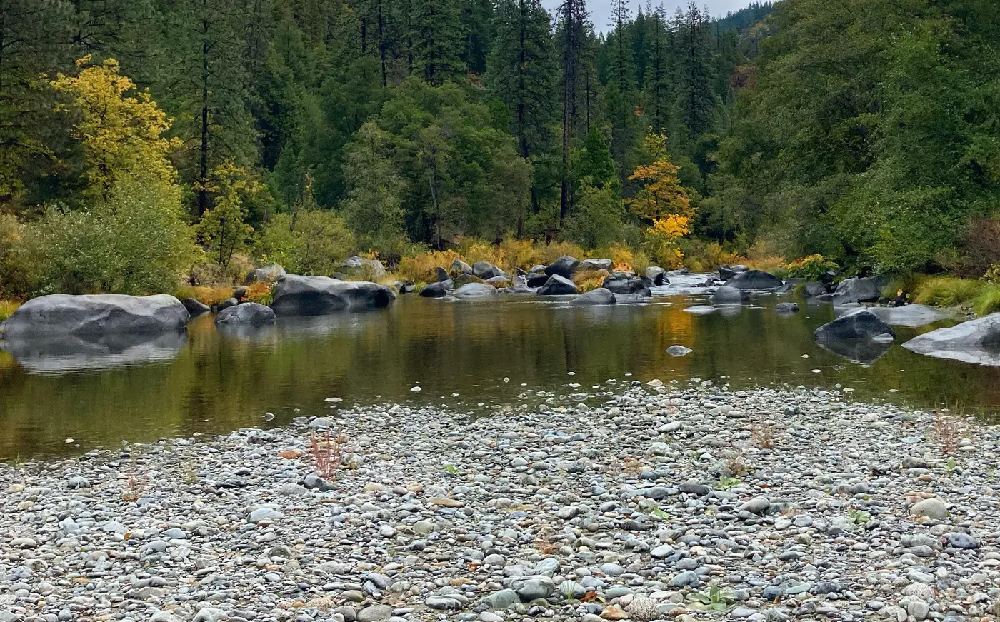
A sign on Salmon River Road marks the Blue Hole River Access. Beside it, a roadside parking area holds about four vehicles, by American Whitewater’s count. From there a short foot trail drops to a sandy beach on the Salmon River and a swimming hole the Forest Service calls very deep.
The sources place the turnout differently. American Whitewater puts it about two miles upriver from Somes Bar and Highway 96. The Klamath National Forest’s river page puts it approximately one mile east of Somes Bar on Highway 2B01, at a small turnout on the right, and says only to hike down to the water. The site has no potable water, and the Forest Service has no restroom information for it. The lowermost three miles of Salmon River Road are the only part of the river with municipal power, carried on utility lines up from the Klamath River corridor.
The Salmon River Restoration Council describes the water at the bottom of the trail as translucent. The river rolls a heavy load of gravel and boulders along its bed. Outside of floods it carries little sediment in the current. Where the grade is low, the channel is lined with boulders, and where it steepens, the channel is bedrock. Summers here are hot, sunny, and very dry. Nearly all of the year’s precipitation falls between November and May.
Swimmers, tubers, and the Ikes Run
Blue Hole is a popular swimming spot in late spring and summer, and the Six Rivers National Forest lists it as a good access for tubing. Boaters also carry their craft down the same trail. American Whitewater notes that some use it as a put-in for the lower half of the Lower Salmon, a Class II(III) reach running from Brannons Bar to the Klamath River. They usually do so to add this stretch of the Salmon to the start of a day on the Ikes Run of the Klamath.
The access lies inside the geographic boundary of the Klamath National Forest but belongs to the Ukonom Ranger District. The Six Rivers National Forest has administered that district since September 1999, under an agreement between the two forests approved by the Region 5 Regional Forester. The district appears on both forests’ maps.
Katamin and the gold miners
Below the access the river runs on to the Klamath. The Karuk know the area at that confluence, near Somes Bar, as Katamin, the “Center of the World.” The tribe’s World Renewal ceremonies continue to be held there.
Native people, Karuk, Shasta, and Konomihu, have lived in the Salmon River watershed for several thousand years. By the River Council’s figures, sixty-seven percent of the watershed lies in Karuk ancestral territory and the remainder in Shasta territory. Salmon, “Ama” in the Karuk language, was and still is a major source of food for the Karuk and other tribes in the area. The Konomihu, a fairly small tribe, were eliminated by genocide in the early days of the Gold Rush.
That rush reached the river in the summer of 1850, when the discovery of gold drew European, Chinese, and Euro-American emigrants. The first miners settled at Bestville Flat on the North Fork, immediately downstream from Sawyers Bar. Through the mid to late 1800s, miners and other settlers displaced, sickened, and killed a substantial portion of the Native population.
Hydraulic mining began in the 1850s and peaked in the late 1800s. In the River Council’s account, the naturally translucent green river “probably flowed rich with brown, redd-choking sediment for several decades.” The stream channel is now armored with large boulders left from mined areas. Mining had declined substantially by the 1920s and revived briefly during the Great Depression. It held on in the local economy until the last commercial gold mine closed in the 1990s. About 250 people live in the watershed today, clustered around Somes Bar, Forks of Salmon, Cecilville, Sawyers Bar, and Big Flat.
A river without dams
The Salmon has no dams, diversions, or significant irrigation withdrawals, and no dam or barrier stands between it and the Pacific. Its North Fork rises in the Marble Mountains Wilderness and its South Fork in the Trinity Alps Wilderness. The forks join at Forks of Salmon, and twenty miles farther west, by the Forest Service’s measure, the river empties into the Klamath. Its mouth lies at 456 feet.
In 1972 California governor Ronald Reagan signed the California Wild and Scenic Rivers Act, which named the mainstem, both forks, and Wooley Creek state Wild and Scenic Rivers. On January 19, 1981, the same reaches entered the federal Wild and Scenic Rivers System for their outstandingly remarkable fisheries, with the mainstem classed as Scenic and Recreational.
Spring Chinook, fall Chinook, coho, steelhead, green sturgeon, and Pacific lamprey all run in the river. The River Council reports that recent counts have been alarmingly low in some years, especially for spring Chinook. There are no hatchery fish in the Salmon River.
Notable Events
- 1850The discovery of gold triggered a substantial European, Chinese, and Euro-American emigration to the Salmon River beginning in the summer of 1850; gold miners first settled at Bestville Flat on the North Fork Salmon, immediately downstream from Sawyers Bar. srrc.org
- 1850sBeginning in the 1850s and peaking in the late 1800s, large scale hydraulic mining and related activities greatly altered the Salmon River channel, tributaries, and riparian areas. srrc.org
- 1972California governor Ronald Reagan signed the California Wild and Scenic Rivers Act in 1972, designating the North Fork, South Fork, mainstem Salmon River, and Wooley Creek as state Wild and Scenic Rivers. srrc.org
- 1981The Salmon River was designated a Scenic River and Recreational River within the National Wild & Scenic Rivers System in 1981; the North Fork was designated a Wild and Recreational River and the South Fork a Scenic and Recreational River the same year. fs.usda.gov
- 1990sMining continued to influence the local Salmon River economy into the 1990s, when the last commercial gold mine closed. srrc.org
- 1999The Ukonom Ranger District, within the Klamath National Forest boundary and managing the Blue Hole River Access, came under Six Rivers National Forest administration through an agreement between the two national forests approved by the Region 5 Regional Forester. fs.usda.gov
People
- Ronald Reagan, California governor who signed the California Wild and Scenic Rivers Act, designating the mainstem Salmon River and its forks as state Wild and Scenic Rivers (1972).
Sources
- fs.usda.gov/r05/sixrivers/recreation/blue-hole-river-access
- fs.usda.gov/r05/klamath/recreation/salmon-national-wild-scenic-river-0
- americanwhitewater.org/content/River/view/river-detail/point-of-interest/access/RsITrHRuzrLujpozOmKRH
- fs.usda.gov/r05/sixrivers/recreation/ukonom-ranger-district-0
- fs.usda.gov/r05/sixrivers/recreation/blue-hole-river-access
- fs.usda.gov/r05/sixrivers/recreation/ukonom-ranger-district-0
- fs.usda.gov/r05/klamath/recreation/salmon-national-wild-scenic-river-0
- srrc.org/~srrcorg/watershed/naturalhistory.php
- srrc.org/~srrcorg/watershed/humanhistory.php