
Big Sur Coast Highway (Route 1)
Monterey, Monterey County, California. All-American Road.
Details

- Where
- Monterey, Monterey County, CA. No street address stated. Directions
- Season
- For fewer crowds and lower impacts, travel in early fall or early spring.
- Getting there
- Highway 1 connects Monterey County to San Luis Obispo County.
- Fees
- None.
- Access
- Highway 1 at Regent's Slide is now open.
- Phone
- 831-667-2100
- Website
- bigsurcalifornia.org
- Managed by
- Big Sur Chamber of Commerce.
- Established
- 1996.
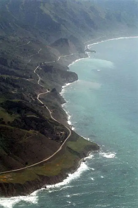
On September 14, 2026, the Big Sur Chamber of Commerce posted one line under its highway conditions: “Highway One is now fully open through Big Sur.” Route 1 is the only way into Big Sur. It runs as two lanes between the Santa Lucia Mountains and the Pacific, from the Carmel River south toward San Simeon and the San Luis Obispo County line. The sources give different lengths. The federal byway listing says 72 miles, and allows an hour and a half to drive it or five hours to see it. The National Scenic Byway Foundation says roughly 90 miles, and the Chamber calls Big Sur itself a 90-mile stretch of coast. The Cambria Historical Society and See Monterey both put the Carmel–San Simeon road at nearly 100. There is no fee. The route has been an All-American Road since 1996.
Falls, pullouts, and elephant seals
The Byway Foundation’s itinerary starts at the San Luis Obispo County line, north of Ragged Point Vista, and works north. In the southern part of the coast, elephant seals haul out on beaches a car can drive right up to. The Chamber gives December through February as the peak, when the large males compete for mates. Wildflowers line the stairs down to the beach at Sand Dollar Picnic Area. Farther north, Kirk Creek Campground sits above the open coast, and Limekiln State Park holds the 100-foot split-stream Limekiln Falls. Higher up the slope is the New Camaldoli Hermitage, home to 12 monks. Its bookstore sells religious items and cards printed with pointillist scenes by Father Arthur Poulin.
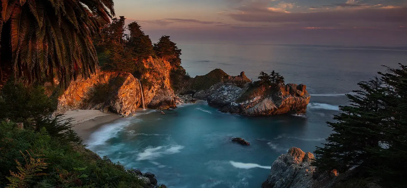
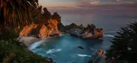
At Julia Pfeiffer Burns State Park, McWay Falls drops some 70 feet from the cliff to a sandy beach that no one can reach. Caltrans keeps a Vista Point near the park and another near Garrapata, and drivers are asked to stop at these pullouts rather than on the shoulder. Twenty-three miles north of the hermitage, and less than a mile south of Nepenthe, the Henry Miller Memorial Library keeps the novelist’s books in a cabin, shelved with Robinson Jeffers, Jaime de Angulo, and Lillian Bos Ross. Miller lived in Big Sur from 1944 to 1962.
Condors, with a ten-foot wingspan, fly over the road. Pfeiffer Big Sur State Park, 28 miles south of Carmel, has a condor flight simulator in its Ewoldsen Nature Center. The Ventana Wildlife Society, which See Monterey credits with the bird’s recovery after it neared extinction in the 1980s, runs a Discovery Center at Andrew Molera State Park, 23 miles south of Carmel. Gray, humpback, and blue whales pass offshore. Visit California gives December through April for the grays and early spring for orange poppies. Hurricane Point looks down the coast. North of Bixby Bridge, the Point Lobos State Natural Reserve keeps a whaling museum. The byway officially ends at Ocean Avenue in Carmel-by-the-Sea.
The road has smaller relics. Natural springs turned up during construction, and the Civilian Conservation Corps built six stone drinking fountains to serve the water to drivers. Five remain, mostly as stone ruins. The one 47 miles south of Carmel carries the name of State Senator Elmer Rigdon. Coastal fog cools the summer mornings and usually lifts by early afternoon. More than 50 inches of rain fall in an average year. Electricity did not reach Big Sur until the early 1950s, and it still does not run the length of the coast.
Cliffs that will not hold
The rain helps explain the closures. A 2001 California Geological Survey report found that the slopes here rise from sea level to over 3,000 feet in less than three miles. The Santa Lucias are still being lifted, and the waves keep cutting at their base. In Big Sur, deeply weathered rock gives way as debris flows when heavy rain follows a wildfire. At Lucia the rock is weak enough that ordinary waves and rain set it sliding. The bedrock at Julia Pfeiffer Burns is probably the most resistant on the coast, yet its steep slopes failed in the extraordinary rainfall of 1983. The survey marked the stretch between Cow Cliffs and Rain Rocks as having the highest density of landslides on the coast.
Regent’s Slide came down in that country and closed Highway 1 on February 9, 2024. It began about 450 feet above the pavement and shut a 6.8-mile segment. Caltrans worked from the top down, digging from above until a stable slope remained. Crews used drones, remote-controlled drills, and carefully controlled explosives to break rocks too large to move any other way. The agency estimated the total cost at approximately $82 million. The road would not be rebuilt on the debris; it might shift slightly east onto stable ground. The Chamber announced the reopening at Regent’s Slide for Friday, February 20, 2026.
The arch at Bixby Creek
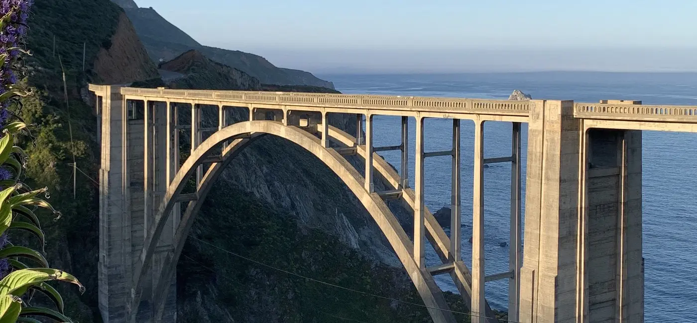
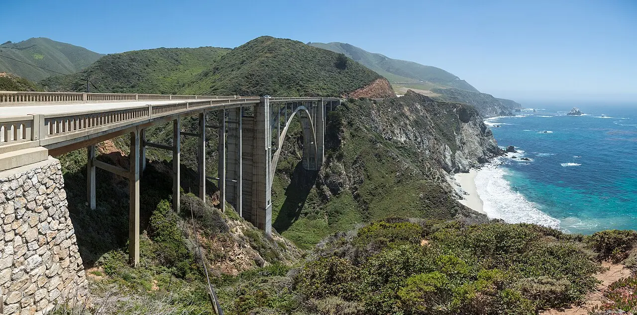
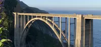
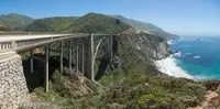
Parking on or near Bixby Bridge is prohibited. Most people still stop near it, because the bridge appears on postcards and in automobile commercials. It stands 13 miles south of Carmel by Wikipedia’s and the Cambria society’s count, and eighteen by an essay on the Monterey County Historical Society’s site. The bridge is a reinforced concrete open-spandrel arch with a 360-foot main span. It carries the road about 260 feet above a V-shaped canyon roughly 100 feet wide at the bottom, whose walls are altered and disintegrated granite. The bridge is built on a curve.
State engineers had another option: an 890-foot tunnel and a smaller bridge upstream. They chose the high crossing at the coast because it was safer and gave more of the view. Engineers C.H. Purcell and F.W. Panhorst picked concrete over steel. Steel would have needed constant painting against the sea air, and concrete would echo the color of the rock cliffs. On August 13, 1931, the contract went to Ward Engineering Co. of San Francisco. Wikipedia gives the bid as $203,334 and the Historical Society essay as $202,334. The bridge was finished for $199,861.
Most of the work went into the falsework, a wooden frame built to shape the arch and hold the wet concrete. It used about 300,000 board feet of Douglas fir. Trucks of M.J. Murphy, Inc. of Carmel hauled the timber from the Monterey rail yards over a one-way road with hairpin turns. The general superintendent, E.C. Panton, spent two months raising the frame in high winds, about 250 feet tall. Waves sometimes reached its foundation, and work stopped until the winter storms passed. Cement came from Davenport, near Santa Cruz, and from San Andreas, and the creek below supplied the water for the mix. Platforms on slings, hung from a cable 300 feet above the creek, carried the concrete across.
The sources disagree on when it was finished. The Historical Society essay and Wikipedia give October 15, 1932, with a dedication on November 27. The Cambria society and See Monterey give November 23, 1932, and say the bridge was then the largest arched highway structure in the Western states. Wikipedia calls it, at completion, the highest single-span arch bridge in the world.
Before 1932 the creek was Mill Creek, named for the sawmill Charles Henry Bixby built on it. Bixby came to the Monterey Peninsula in 1868. He shipped lumber, tanbark, and later lime from Bixby Landing on the point, and the creek and canyon took his name when the bridge was completed. For a time the bridge was also called the Rainbow Bridge, after the Rainbow Lodge up the canyon. Army Captain Howard Sharpe and his wife, Frida, ran the lodge. They sold part of their land to the state for the right-of-way in 1930. Once tourists no longer had to drive down to the creek, Sharpe built a new lodge on the highway north of the bridge.
A $20 million seismic retrofit, finished in November 2000, rebuilt the bridge inside its old shape. Its 24-foot deck is still officially “functionally obsolete,” narrower than the 32 feet required of new bridges. In 1986 the seven concrete arch bridges between Point Sur and Carmel went on the National Register of Historic Places. Besides Bixby, they include Rocky Creek, Granite, Garapata, Malpaso, and Wildcat Creek, the last built as three short arches about five miles south of Carmel.
A doctor on the Point Sur road
The Esselen lived here first, from Point Sur to Big Creek and inland to the Carmel and Salinas valleys. The Ohlone lived to the north and the Salinan to the south. In 1542, Juan Rodriguez Cabrillo wrote of “mountains which seem to reach the heavens, and the sea beats on them; sailing along close to land, it appears as though they would fall on the ships.” The Spanish called the land “El Pais Grande del Sur,” according to a 1996 Caltrans history; the Chamber gives the name as El Sur Grande, the Big South. In the 1880s Monterey County finished the Old Coast Road from Monterey to Big Sur, and parts of the highway north of Big Sur still follow it. South of that point, homesteads were linked only by a horse trail, and steamers landed heavy goods at Notley’s Landing, Partington Cove, and the mouth of the Little Sur River.
On the evening of April 21, 1894, the S.S. Los Angeles, a passenger ship bound from San Pedro to San Francisco, struck a rock and sank within sight of the Point Sur light. Dr. John L.D. Roberts, a Monterey Peninsula physician, drove a horse-drawn wagon to the wreck. The Cambria society and Caltrans say the trip took three and a half hours; the Federal Highway Administration says he rode and took nearly four. By the time he had tended the injured and dying, he was sure the coast needed a road.
In 1897 he walked from Monterey to San Simeon and estimated the cost at $50,000. See Monterey tells it differently: Carmel to San Luis Obispo, mapping a route, in five days. Roberts had founded the town of Seaside, which he hoped would rival Pacific Grove. Caltrans and the Cambria society both note that he was a land speculator, and that the business of tourist travel was not lost on him.
His ally was Elmer S. Rigdon, Cambria’s state senator and a member of the Senate Committee on Roads and Highways. Rigdon arranged for Roberts to address a joint session of the legislature. The road only moved, the Cambria society says, when Rigdon sold it for its military value in defending California, and the money went into the “Military Highway Bill.” World War I delayed the $1.5 million bond until voters approved it in 1919. Most sources date the start of construction to 1922, the year Rigdon died; the Federal Highway Administration and Wikipedia say 1919.
Convicts, dynamite, and a boulder at Pfeiffer Redwoods
Supplies came in by boat, and steam donkey engines hoisted them up to the roadbed. The Fresno Bee of March 1, 1923 reported that hardly a week passed without an accident to one of the four big shovels. In one, a slide left a shovel hanging 300 feet above the ocean, held by a few inches of earth under one tread, and the operator kept working without noticing. Work stopped in 1924. It resumed in March 1928 with convict crews, under a 1915 law that let prisoners do the unskilled labor while free men ran the machines.
San Quentin set up the camps. Caltrans places them at Salmon Creek and the South Fork of the Little Sur, and later at Point Gorda, Kirk Creek, and Anderson Canyon. The Federal Highway Administration lists three, at the Little Sur River, Kirk Creek, and Anderson Creek. The inmates earned 35 cents a day and time off their sentences, and John Steinbeck worked on the road too. The FHWA records seventy thousand pounds of dynamite and more than 10 million cubic yards of rock blown away. In 1945, crews found some of the original dynamite sticks still under the road. The 1939 WPA guide to California tells of one winter night when slides had blocked the road. A woman in the freemen’s camp was about to give birth and needed a doctor, and “of their own free will, men from both camps poured out to work in pouring rain and pitch darkness, blasting open with dynamite a road to the Community Hospital.”
The first bridge, a small timber span over Salmon Creek, opened in 1928. On September 18, 1934, crews from two camps working toward each other met and removed the last barrier. A few official cars drove from San Simeon to Carmel, one lane wide in places, taking steep detours into canyons where bridges were not yet built.
On the morning of June 27, 1937, Governor Frank Merriam’s car led a caravan from the Cambria Pines Lodge to San Simeon. There, Alicia Rigdon planted a silver fir for her husband. That afternoon, at Pfeiffer Redwoods State Park, Merriam and Public Works Director Earl Lee Kelly used a stick of dynamite and a bulldozer to push a boulder out of the highway’s path, with Dr. Roberts watching. The road was named the Carmel–San Simeon Highway but was known as the Roosevelt Highway. It had cost around $10 million. For years it was a summer and fall road that often closed in winter. In 1940 it received 12 miles of steel guard rail, because, as District Engineer Lester H. Gibson put it, “a car leaving the road at some places may fall hundreds of feet.”
In June 1965 the road from the Carmel River to the San Luis Obispo County line became California’s first official scenic highway. On September 21, 1966, Lady Bird Johnson dedicated it at Bixby Bridge, with State Senator Fred Farr beside her. His son, Sam Farr, said his father kept billboards off the road. “We were so proud of our scenery,” Sam Farr told See Monterey. “Why would we want to interrupt that natural scenery with, as Ansel Adams used to call them, urban acne, billboards scattered all over our highways?”
Notable Events
- 1880sMonterey County completed the Old Coast Road from Monterey to Big Sur in the 1880's; parts of the highway north of Big Sur follow it. conservation.ca.gov
- 1894The S.S. Los Angeles ran aground at the Point Sur lighthouse; the event prompted a local physician to lobby for an improved road along the Big Sur coast. web.archive.org
- 1897Dr. Roberts made a trip on foot from Monterey to San Simeon and estimated the cost of constructing the road at $50,000. web.archive.org
- 1919A $1.5 million bond issue was placed on the ballot; World War I delayed its approval until 1919. cambriahistoricalsociety.com
- 1921Federal funds were appropriated and in 1921 voters approved additional state funds. fhwa.dot.gov
- 1922Construction of the road began in 1922, the same year Rigdon died. cambriahistoricalsociety.com
- 1924Work ground to a halt in 1924. web.archive.org
- 1928The first bridge, a small timber structure across Salmon Creek about 19 miles north of San Simeon, opened in 1928. cambriahistoricalsociety.com
- 1928Work resumed in March 1928, when convict labor crews were employed on the road building job. web.archive.org
- 1930The Sharpes sold part of the Bixby Landing right-of-way to the State of California for its construction of Highway 1 and the bridge. mchsmuseum.com
- 1931The contract was awarded to the low bidder, Ward Engineering Co. of San Francisco; concrete placing began November 27th. mchsmuseum.com
- 1932When completed, the Bixby Bridge became the largest arched highway structure in the Western states. cambriahistoricalsociety.com
- 1934Convict labor from two camps working towards each other met, the final barrier was removed, and a few official cars drove from San Simeon to Carmel for the first time. cambriahistoricalsociety.com
- 1937A caravan led by Governor Frank Merriam's car left the Cambria Pines Lodge for dedication ceremonies at San Simeon. cambriahistoricalsociety.com
- 1937Highway 1 was constructed through this geologically diverse landscape in the 1930's and opened in 1937. conservation.ca.gov
- 1937A gala celebration at Pfeiffer Redwoods State Park commemorated the opening of the highway. web.archive.org
- 1939The Carmel River to Cambria portion was incorporated into the state highway system as California Highway 1. cambriahistoricalsociety.com
- 1940The largest installation of guard rail ever placed on a California state highway under one contract: 12 miles of steel guard rail and 3,649 guide posts along 46.6 miles of State Route 01. web.archive.org
- 1945Work crews found some of the original dynamite sticks under a section of the road. fhwa.dot.gov
- 1965The Carmel River to Cambria portion of Highway One was declared a State Scenic Highway. cambriahistoricalsociety.com
- 1965Mrs. Lyndon B. Johnson came to California for the official scenic highway designation ceremony, held at Bixby Bridge. web.archive.org
- 1986The seven concrete arch bridges between Point Sur and Carmel were listed in the National Register of Historic Places. cambriahistoricalsociety.com
People
- Dr. John L. D. Roberts, Promoted the road; land speculator and entrepreneur.
- Elmer S. Rigdon, State Senator of Cambria; ally of Roberts' proposal (died 1922).
- John Steinbeck, Local who worked on the road.
- Charles Henry Bixby, Early settler in the area whose name the creek, the landing and the bridge carry (came to the Monterey Peninsula in 1868).
- E.C. Panton, General superintendent of Ward Engineering Co.; the falsework, the wooden structure built to shape the arch and form the wet concrete, was one of the outstanding accomplishments of his.
- Howard Sharpe, Army captain who with his wife operated Rainbow Lodge near the crossing, origin of the bridge's Rainbow name, and who built and improved a dirt road from the lodge up the canyon to Bixby Landing (bought the ranch in the Bixby Creek Canyon in 1919).
- Alicia Rigdon, Wife of the late state senator who pushed to make the highway a reality; dedicated a silver fir tree to her husband's memory during the dedication festivities (June 27, 1937).
- Fred Farr, California State Senator who attended the ceremony at Bixby Bridge with the First Lady; his son said he helped create the state's scenic highway system and ensured the road would not be marred with billboards.
- Lady Bird Johnson, First Lady who dedicated Bixby Bridge and the roadway as California's first official scenic highway (September 21, 1966).
- Dr. John L.D. Roberts, Medical doctor on the Monterey Peninsula whose territory included the northern Big Sur coast; lobbied for the road.
- Earl Lee Kelly, Public Works Director; symbolically pushed a boulder out of the highway's path to open the road.
- Governor Frank Merriam, Symbolically pushed a boulder out of the highway's path to open the road.
Sources
- fhwaapps.fhwa.dot.gov/bywaysp/byway/2301
- bigsurcalifornia.org/national-scenic-byways-program
- bigsurcalifornia.org/highway-1-conditions/highway-one-closure-update
- nsbfoundation.com/nb/big-sur-coast-highway-route-1
- visitcalifornia.com/Highway1
- dot.ca.gov/caltrans-near-me/district-5/district-5-current-projects/05-1r640
- facebook.com/BigSurInformation
- seemonterey.com/blog/the-story-behind-california-highway-1
- mchsmuseum.com/local-history/historic-places/bixby-creek-bridge
- conservation.ca.gov/cgs/Documents/landslides/Caltrans/SR_185/CT001mon%20Report.pdf